

-
 (Photograph by Beth Sullebarger)
 -
 (Photograph by Beth Sullebarger)
 -
 (Photograph by Beth Sullebarger)
 -
 (Photograph by Beth Sullebarger)
 -
 (Photograph by Beth Sullebarger)
 -
 (Photograph by Beth Sullebarger)
 -
 (Photograph by Beth Sullebarger)
 -
 (Photograph by Beth Sullebarger)
 -
 (Photograph by Beth Sullebarger)
 -
 (Photograph by Beth Sullebarger)
 -
 (Photograph by Beth Sullebarger)
 -
 (Photograph by Beth Sullebarger)
 -
 (Courtesy of Library of Congress, Prints and Photographs Division)


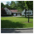
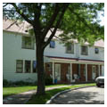
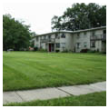
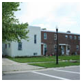
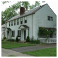
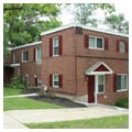
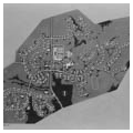
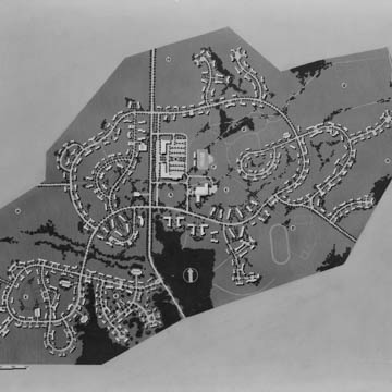
Opened to residents in 1938, Greenhills is one of only three new greenbelt towns developed by the Resettlement Administration during the New Deal. The goal of the greenbelt towns was to relocate residents of blighted urban neighborhoods to a complete community of moderate-cost housing in a healthier environment. One of the distinguishing characteristics was a “green belt” of open space completely surrounding the community. Greenhills retains 2,000 acres of its original greenbelt, which have been preserved as Winton Woods County Park. Greenhills is not only significant in the context of New Deal suburban resettlement programs, but also in the context of American garden city planning, neighborhood planning, and small house design. It features a highly innovative and distinctive curvilinear plan—both in its relationship to the natural topography and its use of setbacks, super-block planning, and cul-de-sacs, which would become a ubiquitous characteristic of post-World War II neighborhoods.
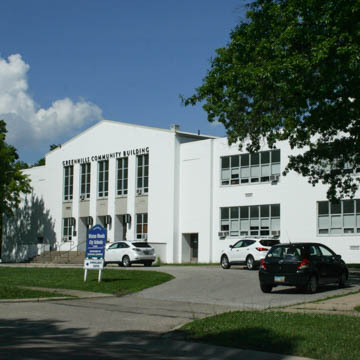
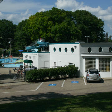
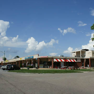
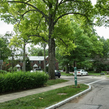
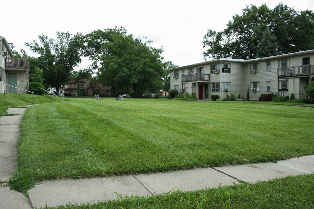
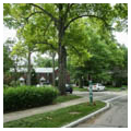
Located thirteen miles north of downtown Cincinnati, construction of Greenhills began in 1935 shortly after the federal government purchased 5,930 acres of farmland. Of this land, about 800 acres were selected for the initial construction of the incorporated town and 4,000 acres were set aside for the greenbelt. The community’s civic and commercial center is located on the east side of Winton Road, a four-lane artery that bisects the village and includes a town common surrounded by a shopping center, the imposing community building/school, various church-related buildings, and a large swimming pool and other recreational facilities. The community was organized into neighborhood sections with letters A through F applied to all street names. Each section has a mix of dwellings, one or more collector streets, a series of cul-de-sacs or short lanes, pedestrian paths, parks, playgrounds, and public green spaces such as commons or planted median strips.
Greenhills’s design was the work of a team of planners and architects employed by the Resettlement Administration: Justin R. Hartzog, chief town planner and landscape architect, who had worked for John Nolen in the design of nearby Mariemont; William A. Strong, assistant town planner; Roland Wank, chief architect who had contributed to the design of Cincinnati’s Union Terminal; and G. Frank Cordner, assistant chief architect who took over as chief architect after Wank went to the Tennessee Valley Authority in 1936.
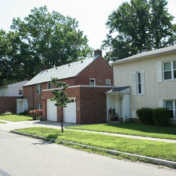
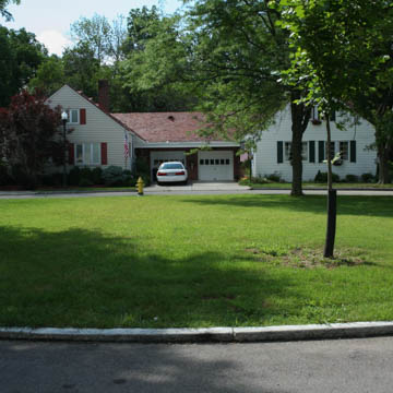
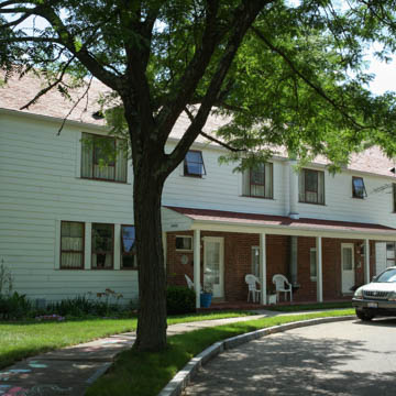
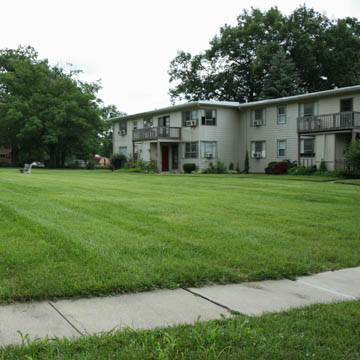
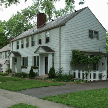
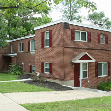
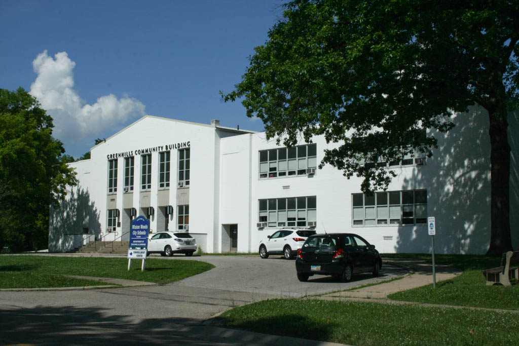
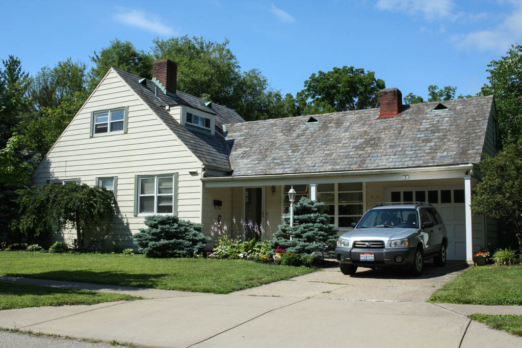
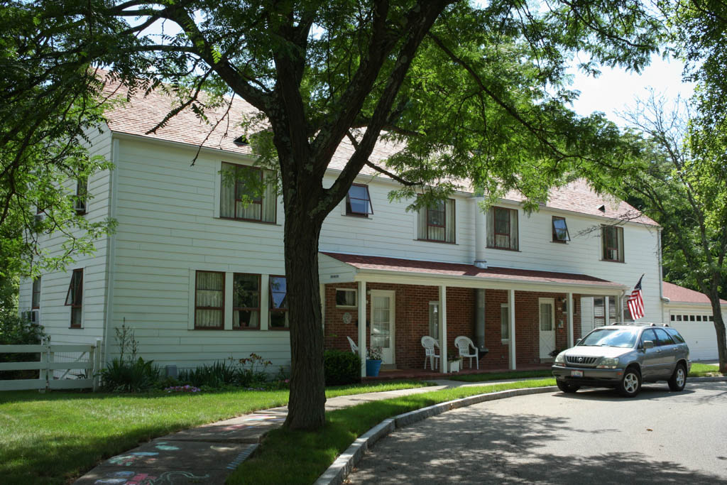
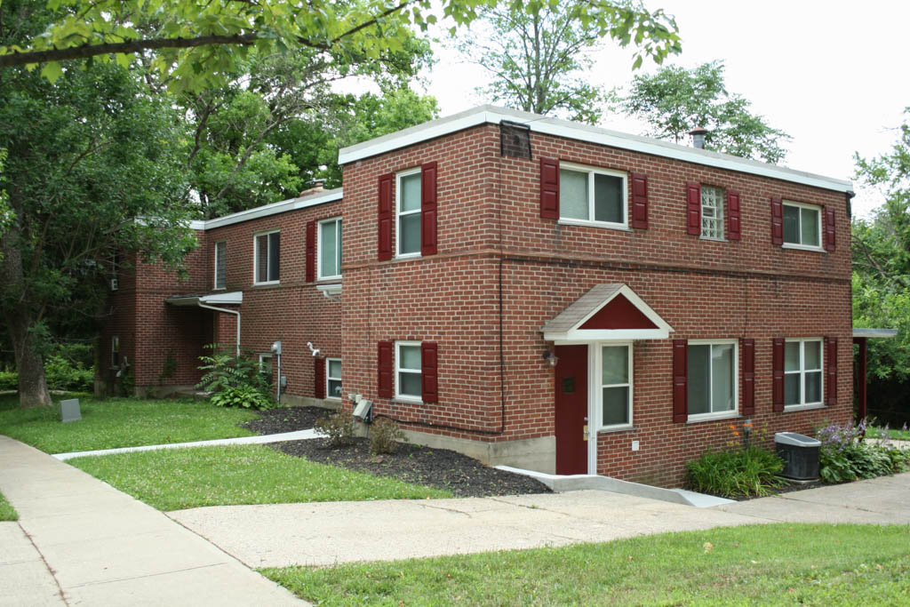
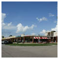
In terms of style, Greenhills’s new buildings were a mix of traditional and modern design, from Colonial Revival to Moderne and International Style modernism, sometimes on a single block. Because of this intentional mix Greenhills had the appearance of a community that developed over time rather than all at once. The range of materials included brick, stucco, concrete block, and asbestos-cement lap siding. The Moderne-style shopping center is separated from Winton Road by a parking lot and tree-shaded, grassy border. The bright, white-painted community building/school, set off by a large town green, is an amalgam of stripped Classicism and International Style, with its monumental gabled entrance to the gymnasium/assembly hall and flat-roofed classroom wings with grouped windows. Amenities include underground utilities and conveniently located grouped garages.
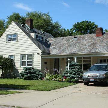
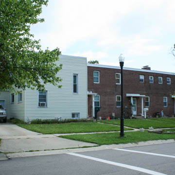
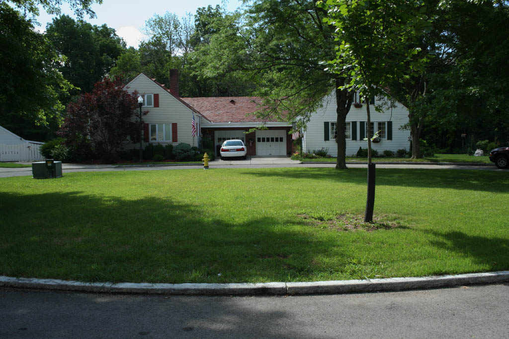
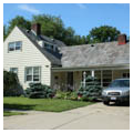
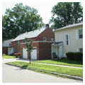
Housing ranges from traditional single-family homes to many variations of row house groupings and multi-family apartment buildings. The design team created more than thirty different floor plans. Grouped housing units are staggered or stepped for variety, some in an orderly chevron arrangement. The placement of single-family homes and duplexes on curving streets and cul-de-sacs was particularly innovative, foreshadowing the design of postwar Federal Housing Administration subdivisions. The evolution of curvilinear design can also be seen in the streets of single-family homes built on Damon Road and Gambier Circle and sold to veterans immediately following World War II.
Another important aspect of Greenhills was the incorporation of murals, sculpture, and other artwork by the Works Progress Administration. The community building contained a series of large murals by Richard Zoellner, Leo Murphy, and Paul Chidlaw in the library, cafeteria, and second-floor music room, respectively. Whitney Atchley’s Community Life, a ceramic bas-relief of two figures, hangs above the stage in the gymnasium. Two outdoor limestone sculptures by Seth Velsey, intended for the common, were never delivered to Greenhills. Today they are in the collection of the Dayton Art Institute.
In 1950, the federal government sold the property within the corporate area of the town to the Greenhills Cooperative Association. In the following decade, the village hall/fire station relocated to an outlying site on Winton Road south of the Whallon House. Construction of privately financed single-family housing occurred in subsequent decades in the northeast area of the village on curvilinear streets with mid-block walking paths and median strips similar in character with the original plan.
References
Arnold, Joseph L. The New Deal in the Suburbs: A History of the Greenbelt Town Program 1935–1954. Columbus: Ohio State University, 1971.
Hartzog, Justin R. “Town Planning of the Greenhills Project.” TS, November 1937, Justin Hartzog Papers, Archives of Cornell University.
Leach, Charles Bradley. “Greenhills, Ohio: The Evolution of an American New Town.” Ph.D. diss., Case Western Reserve University, 1977. Ann Arbor, MI: University Microfilms International, 1978.
McClelland, Linda. “An Approach for Greenhills Historic District Nomination (NHL).” National Historic Landmarks Program field notes, 2012.
Mills, Debbie, and Margo Warminski with the Greenhills Historical Society. Images of America: Greenhills. Charleston, SC: Arcadia Publishing, 2013.
Walsh, Rita. “Greenhills Historic District,” Hamilton County, Ohio. National Register of Historic Places Inventory-Nomination Form, 1988. National Park Service, U.S. Department of the Interior, Washington, DC.