

-
 (Photograph by Carol M. Highsmith, Library of Congress, Prints and Photographs Division)
 -
 (Photograph by Carol M. Highsmith, Library of Congress, Prints and Photographs Division)
 -
 (Photograph by Carol M. Highsmith, Library of Congress, Prints and Photographs Division)
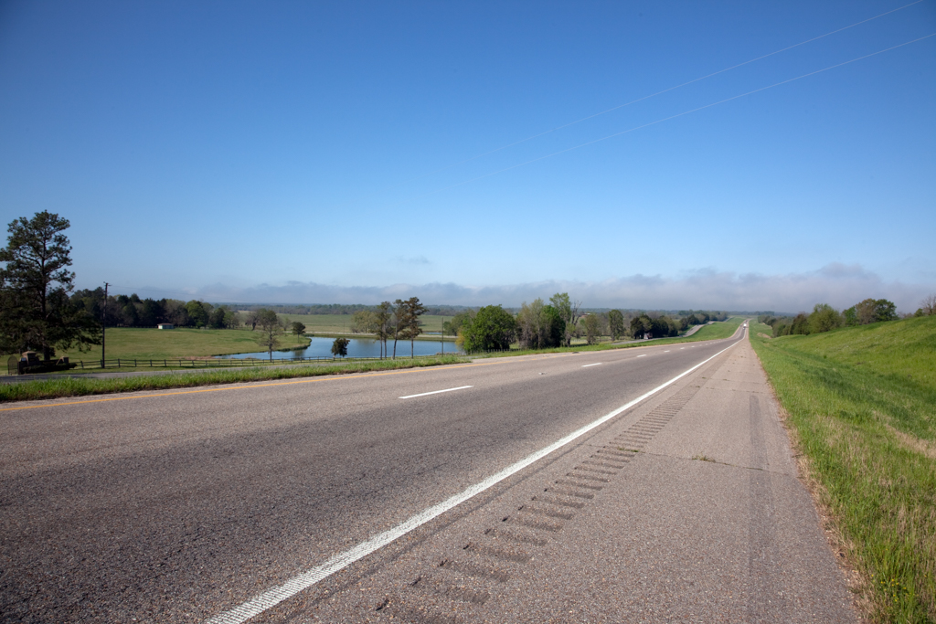

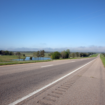
The Selma to Montgomery National Historic Trail covers the 54-mile distance along U.S. 80 between Selma and Montgomery, Alabama. The trail follows the route of three marches held in 1965 to protest voting discrimination against African American citizens. The marches were a turning point in the civil rights movement; the Voting Rights Act was signed into law just five months after the demonstration. The National Historic Trail, intended as an auto route, is punctuated by a series of sites along the historic march as well as two National Park Service interpretive centers: one in Selma and one at the midway point in Lowndes County. The third and final interpretive center on the Alabama State University campus in Montgomery was completed in March 2017.
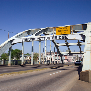
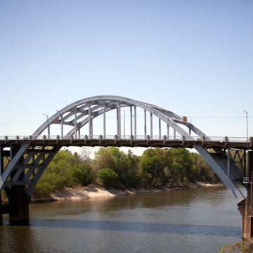
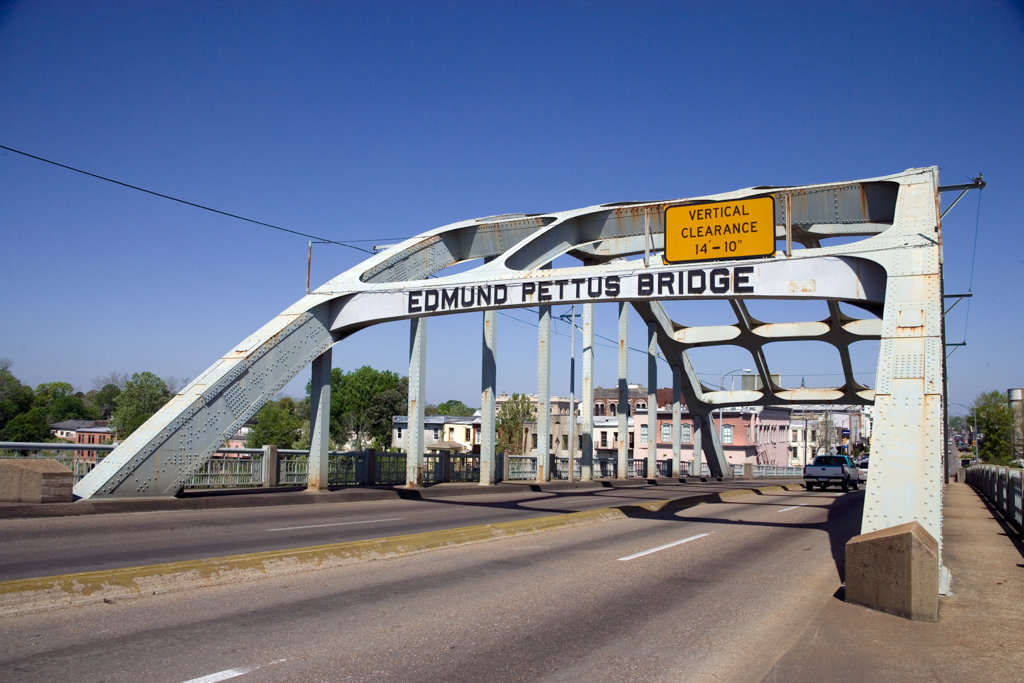
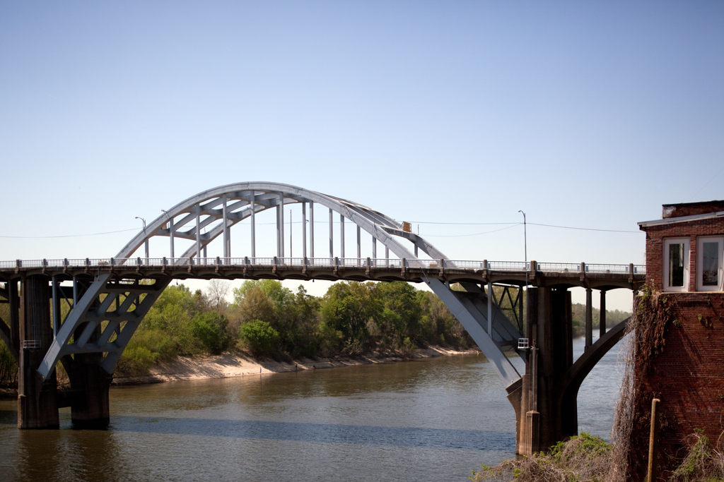
Selma was known for maintaining segregated schools and other facilities and for enforcing Jim Crow laws and customs with violence if necessary, including actions by the Ku Klux Klan (KKK). Nearly half of Selma's residents were Black, but because of restrictive electoral laws only one percent were registered to vote. In the 1960s civil rights workers had begun to organize in Selma to register Black citizens to vote in the upcoming elections. The first march, held on March 7, 1965, was organized in response to the shooting of Jimmie Lee Jackson by an Alabama state trooper during a peaceful nighttime civil rights demonstration in Marion, Alabama. As a memorial to Jackson and a protest for voter’s rights, more than 600 demonstrators gathered at the Brown Chapel African Methodist Episcopal Church in Selma to begin their journey to Montgomery, the state capital. The events of the march were memorialized as “Bloody Sunday” after a formidable wall of state troopers and local officers forcibly blockaded the nonviolent protestors’ progress at the Edmund Pettus Bridge over the Alabama River. Without provocation, the officers violently attacked the marchers with tear gas and billy clubs
In reaction to the widespread media coverage of law enforcement’s brutality against the peaceful protestors, civil rights activists gathered once more in Selma to attempt the march. On March 9, Martin Luther King Jr. led around 2,500 activists to the Edmund Pettus Bridge. On what came to be known as “Turn-Around Tuesday,” they were once again prevented from advancing by Alabama law enforcement. Activists sought and won an injunction in federal court to support the peaceful march, and the final attempt proceeded on March 21, 1965 under the protection of state and federal law enforcement. The journey, supported by the Southern Christian Leadership Conference and the Student Nonviolent Coordinating Committee, took 5 days, with the 25,000 protestors averaging about 10 miles a day along U.S. 80. The group reached the Alabama State Capitol on March 25, and the march culminated with a rally that featured King’s iconic “How Long, Not Long” speech.
The Selma to Montgomery march is recognized as the apex of the civil rights movement. In response to the national and international coverage of the events in Selma, Congress rushed to create the Voting Rights Act, signed into law by Lyndon B. Johnson on August 6, 1965. In 1996, Congress officially designated the route the Selma to Montgomery National Historic Trail. Today, the trail pays homage to the sacrifices and perseverance of those activists who fought for their rights as citizens while memorializing the physical route traveled by them. The trail includes stops at Selma’s Brown Chapel AME Church, which served not only as the starting point for Bloody Sunday’s harrowing march, but also as the host for the Southern Leadership Conference in 1965. The brick building, with striking twin towers in a strong Romanesque Revival style, was built in 1908 by A.J. Farley, an African American builder. The next landmark is Edmund Pettus Bridge, the site of the violence on Bloody Sunday, which was subsequently adopted as a symbol for the civil rights movement. The trail continues along the route, with markers at each of the four campsites along the way: David Hall Farm, Rosie Steele Farm, Robert Gardner Farm, and City of Saint Jude.
The Lowndes Interpretive Center serves as the halfway point of the trail, and pays tribute to the history of “Bloody Lowndes” County, a locus of the civil rights movement and the birthplace of the Black Panthers. The Center features an exhibit remembering Tent City, a makeshift refuge created when thousands of sharecroppers in the county were evicted from their land and fired from their jobs when they attempted to register to vote. Nearby is the Viola Liuzzo Memorial, which marks the spot where Viola Liuzzo was shot and killed by KKK members while driving marchers home from Montgomery on March 25, 1965. The trail ends at the state capitol in Montgomery, where King and other civil rights leaders addressed the crowd from a wooden podium in front of the building, as the governor would not allow them to speak from the capitol’s steps. Montgomery is home to a wealth of sites that played critical roles in the civil rights movement.
References
National Voting Rights Museum and Institute. “Selma Movement.” Accessed February 20, 2017. www.nvrmi.com.
National Park Service. “Selma to Montgomery.” Accessed February 20, 2017. www.nps.gov.