

Cahokia Mounds
You are here
Cahokia Mounds State Historic Site
700–1200. Bounded by I-70, West Point Ave., and railroad tracks to the south and west.
-
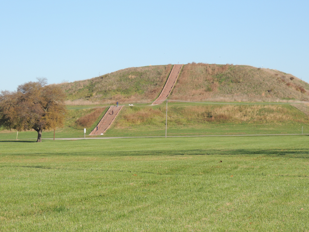
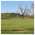
 Monks Mound (Photograph by Jean Follett)
 -
 Monks Mound (Photograph by Jean Follett)
 -
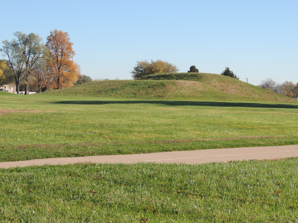
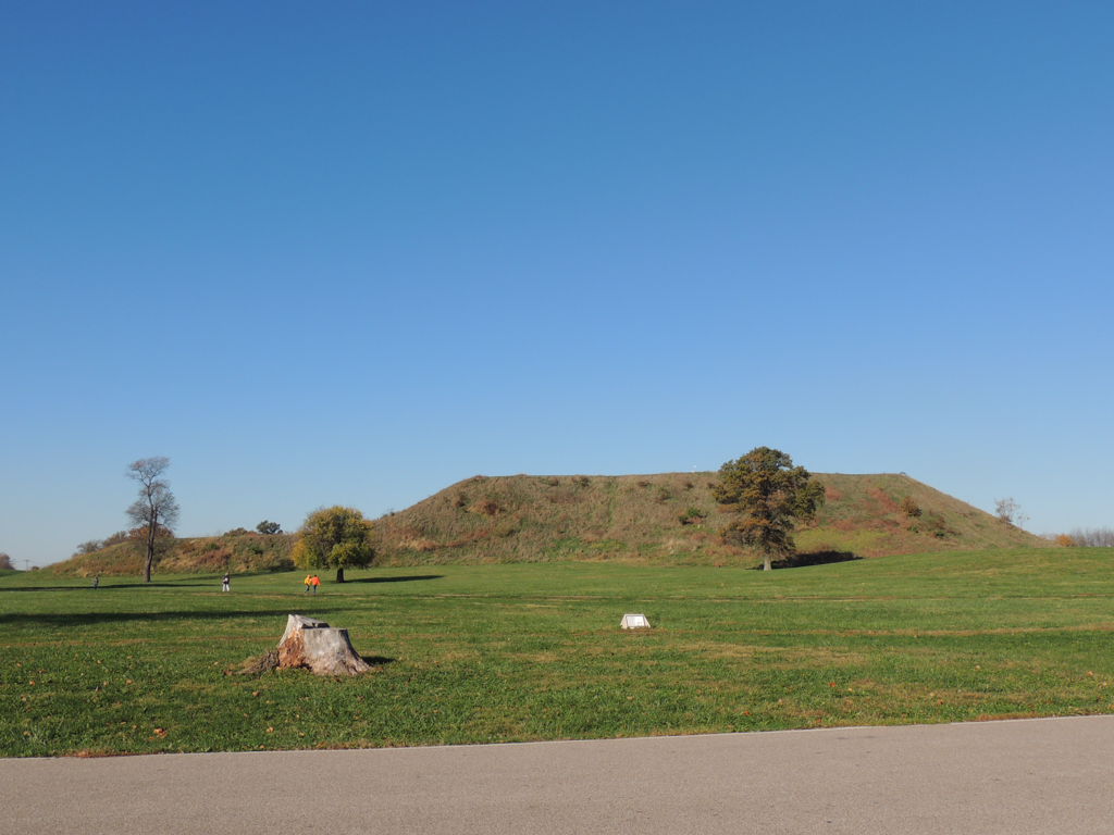
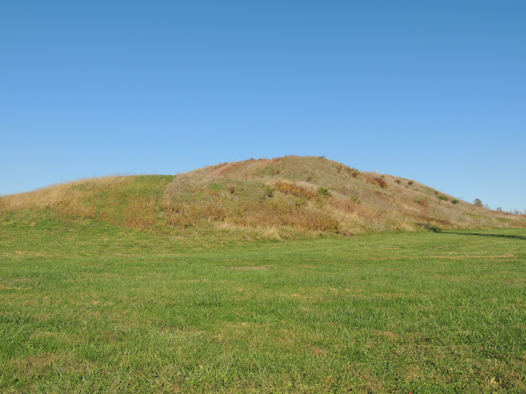
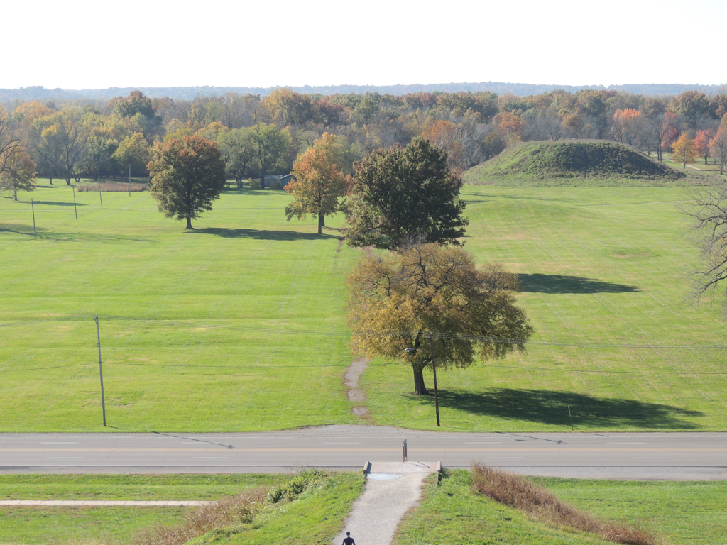
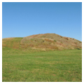
 Subsidiary mound on Grand Plaza (Photograph by Jean Follett)
 -
 Subsidiary mound on Grand Plaza (Photograph by Jean Follett)
 -
 Subsidiary mound on Grand Plaza (Photograph by Jean Follett)
 -
 Monks Mound, First Level (Photograph by Jean Follett)
 -
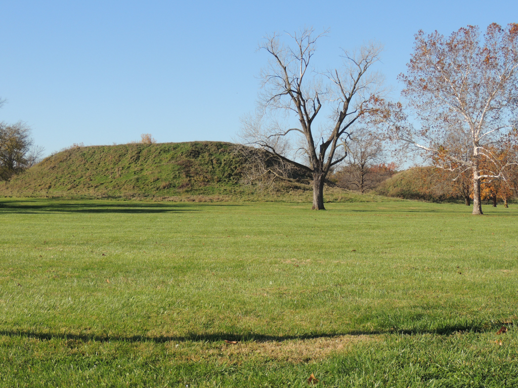
 Monks Mound, side view (Photograph by Jean Follett)
 -
 Community Life (Courtesy Cahokia Mounds State Historic Site)
 -
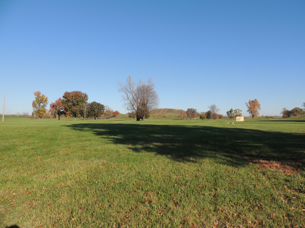
 View from Monks Mound across the Grand Plaza (Photograph by Jean Follett)
 -
 View from Monks Mound across the Grand Plaza (Photograph by Jean Follett)
 -
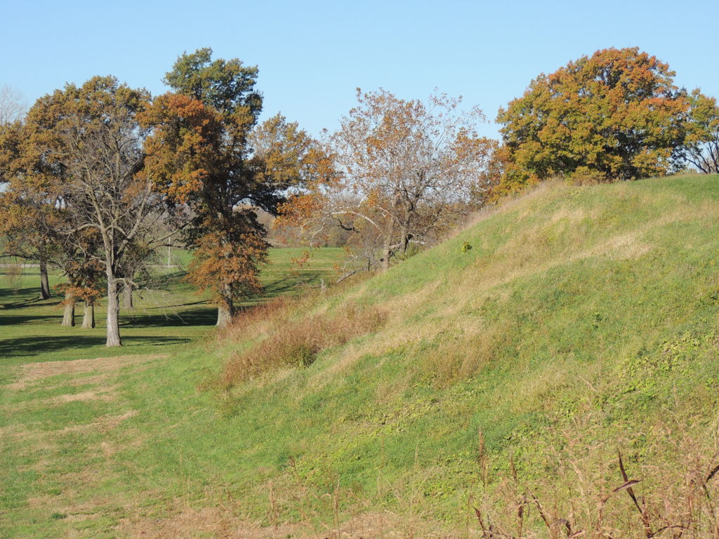
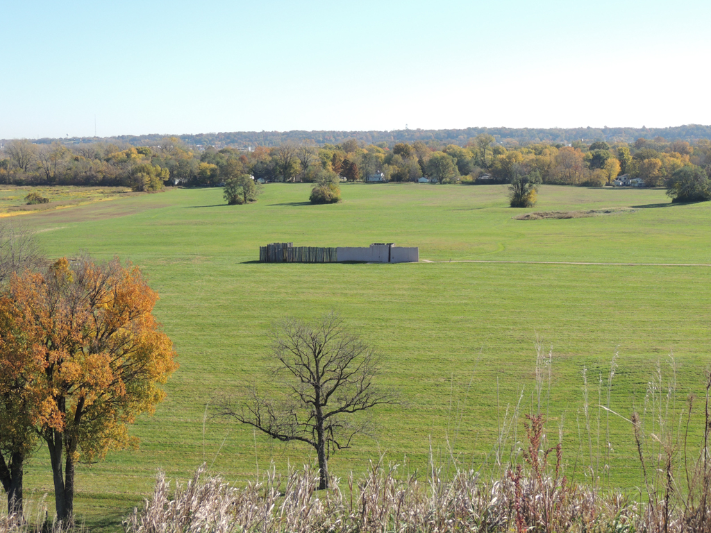
 View from Monks Mound to the west towards stockade (Photograph by Jean Follett)
 -
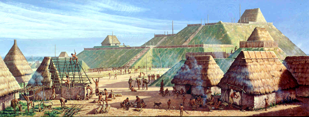
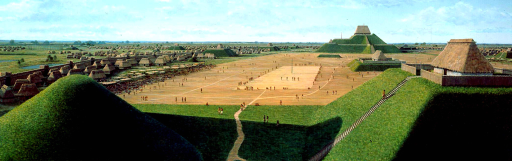
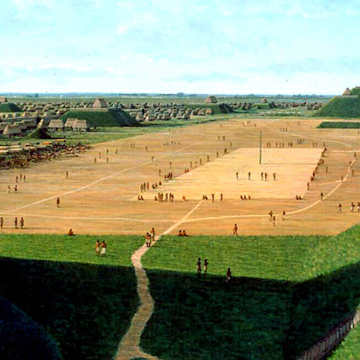 Townsend Mural of Cahokia (Courtesy Cahokia Mounds State Historic Site)


Cahokia Mounds is currently the only UNESCO World Heritage site in Illinois. What we see today is the underpinnings of what was once the largest city in North America, the center of a thriving and complex culture that existed here from about 700 CE to the mid-1300s.
Cahokia Mounds lies at the center of the broadest part of the American Bottom, a fertile ridge and swale topography created by the shifting bed of the Mississippi River since the retreat of the last glacier. With the Mississippi River just 5 miles to the west and the confluences of the Missouri River and the Illinois River to the north, this region provided abundant opportunities to establish extensive routes for the exchange of goods and culture. There has been human settlement in the American Bottom since at least 9500 BCE.
Mound building was present in prehistoric cultures in North America as early as 4500 BCE. From its rise during the Archaic Period (8000 BCE–600 BCE) it spread throughout what is today the eastern United States. Interesting examples from the Woodland Period (1000 BCE–1200 CE) can be found in Ohio and in the Lower Mississippi Valley.
Cahokia Mounds reached its cultural peak starting around 1000 CE during the Mississippian Period. The peak population here is estimated to have been between 10,000 and 20,000. This period was a time of expanding agriculture, an increasingly complex social order, craft specialization, and wide trade networks. Communities of various sizes were present throughout North America, but were especially abundant in the American Bottom. Current research suggests that Cahokia had as many as 120 mounds. Nearby East St. Louis had 45 mounds and St. Louis (once called “Mound City”) had 26—numbers that are a good indication of the American Bottom’s importance as a cultural nexus. Although development destroyed most of the mounds in East St. Louis and St. Louis by the late nineteenth century, Cahokia still has at least 80 mounds, of which 72 are protected as part of the State Historic Site.
Monks Mound, 100 feet high and 910 by 720 feet in area, was the center of this ceremonial city. Its great height provides a commanding view for miles in every direction, including Eero Saarinen’s Gateway Arch (designed 1947, built 1963–1965) in St. Louis, Missouri. On the south the mound overlooks the Grand Plaza, whose 50 acres encompass one of the largest public spaces in the Americas. The Plaza’s artificially level space is a masterwork of prehistoric engineering. It was the site of many ritual activities and possibly of trading activity. Archaeology suggests that Monks Mound was used as the site for the city’s most elite activities: it had a temple with a courtyard on its top level and the acoustics provided by the Grand Plaza would have made pronouncements from its top platform audible to those on the ground below.
There are numerous subsidiary mound groups surrounding Monks Mound and its plaza. These secondary groupings are placed on east, north, and west axes in relation to Monks Mound. In addition to platform mounds, like Monks Mound, the site also contains several other mound morphologies including conical mounds and ridgetop mounds. The latter type of mound is unique to Cahokia. Although archaeological excavations have been carried out in this area for the past 100 years, only a very small percentage of the mounds and the surrounding ground have been exposed, leaving many questions unanswered about the mounds, their construction, and their uses.
The bulk of the structures used for everyday living were found at ground level. Archaeological analysis suggests the structures were built with a pole frame set in the earth, probably covered by plant material and/or hides. Storage pits, both inside and out, were common features. The frequent flooding of this area must have meant frequent rebuilding, which eventually depleted the wood found in the nearby forests.
Along with the depletion of the available natural resources needed to support such a large population, the Mississippians probably also suffered from climate change and political turmoil. Around 1135 the climate began to cool and there was a prolonged period of drought, which would have affected crop production and the availability of wildlife. In addition, the importance of Monks Mound as a cultural and economic capital was challenged by the growth of surrounding population centers, as is evidenced by the construction of a palisade around the main ceremonial precinct circa 1175. The palisade was rebuilt four times as protection against growing threats.
By the mid-1300s this great ceremonial complex and its surrounding villages were abandoned. The mounds were an impressive sight for the first white settlers, and Monks Mound, in particular, was an important physical landmark in the American Bottom. French missionaries built a mission on the south terrace in 1735, catering to a small tribe of Illiniwek. During the Revolutionary War a trading post operated on what was by then known as the “Great Nobb.” In 1809, Trappist Monks received a grant of land including the principal mounds from Frenchman Nicholas Jarrot. Although their mission was short-lived, it was during their occupation of the site that Henry Brackenridge, lawyer and citizen-journalist, visited Cahokia and published the first description of the site. It was Brackenridge who gave the largest mound the name “Monks’ Mound.”
In 1864 Thomas Ramey purchased the land and encouraged archaeological investigations, including a tunnel into Monks’ Mound. Cahokia Mounds soon felt the impact of poorly regulated excavations encroachment from surrounding development. To forestall this damage and recognizing the site’s great significance, the State of Illinois purchased the central portion of Cahokia Mounds in 1923.
In the 1950s Cahokia’s proximity to St. Louis put the entire site in jeopardy when plans were announced for extensive highway construction in the area around the mounds. Although the integrity of the site was badly compromised, considerable money was invested in archaeology at this time. These excavations, the first large-scale professional investigations, yielded significant discoveries about the nature of the site. Important burials were uncovered and evidence of daily life slowly emerged, including the only surviving Mississippian copper workshop.
In addition to the challenges caused by modern development, the impact of environmental change has also been significant. Because the water table in the American Bottom has dropped and rainstorms are becoming more severe, slumping and cracking have emerged on Monks Mound. During the 1960s the State of Illinois acquired additional land to the existing state historic site, ultimately protecting 68 of the surviving 109 mounds. In recent years Illinois’s precarious financial condition has put Cahokia’s maintenance and public access to the sites in a very uncertain position.
Today, nearly 2,000 years after they were first conceived, the great earthworks of this ancient city are still impressive. No one who has climbed to the top of Monks Mound and looked out across the Great Plaza and the surrounding countryside can doubt the dominant position that Cahokia must have had in prehistoric America.
References
Kitt Chappell, Sally A. Cahokia: Mirror of the Cosmos. Chicago: University of Chicago Press, 2002.
Iseminger, William. Cahokia Mounds: America’s First City. Charleston: History Press, 2010.
Mehrer, Mark W. Cahokia’s Countryside: Household Archaeology, Settlement Patterns and Social Power. DeKalb: Northern Illinois University Press, 1995.
Writing Credits
Coordinator:
Jean A. Follett
James E. Peters
Elizabeth A. Milnarik
If SAH Archipedia has been useful to you, please consider supporting it.
SAH Archipedia tells the story of the United States through its buildings, landscapes, and cities. This freely available resource empowers the public with authoritative knowledge that deepens their understanding and appreciation of the built environment. But the Society of Architectural Historians, which created SAH Archipedia with University of Virginia Press, needs your support to maintain the high-caliber research, writing, photography, cartography, editing, design, and programming that make SAH Archipedia a trusted online resource available to all who value the history of place, heritage tourism, and learning.