

Big-I; Crossroads of New Mexico
You are here
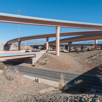
I-25 and 1-40 Interchange
2002–2004, New Mexico Department of Transportation; 2007 landscape, Morrow Reardon Wilkinson Miller, Ltd. I-25 and I-40 Interchange.
-
 (Photograph by Christopher C. Mead)
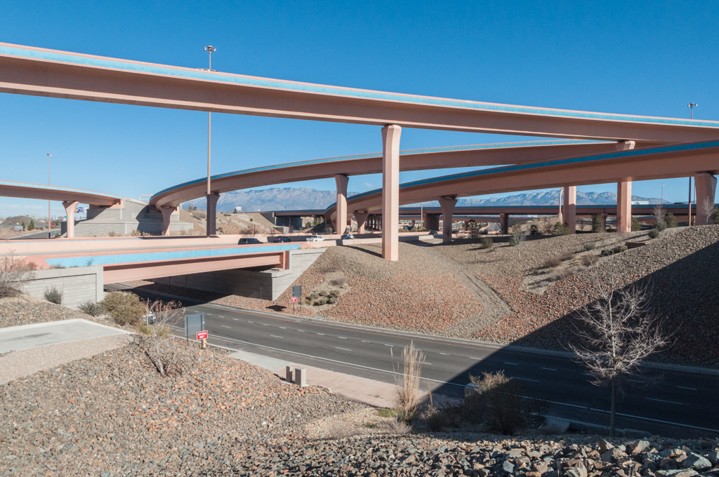
Located in the heart of Albuquerque, the Big-I marks the intersection between I-40, running east to west from Tennessee to California, and I–25, running north to south from Wyoming to Mexico. Transcontinental highways cross at other cities, but only Albuquerque celebrates this intersection with such dramatic, if paradoxically invisible, clarity.
The rebuilt Big-I is the largest public works project in the history of New Mexico, yet what motorists experience is less a massive physical structure than an expanding spatial void where we never come to rest in our rush from somewhere to somewhere else. Space and time atomize into discontinuous events. Like the principle of quantum mechanics that tells us we can know either the position of a particle or its speed and direction, but never both at once, we accelerate through the Big–I and are gone from its center without having ever arrived.
The first interchange was built in 1965–1966 as part of the Dwight D. Eisenhower National System of Interstate and Defense Highways authorized by the Federal Aid Highway Act of 1956. I-40 paralleled and replaced Route 66, which crossed Albuquerque along Central Avenue, while I-25 replaced the Pan American Highway, which ran though the city along Fourth Street a mile west of the interstate. Situated on what were then sand hills separating the city’s valley areas to the west from its mesa heights to the east, the original Big-I seemed to be at Albuquerque’s edge, even though it already was in the middle of a growing city; its planned traffic load of 44,000 cars per day reflected the fact that the interstates were supposed to be largely independent of Albuquerque’s surface streets and traffic.
By the time the Big-I was rebuilt in 2004–2005, its urban centrality was clear to everyone. The intended capacity was increased to 400,000 cars per day and the interchange was redesigned as a complex, stacked system operating on five overlapping levels of surface streets, roadways, ramps, and flyovers. In all, the Big-I contains 55 bridges, 45 of them new. To facilitate its reconstruction while the interchange continued to function, the 8 flyover ramps were assembled from 662 box-section segments that were pre-cast on site; single-lane segments are 4.5 meters (14.76 feet) and double-lane segments 4 meters (13.12 feet) in length. In 2007, the firm of Morrow Reardon Wilkinson Miller Ltd. developed a landscape plan for the interchange, which combined high desert plants, references to the east mountain foothills, and the geometric sweep of the flyover structures.
Writing Credits
Coordinator:
Christopher C. Mead
Regina N. Emmer
If SAH Archipedia has been useful to you, please consider supporting it.
SAH Archipedia tells the story of the United States through its buildings, landscapes, and cities. This freely available resource empowers the public with authoritative knowledge that deepens their understanding and appreciation of the built environment. But the Society of Architectural Historians, which created SAH Archipedia with University of Virginia Press, needs your support to maintain the high-caliber research, writing, photography, cartography, editing, design, and programming that make SAH Archipedia a trusted online resource available to all who value the history of place, heritage tourism, and learning.