

Shaker Village
You are here
Shaker Heights
1911, Oris P. Van Sweringen, Mantis J. Van Sweringen, and F. A. Pease Engineering Company. Roughly bounded by Fairmount Blvd., Moreland Blvd., Chagrin Blvd., and Green Rd.
-
 (Photograph by Peter Ketter)
 -
 (Photograph by Peter Ketter)
 -
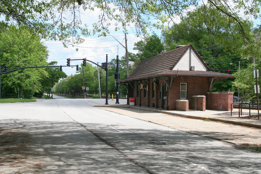
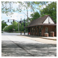
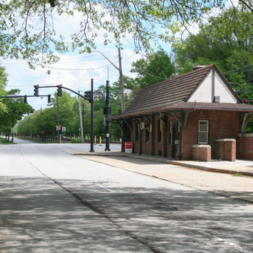 Rapid Transit Station (Photograph by Peter Ketter)
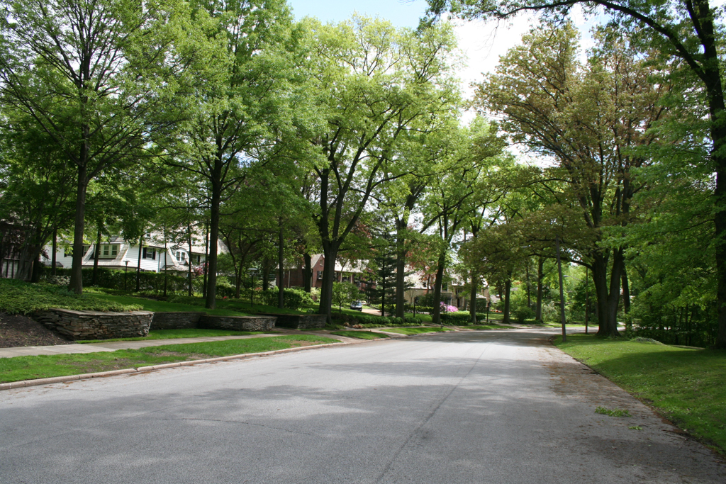
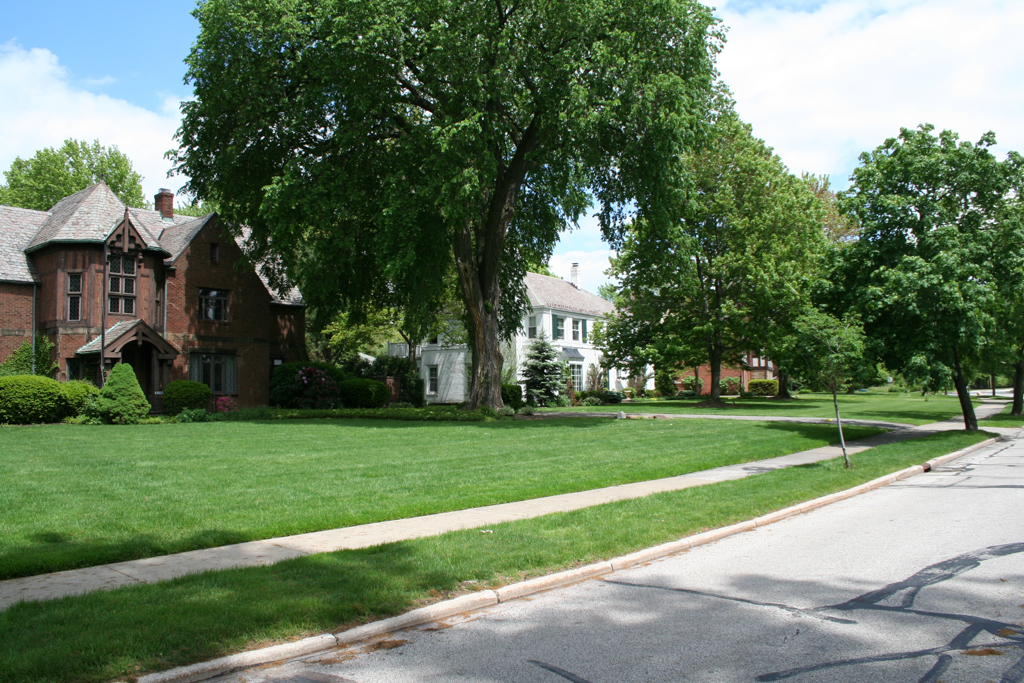
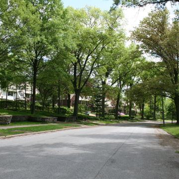
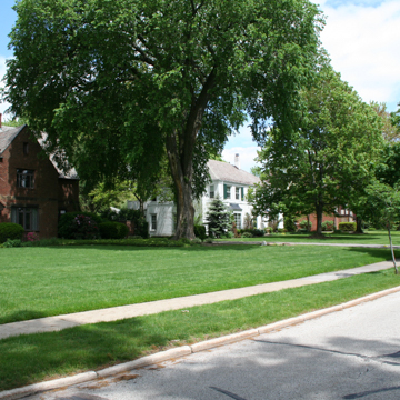
Shaker Heights is an early-twentieth-century garden suburb on the east side of Cleveland named in honor of the North Union Shaker religious colony that occupied the site from 1822 to 1889. Beginning in 1905, brothers Oris P. and Mantis J. Van Sweringen orchestrated this ambitious development effort to create an idyllic residential community on approximately 1,200 acres of land. Incorporated as the Village of Shaker Heights in 1911, the suburb was master planned using concepts then at the forefront of residential development, drawing inspiration from the City Beautiful movement and English Garden Cities. Its curvilinear streets, laid out by the F.A. Pease Engineering Company, followed the natural topography of the site and were integrated with a greenbelt of parkland along Doan Brook and the Shaker Lakes. Development was controlled with strict deed restrictions governing the arrangement of each lot and the physical and aesthetic characteristics of every building. The comprehensive plan designated sites for public and private schools, churches, civic buildings, small commercial districts, and amenities like a country club, all located and designed with what was regarded as appropriate deference to the suburb’s defining residential character. The houses were required to meet stringent design standards and minimum expenditures and regulations governing house sizes and costs also varied by street. This produced economic and physical diversity within Shaker Heights’ overall community framework. Stylistically the houses reflect the eclectic historicism typical of much early-twentieth-century residential architecture, with influences drawn from a range of Colonial, English, and French precedents. Allowable construction materials included slate, wood shake shingles, wood clapboard siding, brick, stone, and stucco. In 1925, the Van Sweringens printed their guidelines for architectural styles and materials in the booklet Shaker Village Standards.
While the Van Sweringens’ carefully designed setting and strict planning controls produced beauty and exclusivity, their vision for the community also extended to enhanced connectivity with Cleveland’s downtown business district. The transportation plan centers on a pair of wide thoroughfares, Shaker Boulevard and Van Aken (formerly South Moreland) Boulevard, each with automobile lanes on either side of a large grass median with rapid transit rail lines running down the center. The opening of Shaker Heights Rapid Transit in 1920 was critical to the suburb’s success and continued expansion. In their quest to deliver this essential amenity to Shaker Heights, the Van Sweringen brothers gave the same attention to transportation infrastructure that they did to architecture: they constructed the rail lines, established and operated their own rapid transit service, and acquired the entire 513-mile right-of-way of the Nickel Plate Railroad in order to control one 5-mile section. They also successfully lobbied for their downtown terminus on Public Square [OH-01-035-0034] to become Cleveland’s primary rail station, not just for local transit but for through rail traffic as well, completing the massive Union Terminal complex in 1930.
Shaker Heights’ promise of bucolic suburban living with easy access to the city center proved immensely popular, and nearly 900 houses were constructed by 1923. With the plan, infrastructure, and municipal government all in place, Shaker Heights continued to develop rapidly throughout the decade in line with the Van Sweringens’ vision. Shaker Square, a shopping center, was added in 1927–1929 at the suburb’s northwest gateway. Although the site is technically within the City of Cleveland and the realized scheme diverged slightly from the original plan for this intersection, the Van Sweringens developed Shaker Square following the residential character and traditional aesthetic of Shaker Heights.
Effectively built out by the early 1930s, the physical environment of Shaker Heights has remained relatively constant even as the community has continued to evolve socially and culturally. Residents have generally embraced and defended its original design and development controls. In the 1960s, for example, they successfully defeated a proposal to bisect the city with new freeways. In the 1970s and 1980s, activist residents worked to achieve racial integration in Shaker Heights, across the community and in the schools. In the 2000 census, African Americans represented 30 percent of Shaker Heights’ total population of 29,405. Shaker Heights remains an attractive and desirable residential community and an excellent example of an American garden suburb from the early twentieth century.
References
Forgac, Patricia J., “Shaker Village Historic District,” Cuyahoga County, Ohio. National Register of Historic Places Inventory-Nomination Form, 1984. National Park Service, U.S. Department of the Interior, Washington, D.C.
Harwood, Herbert H. Jr. Invisible Giants: The Empires of Cleveland’s Van Sweringen Brothers. Bloomington: Indiana University Press, 2003.
Johannesen, Eric. Cleveland Architecture, 1876-1976. Cleveland: The Western Reserve Historical Society, 1976.
Johannesen, Eric, “Shaker Square Historic District,” Cuyahoga County, Ohio. National Register of Historic Places Inventory-Nomination Form, 1983. National Park Service, U.S. Department of the Interior, Washington, D.C.
Marshall, Bruce T. Shaker Heights. Charleston, SC: Arcadia Publishing, 2006.
Writing Credits
Coordinator:
Barbara Powers
If SAH Archipedia has been useful to you, please consider supporting it.
SAH Archipedia tells the story of the United States through its buildings, landscapes, and cities. This freely available resource empowers the public with authoritative knowledge that deepens their understanding and appreciation of the built environment. But the Society of Architectural Historians, which created SAH Archipedia with University of Virginia Press, needs your support to maintain the high-caliber research, writing, photography, cartography, editing, design, and programming that make SAH Archipedia a trusted online resource available to all who value the history of place, heritage tourism, and learning.