

-
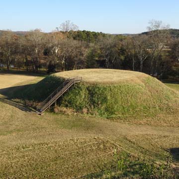 Mound B (Photograph by Robert M. Craig)
 -
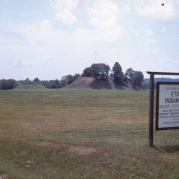
 Mound A (right) and Mound B (left), 2014 (Photograph by Robert M. Craig)
 -
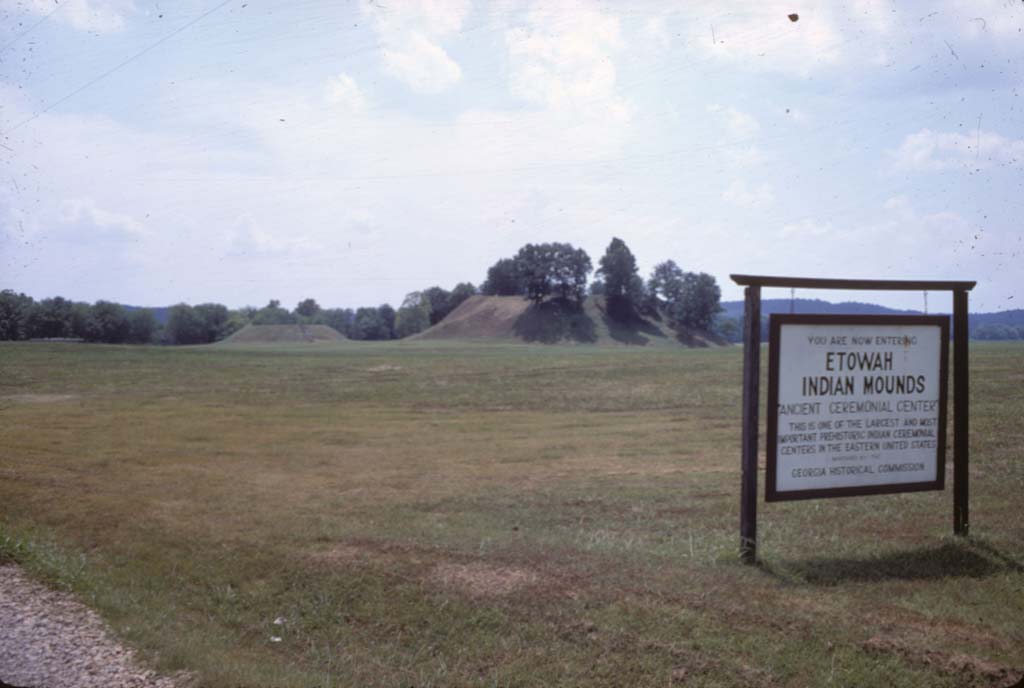
 Mound A (right) and Mound B (left), 1968 (Photograph by Robert M. Craig)
 -
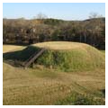
 Mound D (Photograph by Robert M. Craig)


The 54-acre Etowah site was occupied by Native Americans from about 1000 to 1550 and remains today the most intact Mississippian Culture site in the Southeast. The Mississippian Culture extended from Eastern Oklahoma to Florida, and, after its decline, Creek Indians (thought by some to be descendants of the Mississippian Culture Indians) subsequently occupied land throughout the region that would later become Georgia and Alabama. This immediate region of Etowah and the larger northwest corner of Georgia developed into the heart of the Cherokee Nation, whose capital at New Echota is in nearby Gordon County.
The Etowah site consists of three large earthen mounds (A, B, and C), three smaller mounds (E, F, and G), a village and plaza, and other pits. During the first hundred years of settlement, a portion of Mound A was erected with a small plaza adjacent, and about half the height of Mound B was built. In 1100, the Etowah site was then abandoned but reoccupied about 1250, initiating 125 years of the culture’s fullest development. Mound A, which covers 2.5 acres, was enlarged to a height of 63 feet with a half-acre platform on top. It served as residence and ceremonial site for successive priest chiefs and was the centerpiece of the chiefdom, whose capital was here from about 1250–1375. Around 1250, Mound B was also enlarged, doubling in size to 25 feet, and the 10-foot-high Mound C was built to serve as a burial site for the elite of the community. Between 1325 and 1375 a bastion wall was built around site and a large plaza developed at the base of Mound A. Recent scholars believe increased war activity in the region promoted the site’s declined after 1375 and abandonment by 1550.
Etowah’s Indian Mounds are among the most significant and largest surviving mounds in the country, yet archaeological excavations at the site during the nineteenth and twentieth centuries have been inadequate. Digs began about 1883–1885 under the sponsorship of the Bureau of Ethnology of the Smithsonian Institution. These early excavations were conducted by John P. Rogan under the direction of Cyrus Thomas, but without modern archaeological methods and controls, stratigraphy was ignored and levels of finds were not recorded, a circumstance that complicated later digs. Between 1925 and 1927, Andover Academy’s Warren Moorehead conducted three seasons of excavations, removing the summit of Mound C, and excavating its southeast flank to ground level.
Finally, in 1953, Henry Tumlin sold the site to the State of Georgia, whose Georgia Historical Commission commissioned further archaeological excavations and began to administer the site as a state park. Headed by state archaeologist Lewis Larson, working with University of Georgia professor A. R. Kelly, these excavations brought to the surface some of the best artifacts from several periods of pre-Columbian Indian occupation. Among Larson’s best known individual finds were a pair of 3-foot-high painted marble effigies of a seated man and woman, and human remains unearthed from a wooden tomb. Also notable at Etowah were the rich ritualistic paraphernalia found at Mound C, rivaled, perhaps, only by that uncovered on Craig Mound of the Spiro Mound Group in modern-day Oklahoma. These findings indicated the culture’s highly complex ceremonies with elaborate costumes and unique symbols. Log tombs and auxiliary burials were uncovered around the base of Mound C, but by 1961 excavations had so penetrated the mound itself that Mound C was destroyed and has since been reconstructed.
Only about nine percent of the site has been excavated. Mounds A and B remain untouched by digs. In addition to the six earthen mounds and plaza and village, the site also features borrow pits and a defensive ditch, the latter likely formed when earth was dug for the creation of the mounds. In 2005–2007, remote sensing and geophysical tests of the site, in which equipment measures underground magnetism, density, and electrical properties, have disclosed evidence of 140 buildings once here, and have allowed more accurate mapping of the acreage, a site now understood to be far more elaborate than earlier scholars had believed.
Today, the Etowah Indian Mounds Historic Site remains a state park open to the public and features an interpretive museum containing artifacts found on site.
References
LeDoux, Spencer C. “The Fall of Etowah, A.D. 1375: Warfare in the Iconographic Record.” Field Notes: A Journal of Collegiate Anthropology 2, no. 1 (2010): 37-49.
Kelly, A. R., and Lewis H. Larson, Jr. Explorations at Etowah, Georgia, 1954–1956. Atlanta: Georgia Historical Commission, n.d.