

-
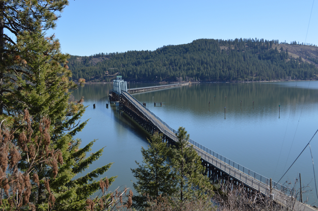
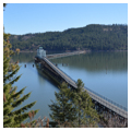
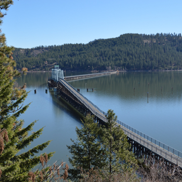 Chatcolet Bridge (Photograph by Wendy R. McClure)
 -
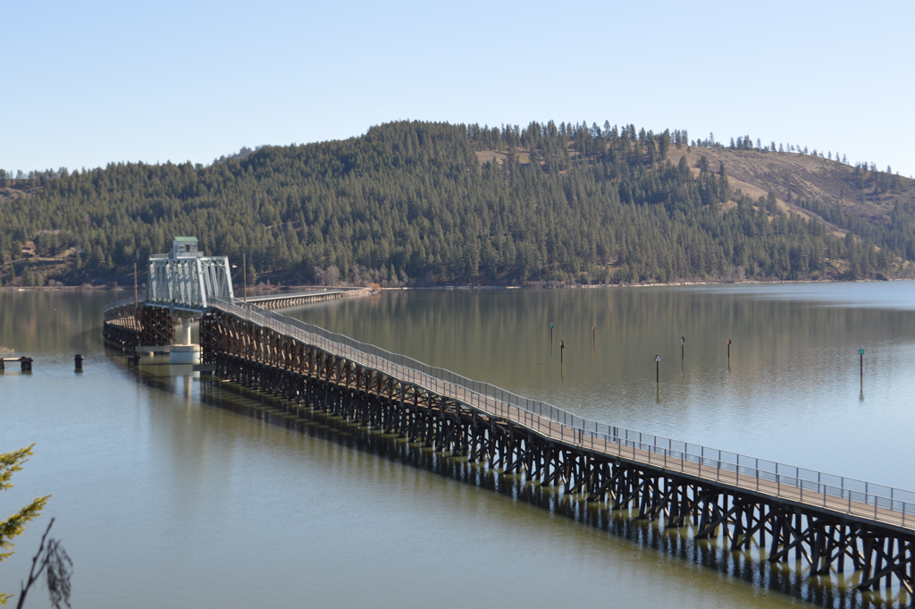
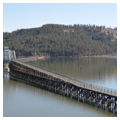
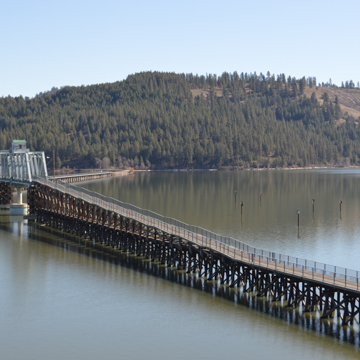 Adapted wooden and steel swing railroad bridge (Photograph by Wendy R. McClure)
 -
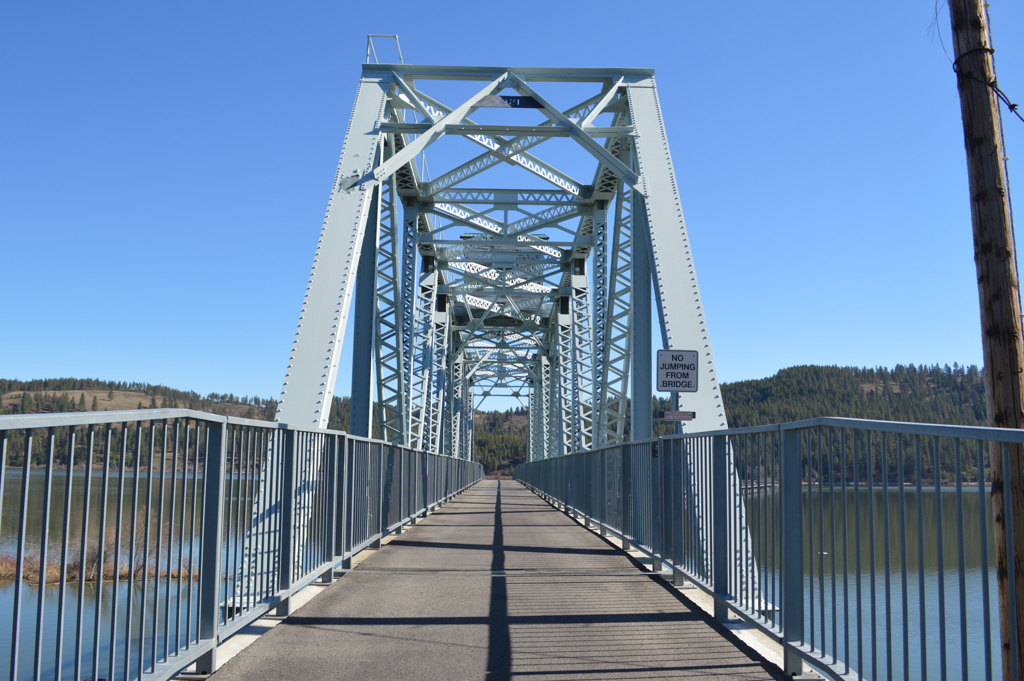
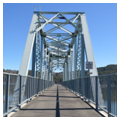
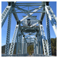
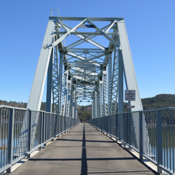 Adapted 1921 warren truss steel swing bridge (Photograph by Wendy R. McClure)
 -
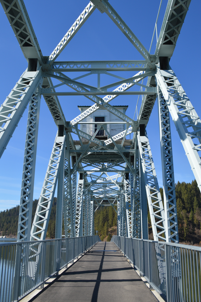
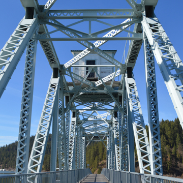 Former Bridge Tender's railroad signal tower (Photograph by Wendy R. McClure)
 -
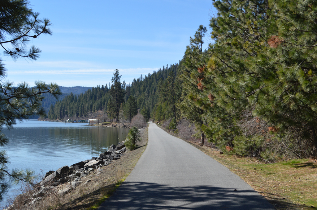
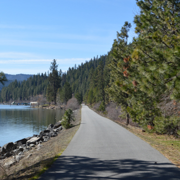 Bike trail in Heyburn State Park (Photograph by Wendy R. McClure)
 -
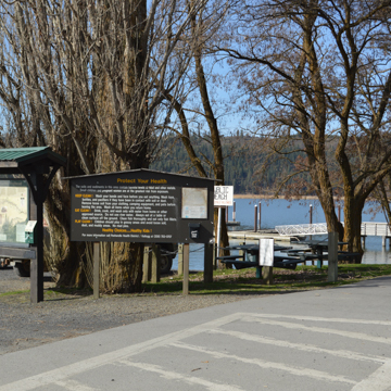
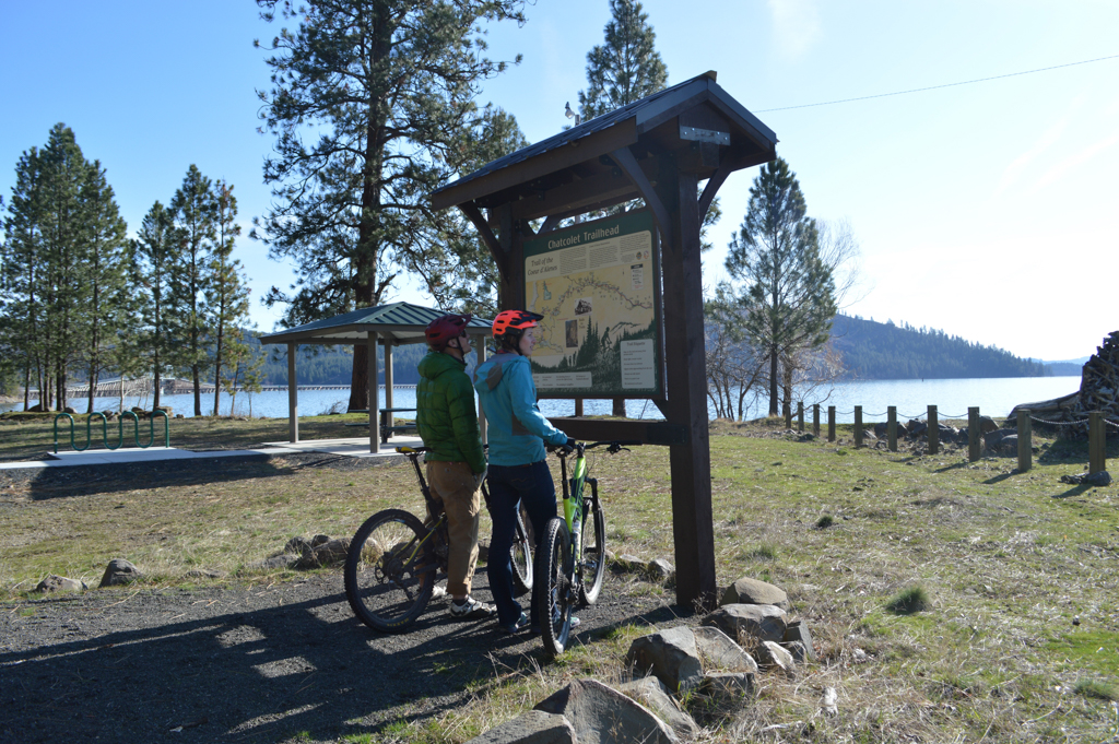
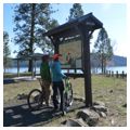
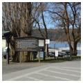
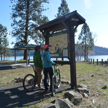 Kiosk at Chatcolet Trailhead Heyburn Park (Photograph by Wendy R. McClure)
 -
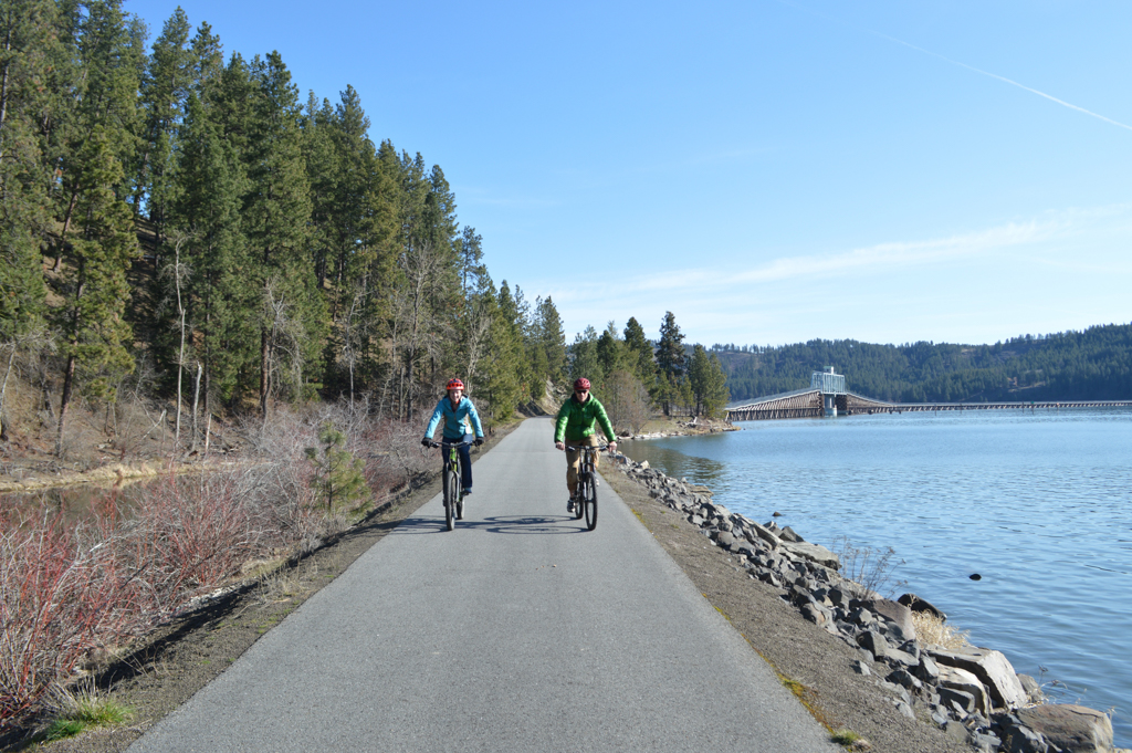
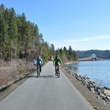 Early season bicyclists (Photograph by Wendy R. McClure)
 -
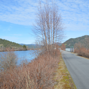
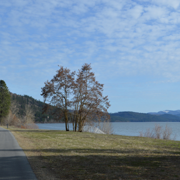
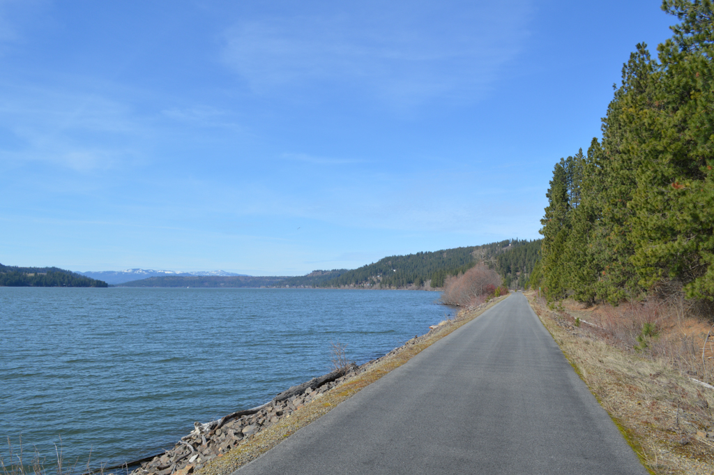
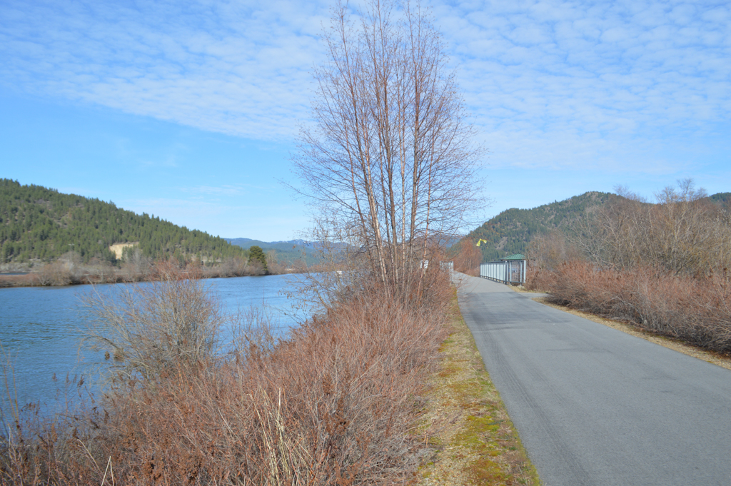
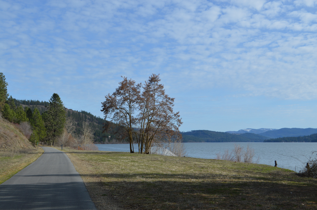
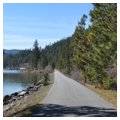
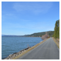
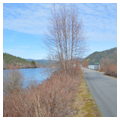
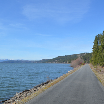 Northbound along Coeur d'Alene Lake (Photograph by Wendy R. McClure)
 -
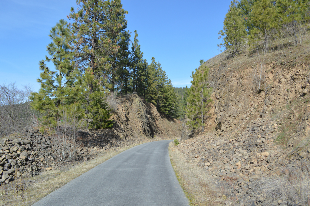
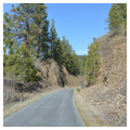
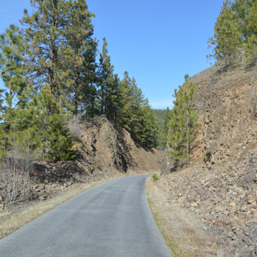 Railroad cut through basaltic outcrop (Photograph by Wendy R. McClure)
 -
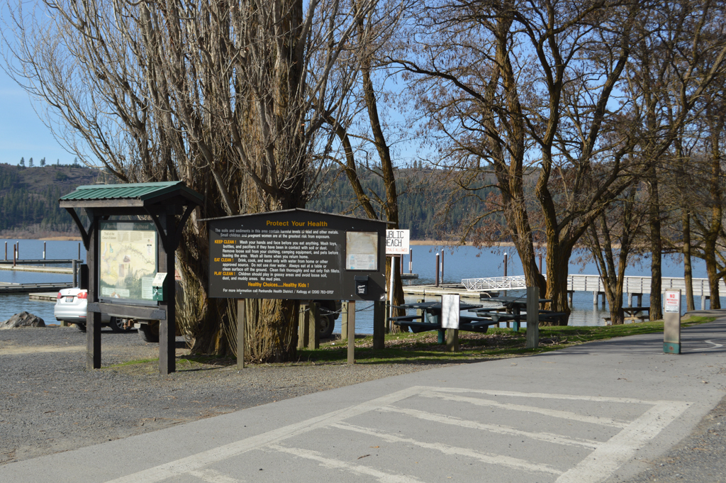
 Warning signs at Harrison Trailhead and Beach (Photograph by Wendy R. McClure)
 -
 Coeur d'Alene River Basin (Photograph by Wendy R. McClure)
 -
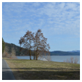
 (Photograph by Wendy R. McClure)

The Trail of the Coeur d’Alenes is a 72-mile, non-motorized recreational path that runs from Plummer, Idaho, a farming community and headquarters for the Coeur d’Alene tribe, northeast along Lake Coeur D’Alene and the Coeur d’Alene River Basin, to the town of Mullan, six miles west of the Idaho-Montana border. The trail’s entirety is encompassed by a geographic region that, for thousands of years, was traditional hunting, gathering, and fishing grounds for the Indigenous Schitsu-umsh people, or “those who were found here.” Ancestral trails once connected the region’s diverse geographies, including prairie lands, the Bitterroot Mountains, and the Coeur d’Alene Basin’s river systems, wetlands, and lakes. The routes of Indigenous people served as palimpsest for regional nineteenth-century transportation systems, including mule trains, military wagon roads, navigation systems, and rail lines. The Trail of the Coeur d’Alenes represents an early-twenty-first-century layer that was built upon the foundations of these historic routes of travel.
Early transportation systems associated with white settlement were shaped by a combination of religious, military, and economic forces. In 1846, Father Desmet, a Jesuit priest, founded a mission along the Coeur d’Alene River with the purpose of converting the Schitsu-umsh people to Catholicism. The Old Sacred Heart Mission, constructed with the help of tribal members in 1852, was accessed by boats that traveled up the Coeur d’Alene River to Mission Landing. In 1858, Lieutenant John Mullan was tasked with constructing a military road between Fort Walla Walla in Washington and Fort Benton in Montana. The route originally followed the south fork of the Coeur d’Alene River from the Montana territories to the south end of Lake Coeur d’Alene at the mouth of the Saint Joe River. The Mullan Road’s steep grades and multiple river crossings proved too difficult to navigate for regular use by military troops and pioneer wagons; however, gold prospectors moved mule trains along it to access their claims in the Coeur d’Alene River Valley and to cross Lookout Pass, the western gateway to gold reserves in Montana.
As placer mining waned, discovery of galena in 1885 by Noah Kellogg reactivated mining activities in the Coeur d’Alene River Valley. Deep silver reserves spawned corporate mining operations and town development along the river and its tributaries. The mining community of Wallace emerged as a central market place for the Coeur d’Alene mining district in a region also known as “The Silver Valley.”
Beginning in 1886, newly formed regional railroad companies competed to dominate the Silver Valley’s promising transportation market. Local companies raced to secure routes from various approaches that would link with lines operated by national railroad giants: the Northern Pacific Railway (NP) and the Union Pacific Railroad (UP). The first, the Coeur d’Alene Railway and Navigation Company (CR&N), constructed a line from Old Mission Landing on the south fork of the Coeur d’Alene River, to its final destination in Wallace. Passengers as well as payloads of silver, zinc, and lead, were transferred from trains to company steamships that operated service between Mission Landing and Coeur d’Alene City. Parent company affiliate, the NP, completed linkage to their transcontinental route by extending tracks to Coeur d’Alene City from Rathdrum, Idaho.
Also in 1886, the newly formed Washington and Idaho Railroad (W&IR) surveyed a route accessed from the southwest across the Coeur d’Alene Reservation. Congressional approval was given in 1888 to construct tracks on the reservation, at which time WI&R rights were transferred to the Oregon Railway and Navigation Company (OR&N), which maintained close ties with the UP. In 1889 the OR&N completed its route between Wallace and Spokane Falls, WA. OR&N’s route necessitated construction of a one-mile-long wooden trestle bridge, with a steel swing section to allow for steamship navigation, that spanned the mouth of the Saint Joe River at the south end of Lake Coeur d’Alene. Although the route was circuitous and subject to spring floods, it was generally favored over CR&N’s combined system, which required multiple freight transfers between rails and steamships. OR&N passengers frequently expedited their travel by transferring to the company-operated steamship service between the port cities of Harrison and Coeur d’Alene.
To remain competitive, the NP constructed a “temporary” route from Missoula, Montana, over Lookout Pass to Wallace via Mullan in 1891. Although the overland route avoided the need for steamship support and expensive tunneling through the Bitterroot Mountains, construction costs, coupled with the national financial panic of 1893, ultimately sent the railroad into receivership. Financial concerns from the 1893 Panic also plagued the UP as the two companies and their subsidiaries continued to battle for regional dominance. Throughout their tenure, both national railroad companies suffered setbacks from the Silver Valley’s unique circumstances: railroad hijackings occurred during violent mining rebellions; the fire of 1910 destroyed railroad trestles as it ravaged 3 million acres between Wallace and Missoula; heavy winters disrupted service; and a devastating spring flood in 1933 inundated much of the Silver Valley, destroying railroad infrastructure. While the NP’s overland route to Missoula remained operational under the ownership of the Burlington Northern (BN) until 1980, the route was regularly subjected to avalanche conditions. After the BN filed for abandonment, the UP assumed ownership of the track between Mullan and Wallace in 1980, solidifying company ownership of the entire right of way between Mullan and Plummer.
Plummeting silver prices in the early 1980s induced closure of the Silver Valley’s largest corporate mining operations including the Bunker Hill and Sunshine mines. The UP cut back service in tandem with the diminished markets. One hundred years of polluting mining and transport practices had taken their toll on human and environmental health. The effects could be evidenced in a variety of forms: children in Silver Valley communities had dangerously high lead levels; mountain sides were treeless due to toxic emissions from smelters; waste impoundment areas contained 20 million tons of highly toxic tailings; and soils in residential neighborhoods were contaminated from airborne dust. The downstream effects were profound. The entire Coeur d’Alene River Basin and its drainage system remain contaminated by downstream flow of lead-laden tailings that were routinely dumped into the Coeur d’Alene River until 1961. The UP’s line between Mullan and Plummer was also fouled by lead and toxins from freight shipments.
In 1985, the Environmental Protection Agency (EPA) declared 21 square miles of the Silver Valley as a Superfund site. The EPA, having determined that clean-up outside of the designated site was not feasible, did not address downstream contamination or pollution along the rail line. Subsequently, in 1996 the U.S. Justice Department a filed a lawsuit holding the UP responsible for clean-up of the railroad corridor between Mullan and Plummer. In 2000, a consent decree among the UP, the State of Idaho, the Coeur d’Alene Tribe, and the federal government resulted in a $30 million settlement for clean-up of mining contamination within the railroad right of way and its conversion for use as a recreational bicycle and hiking trail in the spirit of the Rails-to-Trails Act. The settlement also required that the UP have lifetime responsibility for trail and bridge maintenance and a trust fund to cover costs. The agreement granted the Coeur D’Alene Tribe and Idaho Department of Parks and Recreation shared ownership and operational responsibilities for the trail. Overall, the clean-up solution was a win-win; it promised to create both a unique and stunning recreational asset and to afford some economic stimulus for distressed communities along its route.
In 2000, salvage companies initiated clean-up along the entire route by pulling up ties and rails and decontaminating them. Soil and gravel from the contaminated rail bed was excavated and removed to a depth ranging from 1 to 8 feet depending upon contamination levels, and replaced with clean fill. Felt fabric was used to cap remaining pollutants. The corridor was then paved with a continuous 10-foot-wide bed of asphalt to further cap pollutants and create a rideable surface for non-motorized recreation. The rails to trails conversion process also included adapting the historic railroad swing bridge at the mouth of the Saint Joe River to accommodate both permanent navigation between Lake Coeur d’Alene and the river, as well as ADA-compliant accessibility for trail users. The innovative solution, as designed by the U.S. Army Corps of Engineers, involved lifting the 1921 steel truss section of the bridge and setting it in a permanently closed position. A stepped ramp, supported by matching timber trusses, was added on top of the original wooden sections of the rail bridge on each side of the crossing. The adapted railroad bridge serves as a gateway to Heyburn State Park. It is a popular stopping point for trail users, affording views of historic float residences at Hidden Bay and the unique circumstance of the Saint Joe River flowing through Chatcolet Lake into Lake Coeur d’Alene.
The Trail of the Coeur d’Alenes opened for recreational use in 2004. Trail users travel through the Coeur D’Alene River Basin’s remarkable ecosystems, home to waterfowl and large game. Historic sites aligning the trail, including the Old Sacred Heart Mission, Heyburn State Park, the Wallace Historic District, Harrison, and the entire length of the Coeur d’Alene mining district, reveal important features of the state’s rich architectural and mining heritage. Warning signs along the Coeur ‘d’Alene River section of the trail also remind users of the largely invisible but ongoing challenges to human health and natural systems, wrought by 100 years of exploitive environmental practices. The Trail of the Coeur d’Alenes, as a poster child for Idaho’s growing economy in outdoor recreation and cultural tourism, also communicates optimism about human capacity to transform environmental liabilities into sustainable assets for the public good.
References
Halley, Larry. “Trail of the Coeur d’Alenes.” Friends of the Coeur d’Alene Trail. Accessed January 18, 2019. https://friendsofcdatrails.org/.
Hennessy, Leo, Non-Motorized Trails Program Manager, Idaho State Parks and Recreation. Email communication with author, March 8, 10, 2016.
Miller, Arthur. “The Legacy of the Bunker Hill Mine: Part 2.” Industrial Workers of the World. Accessed January 18, 2019. https://www.iww.org/.
Environmental Protection Agency. “The Bunker Hill Mining and Metallurgical Complex Operable Unit 3.” EPA Superfund Record of Decision, September 2002. Accessed January 18, 2019. https://www.epa.gov/.
Wood, John V. Railroads Through the Coeur d’Alenes. Caldwell, ID: Caxton Press, 1983.