

-
 (Photograph by David Hill)
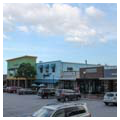
 -
 (Photograph by David Hill)

Cameron Village is a world of firsts: it is Raleigh’s first post–World War II curvilinear suburb, the first mixed-use development on the East Coast, and quite possibly the first greenfield mixed-use development in the United States. Cameron Village was the vision of J.W. (Willie) York, whose father was a prominent builder in Raleigh responsible for such projects as Memorial Auditorium and the Sir Walter Raleigh Hotel. York followed in his father’s footsteps, first as a house builder in Raleigh and then at Cherry Point working for the T.A. Loving Company during World War II. He returned to Raleigh after the war and in 1946 attended a session of the Community Builders Council at the Home Builders Association annual meeting in Chicago, where he heard J.C. Nichols talk about the Country Club development he had built in Kansas City, Missouri. York was inspired by the concept.
York entered a partnership with Raymond Bryan and selected a property in Raleigh about one mile northwest of the city center and three-quarters of a mile northeast of North Carolina State College (now University). The 160-acre parcel, owned by the Smallwood family, was once part of the Cameron Plantation, one of the four major land holdings that originally encompassed Raleigh and its surrounding region. The property is roughly bounded by the Cameron Park neighborhood to the south, Oberlin Road to the west, St. Marys Street to the east, and Rex Hospital to the north. York intended to build a shopping center, single-family houses, and apartments. Earlier planned shopping centers were typically adapted to an existing urban matrix but Cameron Village was the first greenfield development, meaning that the project was built on previously undeveloped land. York was at the forefront of this trend, which became the dominant model for new commercial development in suburban America.
After acquiring an option to purchase the land, York and Bryan secured a $2.5 million loan from the Durham Life Insurance Company that was guaranteed through the Federal Housing Authority’s Section 608 Program. The project was without precedent in the area and City Council members were skeptical. Permits to begin construction were finally issued in August 1947, after a period of political debate. To design Cameron Village, York hired Seward Mott, who had previously directed the Federal Housing Authority’s Land Planning Division and then served as director of the Urban Land Institute. York also hired New York–based Leif Valand as architect, who was familiar with prefabricated construction methods, a system York wished to implement in Cameron Village.
With city permits in hand, the team started building the 283-unit Cameron Village Garden Apartments along Nichols Avenue on the northeast corner of the property. Prefabricated construction enabled the apartments to go up quickly and efficiently. In 1948, the design won first place in the Garden Apartments category of the Home Builders Association. Following this success, York built additional apartments along Clarke Avenue in 1959, Smallwood Drive in 1951, and Daniels Street in 1952–1954.
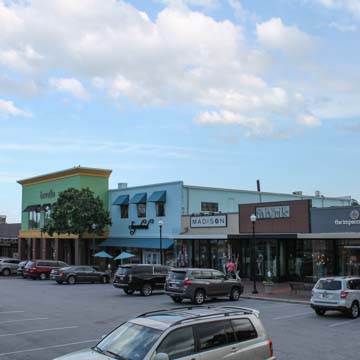
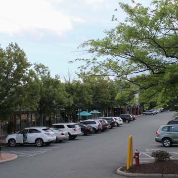
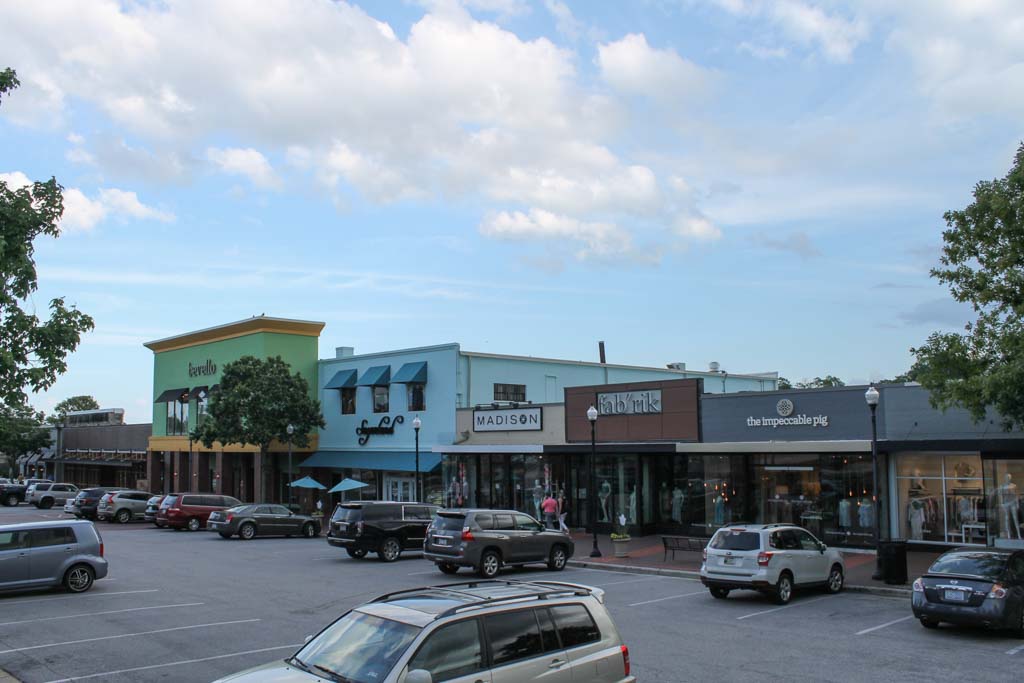
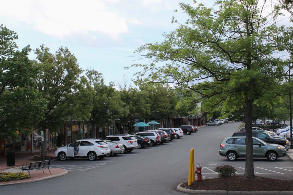
Once apartment construction was well underway, York and Valand turned their attention to the commercial district of shops that was to be the core of Cameron Village. The overall plan employs a gridded commercial core surrounded by curvilinear residential streets. The six-block commercial core was initially designed to consist of mostly one-story and some two-story structures. Valand’s modernist designs featured curtain wall facades with large expanses of glass enframed by brick and stone veneer. York marketed Cameron Village as a “community within a city,” and lured retailers from the downtown central business district, sometimes with lease clauses that guaranteed sales.
The single-family residential section to the north of the commercial core was platted in 1949. As the first postwar curvilinear neighborhood in Raleigh, it started what would become a trend of suburban development that has since defined the region. Mott used longer blocks to save money on paving for cross streets, curving them up and down the rolling hills to slow traffic. Lots are generous in size, typically 40 to 100 feet wide and 100 to 160 feet deep, with 30-foot setbacks and no sidewalks. Houses on corner lots are sited at an angle, facing the intersection. The neighborhood contains a mix of architect-designed houses with ones that builders adopted after published plans; most are ranch-style houses. York used deed restrictions and neighborhood covenants to ensure a continuity of forms. By 1955, six years after being platted, the neighborhood was almost entirely developed.
Valand’s commercial buildings are vaguely modernist, boxy structures that can be adapted to various uses. As architectural historian Richard Longstreth has noted, commercial architecture is rarely of distinguished architectural value because building forms are often governed by zoning laws or use restrictions. Adaptability was a central requirement for the commercial spaces in expectation of turnover. There is an absence of pronounced regional distinction, which represents the initiative of the Community Builders and Urban Land Institute, with which York and Mott were both involved.
In September 1971, Cameron Village opened the Village Subway in the unused basement space of the Woodburn Drive block in the commercial district. Modeled after the Atlanta Underground, it was a network of pedestrian streets lined with shops and restaurants under first-floor retail space. With its bars and restaurants, it became a popular nightlife scene, particularly since most of the stores in Cameron Village closed in the early evening. It eventually closed in the 1980s, however, since there was not enough daytime pedestrian traffic to sustain the shops.
In 2002–2004, the commercial core was renovated from a modernist style to a “Main Street” village aesthetic. The continuous translucent canopies that once unified the complex were removed, as was the parking deck that was once over the block of buildings along Daniels Street between Cameron Street and Clark Avenue. The surrounding residential district has since been designated a historic district.
References
Cohen, Lizabeth. “Town Center to Shopping Center: the Reconfiguration of Community Marketplaces in Postwar America.” American Historical Review101, no. 4 (1996): 1050-81
Gillette, Howard. “The Evolution of the Planned Shopping Center in Suburb and City.” Journal of the American Planning Association51, no. 4 (1985): 449-60.
Hutchins, Nan. Cameron Village: A History, 1949-1999. Raleigh, NC: Spirit Press, 2001.
Jackson, Kenneth T. “All the World’s a Mall: Reflections on the Social and Economic Consequences of the American Shopping Center.” American Historical Review101, no. 4 (1996): 1111-1121
Longstreth, Richard. “Compositional Types in American Commercial Architecture.” Perspectives in Vernacular Architecture2 (1986): 12-23.
Wagner, Heather M., “Cameron Village Historic District,” Wake County, North Carolina. National Register of Historic Places Registration Form, 2010. National Park Service, U.S. Department of the Interior, Washington, D.C.