

U.S. 491 between Gallup and Shiprock
You are here
U.S. 491 Corridor through Navajoland
1925–2003. Western New Mexico within the Navajo Nation.
-
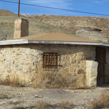
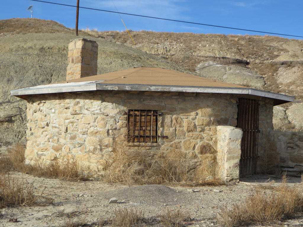
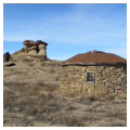
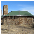
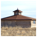
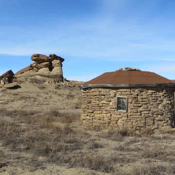 Stone hogan along U.S. 491 (Photograph by Lillian Makeda)
 -
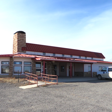
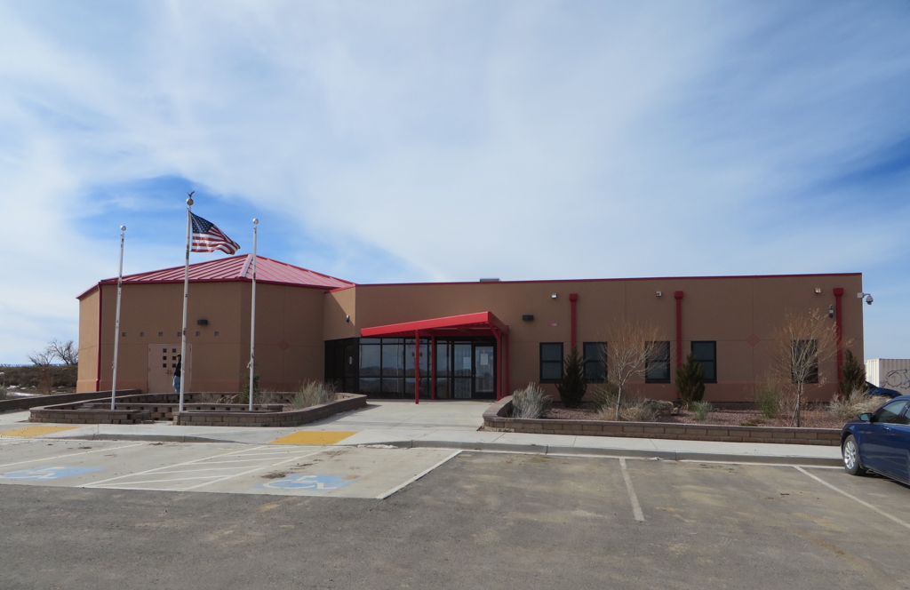
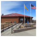
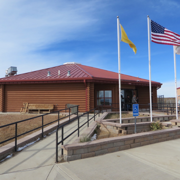 Twin Lakes Senior Citizens' Center, looking northwest (Photograph by Lillian Makeda)
 -
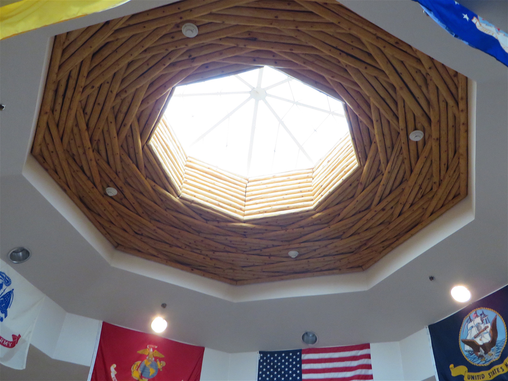
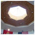
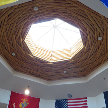 Interior, Twin Lakes Senior Citizens' Center (Photograph by Lillian Makeda)
 -
 Twin Lakes Chapter House (Photograph by Lillian Makeda)
 -
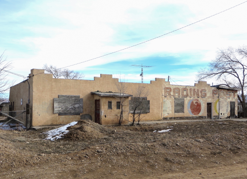
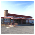
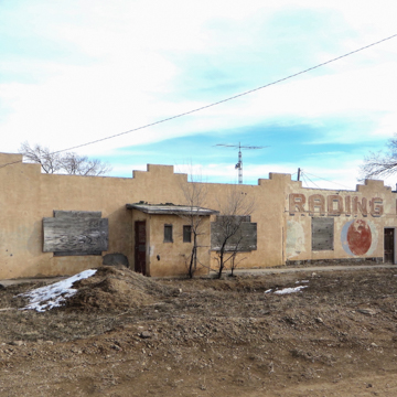 Twin Lakes Trading Post (Photograph by Lillian Makeda)
 -
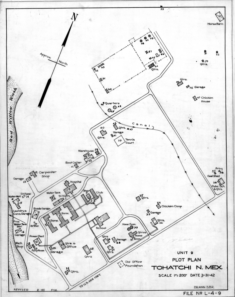
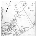
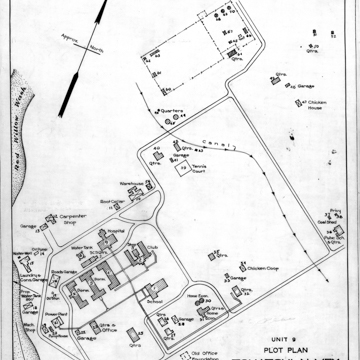 Plot plan of the Tohatchi Boarding School, dated February 1945 (Courtesy of the Bureau of Indian Affairs)
 -
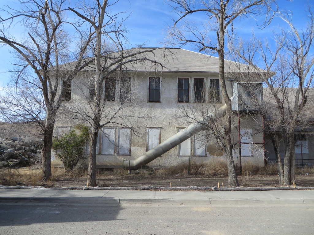
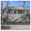
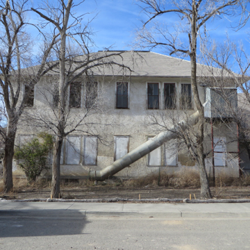 Main school building at the Tohatchi Boarding School with metal escape route (Photograph by Lillian Makeda)
 -
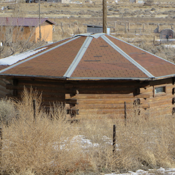
 Double hogan at the Tohatchi Boarding School (Photograph by Lillian Makeda)
 -
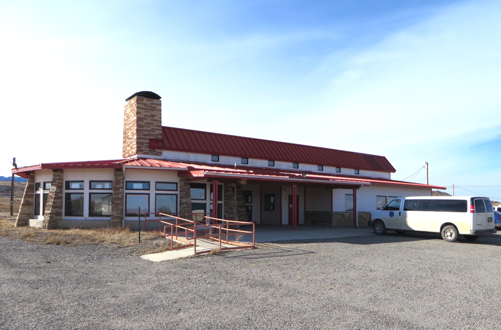
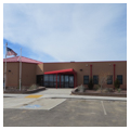
 Sheep Springs Senior Citizens' Center (Photograph by Lillian Makeda)
 -
 Split-log hogan along U.S. 491 (Photograph by Lillian Makeda)
 -
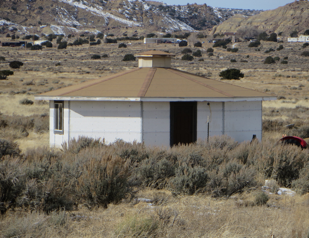
 Hogan with light-frame construction along U.S. 491 (Photograph by Lillian Makeda)
 -
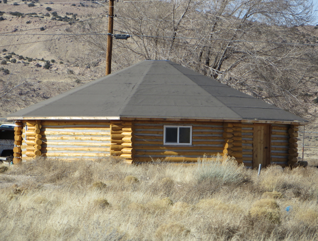
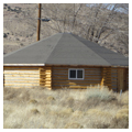
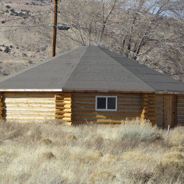 Log hogan along U.S. 491 (Photograph by Lillian Makeda)
 -
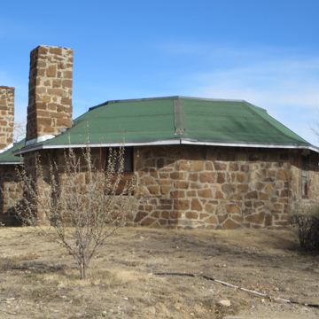
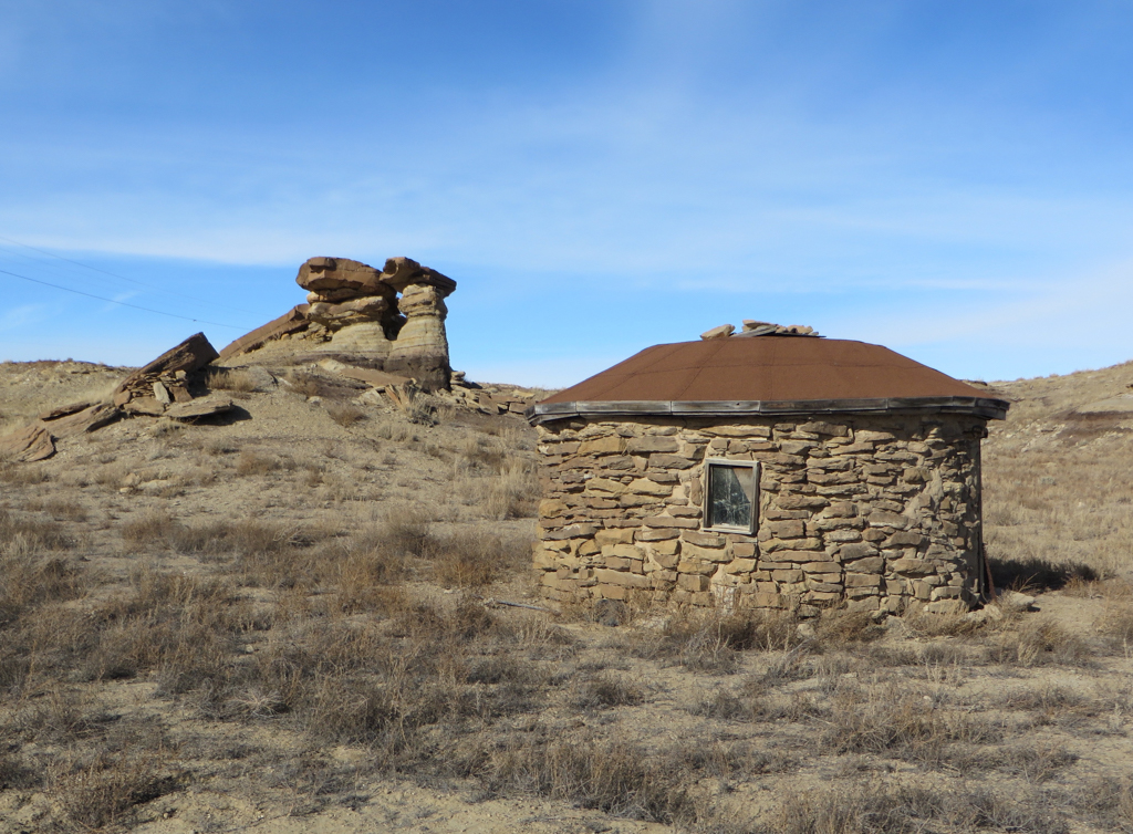
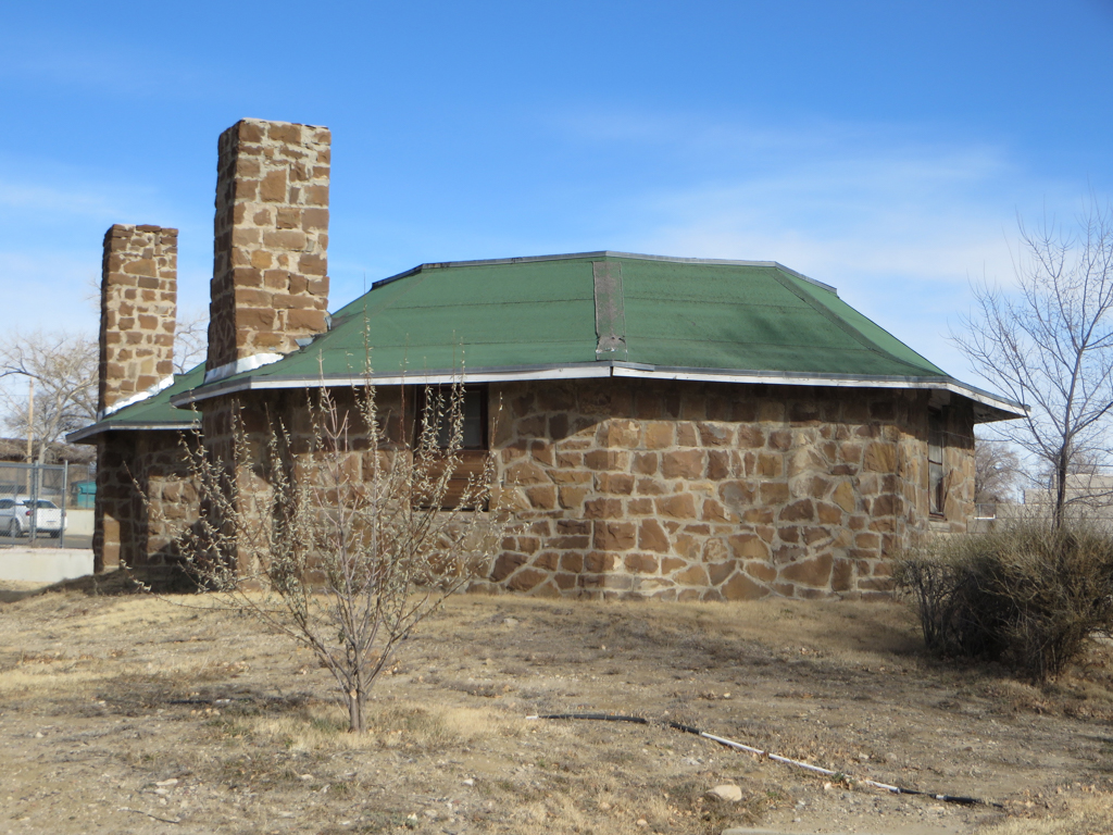
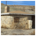
 Stone hogan in Newcomb (Photograph by Lillian Makeda)
 -
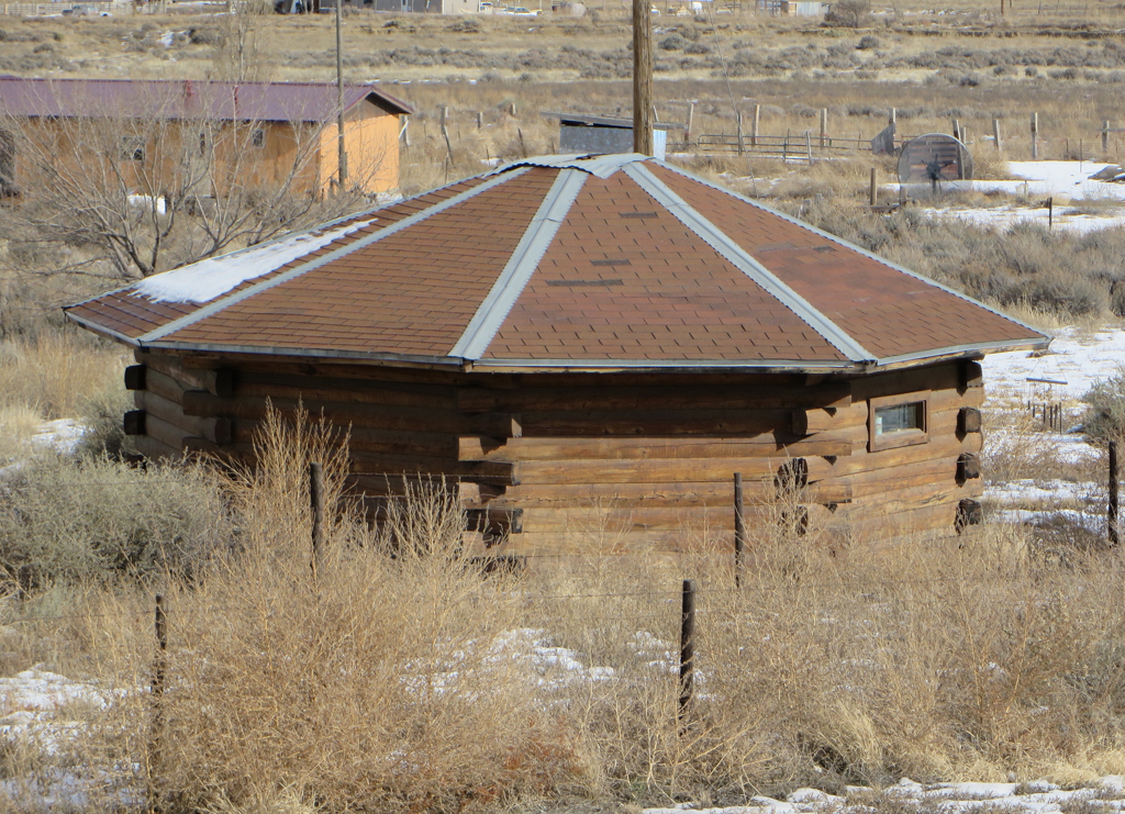
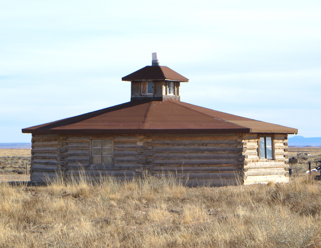
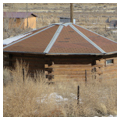
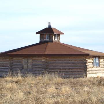 Split-log hogan with cupola along U.S. 491 (Photograph by Lillian Makeda)


U.S. Highway 491 from Gallup to Shiprock serves as the major north-south route through the eastern part of the Navajo Nation, the largest reservation in the country. The highway passes over pre-Columbian roads that have been traveled for at least a thousand years. More recently, the route became known as “the Navajo Trail” and was part of the National Park as a park highway before being incorporated into the federal highway system in 1926.
Gallup (Navajo, naʼnízhoozhí or “place by the bridge”) is the southern terminus of U.S. 491. The town was a major stop on the intercontinental railway system through New Mexico (completed in 1881) and is the largest community on I-40 (formerly Route 66) in western New Mexico. The village of Shiprock is named after Shiprock (Navajo, tsé bit’a’i or “winged rock”) a traditional Navajo (or Diné) sacred site. In geological terms, Shiprock is the neck of a volcano that has eroded away leaving a mass of igneous rock towering 1581 feet above the Colorado Plateau. The highway between Gallup and Shiprock travels through Diné communities with trading posts, Christian missions, and the first Diné boarding school in New Mexico. These buildings testify to the presence of Euro-Americans on the reservation, but the road also passes by houses and civic buildings that reflect the Indigenous architecture of the region. The Diné hogan appears in a variety of permutations, some traditional and some hybridized. These buildings transform the highway between Gallup and Shiprock into an architectural landscape like none other in the world.
The Diné hogan (Navajo, hooghan or “home place”) first appears in historical accounts in 1788 when a Spanish adventurer encountered “a cone-shaped military tent with a square vestibule.” As the historian Peter Nabokov has noted, this was probably a “forked-stick” hogan, a form which is nowadays only rarely found on the reservation. A number of other traditional hogans have developed over the centuries; the most common are circular or polygonal with walls constructed from either palisaded or horizontally laid logs. The finest examples have a hemispherical roof that is corbeled with overlapping timbers. Many hogans in the northern part of the reservation are plastered so that the exterior appears as an earthen dome. With the right builder, this type of hogan can be strikingly beautiful—an example may be found on the west side of U.S. 491 between Gallup and Tohatchi. An absence of timber in some parts of Navajoland has produced round hogans of stone, while the availability of industrially produced building materials has resulted in polygonal buildings that incorporate newer types of construction. Although taking different forms, all hogans worthy of the name are ritually blessed and possess an entrance facing dawn.
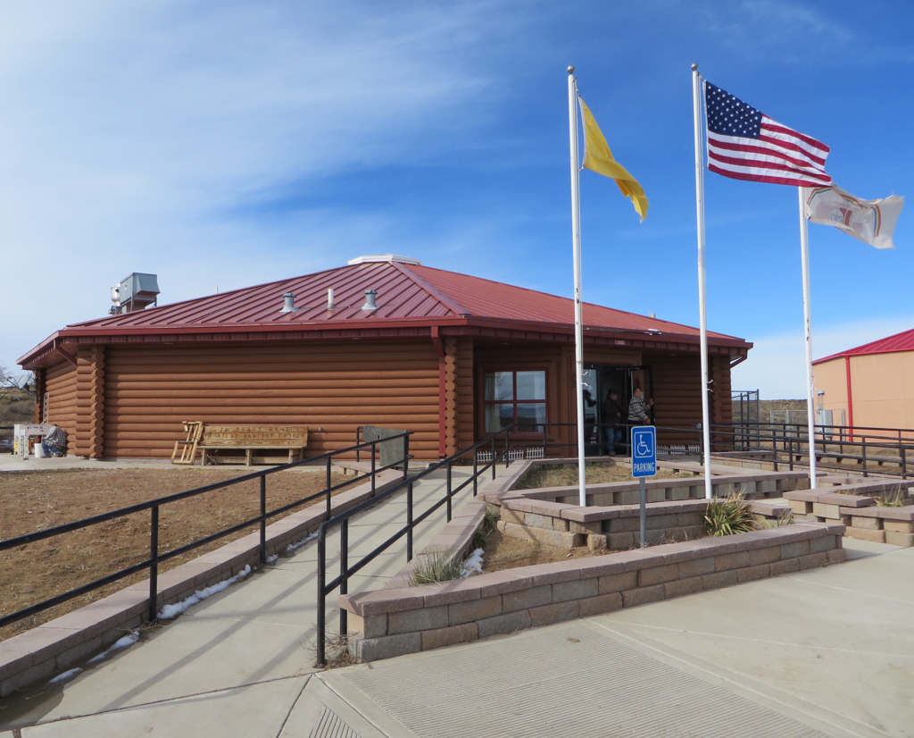
U.S. 491 north of Gallup passes by the intersection with U.S. 264, which connects to Window Rock (Navajo, tségháhoodzání or “perforated rock”), the capital of the Navajo Nation. The capitol complex, located across the Arizona border 19 miles away, dates from the 1930s and includes the Navajo Nation Council Chamber, a National Historic Landmark. A number of different hogans appear along U.S. 491 north to Bahastl’ah (“nook,” formerly Twin Lakes), the seat of the Bahastl’ah chapter. The federal government initiated the chapter system during the 1920s and, with 110 chapters, it continues as the basic form of local governance for the Navajo Nation. The communities that form the center of each chapter typically possess a cluster of buildings with a chapter house, trading post, and senior center. The chapter house provides a space for administrative meetings and local events; the example at Bahastl’ah incorporates a polygonal section that references hogan architecture. The Twin Lakes Trading Post was established by Diné traders Emma and Tom Lee in 1956 and closed in 1981. The senior center at Bahastl’ah, completed in 2004, is a large hogan designed by Leon Shirley, the first board-certified Diné architect. The interior of the building includes a modern interpretation of a traditional corbeled roof.
In 1900, the federal government built a boarding school for Diné children at Tohatchi (Navajo, tó haachʼiʼ or “water is dug out with one’s hand”). It was the third boarding school within the Navajo Nation and the first of these to be located within New Mexico. The school grew to include a complex centered on a large, T-shaped classroom building that remains as one of the oldest two-story structures on the reservation. During the 1930s, the Civilian Conservation Corps-Indian Department constructed a double-hogan for teaching home economics at the school. The mansard roofs on the building serve to create a particularly rare type of hybridized hogan architecture.
North of Tohatchi, U.S. 491 passes through one of the densest areas of pre-Columbian settlement in the Southwest. This ancient landscape is the site of two of the most famous trading posts on the Navajo Reservation, Two Grey Hills and Toadlena, both located about 15 minutes west of U.S. 491. One of the largest hogans in the Navajo Nation is also on the west side of U.S. 491 a few miles south of Shiprock. The building includes wings that project toward each of the four cardinal directions.
Between 1926 and 2003, U.S. 491 was designated as U.S. 666. Over time, the high rate of vehicular accidents on the stretch through Navajoland prompted a number of people to recall the biblical passage in Revelation 13:18 which refers to 666 as “the number of the beast.” By the end of the century, U.S. 666 had become commonly known as “The Devil’s Highway,” a source of amusement to some and apprehension to others. Hexakosioihexekontahexaphobia (fear of the number 666) eventually ruled the day and in 2003, Governor Bill Richardson announced his intention to replace the highway’s designation. The New Mexico State Legislature passed resolutions that noted the obstacles “666” posed to tourism and economic development on the Navajo Reservation, while observing that “people living near the road already live under the cloud of opprobrium created by having a road that many believe is cursed running near their homes and through their homeland.” The route’s name was officially changed to U.S. 491 later that year.
References
Bailey, Garrick, and Roberta Glenn Bailey. A History of the Navajos: The Reservation Years. Santa Fe, NM: School of American Research Press, 1986.
Berkholz, Richard C. Old Trading Posts of the Four Corners. Lake City, CO: Western Reflections Publishing Company, 2007.
Jett, Stephen C., and Virginia E. Spencer. Navajo Architecture: Forms, History, Distributions.Tucson: University of Arizona Press, 1981.
Jole, Everett. Personal communication with Lillian Makeda, December 21, 2015.
Kelley, Klara B., and Harris Francis. Navajoland Trading Post Encyclopedia. Window Rock, AZ: Navajo Nation Historic Preservation Department, 2018.
Nabokov, Peter, and Robert Easton. Native American Architecture. New York: Oxford University Press, 1989.
Sloan, David. Personal communication with Lillian Makeda, December 18, 2015.
Stein, John R. Personal communication with Lillian Makeda, December 31, 2015.
Young, Robert W. The Navajo Yearbook of Planning in Action. Report No. IV, 1954. Window Rock: Navajo Agency, 1955.
Weingroff, Richard. “U.S. 666. ‘Beast of a Highway’?” Highway History. U.S. Department of Transportation, Federal Highway Administration. Accessed January 2, 2015. https://www.fhwa.dot.gov.
Wilson, Les. Personal communication with Lillian Makeda, December 21, 2015.
Writing Credits
Coordinator:
Christopher Mead
Regina N. Emmer
If SAH Archipedia has been useful to you, please consider supporting it.
SAH Archipedia tells the story of the United States through its buildings, landscapes, and cities. This freely available resource empowers the public with authoritative knowledge that deepens their understanding and appreciation of the built environment. But the Society of Architectural Historians, which created SAH Archipedia with University of Virginia Press, needs your support to maintain the high-caliber research, writing, photography, cartography, editing, design, and programming that make SAH Archipedia a trusted online resource available to all who value the history of place, heritage tourism, and learning.