You are here

Capitol Square

-A A +A
1780, layout, Thomas Jefferson and Directors of Public Works. 1816, first landscaping plan, Maximilian Godefroy. 1850–1860, second landscaping plan, John Notman. 1906–1922, landscaping
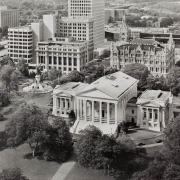
  • Virginia State Capitol and Capitol Square (HABS)

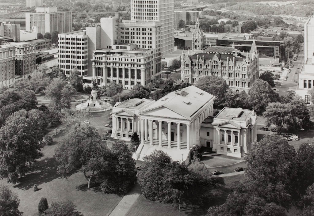
In 1779 the Commonwealth of Virginia decreed that the Richmond plan would be expanded by 200 “squares” or city blocks and that six blocks on Shockoe Hill were to be reserved for state government. In 1780 Governor Thomas Jefferson selected the six blocks that would make up present-day Capitol Square. To center the square on the promontory intended for the future capitol building, Jefferson took half blocks on the north and south. This offset arrangement terminated Franklin Street and Grace Street at the square and created Bank and Capitol streets to the north and south. Through most of its early history the square remained as Jefferson found it: a rough, hilly site with two large ravines. The first attempt to landscape the square came with Maximilian Godefroy's neoclassical plan of 1816. This plan proved unsuccessful because the workmen could not implement its rigid formality in the untamed gullies of the square. The only remaining element is the cast iron fence that surrounds the square. The landscape as it appears today reflects the improvements made by John Notman in the 1850s. The picturesque system of walks and fountains shows the influence of his work at Hollywood Cemetery. A number of other improvements followed the expansion of the capitol in 1906, the most significant being the widening of Bank Street. In 1980, Capitol Street to the north succumbed to the plaza mania and was closed.

Writing Credits

Author: 
Richard Guy Wilson et al.
×

Data

What's Nearby

Citation

Richard Guy Wilson et al., "Capitol Square", [Richmond, Virginia], SAH Archipedia, eds. Gabrielle Esperdy and Karen Kingsley, Charlottesville: UVaP, 2012—, http://sah-archipedia.org/buildings/VA-01-RI1.

Print Source

Buildings of Virginia: Tidewater and Piedmont, Richard Guy Wilson and contributors. New York: Oxford University Press, 2002, 174-175.

If SAH Archipedia has been useful to you, please consider supporting it.

SAH Archipedia tells the story of the United States through its buildings, landscapes, and cities. This freely available resource empowers the public with authoritative knowledge that deepens their understanding and appreciation of the built environment. But the Society of Architectural Historians, which created SAH Archipedia with University of Virginia Press, needs your support to maintain the high-caliber research, writing, photography, cartography, editing, design, and programming that make SAH Archipedia a trusted online resource available to all who value the history of place, heritage tourism, and learning.

,