

-
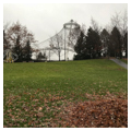
 (Photograph by J. Philip Gruen)
 -
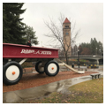
 Childhood Express sculpture by Ken Spiering, 1990 (Photograph by J. Philip Gruen)
 -
 Former U.S. Pavilion, built for Expo '74 (Photograph by J. Philip Gruen)
 -
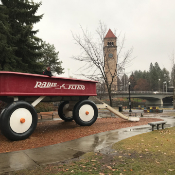
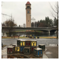
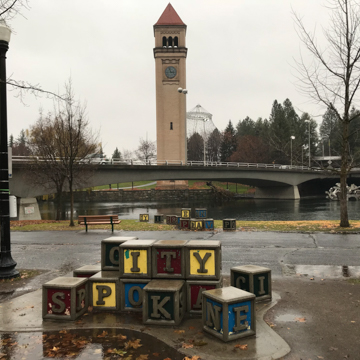 Park view with Great Northern Clock Tower beyond Spokane River (Photograph by J. Philip Gruen)
 -
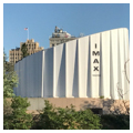
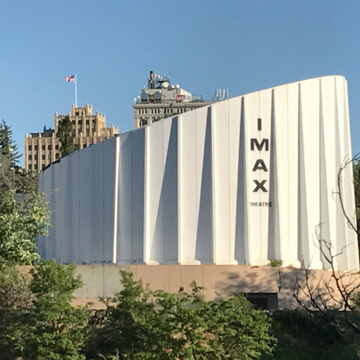 IMAX Theater (Photograph by J. Philip Gruen)
 -
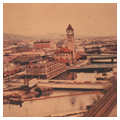
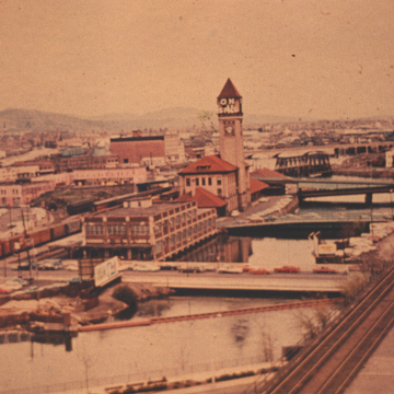 Riverfront Park, view of site prior to Expo '74 (Courtesy of Washington State Archives, Eastern Region Branch, Spokane Planning Department, Expo '74 Photograph Collection)
 -
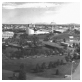
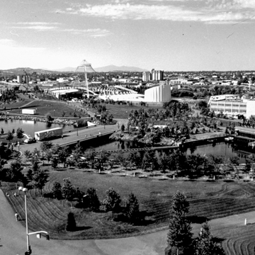 Expo '74 (Courtesy of Washington State Archives, Eastern Region Branch, Spokane Planning Department, Expo '74 Photograph Collection)
 -
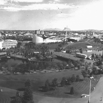 Expo '74 (Courtesy of Washington State Archives, Eastern Region Branch, Spokane Planning Department, Expo '74 Photograph Collection)


Riverfront Park, which comprises 100 acres and straddles the cascading falls, bends, and forks of the Spokane River, was the fulcrum for the transformation of central Spokane from a predominantly industrial area into one of open space, recreation, and leisure. Following widespread clearance of industrial and transportation infrastructure for Expo ‘74, the first world’s fair dedicated to an environmental theme, the fair site was redesigned as a public park by Robert Perron and Associates. Several structures from the fair were left intact and repurposed for new uses, and the park was consciously landscaped to blend its edges with either the urban or natural environments in its immediate midst. As open space and the recognition of the river as a natural asset became more apparent, the park spurred extensive redevelopment in the downtown core.
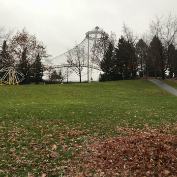
The park features several noteworthy structures and spaces, some of which had existed prior to the area’s reconfiguration in the 1970s and others that were built anew or brought to the site. Already in place by the time park redevelopment began in the mid-1970s was the meandering Spokane River Centennial Trail; the Great Northern clock tower (built in 1902 as part of the expansive Great Northern passenger depot, which was demolished for the fair); and the 145-foot, metal-and- wire-cable tensile structure, designed by Naramore, Bain, Brady and Johanson and originally covered in vinyl, built to serve as the U.S. Pavilion for Expo ‘74. The Looff Carousel, named for principal carver Charles I.D. Looff, was reassembled in Riverfront Park in 1975 following seven years in storage and 66 years entertaining the public at Spokane’s (now demolished) Natatorium Park. New buildings and attractions joined the park landscape after Expo ‘74, including an outdoor amphitheater, a gondola sky-ride that extends over the falls, a fountain, and a new IMAX theater (the original theater built for the fair was dismantled). The clock tower and unique canted silhouette of the former U.S. pavilion are regularly featured in Spokane’s promotional materials, and have become urban icons.
Robert Perron and Associates earned the commission for the plan and landscape design of Riverfront Park following Expo ‘74, which was planned originally by Thomas R. Adkinson. Perron’s design amplified natural features with viewpoints for both the upper and lower falls on sites previously occupied by industrial buildings, warehouses, train tracks, and parking lots. The plan focused the more artificial, manicured elements of the park, such as green spaces and pools, closer to the business district on the southern edge; towards the north and the river, the park elements are less controlled to more closely approximate the appearance of the natural environment. Throughout the park, footpaths and winding pedestrian lanes follow the topography, which was shaped to simultaneously hide and reveal views of the park terrain and falls, as well as to create the edges for an open-air amphitheater. The site straddles and essentially includes the Spokane River, encompassing portions of both the north and south shores as well as two islands (Havermale Island and Canada Island) and several footbridges.
To a certain degree, the design and the park’s location drew upon a 1908 vision from the Olmsted Brothers, who decried the industrial morass that had already begun to alter the river and falls and whose plan sought to safeguard the grandeur of the river from further desecration by a “Gorge Park.” The realization of the Olmsted Brothers’ plan in the form of Riverfront Park, while not carried out precisely, did not began in earnest until the reversal of the industrial landscape in conjunction with the planning of Expo ‘74. In the early 1970s, city planner King Cole, together with local business leaders and property owners, formed “Spokane Unlimited” and generated interest and funding for Spokane to host a world’s exposition at the site—hoping that the exposition would help springboard downtown riverfront development both during and after the fair. As with many world’s fairs, most of the pavilions constructed for the fair’s duration were temporary, intended to inform and entertain the more than five million visitors who attended between May and November of 1974. But the clearance of the area’s industrial legacy for the fair, which adopted the slogan, “Celebrating Tomorrow’s Fresh New Environment,” would provide a new setting for the construction of a lasting city park.
In subsequent years, the park spurred the redevelopment of the Washington State Pavilion, built in conjunction with the fair, into an opera house/performing arts center and convention center on the south side, as well as several hotels and the redevelopment of a brick flour mill, on the park’s northwest side, into restaurants and shops. Today, the park hosts several citywide events, including “Hoopfest” and an annual Chinese lantern festival, while extending its reach eastward to the city’s university district and westward toward the Kendall Yards neighborhood via the 37-mile centennial trail, whose development also was spurred by the fair.
What the fair and subsequent park development did for the immediate area was to give downtown Spokane, and arguably all of Spokane County, an identity that connected it more intimately with the natural environment. The park began another multi-year revitalization project in 2016, with new designs offered by the Berger Partnership together with CH2M Hill and NAC Architecture following a bond issue. The phased, publicly funded project, expected to continue until 2021, includes a new promenade along Howard Street, improved connections to downtown, more park space along the north bank of the river, a destination playground, a new pavilion to house the Looff Carousel, and a new ice rink and skyride facility.
References
Bowers, Dawn. Expo '74 World's Fair Spokane: Official Commemorative of the Spokane World Exposition 1974. Spokane: Expo '74 Corporation, 1974.
Hanson, Clayton. “Expo '74 and the Creation of Riverfront Park.” Spokane Historical. Accessed July 7, 2017. http://www.spokanehistorical.org/.
Spokane Riverfront Development Program. Spokane: Plan Commission, Spokane Riverfront Planners, 1983.
Stratton, David H., ed. Spokane and the Inland Empire: An Interior Pacific Northwest Anthology. Pullman, WA: Washington State University Press, 2005.
Woodbridge, Sally B., and Roger Montgomery. A Guide to Architecture in Washington State: An Environmental Perspective. Seattle: University of Washington Press, 1980.
Youngs, J. William T. The Fair and the Falls: Spokane Expo '74, Transforming an American Environment. Spokane: Eastern Washington University Press, 1996.