

Harpole Bridge; Curtis-Lowe Bridge
You are here
Manning-Rye Bridge
EDITORS' NOTE:
The Manning-Rye Bridge was destroyed by fire on September 7, 2020.
1922; 1928 enclosure. Spanning Palouse River, approximately one mile from the intersection of Manning and Green Hollow rds.
-
 (Photograph by J. Philip Gruen)
 -
 (Photograph by J. Philip Gruen)
 -
 (Photograph by J. Philip Gruen)
 -
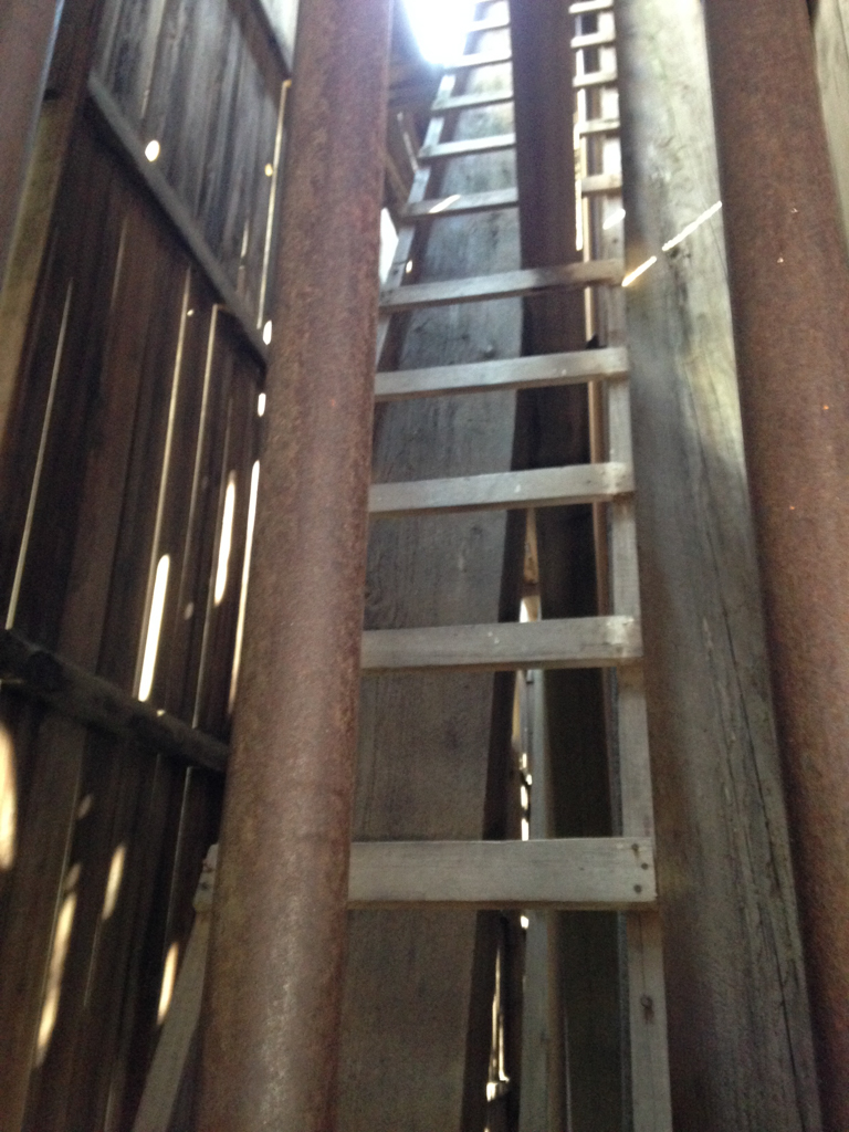
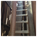
 Interior ladder for maintenance (Photograph by J. Philip Gruen)
 -
 (Photograph by J. Philip Gruen)


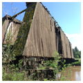

In its rural, picturesque, and nearly inaccessible location amidst the rolling hills of the Palouse River Valley, the largely wooden and partially covered and dilapidated Harpole Bridge appears as a relic of an earlier era, little more than a curiosity attracting photographers and the occasional Sunday driver. The current condition belies its earlier importance: in the early to mid-twentieth century, the boxed Howe truss bridge was part of a railroad network supporting trains delivering wheat, other goods, and passengers through the fertile Palouse hills. The significance of the Harpole Bridge, however, extends beyond its economic role, aesthetic appeal, and picturesque setting. It is an exceedingly rare surviving example of a heavy timber, boxed Howe truss. Only one other bridge of this type is known to exist in North America (the Ashnola River Bridge west of Keremos, British Columbia).
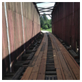
To carry steam trains across the river, the Great Northern Railway constructed the Harpole Bridge in 1922, replacing an earlier bridge built by the electric Spokane and Inland Empire Interurban Railway, which presumably had overhead electric wires. The new bridge featured a 163-foot Howe truss system, patented by William Howe in 1840, with wooden approaches and timber supports. The truss itself contains parallel wooden chords with heavy timber diagonals acting in compression and vertical iron rods acting in tension. In 1928, the Great Northern enclosed the structure with sawn-board vertical siding, leaving wooden and iron cross-bracing exposed at the top where the electric wires likely had been. Enclosing the truss did not prevent inspection of its elements; doors on either side of the original railroad tracks open to a space offering close-up encounters with the bridge’s truss system, and a built-in ladder provides access to the timber and iron cross-bracing hovering over the bridge deck. The railroad evidently considered the boxed Howe truss sturdy enough to carry its steam trains through the Palouse region—so long as the trusses themselves were protected from the elements. At the time, the Great Northern erected four bridges of this type to general specifications along a 37-mile stretch of railway between Colfax and Spring Valley, Washington.
Howe trusses were favored by railroads for much of the nineteenth century due to the standardization of their framing connections, speed of construction, and ease of adjustment. With lumber readily available in the Pacific Northwest, wooden Howe truss bridges, covered or not, enjoyed a relatively long shelf life in places like Washington before their metal replacements were installed. Covered Howe truss bridges in nearby timber-rich Oregon, for example, experienced something of a construction revival following World War I, due in part to a shortage of steel and relative quality and inexpensiveness of wood—although few examples remain today.
The bridge was named originally for Ed Harpole, who owned the land around the bridge, but it was operated by the Great Northern Railroad and then, later, the Northern Pacific until 1967. After the railroad abandoned the line, Ruth Lowe purchased the bridge in 1969. To provide vehicular access to her house on the southwest side of the Palouse River, Lowe laid planks over the former railroad tracks. In 2015, newer wooden planks stretched across the bridge and patches of missing vertical siding on the bridge’s west side revealed some of the wooden diagonals of the truss. Though bridge enthusiasts and folks with an affinity for the seemingly idyllic, deteriorating wooden bridge in the countryside may shudder to consider it, extensive rehabilitation of the wood and iron bridge may be necessary to preserve this now rare piece of Washington infrastructure.
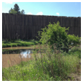
The Harpole Bridge is accessible on foot today via an abandoned rail line, and visible to motorists willing to brave the gravel Manning Road, which hugs the hillside and provides an excellent view of the valley, the river, and the bridge.
References
Bennett, Lola, “Covered Bridges NHL Context Study,” National Register of Historic Properties Multiple Property Documentation Form, n.d. National Park Service, U.S. Department of the Interior, Washington, D.C.
Berkley, Brian T., “Harpole Bridge,” Whitman County, Washington. Historic American Engineering Record, 1995. National Park Service, U.S. Department of the Interior, Washington, D.C.
DeLony, Eric. “Washington’s Unique Historic Bridge Legacy.” In Spanning Washington: Historic Highway Bridges of the Evergreen State, edited by Craig Holstine and Richard Hobbs, 227-238. Pullman: Washington State University Press, 2005.
Holstine, Craig, and Richard Hobbs. Spanning Washington: Historic Highway Bridges of the Evergreen State. Pullman: Washington State University Press, 2005.
Lambeth, Robert M. “The Interurban Railroad.” Spokane Historical. Accessed May 28, 2015. www.spokanehistorical.org.
Long, Priscilla. “Great Northern Railway Builds the Harpole Bridge Spanning the Palouse River in 1922.” Essay 8624. HistoryLink.org: The Free Online Encyclopedia of Washington State History. Accessed May 27, 2015. www.historylink.org.
Soderberg, Lisa, “Manning-Rye Covered Bridge,” Whitman County, Washington. Historic American Engineering Record, 1979. National Park Service, U.S. Department of the Interior, Washington, D.C.
Writing Credits
Coordinator:
J. Philip Gruen
Robert R. Franklin
If SAH Archipedia has been useful to you, please consider supporting it.
SAH Archipedia tells the story of the United States through its buildings, landscapes, and cities. This freely available resource empowers the public with authoritative knowledge that deepens their understanding and appreciation of the built environment. But the Society of Architectural Historians, which created SAH Archipedia with University of Virginia Press, needs your support to maintain the high-caliber research, writing, photography, cartography, editing, design, and programming that make SAH Archipedia a trusted online resource available to all who value the history of place, heritage tourism, and learning.