


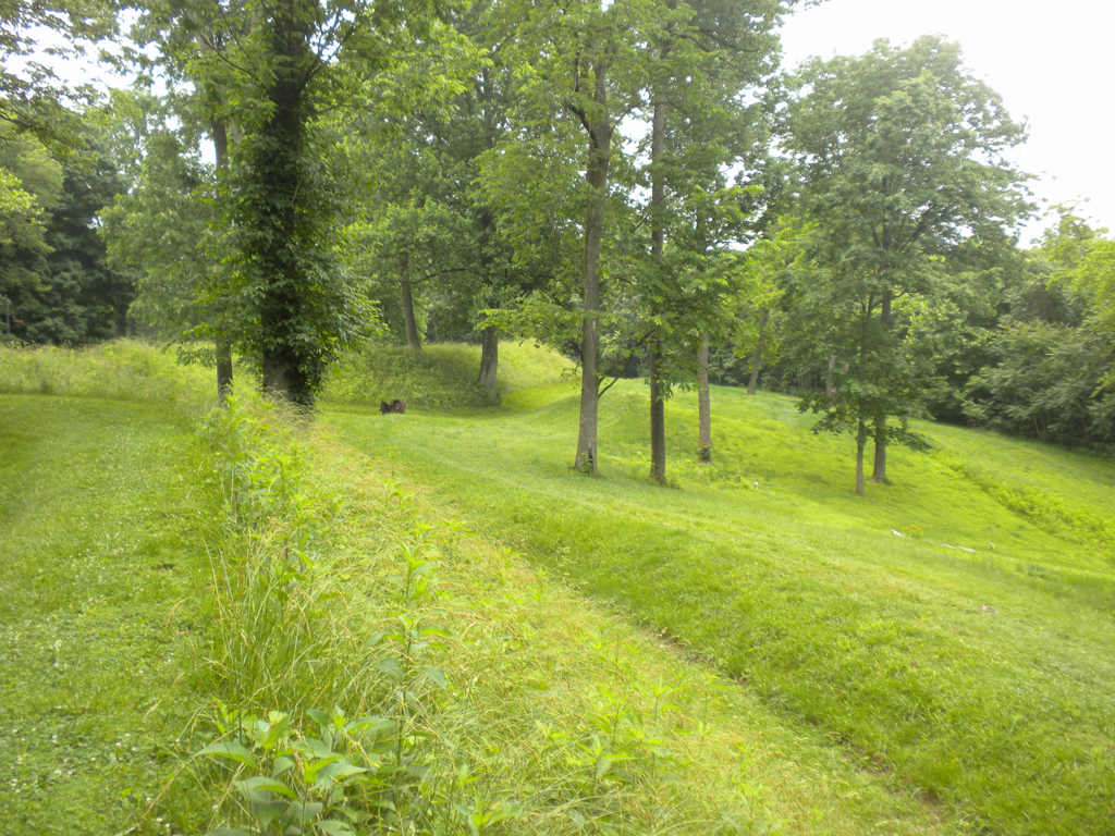
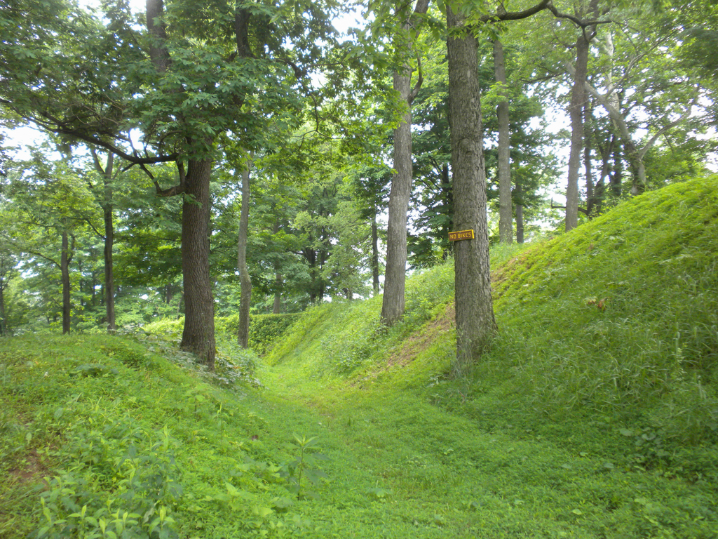
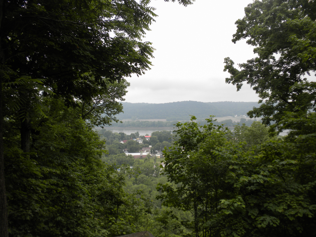


Fort Duffield is the most well-preserved Civil War fortification in Kentucky. Working under the direction of General William Tecumseh Sherman, some 1,000 members of the Ninth Michigan Infantry built the earthen fort on a well-situated knoll overlooking the north-south Louisville and Nashville Railroad line and turnpike at the confluence of the Salt and Ohio rivers. The now slightly degraded earthen parapets originally stood 20 feet high and still measure 1,075 feet long.
After a call to secession in 1860 and President Lincoln’s subsequent call for 75,000 troops to suppress the rebellion, the Kentucky legislature declared the Commonwealth neutral in May 1861. Confederate troops soon thereafter broke the state’s neutrality and occupied Columbus, Kentucky, in a move that was countered with the occupation of Paducah by Union forces. Union Army General Sherman hastily ordered the erection of an earthen fort directly above the river town of West Point at what was then known as Pearman Hill.
Construction of the fort began on November 3, 1861 and was completed by January 1, 1862. The parapets at Fort Duffield were composed of dirt shoveled from both the interior of the fort and its outlying moat. Embrasures or notches cut in the top of the fort walls indicate that the original shape of Fort Duffield was a partial star pattern, which could have inhibited egress if the fort had been attacked. The remains of later Kentucky earthen forts, such as Nelson, Sands, and Boyle, show greater adherence to the traditional star pattern. The surrounding mile-wide area around Fort Duffield was cleared of timber to ease observation across the Ohio River to Indiana as well as down the length of the turnpike and the Louisville and Nashville Railroad lines. This also left a clear field of fire for as many as ten guns that were stationed along the embankment. Presumably the felled timber was used to create a defensive abatis or barricade as well as some fifteen cabins that housed the garrison. Several of these small log cabins have been recreated within the earthworks. A memorial cemetery next to the fort marks the site where the remains of sixty-one soldiers from the Ninth Michigan were interred before being removed to a federal cemetery after the Civil War.
While a skirmish between Union and Confederate troops took place in West Point, Fort Duffield was never challenged during the Civil War. Confederate troops did, however, occupy the fort several times after it was abandoned by Union troops in 1863. In 1895 the United States Army purchased the property from Biderman DuPont and incorporated it into Fort Knox. That same year the Grand Army of the Republic held its national encampment at Fort Duffield. Maintained by the City of West Point since 1978, Fort Duffield is open to the public.
References
Brent, Joseph E., "Fort Duffield,” Hardin County, Kentucky. National Register of Historic Places Inventory–Nomination Form, 1993. National Park Service, U.S. Department of the Interior, Washington, D.C.