

Oregon Trail
You are here
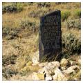
South Pass


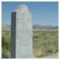
1832. 3 miles south of WY 28.
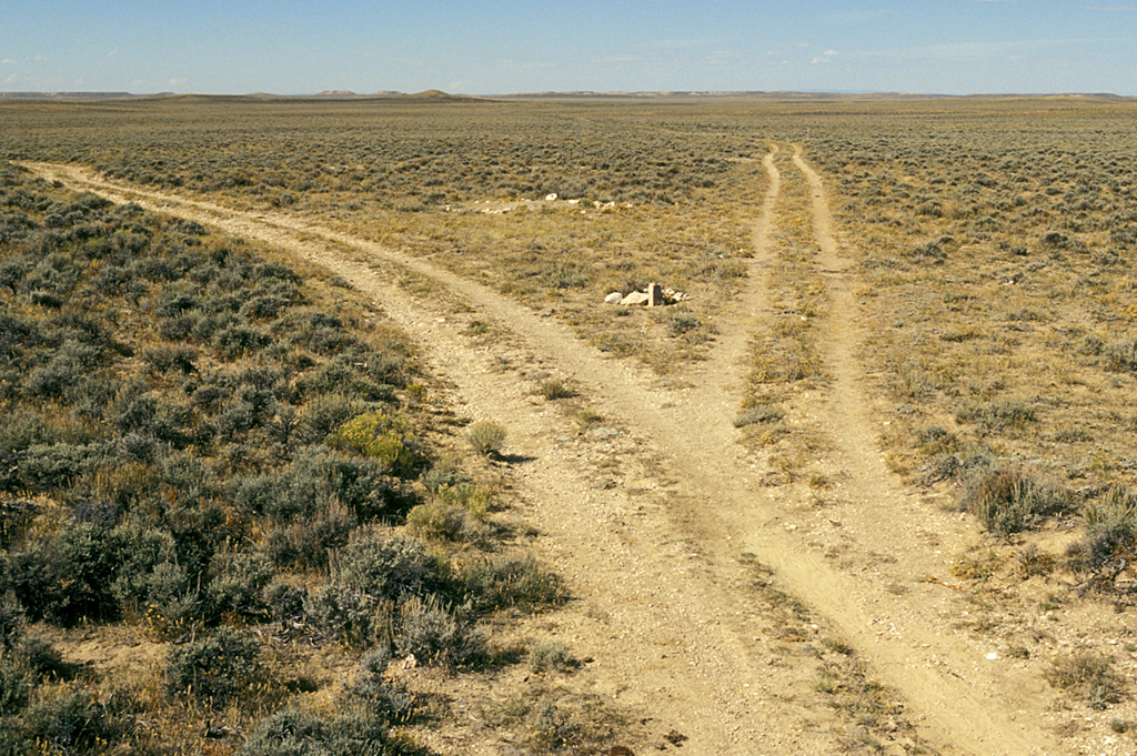
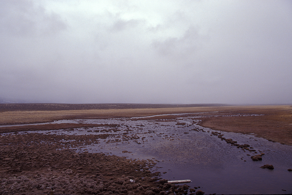

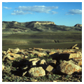
South Pass is a gentle saddle through the Rocky Mountains that straddles the Continental Divide in southwestern Fremont County. Rising 7,440 feet above sea level, the pass is some twenty miles wide and rises gradually from a 35-mile wide basin between the Wind River Mountains to the north and the Oregon Buttes and Great Divide Basin to the south. A natural crossing point between the Atlantic and Pacific watersheds, South Pass, with its sagebrush prairie habitat, became the key that opened the west to settlement.
Early explorers dubbed the route South Pass in recognition of its relationship to the “North Pass,” the torturous route through the Bitterroot Mountains the Corps of Discovery followed. The Lewis and Clark Expedition nearly expired in the Bitterroots in 1805, finally emerging half-starved and frozen. Even today, roads across the Bitterroots are few. Had South Pass not been “discovered,” it is unlikely that the United States government would have had a defensible claim on the Pacific Northwest. Thus, it is no exaggeration to say that, without South Pass, the post-1840 history of the United States would have been very different.
The pass had long been known to indigenous peoples, but it was not until 1812, when Robert Stuart crossed it with six companions during a return trip from Astoria on the Pacific coast, that white explorers are known to have used it. Captain Benjamin Bonneville commanded the first wagon train across the pass in 1832. The first white women to cross were Eliza Hart Spalding and Narcissa Prentiss Whitman, who accompanied their missionary husbands to Oregon Territory in 1836.
By the 1840s, this trickle of westward-bound emigrants had become a steady stream of men, women, and children—scoundrels and visionaries, wealthy and poor, the optimists and the defeated, the eager and the reluctant, the zealots and the sinners—to cross South Pass in search of something better in California, Oregon, or Utah. Most historians agree that somewhere between 350,000 and 500,000 people went west between 1841 and 1865. While their routes varied widely, especially in later years as cutoffs and new trails proliferated, nearly all of them crossed the South Pass. Other routes across the Continental Divide would eventually be found (Bridger Pass to the south is the most notable), but none were as easy to traverse as the reliable South Pass.
Thanks to the gentle slope of the pass, many emigrants had no idea when they actually crossed over from the Atlantic to the Pacific watersheds, making the definition of what constitutes South Pass a subject of debate that continues to this day. Although South Pass was among the first fifty sites to be designated a National Historic Landmark (in 1961) and to be listed on the National Register of Historic Places (1966), these early designations did not define the landmark’s boundaries.
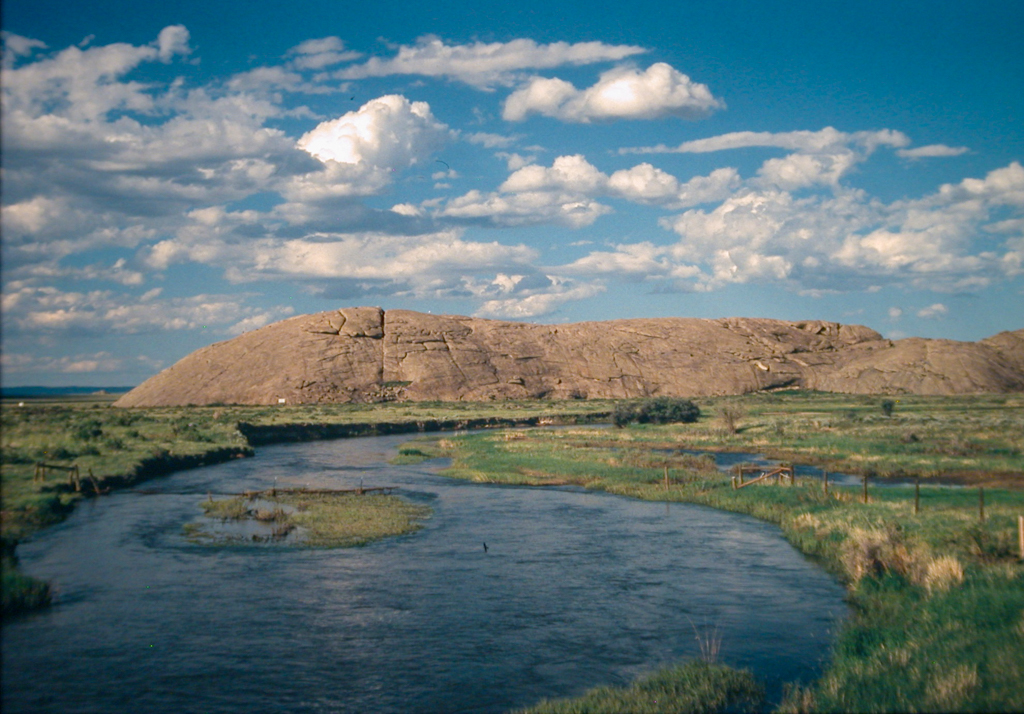
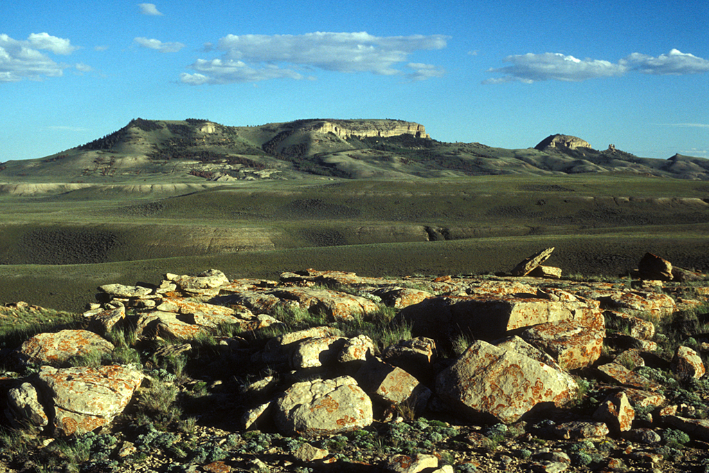
Recent scholarship supports an expansive interpretation of what comprises South Pass. Historian Will Bagley’s comprehensive study of emigrant diaries has revealed that many believed they had begun to cross South Pass almost as soon as they left Independence Rock, more than one hundred miles to the east. Today, many historians refer to the Greater South Pass Historic Landscape, beginning around Independence Rock and ending near Parting of the Ways, approximately 135 miles to the west. This landscape, which the National Park Service has designated “one of the most impressive segments on the entire trail” due to the “quality of the resources and the visual experience,” includes numerous important trail landmarks: Independence Rock, Devil’s Gate, Split Rock, the Ice Slough, Rocky Ridge, Oregon Buttes, Big Sandy, and Parting of the Ways. It also includes some of the most pristine trail ruts of the entire historic trail system. These ruts, depressions in the landscape caused by thousands of footsteps and wagon wheels, are among the most remarkable human alterations the trail.
Independence Rock, dubbed the “Great Register of the Desert” by Jesuit missionary Pierre DeSmet, rises 128 feet above the prairie floor alongside the meandering Sweetwater River. Emigrant J. Goldsborough Bruff wrote that the 1,900-foot-long and 700-foot-wide granite outcropping looked like a “huge whale” from a distance. Its hump-backed sides invite visitors to scramble to the top where they can examine emigrant signatures, engraved into the surface or painted on with wagon grease, tar, or a combination of buffalo grease and glue. Although time and lichen have eroded many of these signatures, dozens remain legible.
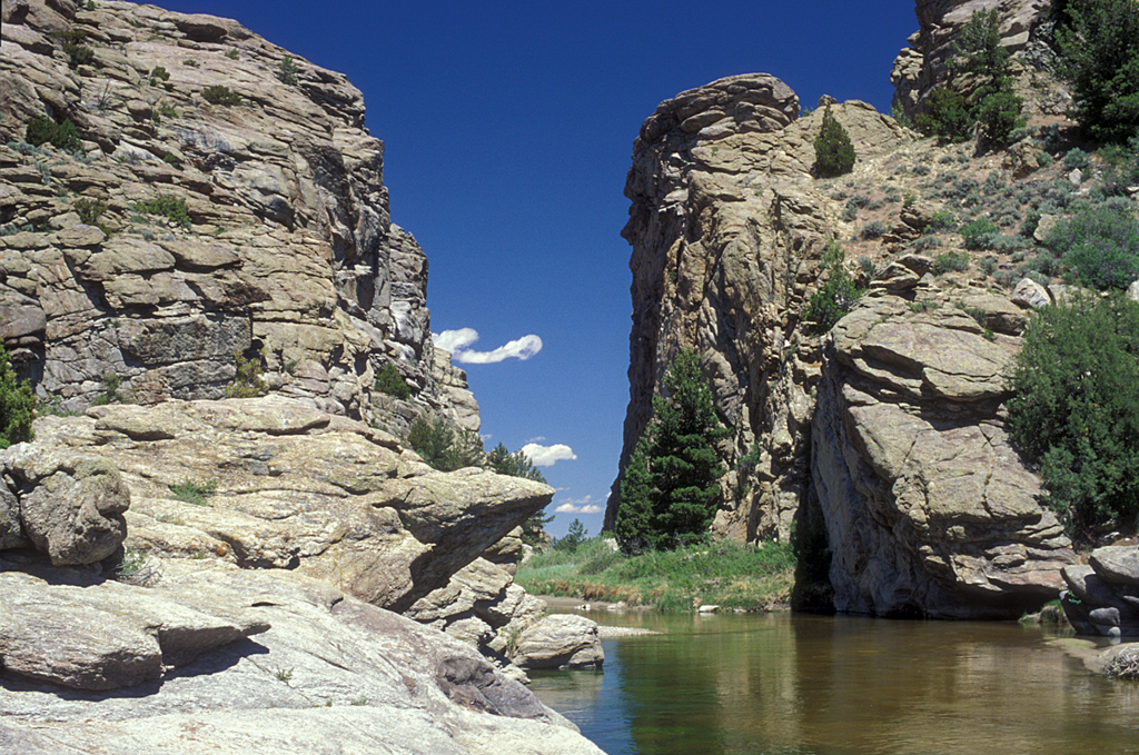
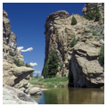
Visible from the top of Independence Rock, and just a few miles down the road, is Devil’s Gate, a huge cleft in the Sweetwater Rocks carved by the Sweetwater River. The cleft, about 370 feet deep and 1,500 feet long, is 300 feet wide at the top, but only 30 feet wide at the bottom. A Native American legend claims that the rocks were torn apart by a huge beast who, enraged by the arrows of hunters, ripped open his escape route with his huge tusks. Although the old trails routed emigrants around Devil’s Gate, many stopped to hike to the top and carve their names. It is believed that some twenty emigrants are buried in this area, although only one marked grave has been found.
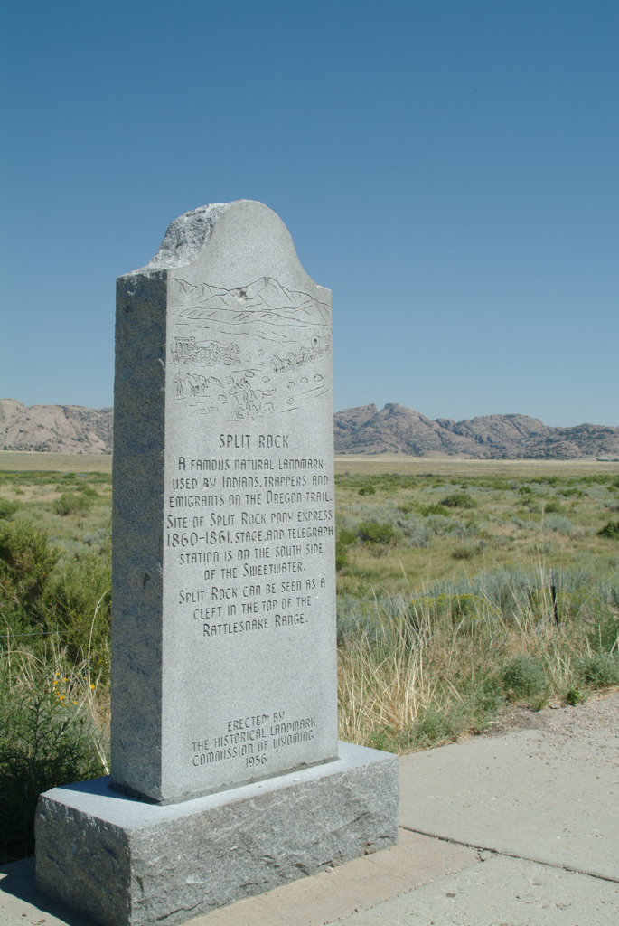
Another granite outcropping in the Sweetwater Valley, Split Rock, can be easily viewed from the highway. This peak in the Rattlesnake Range rises 1,000 feet above the prairie floor and is capped by a visible, quite distinctive “gun-sight” notch. For days prior to arriving, emigrants used the notch as a beacon to guide them towards South Pass. Prominent trail ruts run through the quiet valley that represented a temporary respite for the weary travelers. Just west of Split Rock is Split Rock Station, which served the Pony Express and transcontinental telegraph.
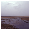
After successfully crossing the maddeningly erratic Sweetwater River three times and trudging through deep sand, the emigrants came to a grassy swamp where, just beneath the surface, they discovered a remarkable bed of solid, clear ice. Noted trail historian, Gregory Franzwa, called the Ice Slough “one of those absolutely delightful interludes that seemed to crop up just as the incessant slogging west was putting emigrants in the lowest of spirits.” J. Goldsborough Bruff described the site in 1849 as “dug up all around by travelers—as much from curiosity as to obtain so desirable a luxury in a march so dry and thirsty….” This amazing natural feature resulted from a small tributary of the Sweetwater River covered by a variety of marsh grasses and sedges to form a patchwork of surface plant life. Water flowing underneath freezes solid in winter, remaining that way through the spring and early summer, thanks to its insulated, peat-like covering.
Rocky Ridge represented the last significant hurdle the tired emigrants faced before crossing the Continental Divide at South Pass. After crossing the Sweetwater for the seventh (and last) time, the emigrants followed a rugged, boulder-strewn path to ascend some 700 feet within two miles, only to end up at a near vertical shelf of rock rising up about 10 feet. In his 1848 guide to the emigrant trails, William Clayton advised travelers that these “rough, rocky ridges” were “dangerous to wagons, and ought to be crossed with care.” Rock cuts carved by wagon wheels as they crossed the treacherous 12-mile stretch of Rocky Ridge present some of the most dramatic remnants of the hardships endured by the westward-bound emigrants, as do the series of markers to the unlucky members of the Willie and Martin Handcart Companies, who suffered incredible losses in October of 1856 between Independence Rock and South Pass.
West of South Pass sits the isolated and poignant site known as Parting of the Ways. In the middle of an open, sagebrush plain, two sets of pristine trail ruts diverge. Here, emigrants faced a major decision point. Those in need of supplies had little choice but to head south to Fort Bridger; the Sublette Cutoff route, opened in 1844, saved some 46 miles but included 50 miles of waterless trail. This isolated spot, where the only sound is often the wind, was the site of many a sad farewell, as emigrants bid goodbye to friends and family, knowing they would likely never meet again. Today, simple rocks marked with arrows, not thought to be original, point the way to “F. Bridger” or “S. Cutoff.”
The same elements that made South Pass attractive to the emigrants have attracted the attention of developers looking to cross the Continental Divide with pipelines, railroads, and transmission lines. These threats resulted in South Pass being included in the National Trust for Historic Preservation’s 1995 Eleven Most Endangered Places list and the World Monuments Fund’s 1998 Monuments Watch List. Recent Bureau of Land Management resource management plans have helped to provide protection for the pass, designating part of the landscape an Area of Critical Environmental Concern. Nevertheless, this precious landscape demands continued and vigilant oversight by those committed to its preservation. Private land holdings, commercial recreational development, the presence of hard rock minerals, and split administrative oversight have combined to make the status of this national landmark utterly precarious.
References
Alliance for Historic Wyoming. “Greater South Pass Historic Landscape.” Accessed January 5, 2015. http://southpasswyoming.org.
Bagley, Will. South Pass: Gateway to a Continent. Norman: University of Oklahoma Press, 2014.
National Park Service. Comprehensive Management and Use Plan for the National Historic Trails. Washington, DC: 1999. Accessed January 16, 2015. https://www.nps.gov/cali/learn/management/upload/CALI-CMP-SM-updated.pdf.
Wooley, Jan, “South Pass,” Fremont County, Wyoming. National Register of Historic Places Inventory-Nomination Form, 1986; updated, 2006. National Park Service, U.S. Department of the Interior, Washington, DC.
Writing Credits
Coordinator:
Mary M. Humstone
If SAH Archipedia has been useful to you, please consider supporting it.
SAH Archipedia tells the story of the United States through its buildings, landscapes, and cities. This freely available resource empowers the public with authoritative knowledge that deepens their understanding and appreciation of the built environment. But the Society of Architectural Historians, which created SAH Archipedia with University of Virginia Press, needs your support to maintain the high-caliber research, writing, photography, cartography, editing, design, and programming that make SAH Archipedia a trusted online resource available to all who value the history of place, heritage tourism, and learning.