


The Wind Cave National Park Administrative and Utility Area Historic District is located in the central portion of Wind Cave National Park in South Dakota, approximately three miles from the south entrance. The district, designated in 1984, includes eighteen structures erected near the historic entrance to Wind Cave, one of the longest and most complex caves in the world, known for its calcite formations called boxwork.
Wind Cave had long been known to region’s indigenous tribes, including the Lakota, for whom the cave is the sacred place of their creation. It was not until 1881 that Euro-American settlers first encountered the cave, soon identifying it as a tourist attraction (after attempts at mining were unsuccessful). In the 1890s, it was managed by Jessie McDonald and John Stabler under the Wonderful Wind Cave Improvement Company. After Stabler’s death, disputes over the land reached the Department of the Interior, which determined that since the lands were not used for mining, neither family had the rights to the mining claims. Efforts to turn it into a national park began in 1899 and were successful in 1903 under President Theodore Roosevelt.
A number of buildings were constructed under the park’s first superintendent, William A. Rankin, including the Superintendent’s Cottage (1905), a stone structure overlooking the original cave entrance that has since received three stuccoed additions. But it was not until the Civilian Conservation Corps established a camp here in the 1930s that a uniform plan for the buildings and landscaping was implemented near the main cave opening. The majority of the eighteen buildings in the area were constructed at this time, possibly under the guidance of Howard Baker, then architect for the National Park Service Branch of Plans and Designs. The wood-frame structures are similar in style, with locally quarried sandstone foundations, yellow-tan stucco walls, and shingle roofs—the Superintendent’s Cottage additions match this later style.
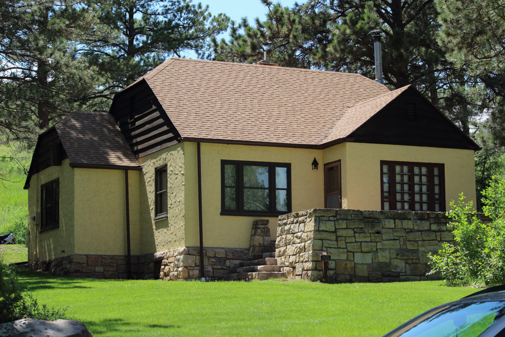
Another Superintendent’s Residence (1934), further uphill and to the north, was the exception to these 1930s designs. The structure incorporates elements of the English cottage tradition, with its steeply pitched roof and clapboarded gable. The concrete and sandstone foundation walls and chimney are also more prominently featured. The Rangers’ Dormitory and Mess House (1931) and two Employee Residences (1932 and 1934, respectively) housed park employees in wood-framed, stucco buildings with native sandstone foundations, while the Bunkhouse (1934) is the only remaining of at least eighteen structures built to house CCC workers; it is also one of the few extant in South Dakota.
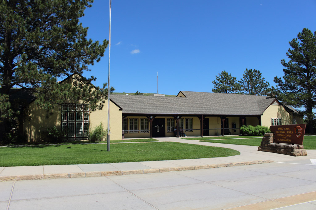
The Visitors’ Center and Administration Headquarters (1936) is similar in style and material to the other park structures, and was originally two structures connected by an open loggia. Set into a hillside, both structures appeared as a single story on the main elevation and as two stories at the rear where the basement level was visible. In 1980, a three-story, H-shaped addition abutted the structures at the rear, greatly increasing the building’s footprint; during this renovation, the loggia was enclosed to form the current entrance.
The cave entrance, an approximately 2 x 3-foot hole, is 200 yards north of the Administration Building and led visitors into the cave via a stairway. Visitors have not used this entrance since 1938, when the Elevator Building was completed 225 yards south of the Administration Building. Like the other park structures, the Elevator Building is constructed of locally quarried sandstone blocks and its wood frame is covered in yellow-tan stucco. The elevator shaft was first completed in 1934, with the elevator itself installed the following year, three years before completion of the exterior building with its three-story tower. In 1959, a second elevator was installed and the first modernized; both elevators were replaced in 1998–1999. Since June 2019, the cave has been closed to visitors due to elevator issues. The alternate cave entrance, with its 155-stair immediate descent, was deemed unsuitable given the sheer number of cave visitors and the safety issues involved. Park visitors may still enjoy the bison, elk, and other wildlife that roam the rolling prairie grasslands and forested hillsides above the cave.