

Wabash and Erie Canal
You are here
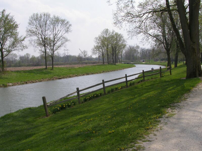
Wabash and Erie Canal Park


1832–1853. 1030 N. Washington St.
The Wabash River flows from northwest Ohio to the Ohio River, extending nearly 500 miles through Indiana. The river served as a major transportation corridor for westward-moving European-Americans from the eighteenth century through the mid-nineteenth century. River-based commerce focused on the cities along the Wabash, Ohio, and Mississippi rivers, with New Orleans offering the largest market for exports by a wide margin.
Planning for a canal connecting the Wabash River with the Great Lakes commenced in 1828 and construction began in 1832. The first segment of the Wabash and Erie Canal opened between Lafayette, Indiana, and Lake Erie in 1843, offering a direct connection to eastern markets via Lake Erie, the Erie Canal, and the Hudson River. The opening of the Wabash and Erie Canal shifted the region’s commercial focus to New York City, which, with a population four times that of New Orleans, offered a more profitable market for agricultural exports—particularly corn, pork, wheat, and whiskey—and a wider selection of goods for importation to the Wabash Valley.
Lafayette remained the dominant transfer point between the Wabash and Erie Canal and the Wabash River as construction of the canal progressed southward. The canal reached Attica in 1846, Covington in 1847, Terre Haute in 1849, and was finally completed to the Ohio River at Evansville in 1853. With a total length of 468 miles, it was the longest canal ever built in North America.
Towns along the waterway grew rapidly and commerce boomed. Canal boats traveled east loaded with western produce and meat, returning laden with manufactured and imported goods as well as new settlers heading west. The population of Indiana counties along the canal’s route more than doubled between 1843 and 1853, sparking a building boom in the Wabash Valley that would continue through the mid-1850s. The opening of the parallel Wabash Railroad in 1856 provided a second source of increasingly rapid transportation between the Wabash Valley and the eastern United States. These advances in transportation provided a period of prosperity and a construction boom that would continue through the outbreak of the Civil War. The establishment of connections with the east allowed for rapid import of eastern goods and publications, including the pattern books and periodicals that helped spread the architectural expressions of mid-nineteenth-century Romanticism and East Coast tastemakers across the United States.
Traffic on the Wabash and Erie Canal’s peaked in 1852, the year that Lafayette’s first two railroad connections opened. Canal traffic began a precipitous decline in the mid-1850s as expanding regional railroad lines absorbed more and more passenger and freight traffic. The canal ceased to be an important transportation corridor long before its official abandonment in 1874. Although the Wabash and Erie Canal’s heyday lasted for little more than a decade, it was the catalyst for the mid-nineteenth-century development of Indiana’s political and economic life. The canal era provided a period of sustained growth and prosperity for numerous communities along its route.
Most of the Wabash and Erie Canal was filled in or allowed to deteriorate after its official abandonment in 1874. The small city of Delphi, Indiana, which boomed during the canal’s heyday, reclaimed a section of this long-neglected transportation landmark. Carroll County Wabash and Erie Canal, Inc., a local nonprofit group, was formed in 1971 to preserve the canal in Carroll County and to highlight the significance of the canal era in Indiana’s history. The organization restored a one-mile segment of the canal and developed Canal Park and the Wabash and Erie Canal Interpretive Center along this stretch, with exhibits on the canal era, living history interpretations, and an operating canal boat. Historic buildings and historic bridges threatened with demolition were moved to the park and a reconstruction of a nineteenth-century lime kiln was built along the canal.
The standard section of the Wabash and Erie Canal was four feet deep and forty feet wide, with wider sections provided at major cities or where necessitated by the terrain. Some urban sections of the canal were 100 feet wide and others included large turning basins. The banks were of sloped earth, with timber reinforcing around mills and other buildings along the route. A towpath was provided along one bank. The Delphi section was seventy feet wide due to swampy conditions along the route. The restored Delphi canal bed follows its historic width and features a towpath along one side.
References
Esarey, Logan. A History of Indiana from its Exploration to 1850.Vol. I. Indianapolis: B. F. Bowen and Company, 1918.
Ross, Benjamin L. “The Moses Fowler House: Examining Gothic Revival Design in the Wabash Valley.” Paper presented at the annual meeting of the Southeast Chapter of the Society of Architectural Historians (SESAH), Athens, Georgia, October 18-19, 2012.
Ross, Benjamin L. “Canal Boat Gothic: Pattern Book Architecture in the Wabash Valley.” Paper presented at the annual conference of the Vernacular Architecture Forum, Chicago, Illinois, 2015.
Shaw, Ronald E. Canals for a Nation: The Canal Era in the United States, 1790-1860.Lexington: University Press of Kentucky, 1993.
Writing Credits
Coordinator:
Benjamin L. Ross
If SAH Archipedia has been useful to you, please consider supporting it.
SAH Archipedia tells the story of the United States through its buildings, landscapes, and cities. This freely available resource empowers the public with authoritative knowledge that deepens their understanding and appreciation of the built environment. But the Society of Architectural Historians, which created SAH Archipedia with University of Virginia Press, needs your support to maintain the high-caliber research, writing, photography, cartography, editing, design, and programming that make SAH Archipedia a trusted online resource available to all who value the history of place, heritage tourism, and learning.