


Within the 131-square-mile footprint of northeastern Arizona’s Canyon de Chelly National Monument are several hundreds of well-preserved archaeological sites, vestiges of occupation by Ancestral Puebloans (formerly called Anasazi) between 350 and 1300 CE. These sites include the White House Ruins, Antelope House Ruins, and Mummy Cave, renowned thirteenth- and fourteenth-century cliff dwellings built within pockets in sheer red sandstone canyon walls. Prehistoric peoples had deserted these fortified habitations by the beginning of the fourteenth century; the Navajos have continuously occupied the canyon since the eighteenth century. The canyon was the site of Kit Carson’s 1864 campaign, which ended the nation’s conflict with the Navajo, who still reside in, farm, and graze livestock there. In the twentieth century, Canyon de Chelly National Monument became a unit of the National Park Service (NPS), though it is situated on Navajo Nation lands and is not federally owned, which adds another layer of significance to this cultural landscape.
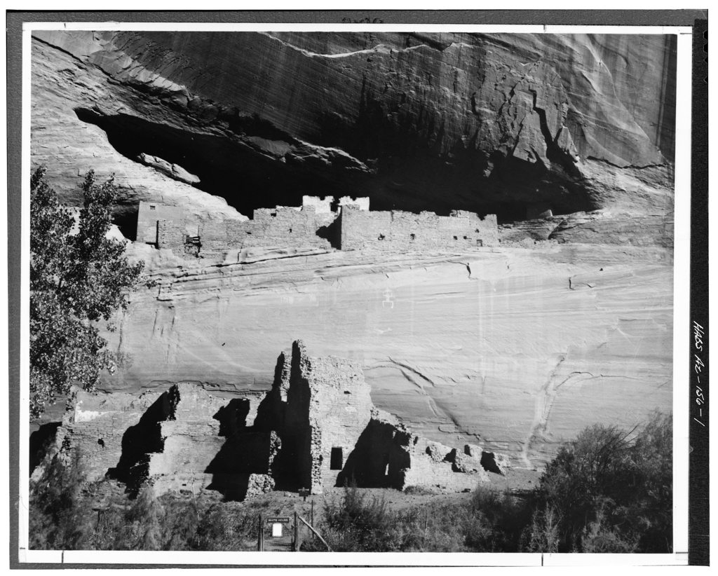
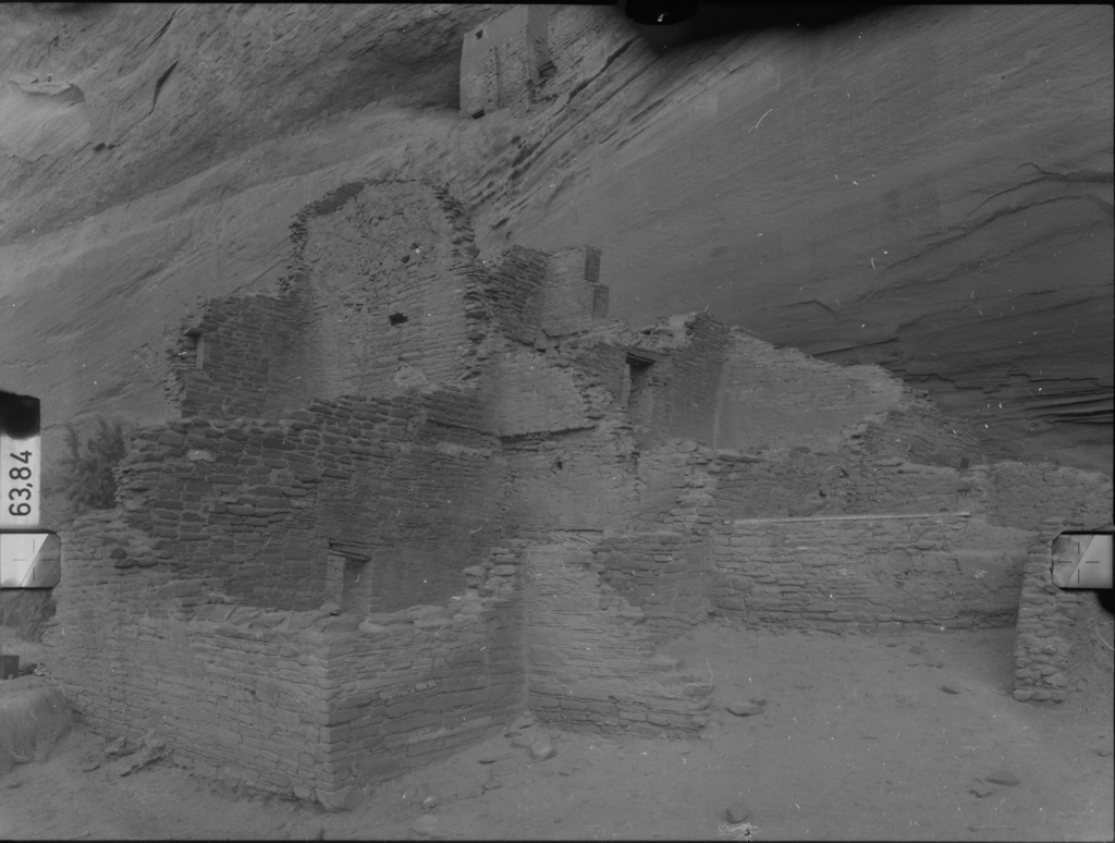
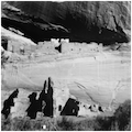
The Walker expedition was the first recorded Anglo-American exploration of the area, when it traversed six miles up Canyon de Chelly in 1847 but missed Casa Blanca (White House), which was discovered by Lieutenant J. H. Simpson the following year. Dated between 1060 and 1275 CE, White House Ruins consists of a protected cliff dwelling that was connected once to an earlier multi-room structure at the base of a 500-foot cliff. Presumably, the lower block offered easy access to arable lands at the canyon bottom, while the upper portion provided sanctuary during enemy incursions. At its apex, the entire complex had approximately 80 rooms, possibly housing as many as 100 persons.
The lower block measures 50 by 150 feet, and the eastern walls rise 12 to 14 feet, although marks on the cliff wall suggest that a 4-story tower rose to a height within four feet of the cave floor. The jacal-constructed walls (vertical poles tied horizontally and coated with mud plaster) ranged from 12 to 15 inches thick, and were protected by the projecting cave roof. An elevated, circular kiva (a religious structure), measuring 18 feet in diameter, was built in the center of the lower block, against the base of the cliff wall. Centuries of periodic flooding have destroyed much of the interior in the lower block, leaving only 60 rooms and 4 kivas, including one at the western end, which was stabilized and partially replastered in 1967. The upper portion now contains only 10 of the original 20 rooms. It was originally accessed by an entryway in the south-facing cliff face positioned 4 feet above the roof of the lower block’s 4-story tower—a distance easily bridged by a removable ladder. At the center lies a large room, measuring 12 by 20 feet, encased by 2-foot-thick masonry walls soaring 12 feet in front and 7 feet on the three interior sides. The exterior of the so-called Casa Blanca was coated in white plaster adorned with a decorative yellow band. While all of the walls facing the cave opening are stone, interior walls were built of adobe or stone mixed with adobe.
In 1873, F. H. O’Sullivan first photographed the White House Ruins as part of the Hayden geological survey. Though these images were distributed in the print media, they did not stimulate much touristic interest. In 1919, Leon H. “Cozy” McSparron purchased land at the mouth of Canyon de Chelly and built the Thunderbird Ranch resort, where Hollywood film stars stayed while shooting on location in the 1930s–1950s. After President Herbert H. Hoover established the Canyon de Chelly National Monument in 1931, the NPS immediately stabilized ruins and restored the tower wall at Mummy Cave (completed in 1932). After Robert Budlong became the site’s first custodian in 1934, facility development began on a 10-acre parcel just south of Thunderbird Ranch. Construction of the custodian’s residence and office (Building #1) was begun in September 1935. NPS architect Lyle Barcume designed the adobe house in the Pueblo Revival style in an attempt to tie the modern edifice with its historical and regional context.
This was the extent of modern construction until a building campaign was begun in 1960, as part of the NPS Mission 66 program. The campaign called for new roads and trails, a visitors’ center, three employee residences, and other utilities and facilities. Staff housing southeast of Thunderbird Ranch (Clyde V. Hutchisan, contractor) was built in 1960; the following year a comfort station was erected by W. H. Elliott. The largest undertaking was the erection of a visitors’ center on a hill above the canyon’s mouth, which opened in 1964. Designed by NPS architect Cecil Doty and constructed by the Flaugh-Slavens Company of Cortez, Colorado, the visitors’ center is a stark, low-slung brick structure that embodies modernist functionality. Its signature feature is a terrace affording framed views of the canyon and valley. In 1967 a comfort station, campfire circle, and an additional residence were built, and the 1932 residence was rehabilitated.
References
Allaback, Sarah. Mission 66 Visitor Centers: The History of a Building Type. Washington, D.C.: U.S. Department of Interior National Park Service, 2000.
Brugge, David M., and Raymond Wilson. Administrative History: Canyon de Chelly National Monument, Arizona. Washington, D.C.: U.S. Department of the Interior National Park Service, 1976.
“Canyon de Chelly National Monument, Arizona.” National Park Service. Accessed November 25, 2014. http://www.nps.gov/.
Harrison, Laura Soullière, and Beverley B. Spears. “Historic Stricture Report: Chinle Trading Post, Thunderbird Ranch, and Custodian’s Residence, Canyon de Chelly National Monument, Arizona.” Southwest Cultural Resources Center Professional Papers No. 17. Santa Fe, NM: U.S. Department of Interior National Park Service, Southwest Regional Office, Division of History, 1989.
Mindeleff, Cosmos. The Cliff Ruins of Canyon de Chelly, Arizona: Sixteenth Annual Report of the Bureau of Ethnology to the Secretary of the Smithsonian Institution, 1894-95. Washington, D.C.: Government Printing Office, 1897.
Morgan, William N. Ancient Architecture of the Southwest. Austin: University of Texas Press, 1994.
Plog, Stephen. Ancient Peoples of the American Southwest. London: Thames and Hudson, 1997.
Voll, Charles B. “Canyon de Chelly National Monument,” Apache County, Arizona. National Register of Historic Places Registration Form, 1970. National Park Service, U.S. Department of the Interior, Washington, D.C.