

El Quartelejo
You are here
El Cuartelejo
1664. 520 W. Scott Lake Dr.
-
 (Photograph by David Sachs)
 -
 (Photograph by David Sachs)
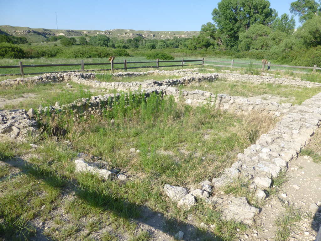


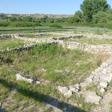
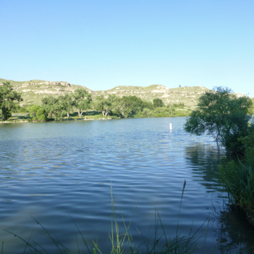
El Cuartelejo is a rich archaeological site providing evidence of the settlement patterns of Plains Indians of the Dismal River culture. The site reveals the relationship between the Plains and Pueblo Indians, and between the Pueblo and early Spanish explorers in New Mexico and Arizona. Located in a deep gorge in present-day Scott Lake State Park, the site is north of Scott City on US 83.
In the late seventeenth century, Spanish soldiers gave the name El Cuartelejo to an Apache village that harbored Taos Indians who had fled Spanish-controlled lands in 1664. The name, now translated as “the old building, or barracks,” refers to a seven-room pueblo built by the refugees, who were captured by Spanish soldiers a few years later. Near the end of the seventeenth century, the Picurus, another group of Pueblo Indians from the Spanish territory, took shelter among the Apache in the pueblo built by the earlier refugees. They, too, were captured by the Spanish and forcibly brought back to their homeland.
The site was first excavated in 1898 by a pair of archaeologists from the University of Kansas, S. W. Williston and H.T. Martin. They found evidence of habitation by members of the Dismal River culture, of which the Apache were a part, both before and after the visits from the Pueblo people. The Apache seem to have left the site somewhere in the mid-eighteenth century. It has been assumed that the Utes or the Comanche Indians pushed the Apache further to the south.
Williston and Martin found good evidence of what is assumed to be the northernmost pueblo built in North America. They found two-and-a-half-foot-tall, two-inch-thick, plastered stone walls. The remains indicate that the building originally had a roof structure made of willow poles that supported plastered brush. Twenty-five other nearby archaeological sites produced artifacts from the Dismal River and Pueblo cultures. The sites are all located in a deep gorge known as the Ladder Creek Canyon. The gorge landscape resembles that of the Flint Hills of eastern and central Kansas but is relatively rare in the high plains of western Kansas. The easily available water and milder microclimate of the protected bottomland made this a natural place for settlement. There is evidence that the Apache modified their nomadic ways and built more permanent lodges and began growing crops in the rich valley soil. Later, Ladder Creek was dammed to form Lake McBride, subsequently named Scott Lake.
Other archaeologists built upon Williston and Martin’s work. In 1939, Waldo Wedel from the Smithsonian Institution excavated the site. A few years later, A. T. Hill from the Nebraska Historical Society continued this work. Over the years, amateur archaeologists uncovered and carried off other artifacts. By 1969, when the Kansas State Historical Society began reexamining the site, many of the resources described by Williston and Martin were gone and the walls of El Cuartelejo were barely visible. The walls have since been reconstructed and the remaining resources were protected by the 1964 designation of the area as a National Historic Landmark, and by the incorporation of the area into Scott Lake State Park. The park preserves both the artifacts and the uniquely powerful landscape in which they reside.
NOTE: This entry was originally published in David Sachs and George Ehrlich, Guide to Kansas Architecture (Lawrence: University Press of Kansas, 1996). © 1996 by the University Press of Kansas.
References
Weiss, Francine, and Emerson L. Pearson, “El Cuartelejo,” Scott County, Kansas. National Register of Historic Places Inventory-Nomination Form, 1975. National Park Service, U.S. Department of the Interior, Washington, D.C.
Writing Credits
Coordinator:
David Sachs
If SAH Archipedia has been useful to you, please consider supporting it.
SAH Archipedia tells the story of the United States through its buildings, landscapes, and cities. This freely available resource empowers the public with authoritative knowledge that deepens their understanding and appreciation of the built environment. But the Society of Architectural Historians, which created SAH Archipedia with University of Virginia Press, needs your support to maintain the high-caliber research, writing, photography, cartography, editing, design, and programming that make SAH Archipedia a trusted online resource available to all who value the history of place, heritage tourism, and learning.