

Waldo/Hancock Bridge
You are here
Penobscot Narrows Bridge


2003–2006, Figg Engineering. U.S. 1 between Prospect and Verona Island.
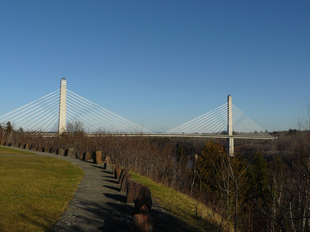
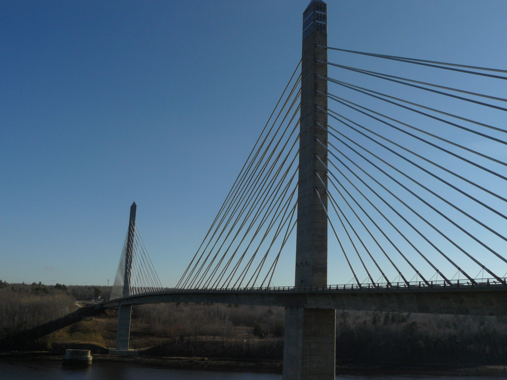

The Penobscot Narrows Bridge and Observatory is located on Route 1 and spans the Penobscot River between Prospect and Verona Island in Downeast Maine. The bridge is the economic gateway for tourists and commerce traveling Downeast and to the Canadian Maritime provinces. In 2006 it replaced the historic Waldo-Hancock Bridge (1931) at the same location. A routine inspection in 2003 revealed the suspension cables of the Waldo-Hancock Bridge to be in a state of advanced deterioration. Rather than replace it with another suspension design, the Maine Department of Transportation (MaineDOT) elected to build a modern cable-stayed bridge, which required less cable and could be constructed with identical, precast sections that allowed for faster construction and easier long-term maintenance. While cable-stayed bridges are now commonplace, the Penobscot Narrows Bridge has the distinction of being the tallest public bridge observatory in the world.
The 2,119-foot-long bridge is 57 feet wide and consists of two, 447-foot-high concrete, granite-sheathed pylons or towers. The west tower is topped by an observatory accessed by an elevators located in the column shaft. Similar to Boston’s Zakim Bridge and the Veterans’ Glass City Skyway in Toledo, Ohio, the multiple cables of the Penobscot Narrows Bridge are sheathed in a 16.5-foot-diameter hard plastic tubes or cradles that are strung through the pylons to carry each epoxy-coated steel strand as a continuous element, thus eliminating anchorage in the pylons.
In July 2003, MaineDOT hired Figg Engineering of Tallahassee, Florida, and the Maine contracting companies of Cianbro Corporation and Reed and Reed to build the new span. Figg Engineering proposed a design with high granite main supports (pylons) meant to reflect the solidity of adjacent Fort Knox and to reference the granite quarrying history of Penobscot Bay. Indeed, the granite used in the bridge’s construction came from nearby Mount Waldo.
Since its opening on December 30, 2006, the Penobscot Narrows Bridge has won over 15 awards for its design excellence. The observatory is open to the public from May 1 to October 31.
References
“Building a Landmark…The Engineering and Construction of Penobscot Narrows Bridge & Observatory.” Maine Department of Transporation. 2016. http://www.maine.gov/
Nordrum, Amy. “The Rise of the Cable-Stayed Bridge.” Scientific American, February 1, 2015.
“Penobscot Narrow Bridge and Observatory.” Maine Department of Transporation. 2016. http://www.maine.gov/mdot/pnbo/.
Writing Credits
Coordinator:
John F. Bauman
If SAH Archipedia has been useful to you, please consider supporting it.
SAH Archipedia tells the story of the United States through its buildings, landscapes, and cities. This freely available resource empowers the public with authoritative knowledge that deepens their understanding and appreciation of the built environment. But the Society of Architectural Historians, which created SAH Archipedia with University of Virginia Press, needs your support to maintain the high-caliber research, writing, photography, cartography, editing, design, and programming that make SAH Archipedia a trusted online resource available to all who value the history of place, heritage tourism, and learning.