

Custer Battlefield National Monument
You are here
Little Bighorn Battlefield National Monument
1881 Calvary Memorial; 2001–2003 Indian Memorial, John R. Collins and Alison J. Towers. I-90 Frontage Rd.
-
 (Photograph by Frank Bodden, CC BY 2.0)
 -
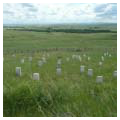
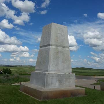 Last Stand Hill Monument (Photograph by Frank Bodden, CC BY 2.0)
 -
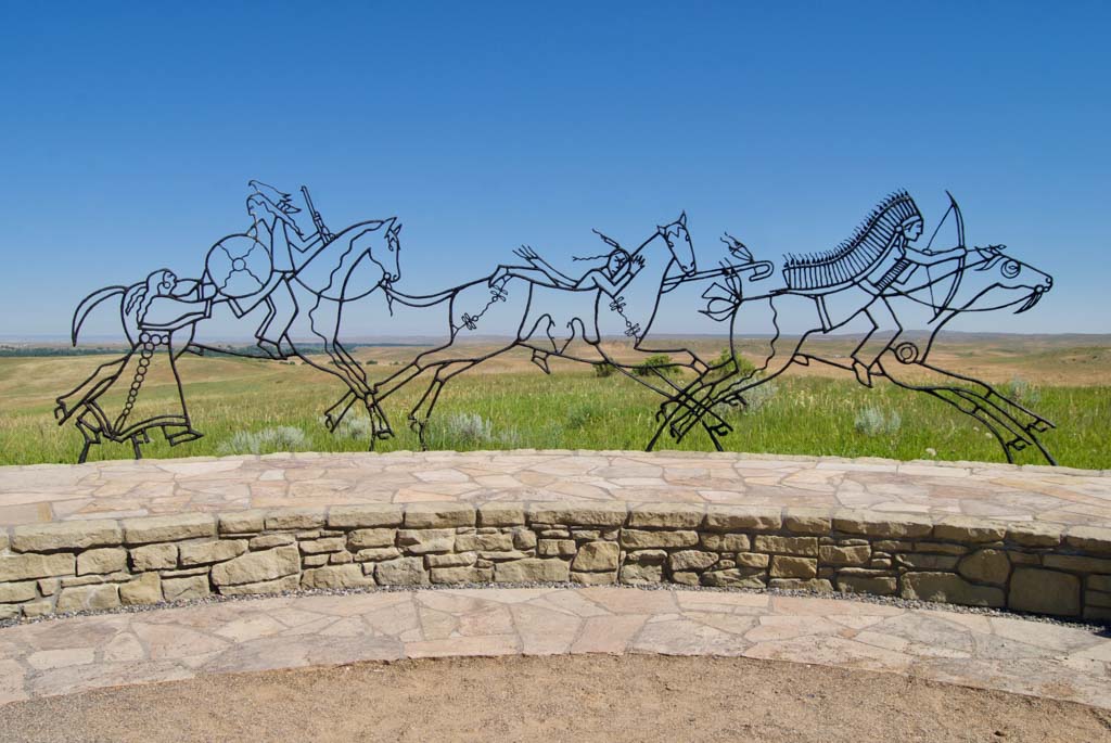
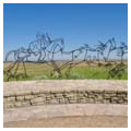
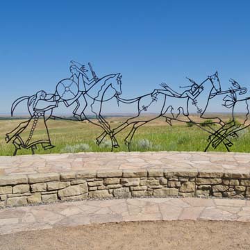 Indian Memorial (Photograph by Nick Amoscato, CC BY 2.0)


The Little Bighorn Battlefield National Monument, formerly known as Custer Battlefield National Monument, spans 765 acres outside of Crow Agency, Montana. The national monument includes the site of the Battle of Little Bighorn, fought between the Seventh Regiment of the United States Cavalry and Lakota Sioux, Northern Cheyenne, and Arapaho warriors on June 25 and 26, 1876. It also includes Custer National Cemetery and the Reno-Benteen Battlefield.
The Battle of Little Bighorn was one of the last armed conflicts between the United States Army and the nomadic Western tribes who fought to preserve their territory and way of life, and one of the few larger-scale victories for the tribes. Its controversial legacy in American history and its evolving cultural significance are reflected at the Little Bighorn Battlefield National Monument, which is a space of layered meanings and multiple, sometimes conflicting, cultural narratives.
Lieutenant Colonel George Armstrong Custer, who led the battle and perished alongside hundreds of Cavalry soldiers, has been lauded as an American hero and also decried as an agent of oppression. Throughout the site’s history, Custer’s memorialization and the historic characterization of the Battle of Little Bighorn has been both celebrated and protested. Today, memorials to the Seventh Cavalry exist alongside memorials honoring the Sioux, Cheyenne, and Arapaho warriors who also fought in the battle, but for much of the site’s history the story of loss and remembrance told was predominantly monocultural.
In the battle’s aftermath, the task of burying the dead was hastened by the need to evacuate wounded soldiers and the lack of good equipment. Each fallen soldier was buried in place, their graves marked with simple wooden stakes. In the following years, winds spread horse bones across the site, creating what some considered an unsightly scene. To amend this issue, and to provide a temporary monument while a permanent one was being built and transported, in 1879 Captain George K. Sanderson, who was leading a reburial detail on the battlefield, collected all the bones found on the site and erected the first monument on top of the hill where Custer and many soldiers had fallen. The 11-foot-tall wood and bone pyramid, which came to be known as the Cordwood Monument, was placed on top of a mass grave on the hill, known as Last Stand Hill or Custer Hill, where it stood until it was replaced two years later.
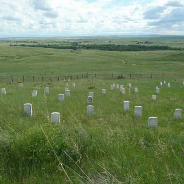
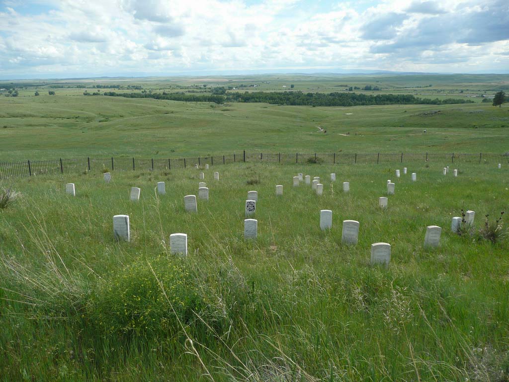
In July 1881, all the remains of fallen soldiers on the battlefield were moved Last Stand Hill, where a white granite monument was erected. The 14-foot obelisk, engraved with the names of fallen Seventh Cavalry soldiers, rises from the center of the burial site (roughly 100 feet square) on the crest of the hill, framed by a high iron fence. The wooden stakes that marked the original gravesites were left in place, and replaced in 1890 with the 249 white marble markers that exist today. Fifty-two of these marble gravestones lie in a dense cluster directly downhill of the monument, enclosed by a low iron fence. The remaining 197 gravestones are strewn throughout the battlefield, many weaving through the Deep Ravine, where soldiers were trapped and taken down by the Sioux, Cheyenne, and Arapaho warriors. The largest collection of these markers, apart from Last Stand Hill, is on the eastern face of the ridge that runs southeast from the Cavalry monument, marking the spot where Captain Myles W. Keogh and his soldiers made a defensive stand. More than 40 stones are grouped in clusters on the ridge, with 30 more scattered along the ravine toward Last Stand Hill, recording the retreat of survivors as they fled from the ridge and tried to reach the final rallying point of the battle.
After the battle, the bodies of the fallen Lakota and Cheyenne warriors were removed by tribal members and set to rest in teepees and tree scaffolds across the Little Bighorn Valley. In the years after the construction of the Seventh Cavalry memorial, several requests were made by families of fallen Indian warriors to place markers at the locations where their loved ones died on the battlefield, but these requests went unfulfilled for nearly 100 years. In the late 1990s, the first stone markers, made of red speckled granite instead of white marble, were placed to remember fallen Indian warriors.
In 1991, Public Law 102-201 officially changed the name of the site from Custer Battlefield National Monument to Little Bighorn Battlefield National Monument. The law also called for the construction of an Indian Memorial. In 1996, the government held a national competition. Two Philadelphia landscape architects, John R. Collins and Alison J. Towers, won the competition with their landform-based design. A “spirit gate” at one end faces Last Stand Hill and at the other, a bent-iron sculpture depicting Indian warriors in battle stretches across the rim of a low stone wall, framing the landscape beyond. The new memorial shares an axial relationship with the Cavalry Monument, but in many ways it is a counterpoint to the older structure. While the Cavalry obelisk juts from the hilltop, the Indian Memorial folds into the landscape. An immersive stone circle, engraved with text and imagery, memorializes both the battle and the nomadic traditions of the tribes involved. Construction on the memorial began in 2001 and it was dedicated on June 25, 2003.
Today, Little Bighorn Battlefield National Monument is a space that communicates a narrative of remembrance across time and cultures. The visitor center, completed in the early 1950s, provides interpretive programming, and multiple monuments situated in the landscape represent a breadth of meaning and experience available at the site.
References
Brust, James S., Brian C. Pohanka, and Sandy Barnard. Where Custer Fell: Photographs of the Little Bighorn Battlefield Then and Now. Norman: University of Oklahoma, 2007.
Utley, Robert M. “Whose Shrine Is It? The Ideological Struggle for Custer Battlefield.” Montana: The Magazine of Western History42 (1): 70–74.
Writing Credits
Coordinator:
Thaïsa Way
If SAH Archipedia has been useful to you, please consider supporting it.
SAH Archipedia tells the story of the United States through its buildings, landscapes, and cities. This freely available resource empowers the public with authoritative knowledge that deepens their understanding and appreciation of the built environment. But the Society of Architectural Historians, which created SAH Archipedia with University of Virginia Press, needs your support to maintain the high-caliber research, writing, photography, cartography, editing, design, and programming that make SAH Archipedia a trusted online resource available to all who value the history of place, heritage tourism, and learning.