


The neighborhood of Radburn in Fair Lawn, New Jersey, is the first-phase fragment of a planned town that dates from the late 1920s. The planned town was considered radical in design concept and it emerged in response to safety problems presented by the growing influence of automobiles on everyday life in American cities and their suburban residential fringes. Radburn was marketed as “A Town for the Motor Age,” and its scheme featured a complete separation of pedestrian and vehicular circulation. As automobile use in America steadily increased in the early twentieth century (particularly after the introduction of Ford's Model T in 1908), pedestrian-vehicular accidents increasingly became a problem.
Planners and designers Clarence Stein and Henry Wright, together with landscape architect Marjorie Sewell Cautley, created Radburn as an American adaptation of the “garden city” concept that had been theorized in 1898 by English social critic and reformer Ebenezer Howard. Garden cities were defined by Howard as an idealized exurban amalgamation of urban and rural qualities—a cure for the ailments of dense and dirty life within industrialized cities. In the prototypical English new towns of Letchworth and Welwyn, planner Raymond Unwin gave Howard’s diagrammatic ideas life during the first two decades of the twentieth century. By the early 1920s, Stein and Wright had traveled to England to investigate Unwin’s communities; the English garden city was linked primarily by rail to outlying employment centers or neighboring towns. Anticipating the preeminence of the automobile in America, Stein and Wright sought to develop a garden city that might be linked with adjacent towns by rail but could also safely accommodate automobiles, which many families would use on a daily basis.
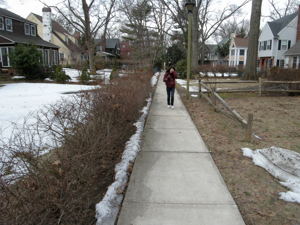
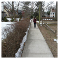
Stein and Wright had first experimented with garden neighborhood patterns at Sunnyside Gardens in the New York City borough of Queens. Sunnyside featured attached dwellings bordering and facing the established street grid; their innovation was the interconnectedness of the green areas within blocks, which included semi-private rear yards that linked to a central commons. The subsequent design for Radburn was unconstrained by an existing street pattern. Upon the tabula rasa of a large parcel that had once been a spinach farm, Stein and Wright created a system of collector loop streets that defined the edges of superblocks that were labeled “parks,” with an array of minimally dimensioned cul-de-sacs providing vehicular access to houses within the parks. The several parks, in turn, were to be linked to each other for pedestrian access by grade-separated pathways (underpasses or bridges) so that one could walk or bike through the several parks without ever crossing a street. With this radical approach, cars and pedestrians—and particularly cars and resident children—were functionally separated.
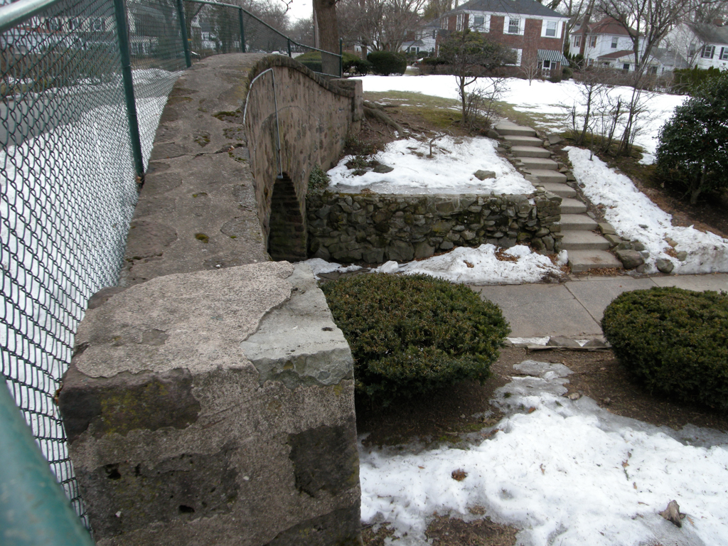
The economic downturn that followed the stock market crash of 1929 halted development at Radburn after the construction of only two parks (Park B and approximately half of Park A) and a built portion of 149 acres that represented about 20 percent of the entire original Radburn plan. Parks A and B include 469 single-family units, 30 duplexes, and 48 town houses along with a 93-unit apartment complex. The parks are linked together for pedestrians by Radburn’s famous underpass, artfully designed to “split the difference” for vehicles and pedestrians by elevating Howard Avenue a few feet on a short cresting bridge so that the excavation for pedestrians underneath it could be more shallow. This linkage is critical for the neighborhood because the larger (and completed) Park B contains Radburn’s single elementary school as well as its primary recreation complex.
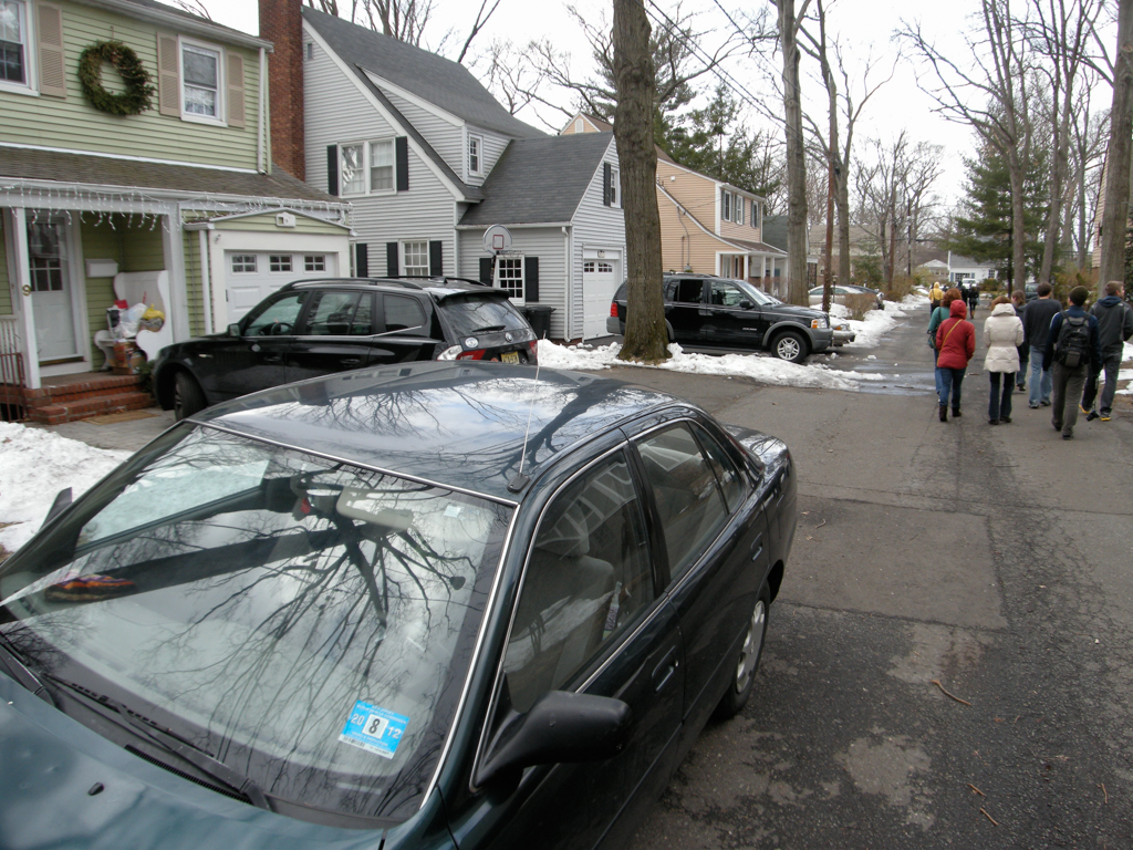
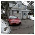
Short “hammerhead” cul-de-sacs (average length about 400 feet) penetrate the two parks, with most of the residential Radburn units backing onto these access lanes. The units backing to the cul-de-sacs front onto a generous swath of common open space, affording a landscape connection among all residences, a feature also seen at Sunnyside. But unlike Sunnyside, the pedestrian space flows uninterrupted between blocks. This “reversed” house orientation was a radical repudiation of the street as social realm; so was the design for the streets, which were reduced in scale and extent nearly to the point where perhaps they could be more accurately described as access lanes or back alleys.
Despite its fragmentary condition (later phases were never constructed), Radburn has been tremendously influential in America and beyond. It became the pattern for the three New Deal–era Greenbelt Towns (including Greenbelt, Maryland) developed by the U.S. Resettlement Association in the 1930s, as well as for larger-scaled, privately developed postwar new towns like Reston, Virginia, and Columbia, Maryland. Variants of the Radburn concept have also appeared in Canada, Australia, and the United Kingdom. For the most part, these later communities appropriated particular Radburn elements, such as the street pattern and especially the extensive armature of interconnecting landscape “tissue.” In only a few cases have imitators replicated the entirety of the Radburn scheme: reversed houses that do not front streets; minimized car access via cul-de-sacs; and complete separation of vehicular and pedestrian circulation.
For a number of reasons, these features proved problematic. The reversed house creates ambiguity for visitors, who could not approach a residence from what they perceived as the public realm. Residents themselves tend to moot the distinction between front and back; since they arrive in cars at the rear, the back door serves, in reality, as the front door. The minimized streets are ill-equipped to accommodate visitors’ cars and are inadequate for resident car parking, especially when, beginning in the postwar decades, families commonly owned two or more cars. The hammerhead cul-de-sacs are challenging for access by large delivery trucks and emergency vehicles. Finally, the complete separation of people and cars was frustrating to residents who valued the lanes as intimately scaled community landscape space that provided a physical connection with the nearest neighbors, were easy to monitor visually from kitchen windows, and proved irresistible to children on bikes because the lanes were paved. Stein himself made note of the unexpected appropriation of the landscapes for incidental “neighboring” activities and for children's hard-surface activities when he re-evaluated Radburn in the 1950s. By the time he designed the Canadian new town of Kitimat in the early 1950s, he had reconsidered many of Radburn’s design features, and the results were a hybrid between fully radical Radburn and what we would consider a more typical suburban pattern of house orientation and street design. In a very few cases, other designers have experimented with modified versions of Radburn, including Wildwood Park (1947) in Winnipeg and Village Homes (1974) in Davis, California.
Perhaps Radburn’s most pervasive legacy is the cul-de-sac—the address of choice in postwar American suburbia—and in particular the “live end” cul-de-sac that affords pedestrians access walks from cul-de-sacs to the connective green spaces into which they terminate. Also, by the end of the twentieth century, the inwardly directed Radburn concept had become a foil for new urbanist theorists such as Andres Duany, who argued for revival of streets as primary neighborhood public realm.
References
Birch, Eugenie Ladner. “Radburn and the American Planning Movement: The Persistence of an Idea.” American Planning Association Journal 46, no. 4 (October 1980): 424-439.
Cautley, Marjorie Sewell. “Planting at Radburn.” Landscape Architecture 21 (October 1930): 23-29.
Filler, Martin. “Planning for a Better World: The Lasting Legacy of Clarence Stein.” Architectural Record 170, no. 10 (August 1982): 122-127.
Howard, Ebenezer. Garden Cities of To-morrow. London: S. Sonnenschein and Company, 1902.
Hudson, Robert B. Radburn: A Plan of Living. New York: American Association for Adult Education, 1934.
Lee, Chang-Moo. “A Closer Look at Radburn.” Journal of the American Planning Association 69, no. 3 (Summer 2003): 314-315.
Martin, Michael David. “The Landscapes of Winnipeg’s Wildwood Park.” Urban History Review/Revue d’histoire urbaine 30, no. 1 (October 2001): 22-39.
Martin, Michael David. “Returning to Radburn.” Landscape Journal 20, no. 2 (January 2001): 156-175.
Parsons, Kermit Carlyle, ed. The Writings of Clarence S. Stein. Baltimore: Johns Hopkins University Press, 1998.
Radburn Association Board of Trustees. “The Radburn Association Guidelines of Architectural Control.” In Radburn Bulletin, no. 2766. Fair Lawn, NJ: Radburn Association, 1997.
Schaffer, Daniel. Garden Cities for America: The Radburn Experience. Philadelphia: Temple University Press, 1982.
Tennenbaum, Robert, ed. Creating a New City: Columbia, Maryland. Columbia, MD: Perry Publishing, 1996.
Unwin, Sir Raymond. Town Planning in Practice: An Introduction to the Art of Designing Cities and Suburbs. London: Ernest Benn, 1932.
Wright, Henry Niccolls. “Radburn Revisited.” Architectural Forum 135, no. 1 (July-August 1971): 52-57.