

Monte Vista Addition; College View Addition
You are here
Monte Vista and College View Historic District
1926 Monte Vista Addition, S.R. De Boer; 1926 College View Addition, Charles McDuffie. Bounded by Girard Blvd. NE, Lomas Blvd. NE, Morningside Dr. NE, Copper Ave. NE and Campus Blvd. NE.
-
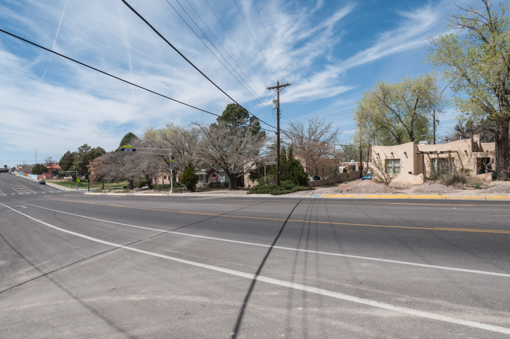
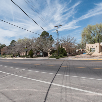 Monte Vista Boulevard (Photograph by Christopher C. Mead)
 -
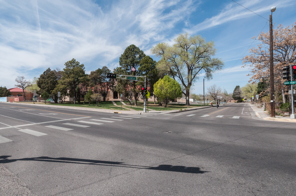
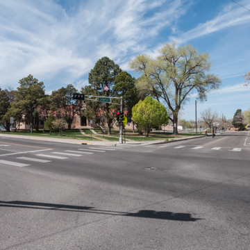 Monte Vista School at Monte Vista and Campus Boulevards (Photograph by Christopher C. Mead)
 -
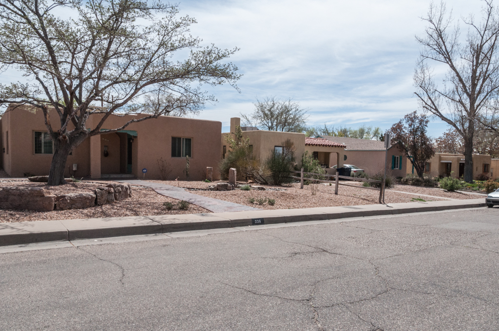
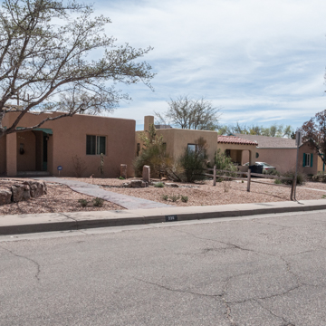 Houses on Tulane Drive (Photograph by Christopher C. Mead)

The Monte Vista and College View Additions were Albuquerque’s first suburbs to be premised on the automobile, which at once made these suburbs accessible and informed their planning, and they furthered the city’s mechanized decentralization. Located beyond the University of New Mexico, at a distance of over 2.5 miles from the downtown, they were platted in 1926, after Albuquerque annexed 4,166 acres of East Mesa land in 1925.
The Monte Vista Addition was laid out by the architect and planner, S.R. De Boer, for the developer, William Leverett Sr. On its perimeter, a rectangular grid of blocks aligns with Girard Boulevard (and the university) to the west, Lomas Boulevard to the north, and Carlisle Boulevard to the east. Inside this perimeter, however, the addition rotates 45 degrees to an inner core of blocks that follow the contours of the southeast sloping site to abut the commercial strip zoned along Central Avenue to the south. This topographic adjustment both allows for rainwater runoff in an area of former sand hills subject to flash floods and organizes the addition around the diagonal intersection of Monte Vista Avenue and Campus Boulevard; Monte Vista follows a natural bend in the site and Campus replaces an earlier arroyo. A roughly triangular plot of land toward the southwest corner, between Campus Boulevard and Monte Vista Avenue, was set aside for a public school, while a small commercial center was located at the avenue’s northeast terminus.
The College View Addition, developed by Charles McDuffie, extends this suburb another 16 rectangular blocks to the east on flat ground between Carlisle Boulevard and Morningside Drive, Albuquerque’s easternmost street at the time. Except for irregular corner plots in the Monte Vista Addition, the blocks in both subdivisions were laid regularly with lots 50 by 150 feet that include rear alleys.
Ninety percent of those lots were built up between 1927 and 1941. Most of the construction occurred after 1935, when the worst of the Great Depression was over and the developers took advantage of newly available Federal Housing Administration financing by directing prospective homeowners to these low-interest loans. The houses, built either by the developers or independent contractors, were one-story structures, sometimes of adobe but usually of wood frame or hollow clay tile finished with stucco. They followed standard plans, with 5 to 6 rooms and rear garages, in California Mission, Mediterranean, Spanish-Pueblo, or Territorial styles. When the remaining lots were built up between 1945 and 1960, houses were often of concrete block, had larger plans and front garages, and introduced more modern idioms like the Ranch Style and the International Style.
By 1930, the city had paved most of the streets in the Monte Vista Addition, had delivered water lines, and was planning to install sewer lines. The realignment of Route 66 along Central Avenue in 1937 encouraged the growth of a nearby commercial strip that served the two additions as much as passing tourists. Together, these suburbs help to establish the standard planning model of residential enclaves served by arterial streets and bordered by commercial strips that define postwar Albuquerque. Both remain stable and have seen ongoing renovation and expansions of the houses since the 1980s.
The Monte Vista and College View Historic District was listed on the National Register of Historic Places in 2001.
References
Kammer, David, “The Twentieth-Century Suburban Growth of Albuquerque, New Mexico,” Bernalillo County, New Mexico. National Register of Historic Places Multiple Property Documentation Form, 1997. National Park Service, U.S. Department of the Interior, Washington, D.C.
Kammer, David, and Edgar Boles, “Monte Vista and College View Historic District,” Bernalillo County, New Mexico. National Register of Historic Places Registration Form, 1998. National Park Service, U.S. Department of the Interior, Washington, D.C.
Writing Credits
Coordinator:
Christopher C. Mead
Regina N. Emmer
If SAH Archipedia has been useful to you, please consider supporting it.
SAH Archipedia tells the story of the United States through its buildings, landscapes, and cities. This freely available resource empowers the public with authoritative knowledge that deepens their understanding and appreciation of the built environment. But the Society of Architectural Historians, which created SAH Archipedia with University of Virginia Press, needs your support to maintain the high-caliber research, writing, photography, cartography, editing, design, and programming that make SAH Archipedia a trusted online resource available to all who value the history of place, heritage tourism, and learning.