

Technical Area 11
You are here
K-Site


1944, Leslie Groves, J. Robert Oppenheimer, U.S. Army Corps of Engineers, and Willard C. Kruger. Los Alamos National Laboratory.


The implosion of explosive spheres was studied in early 1945 in three structures at K-Site in Technical Area 11.
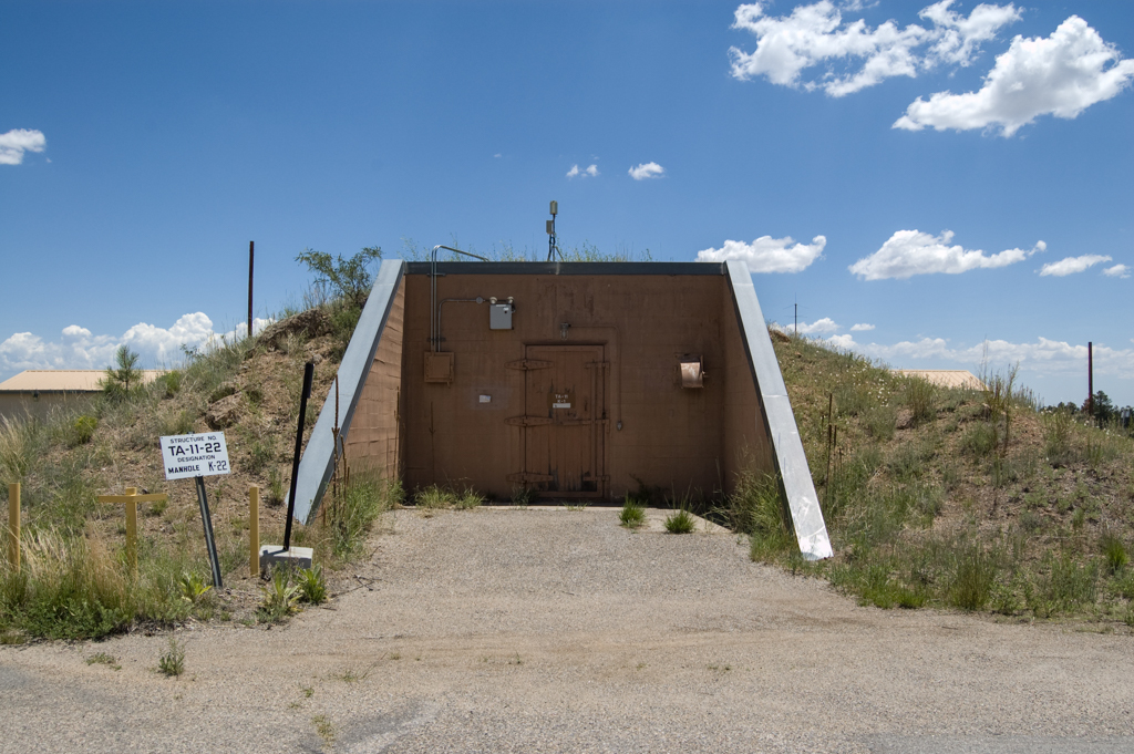
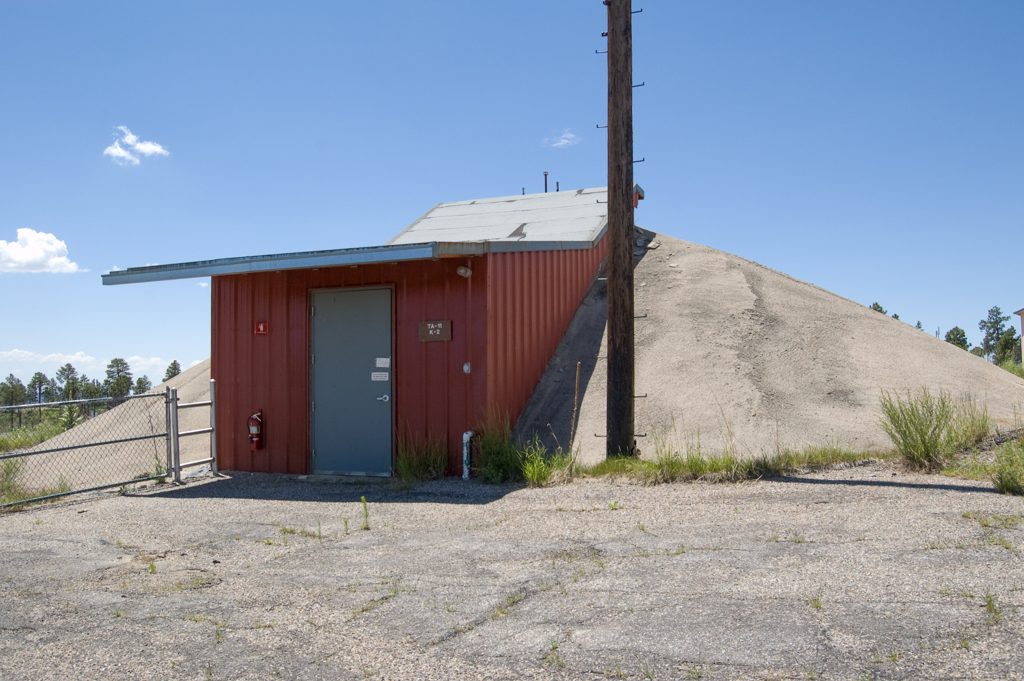
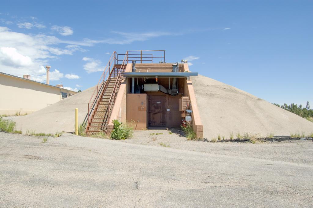
The Control Building (TA-11-1) is a rectangular structure of reinforced concrete with earth berms on its north, east, and south sides, and concrete retaining walls extending from its west entrance. The Betatron Building (TA-11-2) and the Cloud Chamber (TA-11-3) are symmetrical structures of reinforced concrete with walls that thicken from one to three feet toward the back and then chamfer to a point; their sides are covered with mounds of compacted earth and asphalt. These two buildings are aligned with each other north-to-south and placed back-to-back some 50 feet apart, with their entrances on the outward north (TA-11-2) and south (TA-11-3) sides.
Test implosions were detonated between these two structures, while the scientists were a safe distance away in the Control Building. The Betatron Building housed a machine of the same name, a particle accelerator that generated gamma rays by using electromagnetic induction to accelerate electrons in a vacuum chamber to energies in the range of 15-MeV (megavolts). The Cloud Chamber was a particle detector of ionized radiation that used a sealed environment saturated with an alcohol vapor to create ion trails. Gamma rays from the Betatron Building passed through a test implosion and their trails in the Cloud Chamber were then recorded by flash photography. As was often the case in Project Y, technologically complex scientific experiments took place in thrown-together structures that look rudimentary but were in fact functionally sophisticated.
These structures are eligible but not yet included in the Manhattan Project National Historical Park.
References
Los Alamos National Laboratory. The History and Legacy of the Manhattan Project at Los Alamos National Laboratory. Los Alamos, NM: Los Alamos National Laboratory, 2015.
McGehee, Ellen, Sheila McCarthy, Ken Towery, John Ronquillo, Kari Garcia, and John Isaacson. Sentinels of the Atomic Dawn: A Multiple-Property Evaluation of the Remaining Manhattan Project Properties at Los Alamos (1942–1946). Historic Building Survey Report No. 215. Los Alamos: Los Alamos National Laboratory, 2003.
National Park Service. Manhattan Project Sites. Special Resource Study/Environmental Assessment. Washington, D.C.: Department of the Interior, 2010.
Writing Credits
Coordinator:
Christopher C. Mead
Regina N. Emmer
If SAH Archipedia has been useful to you, please consider supporting it.
SAH Archipedia tells the story of the United States through its buildings, landscapes, and cities. This freely available resource empowers the public with authoritative knowledge that deepens their understanding and appreciation of the built environment. But the Society of Architectural Historians, which created SAH Archipedia with University of Virginia Press, needs your support to maintain the high-caliber research, writing, photography, cartography, editing, design, and programming that make SAH Archipedia a trusted online resource available to all who value the history of place, heritage tourism, and learning.