


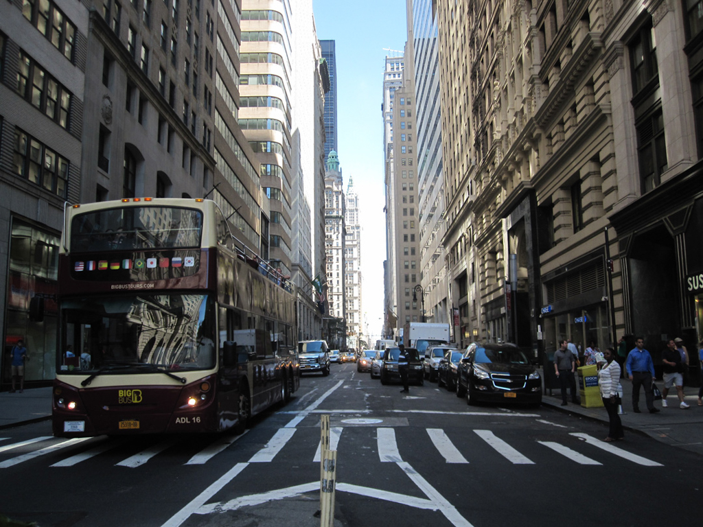


Broadway is a 13-mile roadway running from the southern tip to the northernmost point of the island of Manhattan. It is an internationally recognized route, synonymous with New York City’s midtown theater district, its so-called “Canyon of Heroes” downtown (where the city holds its ticker-tape parades), and as a main thoroughfare in many iconic neighborhoods such as Greenwich Village and Harlem. At its conjunction with West 178th Street and the George Washington Bridge, Broadway joins with US 9 and continues into the Bronx via the Broadway Bridge and up through Westchester County as US 9/Broadway. The designation Broadway terminates when US 9/Broadway intersects with NY 113.
Predating the Commissioners’ Plan of 1811, Broadway was initially a Native American trading trail running the length of Manhattan. Various indigenous peoples living on the island—including Lenni Lenape, Delaware Lenape, and Wickquasgeck—used the route, known as the Wickquasgeck Trail, to exchange goods with each other. Following Dutch settlement in 1609 and the establishment of Fort Amsterdam in lower Manhattan, the Wickquasgeck Trail’s southern endpoint became a site for trading between the indigenous peoples and the European colonists. Today, the location is home to the American Indian Museum, housed in the former U.S. Custom House building (1907, Cass Gilbert), situated at Broadway and Bowling Green.
As the Dutch expanded their settlement, they forcibly pushed the indigenous peoples out of lower Manhattan, but continued to use the Wickquasgeck Trail as a trading route, giving it the Dutch name Heerestrat. When English settlers took control of New Amsterdam in 1664, renaming it New York, they maintained the Wickquasgeck Trail/Heerestrat, but called it Broadway Street, a name likely derived from the Dutch Bredweg or “Broad Road.”
With the advent of the Commissioners’ Plan of 1811, Manhattan was to be parceled into rectilinear plots with avenues running north-south and streets running east-west. Though Broadway was not initially included in the Commissioners’ Plan, over time the roadway was built into the city’s system as the longest artery whose route is not restricted by the grid. As a result, Broadway’s middle section, from West 8th Street up to West 79th Street, runs at an angle to the grid, along the west side of the island. From 79th Street to 169th Street, its route coincides with the formal grid pattern, except for a slight westerly jog in the West 100s. Above 169th Street, it resumes its transecting route as it traverses the northern reaches of Manhattan.
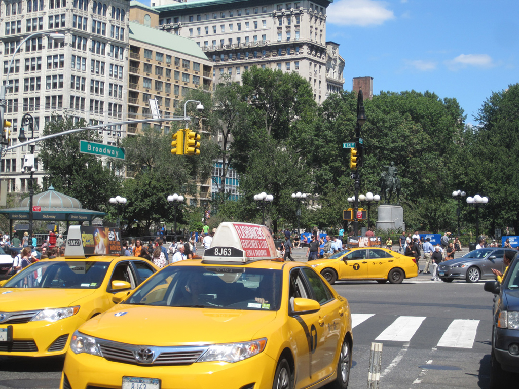
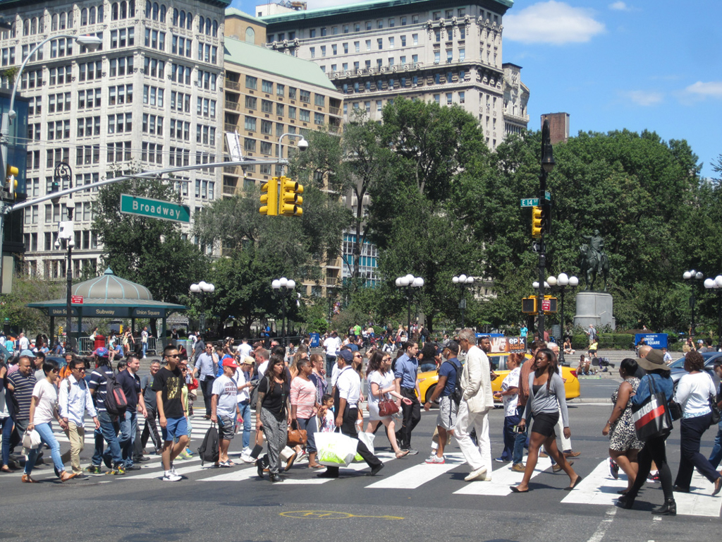
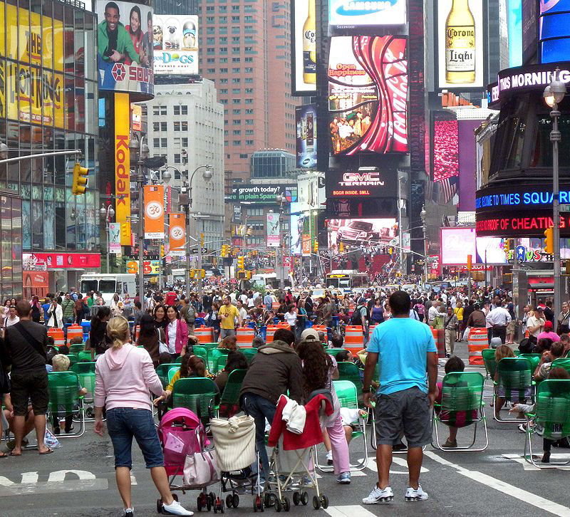
Above 8th Street, Broadway’s intersections with Manhattan’s north-south avenues and major east-west streets created a series of public spaces of varying sizes, uses, and social significance, and while many of these spaces are called “squares,” most are triangular in shape: Union Square at 14th Street and 4th Avenue; Madison Square at 23rd Street and 5th Avenue; Herald Square and Greeley Square at 34th Street and 6th Avenue; Times Square (originally Longacre Square) at 42nd Street and 7th Avenue; Columbus Circle at 59th Street and 8th Avenue; Lincoln Center at West 66th Street and Columbus Avenue (originally 9th Avenue); Verdi Square at 72nd Street and Amsterdam Avenue (originally 10th Avenue); Straus Park at 106th Street and West End Avenue (originally 11th Avenue). Two other public spaces occur where diagonal avenues intersect Broadway’s north-south alignment: the crossing of West 138th Street and Hamilton Place produces Montefiore Square, while that of West 168th Street and St. Nicholas Avenue produces Mitchel Square. During the twentieth century, many public spaces on the Broadway spine, notably Times Square and Union Square, grew into major transportation hubs and urban parks, drawing city residents and tourists alike. Others, like Verdi Square and Straus Park, are quiet oases that serve only their neighborhoods.
The character of Broadway changes as it moves up the island, reflecting the transformation of Manhattan’s built environment in the centuries since European settlement began. Its importance as a high street in New Amsterdam continued when the Dutch ceded the island to the British. As a result, key buildings of colonial and post-revolutionary New York are found on lower Broadway, from St. Paul’s Chapel (1766) to City Hall (1811). As Manhattan’s commercial activity moved uptown during the nineteenth century, Broadway’s development, in effect, followed the money. On Broadway at Chambers Street, A.T. Stewart erected the Marble Palace for the dry goods emporium that became the nation’s first department store (1846, John B. Snook). Between Canal and Houston streets, Broadway is lined with multi-story, palazzo-style commercial buildings that presaged the skyscraper. Originally used for light manufacturing on their upper floors and wholesale dealers at street level, many of these buildings have ornate, frequently classical, cast-iron facades, such as the E.V. Haughwout Building (1857). When manufacturing declined in this area in the middle of the twentieth century, these buildings gradually became home to artists and other creatives who spearheaded the effort to preserve them. Further north, manufacturing gave way to retail towards the end of the nineteenth century, with the city’s primary shopping district emerging along Broadway and 6th Avenue between Union and Madison squares, though some department stores were located below what came to be known as Ladies' Mile, including John Wanamaker on Broadway at 8th Street (1906, Daniel H. Burnham). Lord & Taylor made its initial move uptown from lower Broadway in 1870, relocating into a building James Giles designed as a cast-iron extravaganza of Second Empire detail. With a prominent mansard roof and double-height entrance, it continues to dominate the corner of Broadway and 20th Street more than a century after the venerable department store decamped to a 5th Avenue location further uptown. Opposite the former Lord & Taylor, on the southeast and northwest corners of Broadway, are two distinct McKim, Mead and White buildings, from 1886 and 1890, respectively, that testify to the area’s continued commercial vitality towards the end of the century.
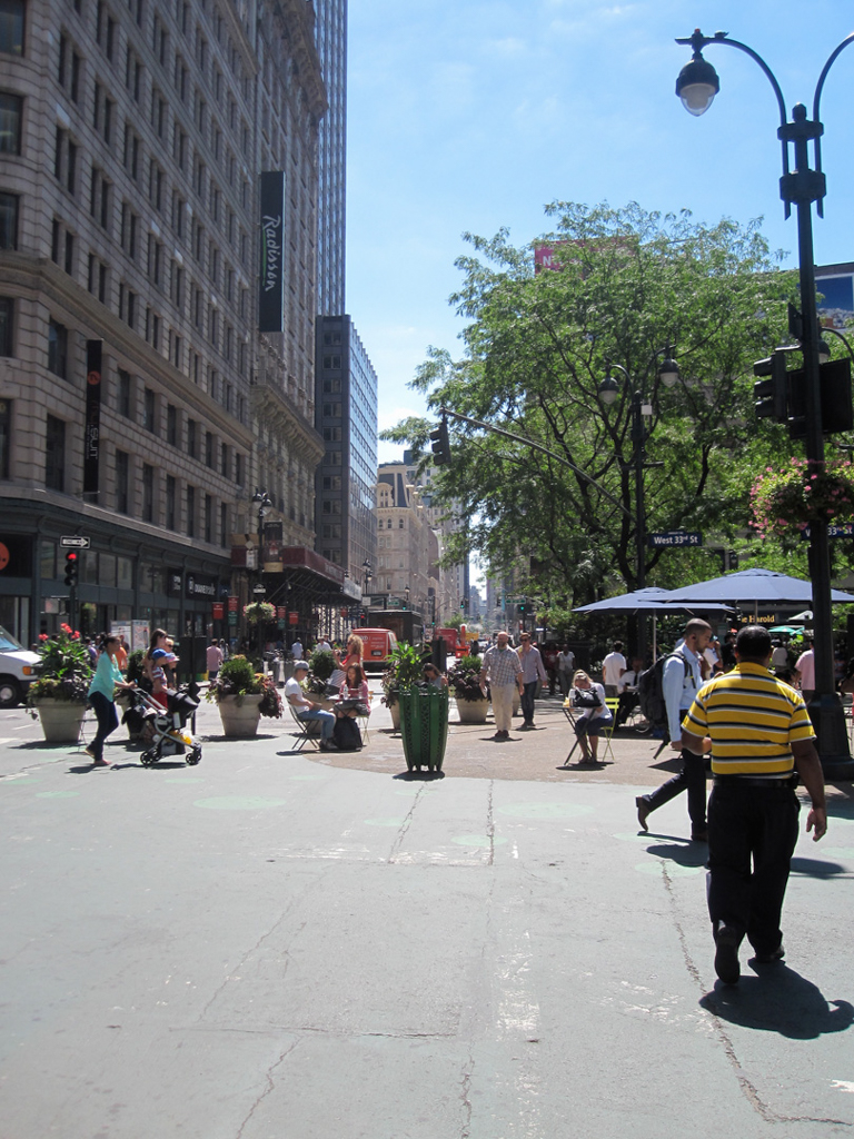
By 1900, entertainment venues had followed wholesalers and retailers uptown, finally settling in an area of midtown that remains the city’s theater district. In the vanguard was the Metropolitan Opera, which opened in a building on Broadway and West 39th Street in 1883. Broadway north of Times Square would soon earn the moniker “The Great White Way,” due to the bright electric streetlamps, theater marquees, and advertising signage lining its route. Though it was not the first illuminated street in the United States, many regarded this stretch of Broadway as the grandest. While many late-nineteenth- and early-twentieth-century theaters remain on the side streets, Broadway through the heart of Times Square was extensively rebuilt, in high-rise form, in the 1980s and 1990s following a period of decline that began after World War II when commercial activity, especially in the area’s cinemas, shifted from popular to pornographic. Five theaters were demolished on Broadway at 45th Street to make way for the Marriott Marquis, a 48-story atrium hotel (containing a theater and a revolving restaurant) designed by John Portman in a dull modernist fashion that opened in 1985. 4 Times Square (1999, Fox and Fowle), on the northeast corner of Broadway and 42nd Street, is also a 48-story tower but—reflecting changing ideas about architecture and urbanism—it responds to Broadway’s over-the-top commercial exuberance with a 3-story superstructure of signage at its base and a 7-story cylinder at its Broadway and 43rd Street corner, whose electronic skin displays a real-time stock ticker, news, and advertisements.
Traffic on Broadway below Columbus Circle runs one-way due south. Traffic north of Columbus Circle runs two-ways on a wide boulevard the city laid out in the years just after the Civil War. At that time, as Broadway traveled through what is today the Upper West Side, the area was largely undeveloped, so there was ample room to build a true Parisian-style boulevard with 40-foot roadways and 22-foot planted medians that became known as the Broadway Malls. Though tall trees graced the malls by the end of the nineteenth century, they were removed when Broadway was ripped up for the construction of the Interborough Rapid Transit subway at the start of the twentieth century. The malls were rebuilt and replanted over several decades, ultimately occupying 10.5 acres of land at the center of a 5-mile stretch of upper Broadway. For much of this section, Broadway has a mixed-use character. Though it is lined primarily with mid-rise and high-rise apartment buildings, most of these have commercial establishments at street level.
The New York City Department of Transportation (NYC DOT) has jurisdiction over Broadway’s maintenance and repair. Beginning in 2007, Transportation Commissioner Janette Sadik-Kahn, appointed by then Mayor Michael Bloomberg, began an ambitious reimagining of Broadway on the two-mile stretch between Union Square and Columbus Circle. The goal of this so-called “rightsizing” project was to improve the flow of both car and pedestrian traffic. In 2008, the NYC DOT removed traffic lanes from Broadway between 35th Street and 42nd Street to create public plazas with bench and table seating. Bicycle lanes were also added to Broadway between 14th Street and 42nd Street. In 2009, the NYC DOT initiated a pilot program to close down Broadway to vehicular traffic in both Times Square and Herald Square. In 2010, the NYC DOT made the closures to vehicular traffic on Broadway in Times Square and Herald Square permanent, and also closed lanes to Broadway in Madison Square and Union Square. Non-profit organizations and public-private partnerships are generally responsible for the management of these pedestrian plazas, including the Times Square Alliance, the 34th Street Partnership, and the Flatiron Business Improvement District. These changes are perhaps the most significant Broadway has witnessed since the street was paved with asphalt early in the twentieth century. If that event made Broadway more amenable to the automobile, this one was intended to give the busiest stretch of one of the busiest city streets in the nation back to the pedestrians.
References
Augustyn, Robert T., and Paul E. Cohen. Manhattan in Maps: 1527–1995. New York: Rizzoli International Press, 1997.
Burrows, Edwin G. and Mike Wallace. Gotham: A History of New York City to 1898. New York: Oxford University Press, 1999.
Ellis, Edward Robb. The Epic of New York City. 1966. New York: Basic Books, 2004.
“Public Plazas in New York.” New York City Department of Transportation. Accessed August 28, 2015. www.nyc.gov.
Shorto, Russell. The Island at the Center of the World: The Epic Story of Dutch Manhattan and the Forgotten Colony that Shaped America. New York: Vintage Books, 2005.