


The National Road was America’s first major public works project and dates from the earliest years of the nineteenth century. Federal legislation passed on April 30, 1802 created the state of Ohio in the Northwest Territory and also included a provision for the construction of a road to the west. The brainchild of Albert Gallatin, Secretary of the Treasury under President Thomas Jefferson, the National Road (also known as the Cumberland Road), began at Cumberland, Maryland, and ultimately extended westward to Vandalia, Illinois. By 1851 Cumberland, on the Potomac River, was the western terminus of the Chesapeake and Ohio Canal that began at Georgetown, adjacent to Washington, D.C. By 1818 the new road had reached Wheeling (then part of Virginia) on the Ohio River. After several years of inactivity, the road was continued westward in 1825 with the stretch from Wheeling to Zanesville. It reached Columbus by 1833 and the Indiana border by 1837; it did not reach Vandalia until 1852. Extensions eventually linked the road eastward to the Chesapeake Bay and the Atlantic Ocean at Baltimore and westward to the Mississippi River at St. Louis.
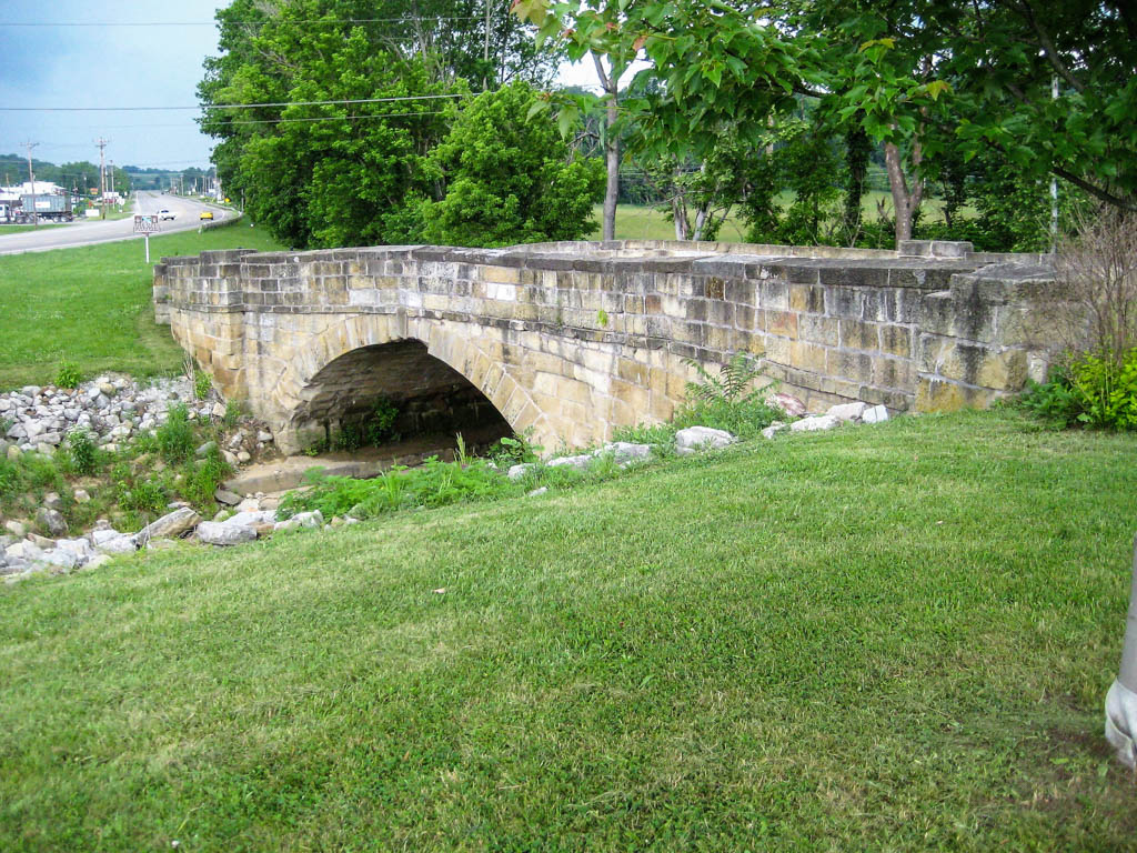
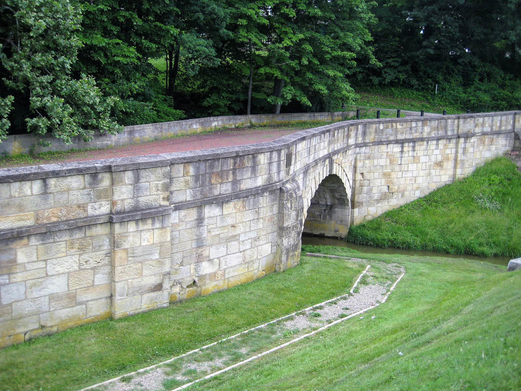
The National Road played a pivotal role in opening the west, crossing both flat lands and steep hills as it made its way westward. Through the years, skilled stonemasons erected a series of substantial stone bridges to traverse waterways large and small. Many of these bridges were straight, but in eastern Ohio several S-shaped bridges, or S-Bridges, crossed small waterways. Most S-Bridges date from c. 1825–1828. They are distinctive engineering structures that add considerably to the rich cultural landscape the National Road created. Several stone S-Bridges were erected where the National Road crossed Belmont, Guernsey, and Muskingum Counties in southeastern Ohio. Among these were bridges at Hendrysburg, one near Old Washington, another west of Cambridge, and one just west of New Concord. The Hendrysburg bridge was straightened in 1933 and the others are in varying states of preservation.
There are a number of explanations for the distinctive configuration of the S-Bridges, from attempts to slow the already-slow horse- and oxen-driven traffic to claims they were the result of drunken bridge builders. More likely, the S-form emerged because many of the streams the National Road crossed did not run at 90-degree angles to the roadway. In an era before sophisticated field engineering, in order to accommodate the surveyed path of the road and still cross the waterways at 90-degree angles, the “S” shape was necessary.
The National Road’s original crushed stone roadway surfaces were no match for twentieth-century vehicular traffic and by about 1919 much of the highway was paved with brick. With the advent of the national highway system in the 1920s, the century-old National Road underwent further “improvements”: widening, by-passing some villages, and by-passing the S-bridges. It was also designated U. S. Route 40 at this time. During the ensuing decades, Route 40 was further improved as passing lanes and stretches of four-lane highway were built, in many cases paralleling the old roadbed and the S-Bridges. The construction of Interstate 70 across Ohio in the 1960s and 1970s marked the next generation of highway travel and Route 40 itself was by-passed. In some instances, at Hendrysburg in Belmont County for example, the interstate was built over the older roadway, completely obliterating the historic National Road and its S-Bridge.
None of the S-Bridges are in use today. In recent years, however, preservationists and engineering historians have recognized the importance of these 1820s bridges and have sought to restore and interpret these unique vestiges of nineteenth-century engineering. This bridge at New Concord and the one west of Cambridge are both listed in the National Register of Historic Places, and the bridge east of Old Washington, Guernsey County, is a National Historic Landmark.
References
Hulbert, Archer Butler. “The Old National Road –The Historic Highway of America.” Ohio Archeological and Historical Publications9 (1901), 405-519.
Loveday, Amos J., Jr. “S-Bridge II,” Muskingum County, Ohio. National Register of Historic Places Inventory-Nomination Form, 1972. National Park Service, U.S. Department of the Interior, Washington, DC.
McKee, Harley J. “Original Bridges on the National Road in Eastern Ohio.” Ohio History81 (1972), 131-144.