

Columbia River Highway
You are here
Historic Columbia River Highway No. 100


1913–1922, Samuel C. Lancaster, landscape architect; John A. Elliott, engineer. Columbia River Hwy.
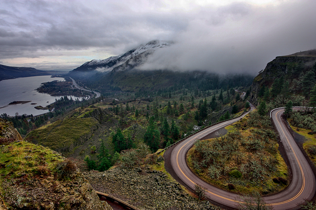

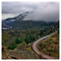
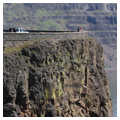
The Historic Columbia River Highway is a 74-mile-long scenic highway that runs east-west along the Oregon side of the Columbia River, between Troutdale and The Dalles. The first purely scenic planned roadway in the United States, it was built through the Columbia River Gorge between 1913 and 1922.
With the rise of the automobile in the early twentieth century, the wagon road that had been built through the gorge in the 1870s along the south shore from The Dalles to just east of Portland was no longer adequate. The existing road had steep grades of up to 20 percent and an awkward and often dangerous alignment. Initially Multnomah County sought to construct a 20-foot roadway with 9 percent grades, but ran into difficulties with the existing topography and railway lines already in place. By 1910, it was clear that a different approach was needed, a position supported by much of the general public.
The Columbia River Highway, as we know it today, was the dream and eventual reality of two visionaries, Samuel Hill (1857–1931), lawyer, entrepreneur, and “good roads” promoter, and Samuel C. Lancaster (1864–1941), an engineer and landscape architect. In 1908, the two traveled to Europe for the First International Road Congress, where Hill represented the state of Washington. They were both impressed by the scenic roadways they encountered there and returned to the U.S. determined to design a scenic roadway along the Columbia River Gorge.
Predating the National Park Service roads initiative of the 1920s, the Historic Columbia River Highway was constructed through county, state, and federal cooperation. Drawing on earlier parkway concepts from the 1880s, Hill and Lancaster envisioned the roadway as a recreational amenity rather than solely a transportation route. Nevertheless, the Columbia River Highway became a lifeline connecting Portland with the many commercial and agricultural areas along the Columbia River and in the Columbia Gorge.
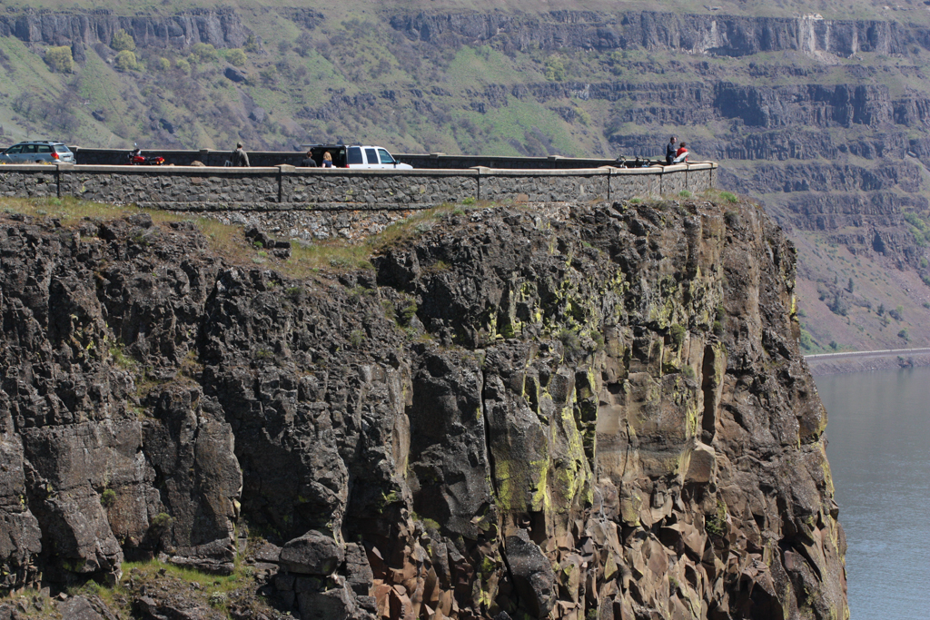
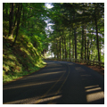
In 1913 Lancaster was hired to design the road, working alongside State Highway Department engineer John Arthur Elliott. Their goal was to emulate the European scenic roadways while incorporating American engineering standards. These standards were reflected in both the materials and construction of the highway. To increase safety and ensure a pleasant ride, the road was designed with grades no greater than 5 percent and no curves with less than a 100-foot turning radius. The highway was surfaced with Warrenite, a patented long-wearing and smooth-riding asphalt concrete pavement. Other innovative features included reinforced-concrete bridges combined with masonry guardrails, guard walls, and retaining walls.
In addition to the state-of-the-art engineering, the two-lane road’s design was marked by a strong relationship between the Columbia River Gorge’s natural landscape and the highway’s built landscape. Rather than cut through major topographic changes, the Columbia River Highway flowed with them, hugging the Gorge landscape. In designing the roadway, Lancaster sought not only to create a transportation artery, but to make the gorge’s “beautiful waterfalls, canyons, cliffs, and mountain domes” accessible to “men from all climes.” According to engineer Elliott, scenic views were prioritized over economic considerations and the road was designed to include certain scenic areas, despite issues of grade, curvature, distance, and expense.
The scenic roadway’s alignment generally had a maximum grade of 5 percent and a curve radius of 200 feet (well over the 100-foot minimum) and was wide enough for 18 feet of roadway and two 3-foot gravel shoulders. Additionally, Lancaster designed a comprehensive drainage system that included raising the center of the road, installing concrete curbs and gutters, and using culverts. Eleven larger reinforced concrete bridges, several viaducts, and 5 tunnels were also built, allowing the road to pass over streams or along steep hillsides with a minimum of disturbance.
Over the ensuing years, several benefactors purchased waterfalls and other sites lining the Gorge to establish parks along the Columbia River Highway. The Highway included designed landscapes at these locations. The masonry guard walls, retaining walls, and bridges on the pedestrian trails closely resemble those seen along the Highway itself.
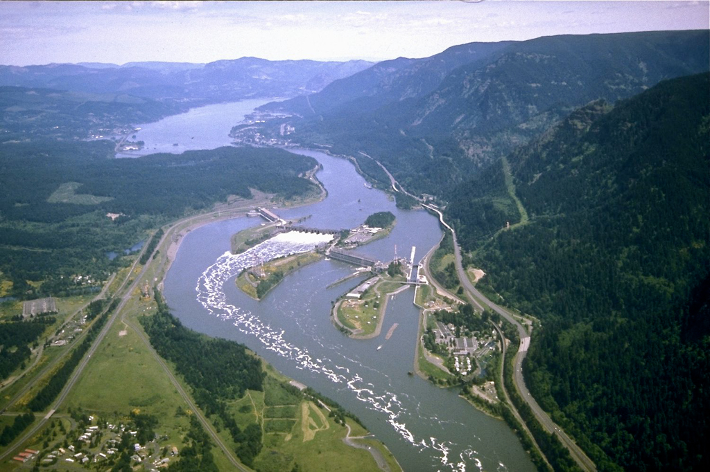
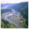
In time, the Columbia River Highway became a vital link between Oregon and the nation’s highway system. By the late 1930s, construction of Bonneville Dam, a New Deal project aimed at providing flood control on the Columbia River and generating electricity, caused a realignment of a portion of the Highway near Tooth Rock and Eagle Creek, in eastern Multnomah County, marking the first major alteration of the route. The Oregon State Highway Department began abandoning segments of the Columbia River Highway in the late 1930s upon completion of the new water-level route from Bonneville Dam to Cascade Locks. Much of the original alignment from Cascade Locks to Hood River had been sacrificed for the new water-level route, and the section from Hood River to Mosier, including the Mosier Twin Tunnels, was also abandoned. By the 1950s, the completion of I-84 allowed travelers to bypass the Columbia River Highway entirely.
Today, the road has once again become popular for its pleasurable driving and sightseeing, as well as for its scenic destinations, including Multnomah Falls. One of the most popular natural sites in Oregon, the Falls draw more than two million visitors annually. The road, now known as the Historic Columbia River Highway No. 100, is mostly owned and maintained by the state through the Oregon Department of Transportation.
References
Smith, Dwight A., “Columbia River Highway Historic District,” Multnomah, Hood River, and Wasco Counties, Oregon. National Register of Historic Places Inventory-Nomination Form, 1984. National Park Service, U.S. Department of the Interior, Washington, D.C.
Writing Credits
Coordinator:
Thaïsa Way
If SAH Archipedia has been useful to you, please consider supporting it.
SAH Archipedia tells the story of the United States through its buildings, landscapes, and cities. This freely available resource empowers the public with authoritative knowledge that deepens their understanding and appreciation of the built environment. But the Society of Architectural Historians, which created SAH Archipedia with University of Virginia Press, needs your support to maintain the high-caliber research, writing, photography, cartography, editing, design, and programming that make SAH Archipedia a trusted online resource available to all who value the history of place, heritage tourism, and learning.