

Cumberland Homesteads Tower Museum and House Museum
You are here
Cumberland Homesteads


1934–1939, William Macy Stanton. 96 TN 68 (Tower Museum) and 2611 Pigeon Ridge Rd (House Museum).
Located on the Cumberland Plateau in Crossville, the Cumberland Homesteads is a New Deal rural resettlement farming community created by the federal government’s Division of Subsistence Homesteads. Constructed in 1934–1939 on 27,800 acres, the Cumberland Homesteads consisted of 251 farmsteads, administrative offices and a water tower, a school complex, cooperative businesses and factories, and a 1,300-acre recreational state park.
The Division of Subsistence Homesteads was created in 1933 as a result of the National Industrial Recovery Act, which included $25 million to purchase land for the development of small resettlement communities throughout the country. In January 1934, at the request of local county officials, the division selected Tennessee’s Cumberland County as a “stranded” region populated by unemployed farmers, factory workers, and coal miners. The experimental program was designed to enable economically distressed workers and their families to sustain themselves on small farms and participate in cooperatively owned businesses. Over time, the relocated workers would be able to purchase their farmstead by setting aside two-thirds of their earnings towards an established price.
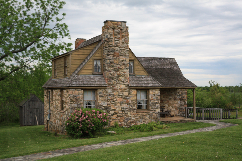
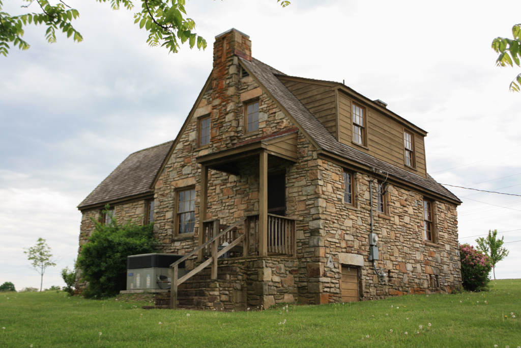
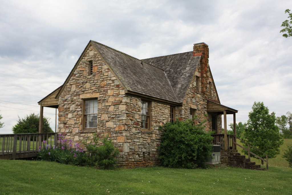
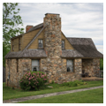
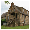
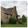
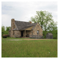
Cumberland Homesteads was the largest of six New Deal resettlement homesteads built for stranded communities in Pennsylvania, North Dakota, West Virginia, and Tennessee. The 251 farmsteads in Tennessee ranged in size from 10 to 160 acres, with an average of 35 acres, and each featured an English Cottage-style sandstone farmhouse. One reason Cumberland County was selected was its proximity to the Tennessee Valley Authority (TVA), which was headquartered in nearby Knoxville. TVA Chairman Arthur Morgan supported the homestead initiative and the cooperative living model it proposed. For Cumberland Homesteads the federal government provided $825,000 to purchase 11,600 acres of timberland to be cleared for the construction of the farmhouses, outbuildings, roads, and supporting structures.
Over 2,500 unemployed miners, textile mill workers, loggers, construction tradesmen, and farmers from the surrounding mountainous region applied to construct and reside in the proposed Cumberland Homesteads. Each homesteader had to meet rigid requirements of “high character, ability, honesty, and willingness to work and cooperate with the government in this planned community.” Both the Civil Works Administration (CWA) and Civilian Construction Corps (CCC) provided labor for constructing infrastructure and community buildings, but the homesteaders were expected to build their own houses.
William Macy Stanton prepared the architectural plans for Cumberland Homesteads. An Ohio native with a master’s degree in architecture from the University of Pennsylvania, Stanton entered government work during the Great Depression, working first for TVA as housing architect for the planned community at Norris Dam. At Cumberland Homesteads, Stanton provided 15 standardized farmhouse designs in stylistic blends of the Tudor Revival and Colonial Revival. The designs ranged in size from two to four bedrooms with rectangular, L-shaped, and T-shaped plans. Most were 1.5 stories in height with gable roofs and one or two stone chimneys. Stanton also served as project manager for three years, overseeing construction of the entire community.
All farmhouses were constructed of locally quarried Crab Orchard sandstone. The houses featured porches, tongue-and-groove paneling, built-in bookcases, batten doors with Z-braces and hardware made in the community blacksmith shop, hardwood floors, attic-mounted water storage tanks, and stone fireplaces for heat. Each house was wired for electricity, which TVA provided in 1939 when the community was formally dedicated, and was equipped with indoor plumbing. This came at the request of First Lady Eleanor Roosevelt, who had a special interest in these resettlement projects and visited Cumberland Homesteads during construction in 1935.
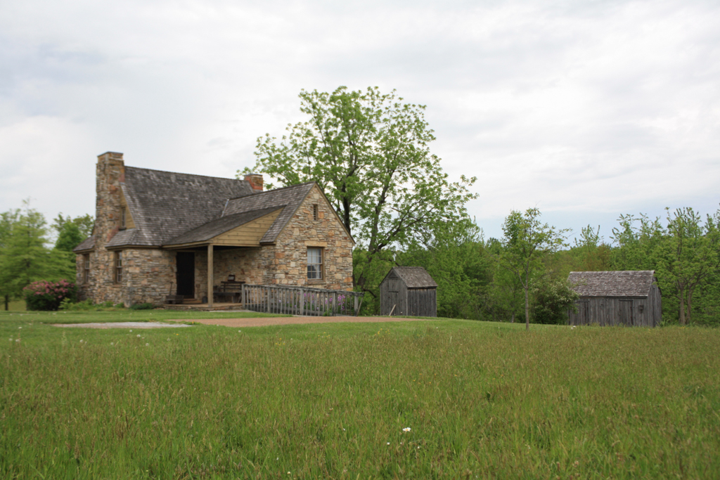
At each homestead, a frame barn with either a gable or gambrel roof was built first with the intention that families would live in the barn until their stone farmhouse was completed. Farmsteads also featured a number of frame outbuildings, including chicken houses, smokehouses, and tool sheds. When their farmhouses were complete, homesteaders focused on raising vegetables, corn, poultry, pigs, cattle, and fruits for canning. Some homesteaders supplemented their income by creating crafts, such as baskets and furniture.
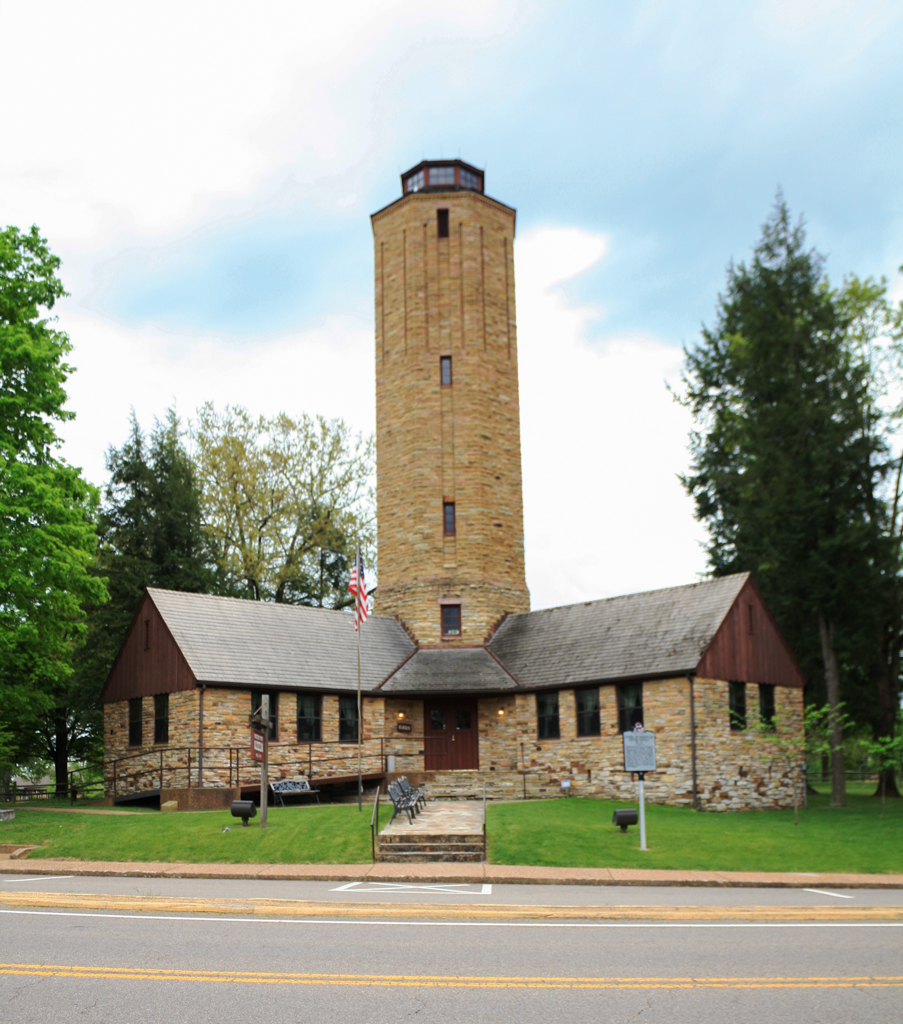
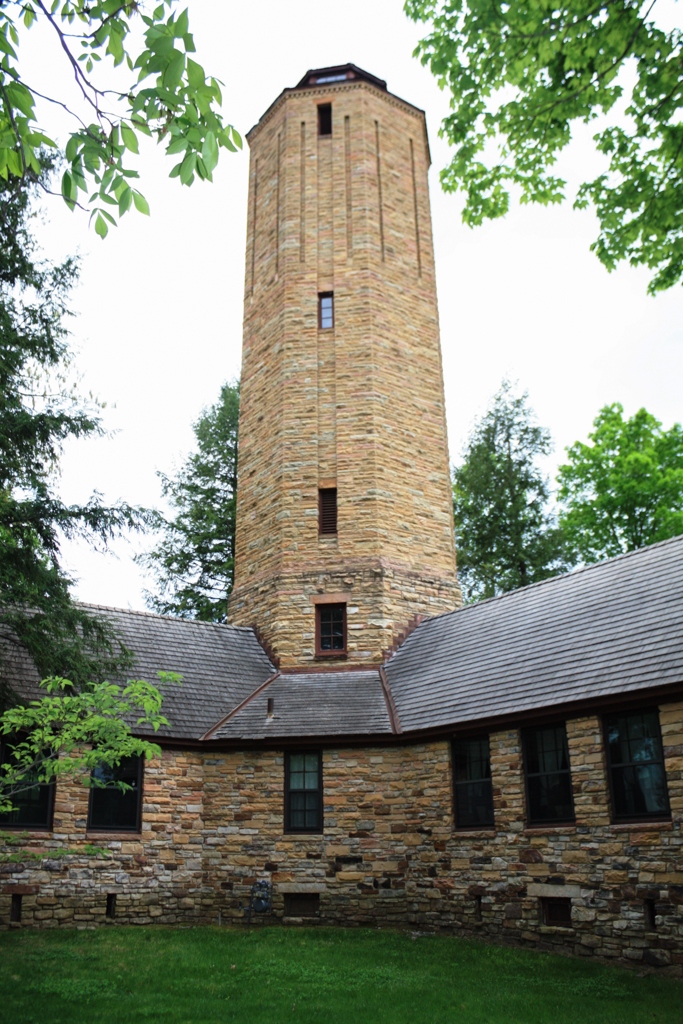
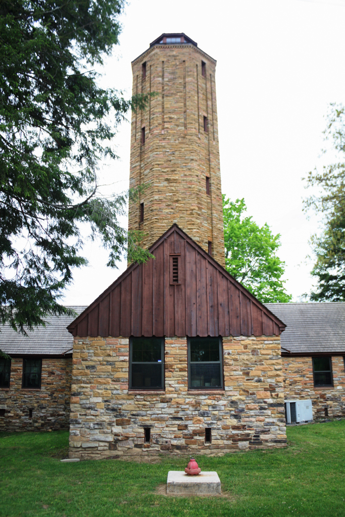
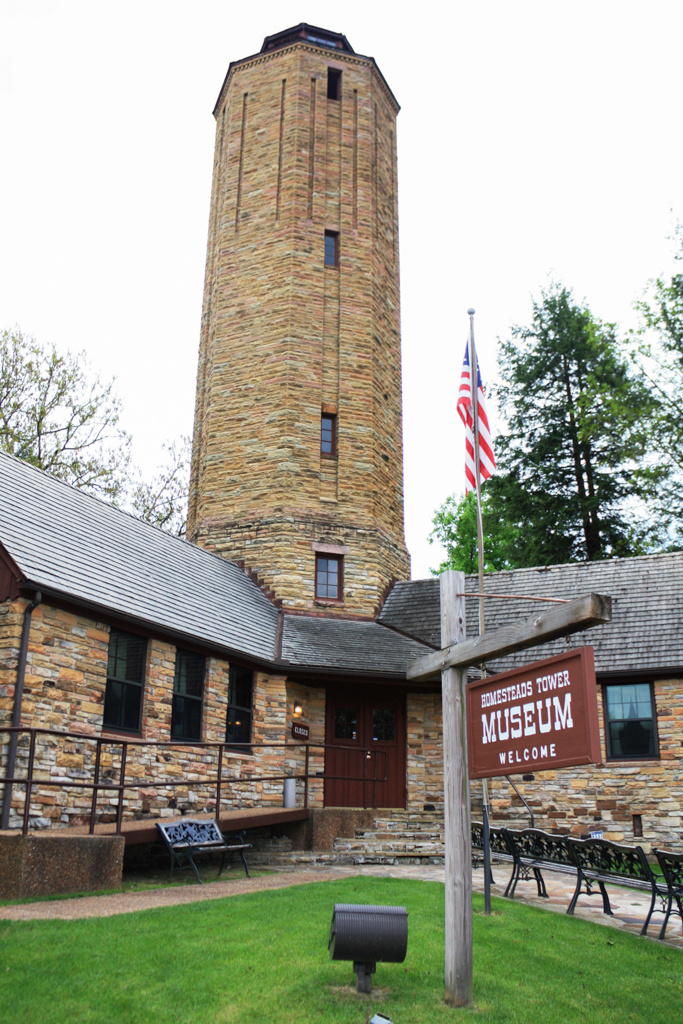
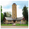
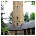
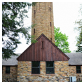
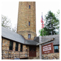
The Cumberland Homesteads included several community buildings: schools, a water tower, and the state-operated Cumberland Mountain State Park, which featured sandstone structures and a recreational lake designed by Stanton and built by the Civilian Conservation Corps. Constructed in 1937–1938 at the junction of U.S. 127 and State Route 68, the water tower is the most distinctive building at the Cumberland Homesteads. The cross-shaped first floor contained the Cumberland Homesteads’ administrative offices, meeting rooms, and the eight-story octagon-shaped central tower contained a 50,000-gallon water tank. A winding staircase leads to a fire lookout platform at the top of the tower.
As with other New Deal–era homestead projects, many of Cumberland’s cooperative businesses failed after a few years, including the cannery and the hosiery mill. By 1947 the federal government had divested itself of the project. The homesteaders were allowed to purchase their farms at market value within five years. Despite the failure of the cooperative experiment, only a handful of homesteaders left and the majority of farms were still owned by the same families in the 1950s. The community buildings, water tower, and schools were donated to the county.
Today, the general layout of the Cumberland Homesteads appears much as it did in the late 1930s. The community was listed on the National Register of Historic Places in 1988 as the largest rural historic district in Tennessee. The individual houses are privately owned and, for the most part, well-tended by devoted owners. The water tower serves as a museum for interpreting the story of the Cumberland Homesteads and a representative Homesteads farm on Pigeon Ridge Road is restored to how it appeared in the 1930s and 1940s. Both buildings are open to the public.
References
Federal Writers’ Project. The WPA Guide to Tennessee. Nashville: Viking Press, 1939; Reprint, Knoxville: University of Tennessee Press, 1986.
Manning, Russ. The Historic Cumberland Plateau: An Explorer’s Guide. Knoxville: University of Tennessee Press, 1993.
Nichols, Ruth. “Cumberland Homesteads.” Encyclopedia of Appalachia. Edited by Rudy Abramson and Jean Heiskell. Knoxville: University of Tennessee Press, 2006.
Straw, Elizabeth, “Cumberland Homesteads Historic District,” Cumberland County, Tennessee. National Register of Historic Places Registration Form, 1988. National Park Service, U.S. Department of the Interior, Washington, D.C.
Straw, Elizabeth. “Cumberland Homesteads.” Tennessee Encyclopedia of History and Culture. Version 2.0, Online Edition. Nashville: Tennessee Historical Society, 2000–2018. http://tennesseeencyclopedia.net/.
Tatman, Sandra L. “William Macy Stanton (1888-1969).” Philadelphia Architects and Buildings. Athenaeum of Philadelphia, 2018. Accessed August 7, 2016. https://www.philadelphiabuildings.org.
West, Carroll Van. Tennessee’s New Deal Landscape: A Guidebook. Knoxville: University of Tennessee Press, 2001.
Writing Credits
Coordinator:
Gavin Townsend
If SAH Archipedia has been useful to you, please consider supporting it.
SAH Archipedia tells the story of the United States through its buildings, landscapes, and cities. This freely available resource empowers the public with authoritative knowledge that deepens their understanding and appreciation of the built environment. But the Society of Architectural Historians, which created SAH Archipedia with University of Virginia Press, needs your support to maintain the high-caliber research, writing, photography, cartography, editing, design, and programming that make SAH Archipedia a trusted online resource available to all who value the history of place, heritage tourism, and learning.