

-
 (HAER)
 -
 (HAER)
 -
 (HAER)
 -
 (HAER)
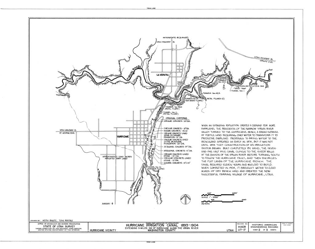


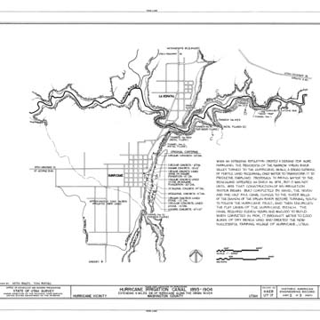
The Hurricane Canal is a 7.5-mile-long, hand-excavated channel for transporting water from the Virgin River, a tributary of the Colorado River. It was built by pioneer settlers between 1893 and 1904 in the small town of Hurricane in southwestern Utah. This arid area with limited cultivable land was prone to erratic floods and the canal was critical to the pioneers’ survival. The Hurricane Canal Company formed in 1893 under the leadership of James Jepson and John Steele and the shareholders began work on the canal immediately.
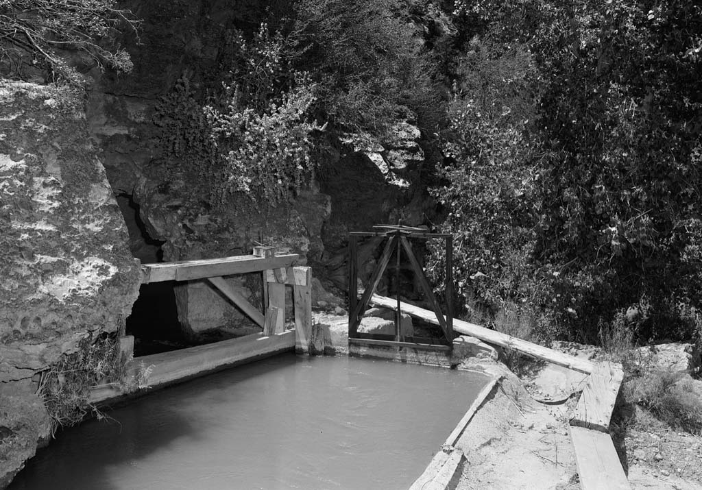
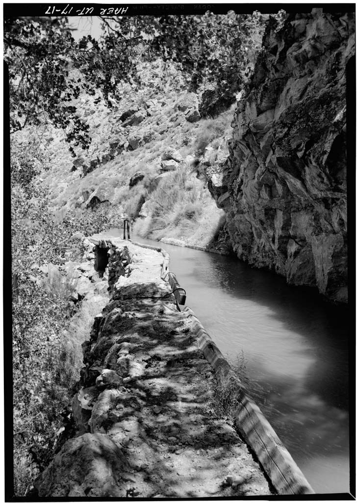
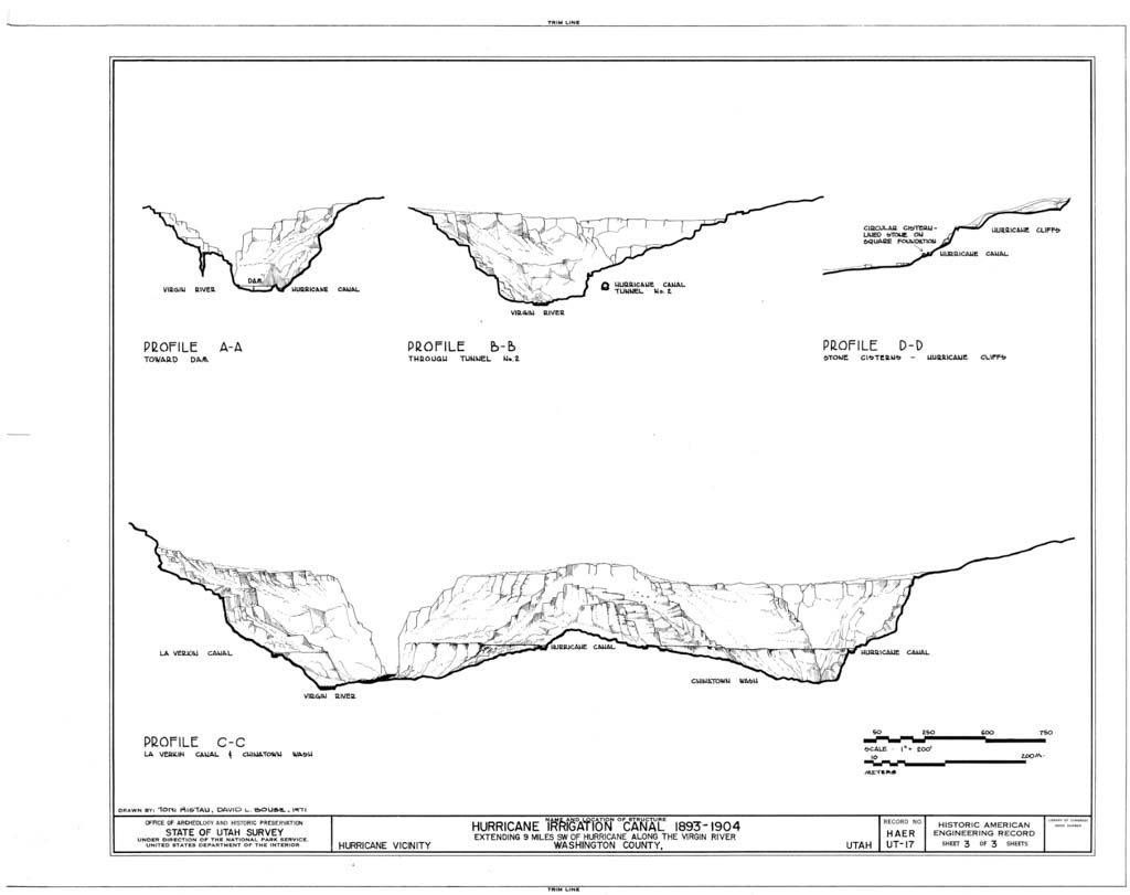
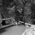
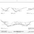
Construction of the canal was difficult, with much of the work completed between November and May, when the pioneers’ own farm work was less demanding. The project included blasting of twelve tunnels and construction of six wooden flumes (since replaced with metal) and a diversion dam, the latter of which was situated at the mouth of the Virgin River. The dam was initially built of existing river boulders and infill boulders placed without mortar, but it broke twice before it was reinforced with concrete and boulders in 1896–1897. The canal is eight feet wide and four feet deep, and is laid out on a twelve-foot-wide shelf of conglomerate and lime rock (and in one place, gypsum). It runs west along the south side of the Virgin River along the canyon for about three and a half miles before leaving the canyon and turning south along the Hurricane cliffs for approximately three miles. The canal then turns west, leaving the cliffs, and providing water for the fields in Hurricane Bench via the ten cisterns that collected and held water. These cisterns were ultimately abandoned following the completion of a modern water system.
The difficulty of the work, coupled with the setbacks that occurred due to landslides and floods, resulted in a much smaller workforce as the shareholders grew increasingly discouraged. In 1902, Jepson obtained a $5,000 loan from the Church of Jesus Christ of Latter-day Saints to continue construction. The canal was completed two years later and the town of Hurricane grew from eleven families in 1906 to over one hundred families (total population 800) by 1917. The canal continued to serve the community until 1985, when a new piping system was installed. A trail now runs along the dry canal bed, and eleven of the original twelve tunnels remain accessible to hikers.
References