


Pathfinder Dam was built by the U.S. Reclamation Service (later renamed the Bureau of Reclamation) as one of several pilot projects for the agency’s mission of developing major irrigation projects in 17 western states and territories. The dam impounds water from the North Platte and Sweetwater rivers to form Pathfinder Reservoir, whose water is used to irrigate farmlands in eastern Wyoming and western Nebraska. The dam is significant both for its engineering and for its role in changing the landscape of the area it serves. It was named in honor of John C. Fremont, “The Pathfinder of the West,” who had explored the area in the 1840s.
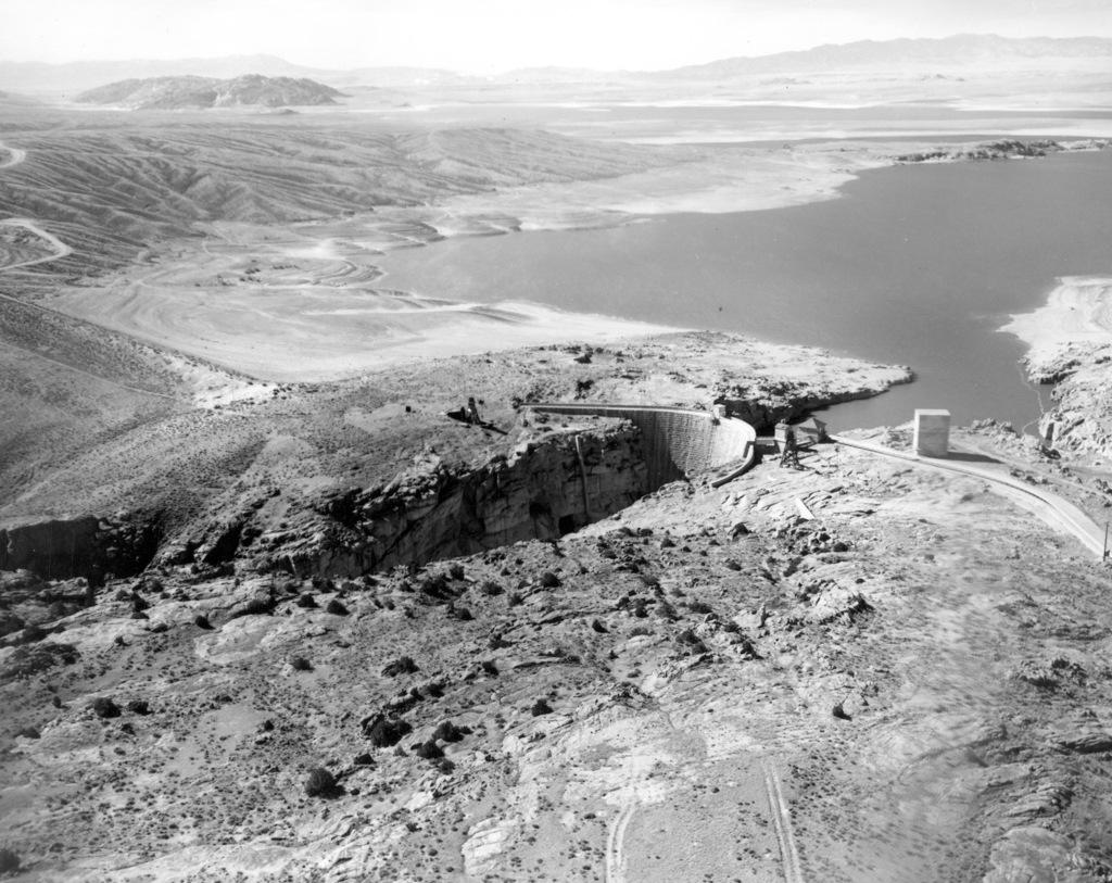
The dam is located in Fremont Canyon, a steep, narrow, granite canyon about three miles below the Sweetwater River’s confluence with the North Platte River. The narrow V-shape of the canyon and the solid granite rock that formed the canyon floor made this a nearly ideal location for a high-arch dam capable of storing the huge volume of flow from the two rivers. Construction began in 1905, and by 1909 the dam was operational. Because of its remote location 47 miles from the nearest city (Casper), the use of concrete, which would have had to be hauled by mule or horse teams, was limited. Instead, locally quarried granite was used both for the rubble interior and the exterior facing of the dam. The core of the arch-shaped dam consists of granite blocks and rubble set in concrete. This core is faced with large, 2- to 3-feet thick, hand-hewn and dressed granite blocks horizontally set in mortar. The upper section (27 feet) of the dam is reinforced with steel within both the upstream and downstream facades to prevent thermal cracking. Built on a 10-foot-deep granite bedrock foundation, the dam is 94 feet thick at its base and rises 214 feet. At its crest it is about 10 feet wide and 432 feet long.
The North Platte Project (originally called the Sweetwater Project) was one of the first five projects of the U.S. Reclamation Service, established in 1902 to develop irrigation projects in the western states. Although small-scale irrigation had been practiced in western Nebraska since the 1880s, farming remained marginal because of limited water storage capacity. In 1904, the Reclamation Service selected the Pathfinder Dam location for the first North Platte Project storage dam, thus opening up acres of land in eastern Wyoming and western Nebraska for irrigated farming. In 1927, a second storage dam, Guernsey Dam, was completed to serve the North Platte Project. Today the Project serves lands extending 111 miles along the North Platte River Valley, from Guernsey, Wyoming, to Bridgeport, Nebraska. Water from Pathfinder and Guernsey dams provides full service irrigation for about 226,000 acres.
While most dams of this era were constructed of poured concrete, Pathfinder Dam is significant for its meticulously cut and dressed granite faces. In terms of engineering, Pathfinder’s design was groundbreaking for its time. Previous dam design had relied heavily on gravity, based on the theory that the solution to retaining more water was more mass. Pathfinder Dam served as a field laboratory to test a new dam design methodology, called the Trial Load Method. Chief engineer George Wisner challenged the common assumption that mass equaled stability, noting that overly massive dams were inefficient (used more material than necessary) and unnecessarily costly. His designs relied on site-specific data on compression (water pressure on the dam’s face) and temperature stresses that would be experienced at the actual dam site, as well as conditions such as the foundation material, uniformity of the material, and the shape of the canyon in which the dam was constructed.
The Trial Load Method revolutionized the design process for high masonry or concrete arch dams, and the Reclamation Service immediately applied what was learned in designing Pathfinder to all the bureau’s high arch dams. For several decades, Pathfinder Dam remained the baseline against which refinements of the method were tested by Reclamation and other engineers around the world. The dam was also where the Reclamation Service developed construction practices that were used on subsequent dam projects.
The Bureau of Reclamation operates the Pathfinder Dam Interpretive Center in the former dam tender’s stone house (1906) at the dam site. Visitors can take a 1.7-mile self-guided interpretive trail that leads across the spillway and to several sites dating from the construction period, including an earthen dike and remnants of the engineers’ camp.
References
Bailey, James M., “Pathfinder Dam Historic District,” Natrona County, Wyoming. National Register of Historic Places Registration Form, 2015. National Park Service, U.S. Department of the Interior, Washington, D.C.