

Poverty Point State Historic Site
You are here
Poverty Point World Heritage Site


c. 1700–c. 1100 BCE. 6859 LA 577
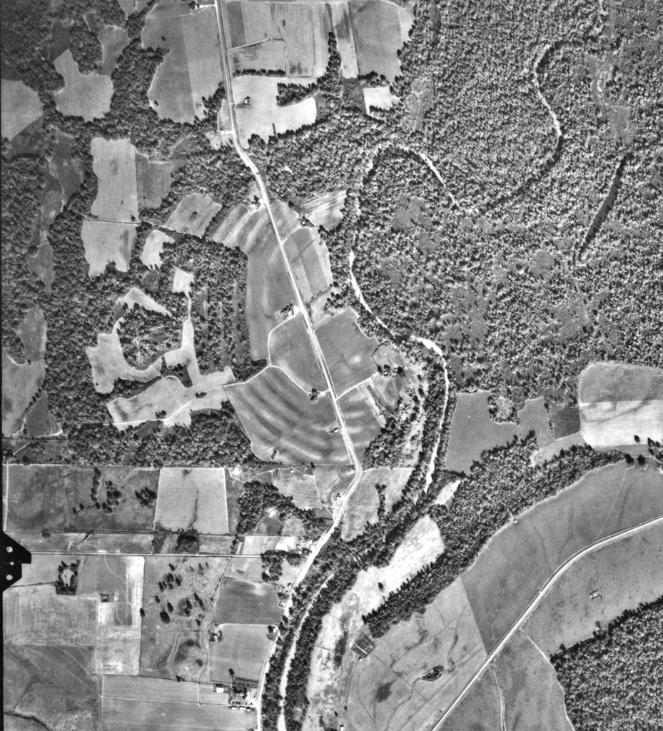
Located about thirty miles west of the Mississippi River, Poverty Point is one of the largest prehistoric native constructions in eastern North America and the oldest of any earthworks of its size in the Western Hemisphere. The 400-acre site, occupying the Macon Ridge approximately 30 feet above the Mississippi River floodplain, consists of six concentric artificial earth ridges constructed in a C-shape enclosing a plaza over 1,800 feet across facing Bayou Maçon. Thought to have been 6 feet in height (now lower as they have weathered), the ridges are spaced 140 to 200 feet apart. The diameter of the outermost ridge is approximately three-quarters of a mile. At the center point of the outer ridge is a mound that has been described as bird-shaped. Measuring around 700 by 640 feet, and more than 70 feet high, it is the largest surviving mound in the state. Two small rectangular mounds are within the enclosure, and a 20-foot-high conical mound located outside and to the north of the enclosure was constructed over a bed of ash and burnt bone fragments.
Over the years, various hypotheses have been suggested as to Poverty Point’s function. Some archaeologists believed that several thousand people lived on the ridges, although little evidence of structures has been found. Others thought it was a campground, occupied temporarily during ceremonies and trade gatherings. Present consensus is that Poverty Point functioned as a residential, ceremonial, and trading center. The builders and users of the site did not grow crops or raise animals for food; Poverty Point is a unique example of a monumental site constructed by hunters, fishers, and gatherers. There is no native stone in this region, so in order to make tools and other artifacts an estimated 78 tons of stone and ore were imported here from distances of up to 1,000 miles. Thousands of artifacts have been retrieved from the ridges in the course of excavations, including arrowheads, cooking implements, small tools, fishing weights, beads, pendants, and bird effigies. Some of these items came from as far away as the Great Lakes, and there is evidence to suggest that Native Americans at Poverty Point may have had contact with the Olmec culture of Mexico (which disappeared sometime around 750 CE for unknown reasons).
The organization and physical labor required to construct these huge mounds, as well as the purpose for which they were built, make Poverty Point a site that elicits awe and wonderment. Its worldwide significance has resulted in its inclusion in 2014 on the United Nations list of World Heritage Sites, Louisiana’s first to be accorded that distinction. Poverty Point is open to the public and the site includes a visitor center and exhibits featuring artifacts found here. There is also a 2.6-mile hiking trail through the earthworks.
Writing Credits
If SAH Archipedia has been useful to you, please consider supporting it.
SAH Archipedia tells the story of the United States through its buildings, landscapes, and cities. This freely available resource empowers the public with authoritative knowledge that deepens their understanding and appreciation of the built environment. But the Society of Architectural Historians, which created SAH Archipedia with University of Virginia Press, needs your support to maintain the high-caliber research, writing, photography, cartography, editing, design, and programming that make SAH Archipedia a trusted online resource available to all who value the history of place, heritage tourism, and learning.