


Scholars often subdivide the study of Native American culture into vast, multistate regions, including the Northeast, the Plains, and the Southwest, to name a few. The Southeast represents a zone bounded by present-day Texas, Missouri, Georgia, and Florida.1 This swath is expansive, and covers multiple environmental geographies: from the tropical tip of the Florida Keys to the Ozark Highlands. A quick survey of Native American building typologies from this region is equally expansive, and includes the famous earthen mounds of Cahokia in Illinois as well as the post-and-lintel chickee huts of the Seminoles in Florida. Honing this scope even further, however, we can examine a series of tribes with a major geographic commonality: the Gulf Coast. Many tribes settled along this slow arch of coastline, inhabiting land that today stretches from Florida to Texas; a selection of these groups, moving east to west, included the Calusa, the Apalachee, the Chitimacha, and the Karankawa.
Thinking in terms of the Gulf of Mexico offers a lens toward understanding how differing tribes used a shared resource. Although it is difficult to pinpoint exchanges between these groups, a map of tribal trade routes c. 1450 describes a path along the Gulf Coast, departing roughly around present-day Cuba, moving north along Calusa territory, toward the Apalachee, wrapping around the Mississippi Delta, and southwest along the Texas coast. From there, routes departed inland, including up the Mississippi River to Cahokia, moving southwest into Pueblo territory, and even spreading northeast into the Iroquois nation.2 It is, moreover, this geographic adjacency that placed all four tribes within the exploratory paths of figures such as Hernando de Soto in the 1530s and beyond. This essay, however, will not attempt to assess those lines of influence between tribes, but rather to catalog their similarities and differences—and in particular, their building activity—around a shared body of water.
Despite these aforementioned similarities, a survey of each tribe’s respective built environment shows tremendous variability, ranging from monumental mound sites to ephemeral campgrounds. Some, such as the Karankawa, lived intimately with the Gulf while others, such as the Apalachee, inhabited isolated agricultural homesteads farther inland. This line of inquiry is complicated even further by the inherently volatile nature of sea levels and environmental change, a challenge that has caused many researchers to employ tools such as underwater archaeology.3 And unlike the adobe and stone dwellings of southwestern tribes, Gulf groups lacked lithic materials—for both tools and buildings—a fact that further tests the boundaries of architectural documentation.4 As an analytical exercise, it is worthwhile to reorient our scope of focus around the Gulf and its peoples in order to understand the sheer heterogeneity of Native American architecture and to suggest further “paths” of exploration among and across indigenous groups.
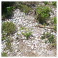
The Calusa, descendants of archaic tribes within the Everglades, dominated Florida’s southwestern coast from 800 CE.5 This chiefdom spanned the mouth of Caloosahatchee River, covering sites such as Pine Island, San Carlos Bay, and Marcos Island. Located in Estero Bay, Mound Key is one of the most prominent archaeological vestiges of the Calusa, and is thought to have once been Calos, the head chief’s village.6 Shell middens and mounds typify this and other Calusa settlements along the coast, in addition to man-made canals, terraces, and ridges.7 Like adjacent tribes within southern Florida, the Calusa were hunter-gatherers, who relied on coastal fisheries and estuaries as opposed to mammal or plant-based foods.8 The Crystal River mound site, though beyond the domain of the Calusa, offers another example of an extensive mound complex on Florida’s Gulf Coast, in this case featuring six significant earthworks that have been the subject of early archaeological studies within the state.
Despite the roaming lifestyle often associated with hunter-gatherers, the Calusa managed to live as a sedentary culture, reaching a level of sociopolitical complexity on par with Mississippian tribes.9 Their early contact with explorers included Juan Ponce de León’s 1513 voyage, as well as Hernando d’Escalante Fontaneda, a shipwrecked Spaniard who spent seventeen years living with the Calusa and whose 1575 memoir provides some documentation of the tribe’s built environment.
According to John Hann, who draws upon chroniclers of Spanish explorer Pedro Menendez de Aviles, the tribe often lived in massive communal houses built of wood and palmetto thatch; one chief’s dwelling, for example, is described as being large enough to fit two thousand persons but featured just two large windows. Internally, the space was subdivided with a chamber for the chief featuring an elevated seat, while the house likewise played host to his multiple wives. In 1697, this same village was documented as having one thousand residents, all of whom lived across sixteen buildings, another indicator of the massive scale and communal nature of Calusa housing. Buildings such as these, designated for tribal leaders, were sited atop mounds or shell middens.10
Such shell works, according to J. M. Goggin and W. C. Sturtevant, represent defining features of the Calusa and include, per Hann’s catalog, “temple mounds, rows of conical mounds, rows of ridges, canals, semicircular ridges or ditches or both, and sets of parallel ridges.” The use of canal ditches is notable, including a fifty-foot-wide thoroughfare separating two major mounds at Mound Key, a feature that infills with high-tide water for canoe transport.11 The earthworks at this site were built using shells, while the village itself became more architecturally developed with time, including a network of canal arteries.12 Another Calusa site, Ortona, likewise features a complex canal system that interweaves itself throughout mounds and ridges, indicating a highly developed knowledge of hydraulics and engineering.13 This canal infrastructure demonstrates Calusa boat-making skill, as the tribe relied upon southern yellow pine to construct canoes up to fifteen feet in length that were used to navigate rivers, canals, lakes, and bays. They also built larger, ocean vessels, up to thirty feet long and hearty enough to transport goods to the coast of Cuba.14
Visitors to the southern coast of Florida can still experience the archaeological remains of several Calusa sites. The Randell Research Center RRC, on Pineland, consists of sixty-seven acres, within which is a shell mound site. The RRC offers a Calusa Heritage Trail, dedicated solely to exploring the history, archaeology, and ecology of the tribe. It is also the site of ongoing field activity, as researchers recently discovered Calusa rope, netting, shell weights, and twine at this location.15 Mound Key, now a state archaeological site, is likewise open to the public. Although only accessible by boat, visitors can hike and tour the ancient mounds and canal system.
The Apalachee chiefdom, dating back to the twelfth century, occupied what we today consider the Florida panhandle. By the sixteenth century, this was a dense province covering a small stretch of land bounded by the Aucilla and Ochlockonee rivers and reaching down to the Gulf. In addition to the sea along its southern perimeter, this region features ponds, lakes, and swamplands, and encompasses an area less than forty miles from east to west.16 Unlike the Calusa, the Apalachee relied on agriculture, farming crops such as maize, beans, and squash. Their monumental mound-building, similar to the adjacent Mississippian culture, was arranged in a manner reflective of the hierarchical society itself.17
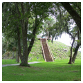
The built environment of the Apalachee mimicked this hierarchy, from the simple, isolated homesteads of commoners to multi-mound complexes such as Lake Jackson. The latter, which today is a state park, originally featured seven mounds, six of which were capped with a platform. Excavations of Mound Three reveal that the earthwork was built in successive stages, surmounted each time by a building. In the earth beneath were burials for children and adults, often interred with artifacts.18
Smaller villages and homesteads were distributed across the hinterlands. When Europeans first made contact, Apalachee villages and towns lacked fortifications or defensive features, which suggests a feeling of security from invasion by other tribes.19 De Soto, who spent October 1539 to March 1540 with the tribe, mentions one village of two hundred “large strong houses.” These were described as being made of thatch grass or with palm leaves.20 Archaeologist J. F. Scarry has studied the homesteads of commoners, and his findings are revealing. One site, Velda, offers a case example. The homestead hosted two homes, with diameters ranging from 5.5 to 7.5 meters wide. Each structure was framed with upright posts, interspersed approximately 1 meter apart, and featuring a single portal. Bishop Calderon’s 1675 description of these houses corroborates the archaeological record: round and built of straw, but with no windows, the hut featured benches for sleeping and a centralized hearth.21 These structures did not have internal partitions. As J. F. Scarry and B. G. McEwan observe, such dwellings were simple, as much of Apalachee life and functional activity took place outside. Ceremonial functions likely occurred in council houses, which further abbreviated the internal programming of the dwelling itself.22 Adjacent to one of these dwellings was a garita, or storage house, another type of building found near Apalachee homes, in addition to external pits, used perhaps for waste disposal and to provide access to clay for infilling structural walls.23 The homestead was spatialized in a distinct way, arranged in specialized external functional spaces, including the central courtyard, with homes and the flanking garita, followed by a midden or pit zone circumscribing all of these.24 Smaller homesteads such as the Velda site were incorporated into a larger hierarchy of population centers, shifting from hamlets, to single-mound villages, and finally to multi-mound complexes.
The Lake Jackson site is now a Florida state park, located in present-day Tallahassee. The park features interpretative trails around the mounds, as well as guided tours. Visitors can also experience Mission San Luis, the location of an Apalachee village that was subsequently replaced with a Spanish colonial capital city. Now a National Historic Landmark, the site consists of historic structures and interpretative exhibitions, the latter of which includes artifacts such as Apalachee pottery shards. Notably, Mission San Luis features a reconstructed Apalachee council house—a massive, conical thatch structure 140 feet wide, five stories tall, with an oculus at the top.
Farther west lies the ancestral lands of the Chitimacha, a tribe that occupied the Mississippi River delta in present-day Louisiana, ranging from New Orleans to Lafayette and south toward the Gulf.25 The Chitimacha hunted deer and smaller game, and used hook and line traps to capture catfish, crabs, turtles, shrimp, and other seafood. Like the Apalachee, the Chitimacha were highly stratified, a society subdivided into noble and “commoner” classes.26
Herbert Hoover describes the relative “simplicity” of the Chitimacha dwelling, which consisted of upright poles covered in palmetto leaves, an austerity no doubt reflective of life in a subtropical climate, where hurricanes were a perennial threat.27 The houses of chiefs were built larger than other villagers, and each hut had a central hearth beneath a smoke hole, which featured an aperture that could be opened or closed depending on the weather conditions.28 Unlike the round Apalachee dwellings, the Chitimacha huts likely had rectangular ground plans.29
Though writing in 1911, John R. Swanton, a prominent anthropologist and a forerunner in Native American scholarship, provides some of the most extensive accounts of the Chitimacha lifestyle, including discussions of the built environment and the ceremony surrounding death. Unlike the Karankawa, the Chitimacha were painstaking in caring for the physical remains of the deceased. Once a tribal member died, the Chitimacha held a dance-house ceremony, followed by the burial of the remains nearby. A year later, the “turkey-buzzard man” would disinter the body, wrap the bones, and assemble the village for yet another ceremony which concluded by interring the skeletal remains in a burial mound; for chiefs, these mounds were raised four or five feet tall. As Swanton observes, the Chitimacha offer a new typology—that of the “bone house,” or charnel house, for the buzzard man, who kept a fire continually burning.30 The Chitimacha continued this practice of mound burying up to the 1920s, and such sites can still be found throughout the Louisiana landscape; in recent decades, the tribe has received a preservation grant to locate and catalog their ancestral burial mounds.31
Other typologies found within Chitimacha settlements included sweathouses—squat, cane-pole structures which were placed atop earthen pits about five feet in length.32 These cavities were filled with hot stones and moss, and a person suffering from sickness or fever would sit on top of them. Every village tended to have a dance house for religious or spiritual ceremony. Swanton describes one such example, located near Grand Lake, as a twelve-foot-square structure featuring a pointed roofline and a perimeter fence that perhaps served as the upright supports for the roof itself. The interior was painted with ceremonial colors including vermillion, black, and white.33
Though few Chitimacha sites remain, the tribe has played an active role in sustaining and promoting its history, including attempts to preserve their language. The legacy of Chitimacha basketry likewise endures, and examples can be found across institutions such as the National Museum of the American Indian in Washington, DC, and the Peabody Museum at Harvard University. Visitors can learn more about the tribe at the Chitimacha Museum, located at 3289 Chitimacha Trail in Charenton, Louisiana.
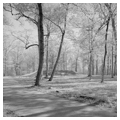
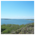
The Karankawa, who represented a sharp departure from the aforementioned tribes, occupied territory running from western Galveston Bay southwest toward the Corpus Christi Bay, roughly along Texas’s current coastline.34 This also included the Matagorda, Lavaca, Guadalupe, San Antonio, Copano, Arnasas, and Baffin bay areas, in addition San Jose and Mustang islands.35 The Karankawas lived a “nomadic maritime existence,” facilitated through the use of dugout canoes; not surprisingly, they ate abundant seafood such as fish, mussels, oysters, and occasionally game such as deer.36 The Karankawa canoe was not built for travel on the open Gulf, but was suitable for transport along the shoreline and inland bays and river inlets.37 The tribe moved seasonally, living fall and winter adjacent to the shore, and relocating farther inland to prairies and wooded creeks during the summer months where they would eat berries and other plant-based foods.38
According to Robert Ricklis, one of the few scholars to conduct an exclusive survey of the Karankawa, dwellings were simple, circular frame structures; these “wigwamlike” huts consisted of a pole structural skeleton and were covered in woven mats or animal hides. The hut, called a ba-ak, was typically composed of a dozen or so willow branches, carved to a point at the end and running around eighteen feet in length. These pointed ends were stuck into the ground, while the upper branches were lashed together. Sometimes only the wind-facing side of the ba-ak was covered. Though the sizes of these dwellings varied, they were often around ten or twelve feet in diameter, a scale that could accommodate seven or eight individuals. A cooking fire was built toward the center of the internal space. Because of the nomadic nature of the Karankawa, these structures were necessarily light, portable, and efficient, able to be broken down and lashed to canoes.39 French navigator Jean Beranger encountered one such encampment in 1720 near the Aransas Pass. “It was surprising,” he reflected, “since I least expected to see in a moment a large market town built of these kinds of houses [hide-covered huts] and five hundred persons, at least, well sheltered.” He goes on to note: “Five leagues north of here, where I was anchored, they have a small permanent village of about a dozen large, quite round huts. This is where they put the supply for the winter that consists of fish that they dry without salt and where worms prevail in large numbers.”40
Albert Samuel Gatschet, another early ethnologist and linguist ofNative American tribes, provides further insight into the Karankawa in his 1891 publication, The Karankawa Indians, the Coast People of Texas. His account includes descriptions of the processes of camp-making: upon arriving at a suitable site, the tribe dragged their canoes up the shore and the women were left to erect the wigwam. These encampments were sited near a “beach or bluff” and, once the light framework was erected, the individual huts were covered in deer, bear, or wildcat skins. Depending on wind or sun, this external sheathing could be shifted accordingly. The “lodge furniture” consisted of those same skins for sitting or sleeping.41 Unlike the Chitimacha, the Karankawa apparently did not build structures or otherwise alter the landscape for burials or death; there was “no place of sepulture,” Gatschet notes, and “wherever one of the tribe died there he was also interred.”42
Because of the ephemeral nature of Karankawa encampments, it is difficult for visitors to experience the tribe’s built environment. The Battle of Three Trees, where Karankawa groups fought Jean Lafitte in 1821, is one of the few marked sites along the Texas coast. This location, on Galveston Island, is near the Rosenberg Library Museum, which features a collection of Karankawa artifacts including arrowheads and pottery shards. Spanish missions that were built to convert tribal members still exist however, and include the Espíritu Santo de Zúñiga Mission and the Presidio Nuestra Señora de Loreto de la Bahía, both of which are National Historic Landmarks.
This survey of Gulf Coast tribes is far from complete and would benefit from additional study of such groups as the Atakapa, the Pensacola, and the Tocobaga, to name a few. As with comparative analyses, this brief juxtaposition reveals how the Calusa, Apalachee, Chitimacha, and Karankawa differ, and how built typologies, styles, and functions can shift so drastically across a shared resource. The Karankawa are notable for the ephemerality of their hunter-gatherer lifestyles, a nomadism that finds some resonance in the portable teepees of the Plains tribes. The Calusa are unique in the sheer infrastructure of their littoralchiefdom, harnessing hydraulics into canals systems that Milanich has described as a “Pre-Columbian Venice.” Fixed between these extremes are the Apalachee and the Chitimacha, both of whom appear to have settled farther inland from the Gulf, leading to the complex regional agrarian developments of the Apalachee and the varied building typologies of the Chitimacha.
Though the field of architectural history has made modest inroads into the realm of Native American architecture, there is only one synoptic text on the matter—Peter Nabokov and Robert Easton’s 1989 volume Native American Architecture—a lacuna both problematic and piquant. The state of research on Gulf coast tribes ranges drastically, and in some cases is highly dated. Some work, such as Milanich’s research on indigenous Floridian tribes, as well as Victor Thompson and William Marquardt’s study of geoarchaeology in Southwest Florida, represent fairly current scholarship; the most recent work on the built archaeologies of the Chitimacha, however, dates from the 1980s. Furthermore, there are limited studies that examine the Gulf as a regional and geographic unit, and few which view it through the specific lens of the built environment. With the threat of rising sea levels and environmental degradation, such studies are of critical importance moving forward. As this survey of built environments across Gulf tribes suggests, the field is ripe for creative and synthetic research into Native American studies through the specific lens of architecture.
Notes
1. See Nabokov and Easton’s Native American Architecture 1989 for their regional subdivisions, as well as Barnes’s Historical Atlas of Native Americans 2015.
2. See the map of “Network of Trade Routes” in Barnes’s Historical Atlas of Native Americans.
3. Thompson and Worth, “Dwellers by the Sea,” 53.
4. Ibid., 58.
5. Milanich, “Water World,” 47.
6. Hann, Indians of Central and South Florida, 2.
7. Thompson and Worth, “Dwellers by the Sea,” 76.
8. Hann, Indians of Central and South Florida, 29–31.
9. Thompson and Worth, “Dwellers by the Sea,” 64.
10. Hann, Indians of Central and South Florida, 35–36.
11. Ibid., 37.
12. Milanch, “Water World,” 48.
13. Hann, Indians of Central and South Florida, 42.
14. Beale, “Calusa Dugout Canoe.”
15. “Rare Calusa Artifacts Found in Waterlogged Florida Midden,” Archaeology 23 March 2017, accessed 1 July 2017, http://www.archaeology.org/news/5397–170323-florida-calusa-midde.
16. Hann and McEwan, The Apalachee Indians and Mission San Luis, 2; Hann, Apalachee, 5.
17. Hann and McEwan, The Apalachee Indians and Mission San Luis, 2.
18. Eric E. Bowne, Mound Sites of the Ancient South: A Guide to the Mississippian Chiefdoms Athens: University of Georgia Press, 2013, 112.
19. Ibid., 6
20. Hann, Apalachee, 24–25.
21. Scarry, “Apalachee Homesteads,” 205.
22. Scarry and McEwan, “Domestic Architecture in Apalachee Province,” 491.
23. Scarry, “Apalachee Homesteads,” 207–9.
24. Ibid., 212–13.
25. Sovereign Nation of the Chitimacha, “Tribal History,” web, accessed 10 June 2017, http://www.chitimacha.gov/history-culture/tribal-history.
26. Hoover, The Chitimacha People, 11–13.
27. Ibid., 27.
28. Swanton, “Indian Tribes of the Lower Mississippi Valley and Adjacent Coast of the Gulf of Mexico,” 345.
29. Kniffen et al, The Historic Indian Tribes of Louisiana, 115.
30. Ibid., 350–51.
31. Penny Jessel, “The Delta Endangered,” Native Voices 1, no. 1 Spring 1996, https://www.nps.gov/archeology/cg/vol1_num1/voices.html.
32. Kniffen et al, The Historic Indian Tribes of Louisiana, 115.
33. Swanton, “Indian Tribes of the Lower Mississippi Valley and Adjacent Coast of the Gulf of Mexico,” 351–52.
34. Newcomb, The Indians of Texas, 59.
35. Foster, Historic Native Peoples of Texas, 84.
36. Newcomb, The Indians of Texas, 61.
37. Ricklis, The Karankawa Indians of Texas, 4.
38. Foster, Historic Native Peoples of Texas, 83.
39. Newcomb, The Indians of Texas, 68.
40. Ricklis, The Karankawa Indians of Texas, 113–14.
41. Gatschet, The Karankawa Indians, 10–12.
42. Ibid., 19.
References
General
Barnes, Ian. The Historical Atlas of Native Americans. New York: Chartwell Books, 2015.
Nabokov, Peter, and Robert Easton. Native American Architecture. New York and Oxford: Oxford University Press, 1989.
Apalachee
Hann, John H. Apalachee: The Land between the Rivers. Gainesville: University Press of Florida, 1988.
Hann, John H., and Bonnie G. McEwan. The Apalachee Indians and Mission San Luis. Gainesville: University Press of Florida, 1998.
Scarry, John F. “Apalachee Homesteads: The Basal Social and Economic Units of Mississippian Chiefdom.” In Mississippian Communities and Households, edited by J. D. Rogers and B. D. Smith, 201–23. Tuscaloosa: University of Alabama Press, 1995.
Scarry, John F. “Resistance and Accommodation in Apalachee Province.” In The Archaeology of Traditions: Agency and History before and after Columbus, edited by Timothy R. Pauketat, 34–57. Gainesville: University Press of Florida, 2001.
Scarry, John F., and Bonnie G. McEwan. “Domestic Architecture in Apalachee Province: Apalachee and Spanish Residential Styles in the Late Prehistoric and Early Historic Period Southeast.” American Antiquity 60, no. 3 July 1995: 482–95.
Calusa
Beale, John. “Calusa Dugout Canoe.” Florida Maritime Museum. Accessed 29 June 2017. http://floridamaritimemuseum.org/calusa-dugout-canoe/.
Goggin, J. M., and Sturtevant, W. C. “The Calusa: A Stratified, Nonagricultural Society with Notes on Sibling Marriage.” In Explorations in Cultural Anthropology: Essays in Honor of George Peter Murdock, edited by W. H. Goodenough, 179–219. New York: McGraw Hill, 1964.
Hann, John H. Indians of Central and South Florida, 1513–1763. Gainesville: University Press of Florida, 2003.
Milanch, Jerald T. “Water World.” Archaeology 57, no. 5 September/October 2004: 46–50.
Thompson, Victor D., William Marquardt, Alexander Cherkinsky, Amanda Roberts Thompson, Karen Walker, and Lee Newsom. “From Shell Midden to Shell Mound: The Geoarchaeology of Mound Key, and Anthropogenic Island in Southwest Florida, USA.” PLOS One 11, no. 4 April 28, 2016, http://journals.plos.org/plosone/article?id=10.1371/journal.pone.0154611.
Thompson, Victor D., and John E. Worth. “Dwellers by the Sea: Native American Adaptations along the Southern Coasts of Eastern North America.” Journal of Archaeological Research 19, no. 1 March 2011: 51–101.
Chitimacha
Hoover, Herbert T. The Chitimacha People. Phoenix: Indian Tribal Series, 1975.
Kniffen, Fred B., et al. The Historic Indian Tribes of Louisiana: From 1542 to the Present. Baton Rouge: Louisiana State University Press, 1987.
Swanton, John R. “Indian Tribes of the Lower Mississippi Valley and Adjacent Coast of the Gulf of Mexico.” Bureau of American Ethnology Bulletin, No. 43. Washington, D.C.: Government Printing Office, 1911.
Karankawa
Foster, William C. Historic Native Peoples of Texas. Austin: University of Texas Press, 2008.
Gatschet, Albert S. The Karankawa Indians, the Coast People of Texas. Cambridge, MA, Peabody Museum of American Archaeology and Ethnology, 1891.
Newcomb, William Wilmon. The Indians of Texas: From Prehistoric to Modern Times. Austin: University of Texas Press, 2002.
Ricklis, Robert A. The Karankawa Indians of Texas: An Ecological Study of Cultural Tradition. Austin: University of Texas Press, 1996.
Writing Credits
If SAH Archipedia has been useful to you, please consider supporting it.
SAH Archipedia tells the story of the United States through its buildings, landscapes, and cities. This freely available resource empowers the public with authoritative knowledge that deepens their understanding and appreciation of the built environment. But the Society of Architectural Historians, which created SAH Archipedia with University of Virginia Press, needs your support to maintain the high-caliber research, writing, photography, cartography, editing, design, and programming that make SAH Archipedia a trusted online resource available to all who value the history of place, heritage tourism, and learning.