


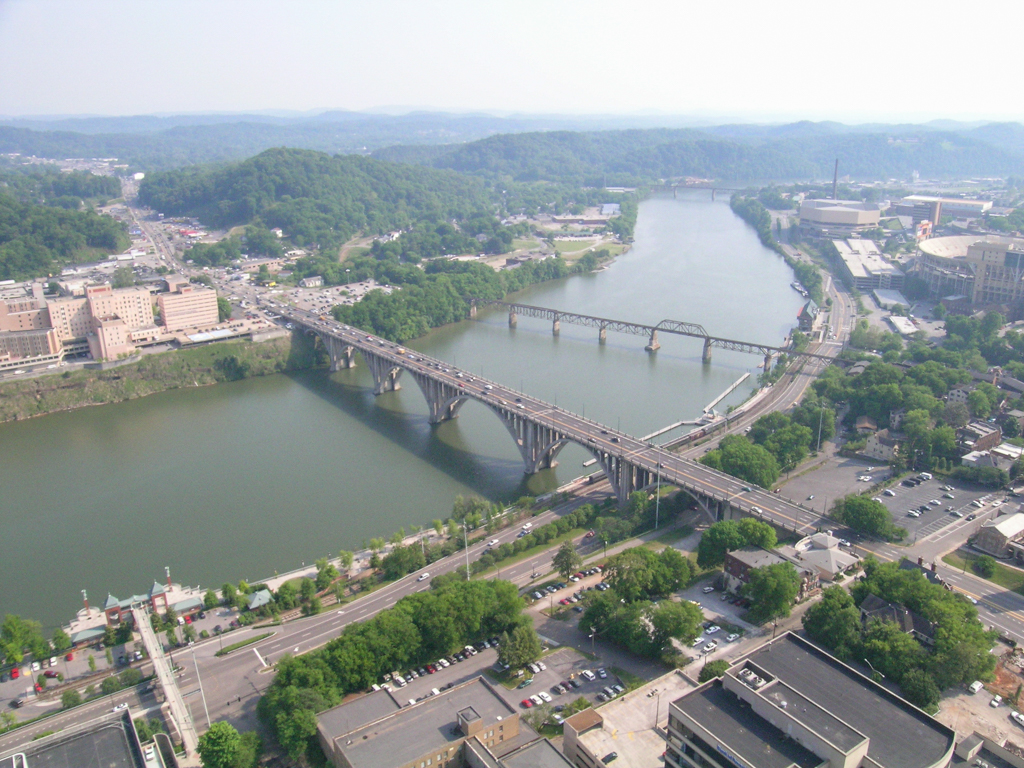
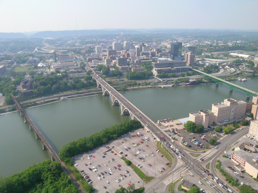

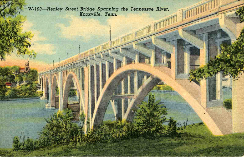


Spanning the Tennessee River in downtown Knoxville, the Henley Street Bridge was constructed during the Great Depression as a locally funded project to connect the city with the Great Smoky Mountains National Park.
The Henley Street Bridge was an outgrowth of Knoxville’s first comprehensive urban plan. The St. Louis firm Harland Bartholomew and Associates produced the plan between 1926 and 1929 with a goal of reshaping the overcrowded riverside area downtown into a modern city with wide concrete boulevards, parks, greenways, civic landmarks, an urbane waterfront, and improved transportation systems. Part of the plan involved the construction of an automobile-only bridge spanning the Tennessee River and connecting to the newly widened Henley Street, a commercial thoroughfare named for the Revolutionary War hero Colonel David Henley (1749–1823).
In August 1928, city and county leaders approved the $3 million project and hired the Baltimore engineering firm J.E. Greiner and Company to design the bridge. The firm recommended a four-lane structure with massive Gothic concrete arches but local leaders had other ideas. Concluding that the proposed bridge was too narrow, the city fired Greiner in July 1929.
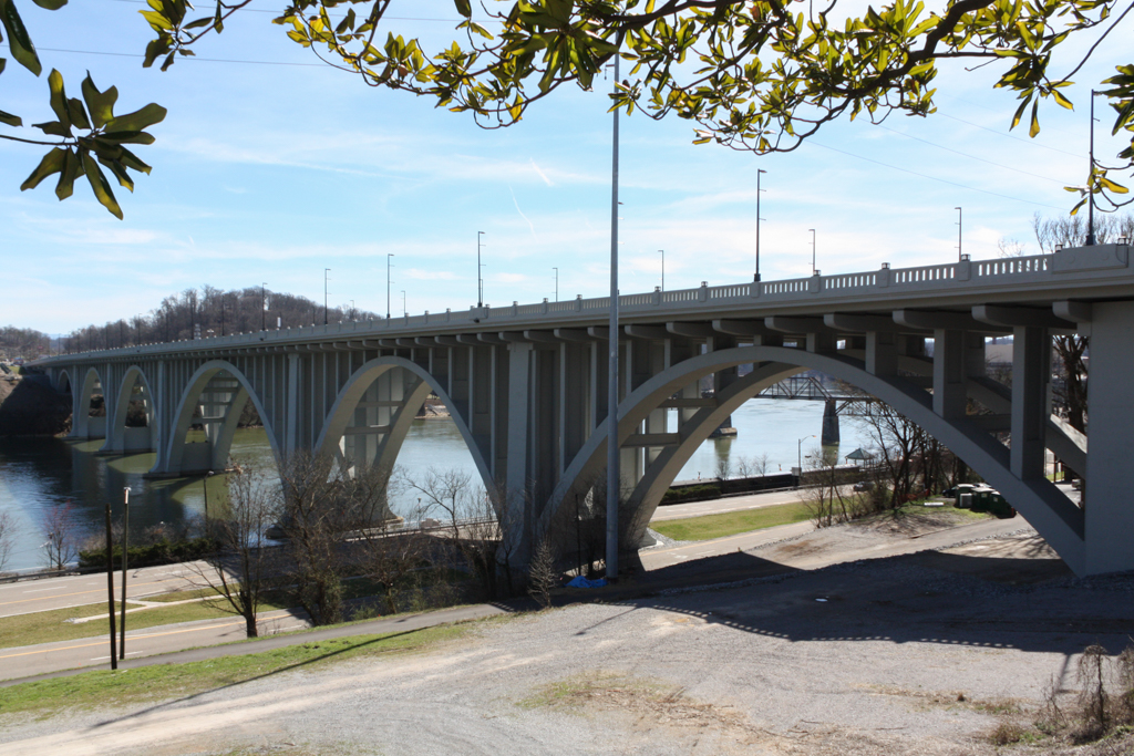
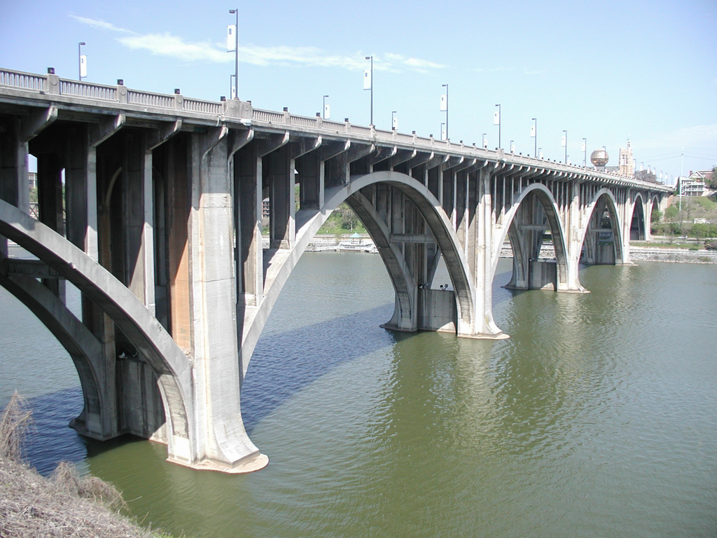
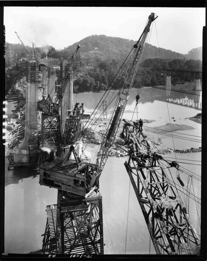
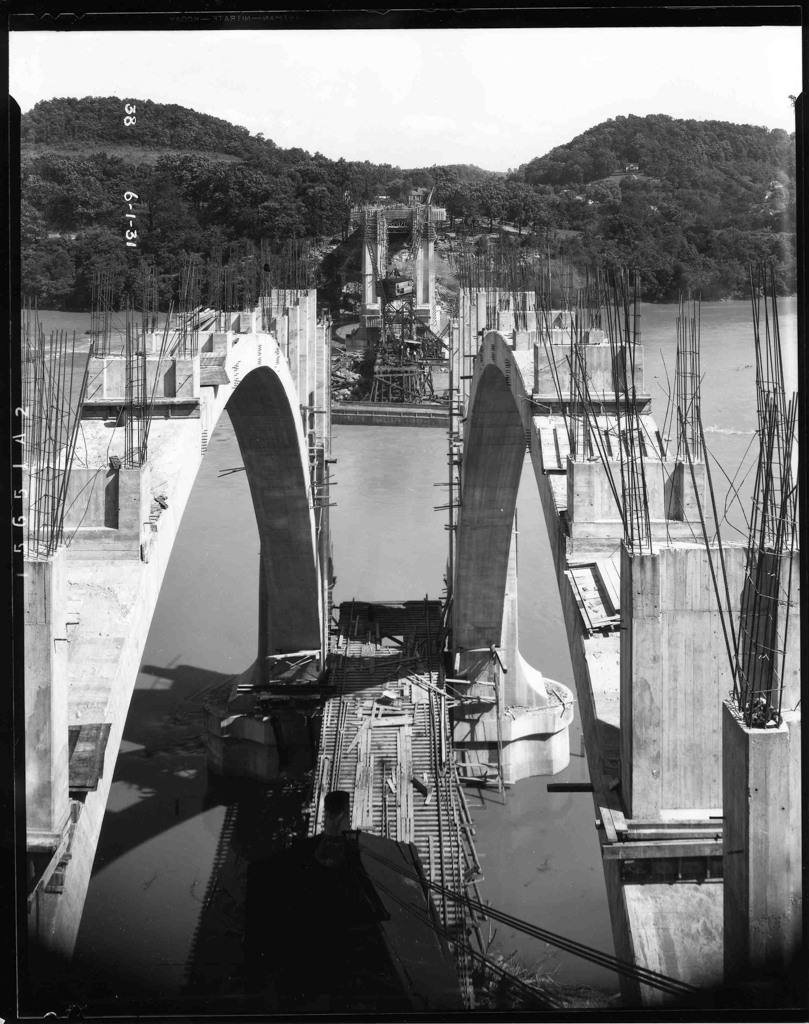
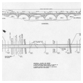
The following April, after a national competition for a replacement, the city hired the Marsh Engineering Company of Des Moines, Iowa. Founded by James B. Marsh (1856–1936), Marsh Engineering had patented the “Marsh Rainbow Arch” bridge in 1911. Since then, scores of their reinforced concrete bridges had been built throughout the Midwest. For Knoxville, Marsh planned a bridge of six reinforced open spandrel concrete arches, the center one spanning 317 feet to accommodate river navigation. These arches support a six-lane roadway that is 66 feet wide and some 1,793 feet in length—the longest bridge of its type in Tennessee. In addition to three car lanes in each direct, the bridge also included 6-foot wide pedestrian sidewalks on each side, provided with guardrails offering some restrained Art Deco detailing.
Groundbreaking for the Henley Street Bridge took place on September 24, 1930, and hundreds of local men found jobs working on the bridge’s construction. Completed in only 15 months, the bridge was dedicated on January 2, 1932, which coincided with the soft opening of the Great Smoky Mountains National Park. President Franklin D. Roosevelt used the bridge when he officially dedicated the park on Labor Day in 1940.
Soon after construction, highways between Knoxville and the Great Smoky Mountains were lined with motels, hotels, roadside attractions, service stations, restaurants, and souvenir shops as millions of tourists traveled through the region. The Henley Street Bridge proved to be crucial to the economic and social growth of East Tennessee.
Between 1987 and 2015 the bridge hosted Knoxville’s popular “Boomsday” Labor Day fireworks display, one of the largest fireworks displays in the South, one that was featured in novels by Pulitzer-prize winning author Cormac McCarthy, including The Orchard Keeper, Suttree, and The Road.
Between 2011 and 2014, the Tennessee Department of Transportation undertook a $32 million rehabilitation of the bridge, repairing deteriorated concrete, installing historically compatible metal light poles, and re-striping the roadway to include bicycle lanes in both directions. The rehabbed bridge currently carries more than 43,000 vehicles daily.
Because of its innovative design, its central role in the Knoxville’s urban planning and tourist industry, and its impact on the Great Smoky Mountains National Park, the bridge is one of Tennessee’s most significant historic structures.
References
Bartholomew, Harland, and Associates. A Comprehensive City Plan for Knoxville, Tennessee. St. Louis, Missouri, 1930. Available online: https://archive.knoxmpc.org/plans/1930-Comprehensive-City-Plan-For-Knoxville.pdf
Birnbaum, Charles A., and Robin Karson, eds. Pioneers of American Landscape Design. New York: McGraw-Hill, 2000.
Jones, Robbie D. The Henley Street Bridge: History of An East Tennessee Landmark. Nashville: Tennessee Department of Transportation, 2006.
Jones, Robbie D. “Historic Architecture Assessment for the Proposed Improvements to the Henley Street Bridge, Knoxville, Tennessee.” Nashville: Tennessee Department of Transportation, 1999. Unpublished report on file at TDOT.
Jones, Robbie D. The Historic Architecture of Sevier County, Tennessee. Sevierville: TN: Smoky Mountain Historical Society, 1997.
Lovelace, Eldridge. Harland Bartholomew: His Contributions to American Urban Planning. Urbana: University of Illinois Press, 1993.
Neely, Jack. “Henley Bridge is Falling Down” and “A Short History of Henley Bridge.” Knoxville Metropulse, January 13, 2010.
Wheeler, William Bruce. Knoxville, Tennessee: A Mountain City in the New South. Knoxville: University of Tennessee Press, 2005.