


In the mid-nineteenth century, the intersection of natural topography and innovative engineering and technology transformed an agricultural landscape into an industrial landscape in what became Holyoke, Massachusetts, known popularly as the “Paper City.” In terms of topography, there was a relatively flat site adjacent to a bend of the Connecticut River at a spot where the river descended about 60 feet in elevation over a relatively short distance of 2 miles. The site proved attractive to investors who envisioned harnessing gravity and falling water to turn waterwheels and water turbines that imparted circular motion to the shafts and pulleys driving the machinery in textile and, increasingly, paper mills.
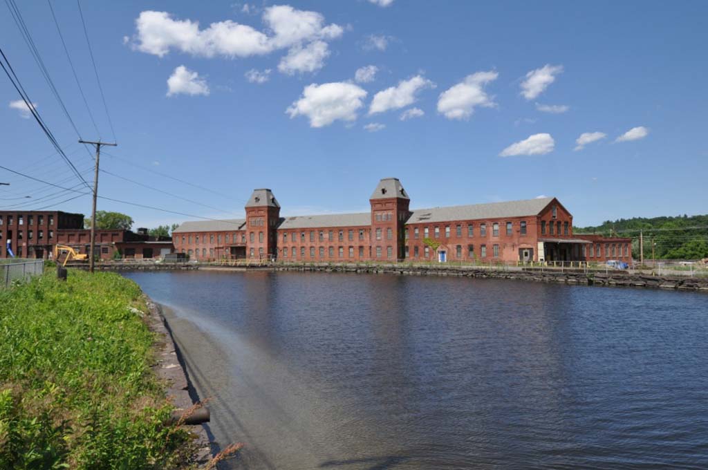
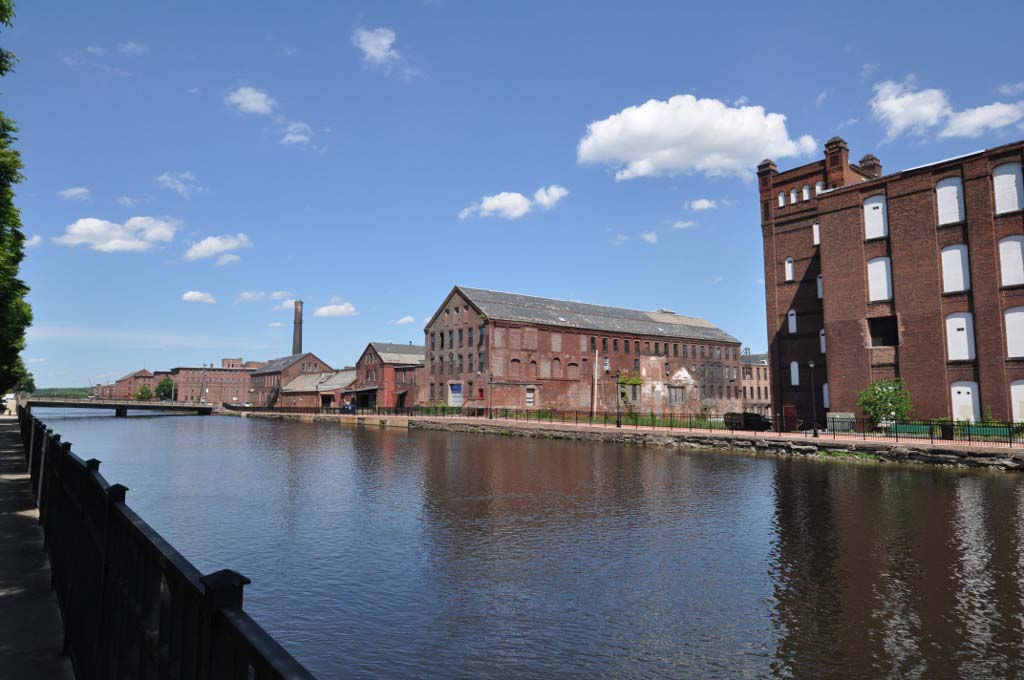
Designed initially by John Chase and Philander Anderson, the waterpower system relied on water that backed up behind a dam built across the Connecticut River. Diverted river water flowed through a gatehouse, which regulated its volume, and entered the top level of a three-level canal system. Water would flow from the first level through the waterwheels and turbines constructed in mills built along the canal. After leaving the various mills lining the first-level canal mills, the water entered a second-level canal and was drawn into the power systems of another line of mill buildings. The water then flowed into the third-level canal where it was once again tapped to power another line of mills before being channeled back into the Connecticut River. Built between 1847 and 1893, this system for the harnessing of water created an extraordinary urban and industrial landscape. Four-and-a-half miles of canals ran through a densely developed landscape that included brick mill buildings, generally four to six stories high, worker housing developments, a system of streets and railroad tracks, and bridges spanning the canals. Sandstone blocks, quarried on the site, lined the canals. The canals were constructed between 80 and 140 feet wide, with depths ranging from 2 feet to 25 feet.
The main braches of the first- and second-level canals ran parallel to one another, separated by a block of land approximately 400 feet in width. The main branch of the third-level canal and a secondary branch of a second-level canal had more curving courses, following the bank of the river, as far as 1,800 feet from the second-level canal. The canals dominated the fabric of the city that grew up around them. Part of the power of Holyoke’s local industrial landscape came from the contrast between the built density of mills and the openness of the canal themselves. The canals carried the reflection of the adjacent buildings on their surfaces but were unmistakably open and undeveloped.
As electrical technology developed in the late nineteenth century, mill turbines were increasingly used to generate electricity to power motors in the various mills and factories. A local power company also used hydropower to generate electricity for broad distribution in the city and region. After World War II, textile and paper production declined precipitously. Many historic mills have been demolished but others have been adapted to new uses. The canal system remains much as it was developed. It stands as an infrastructure and engineering system that significantly structured the industrial landscape and economy of Holyoke. There are currently efforts to attract high-tech and other firms to Holyoke that can utilize the renewable resource of electricity generated sustainably from the waters of the Connecticut River.
References
Jenkins, Candace, “Holyoke Canal System,” Hampden County, Massachusetts. National Register of Historic Places Nomination Form, 1980. National Park Service, U.S. Department of the Interior, Washington, D.C.