


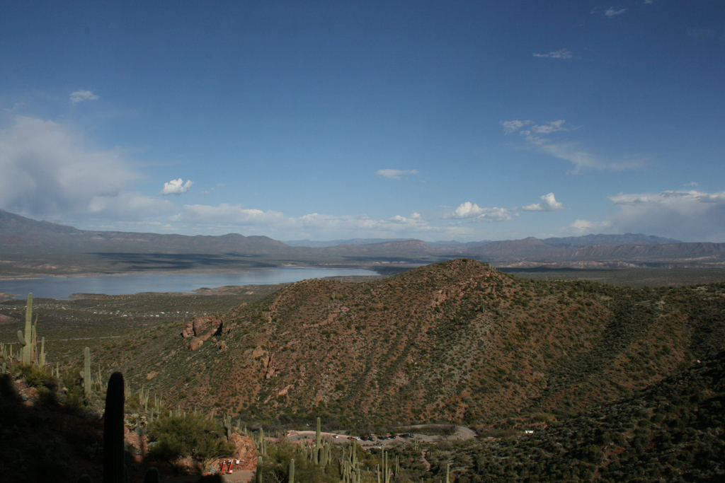


In southeastern Arizona, a 1,120-acre preserve encompasses nearly 70 archaeological sites built by the prehistoric Salado culture between the thirteenth and fifteenth centuries. Named for the arid Tonto Basin that the park overlays, the national monument encompasses three rugged canyons with elevations ranging from 2,300 to 3,900 feet, as well as the Salt River’s alluvial plain in the north. The park’s foci are two well-preserved cliff-dwellings, Lower Ruin and Upper Ruin, which are the only Salado examples open to the public and interpreted for educational purposes.
Coined by archaeologists, the ethnographic term “Salado” refers to the mixture of two distinct prehistoric cultures: the ancestral Sonoran Desert people (formerly called Hohokam), who dwelled in the Sonoran Desert in southern Arizona, and Ancestral Puebloan peoples, who inhabited the mountainous areas to the north and east. The Tonto Basin lies at the geographic threshold between these two cultures’ spheres of influence, and the architecture and material culture left behind proves that the groups intermingled. The natives farmed the fertile Salt River Valley and built adobe pit houses (common among the ancestral Sonorans) as well as masonry cliff dwellings (associated with Ancestral Puebloans).
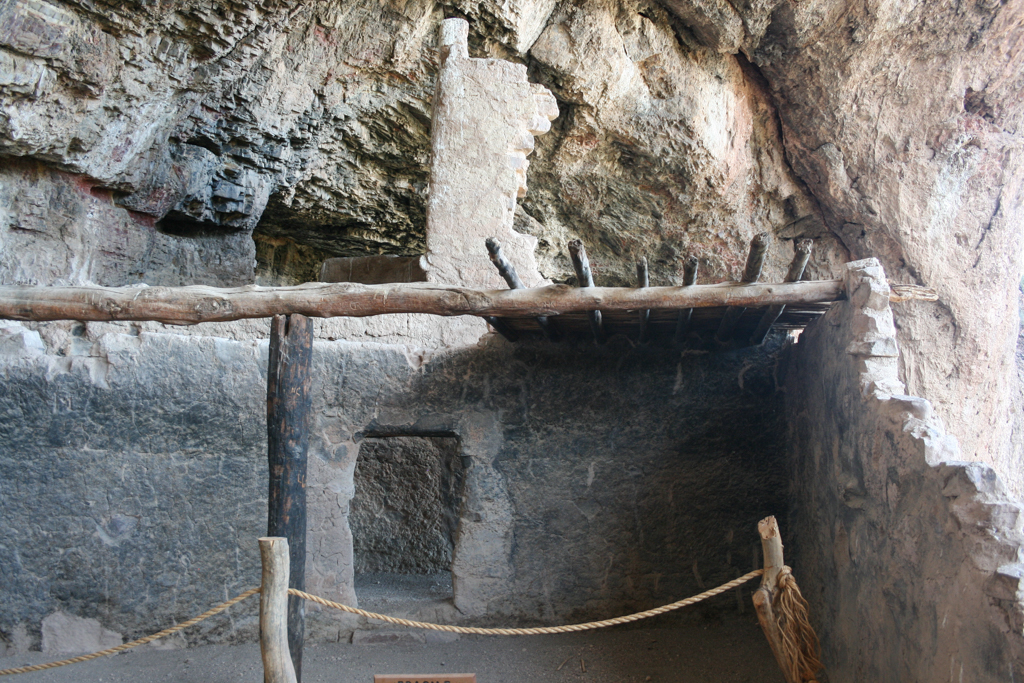
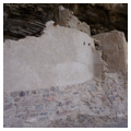
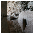
Archaeologist Adolph Bandelier was one of the first Europeans to methodically document the ruins in the Tonto Basin during his 1883 survey. He described the Lower Ruin as a small “pueblo-house” built in a cave measuring 363 feet wide and 20-35 feet high. Situated some 355 feet above the valley floor, the cliff dwelling looks out onto Roosevelt Lake 3.25 miles to the northwest. The pueblo’s two-story walls, built atop loose fill, comprise rough, tapering courses (measuring 18 to 24 inches high) of local, uncut quartzite blocks adhered with a clay mortar mixed with gravel. The exterior was covered with tan-colored adobe clay, while mud was used to plaster the interior walls. Ten doorways, rectangular and T-shaped, with wooden lintels punctuate the walls, as do loopholes on the second story. Floors were composed of packed earth and clay or bedrock, while roofs consisted of one central bearing beam (viga) supported by a timber post and overlaid with sycamore or juniper poles (latía) and saguaro cactus ribs, grass, or reeds then covered with layers of adobe clay. The Lower Ruin was excavated by archaeologist Lloyd Pierson and stabilized in 1950. Steel tension rods and braces prevent lone masonry walls from tumbling, while the natural rock ledge was artificially built outwards to allow visitor traffic around the site.
The Upper Ruin is positioned at 600 feet elevation, and is larger than its counterpart. Two stories high, the unfinished masonry walls are roughly laid, rarely parallel, and therefore rather unstable. The walls are punctuated with rectangular or square doors that were later altered into partial T-shapes, as well as small loopholes measuring 6-7 inches square. The parapet walls supported viga-and-latía roofs comprising juniper or pinyon poles over a sycamore beam, which was covered with vegetal matter and slathered in mud 4-5 inches thick. Despite the use of adobe clay, the floors’ irregularities reflect the cave’s natural bedrock formation. The National Park Service (NPS) first stabilized the Upper Ruin in 1940.
Tonto Basin’s rough terrain and distance from modern urban centers ensured that the wilderness remained untouched and the cliff dwellings pristine until the mid-1870s, when ranchers encroached upon the area. Pressures on the wilderness mounted through the end of the nineteenth century, culminating with the construction of the Roosevelt Dam (1906–1911), which further threatened the basin’s Salado sites. To protect these ruins, President Theodore Roosevelt established the national monument on 640 acres in 1907. Since the park’s inception, scientific excavations have led to better understanding of the Salado people’s material culture and subsistence practices as well as the preservation of these sites.
Originally, the monument was managed by the United States Forest Service, which, in partnership with the Southern Pacific Railroad, graded an entrance road to Cholla Canyon, cleared a parking area, and built a one-mile trail to the Lower Ruin in 1929. By 1932, tourism and vandalism to the cliff dwellings had peaked, and in 1933 the monument’s administration was transferred to the NPS. President Franklin D. Roosevelt expanded the park by another 480 acres in 1937.
Park visitation rapidly increased in the postwar years, and Tonto National Monument was in dire need of updated facilities for both tourists and park employees. The first park ranger’s house was built in 1950, while the NPS erected a new visitors’ center between 1963 and 1964 as part of its Mission 66 building program. Few major construction programs have taken place in the park since the 1960s, although a new administration building was erected in 2013 containing offices, a laboratory, and a conference room. The low-slung building, comprising block walls on a concrete foundation, is painted an earthy brown to blend with its natural surroundings. The slope of the shed roof is mimicked by a veranda spanning the one-story building’s facade. Built by private contractors and NPS staff, the building earned LEED’s platinum certificate for energy efficiency.
References
Allaback, Sarah. Mission 66 Visitor Centers: The History of a Building Type. Washington, D.C.: United States Department of Interior National Park Service, 2000.
Ewing, Cinda. “New Administration Building at Tonto.” Cliff Notes: The Official Newspaper of Tonto National Monument 10 (2012–2013): 1.
Kelley, Linda B., “Tonto National Monument: Lower Ruin,” Gila County, Arizona. National Register of Historic Places Registration Form, 1989. National Park Service, U.S. Department of the Interior, Washington, D.C.
Kelley, Linda B. “Tonto National Monument: Upper Ruin,” Gila County, Arizona. National Register of Historic Places Registration Form, 1989. National Park Service, U.S. Department of the Interior, Washington, D.C.
National Park Service. “List of Classified Structures: Montezuma Castle,” Yavapai County, Arizona. National Park Service, U.S. Department of the Interior, Washington, D.C.
National Park Service. “Tonto National Monument, Arizona.” Accessed January 3, 2015. http://www.nps.gov/tont/index.htm
National Park Service. “Tonto National Monument, Arizona: Architecture.” Accessed January 3, 2015. http://www.nps.gov/tont/historyculture/architecture.htm
Well, Susan J., “Tonto National Monument Archeological District,” Gila County, Arizona. National Register of Historic Places Registration Form, 1987. National Park Service, U.S. Department of the Interior, Washington, D.C.
Wheaton, Rodd L., “Tonto National Monument Visitor Center,” Gila County, Arizona. National Register of Historic Places Registration Form, 2007. National Park Service, U.S. Department of the Interior, Washington, D.C.