

University of California, Irvine
You are here
City of Irvine


1960 city master plan, William L. Pereira and Associates; 1961–1980 university master plan, William L. Pereira and Associates. Roughly bounded by I-405, MacArthur Blvd., Bonita Canyon Dr., Shady Canyon Dr., Turtle Rock Dr., Ridgeline Dr., and University Dr.


Suburban development dominated the growth of American cities in the 1950s and 1960s, but the results were often criticized by architects, academics, and planners as uncoordinated, inefficient, and ugly. When the University of California Regents selected a site for a new southern campus on the largely agricultural Irvine Ranch in Orange County in 1959, architect William Pereira recognized an extraordinary opportunity to build a model suburban city from the ground up to correct those problems. As consultant to both the University’s Board of Regents and to the board of the Irvine Foundation, which controlled the Irvine Ranch, Pereira proposed an all-new, 10,000-acre master planned city with the university at its heart.
The concept of master planning was a part of the modern movement in architecture. It was believed that with rational planning cities as well as buildings could be designed to express their functions; this would solve the problems of congestion, pollution, and insufficient amenities such as parks, open space, libraries, schools, and retail centers seen in many older cities. Architects and planners had proposed theoretical solutions (such as Ebenezer Howard’s Garden City and Tony Garnier’s Cité Industrielle) and built small-scale New Deal model communities (such as Radburn, New Jersey, and Greenbelt, Maryland), but the enormous economic and population growth after World War II made the construction of large-scale master planned developments realistic. Europe saw many examples of New Towns built in the aftermath of the war’s destructiveness; in the United States major examples included Irvine and two other major master planned communities, in Columbia, Maryland, and Reston, Virginia.
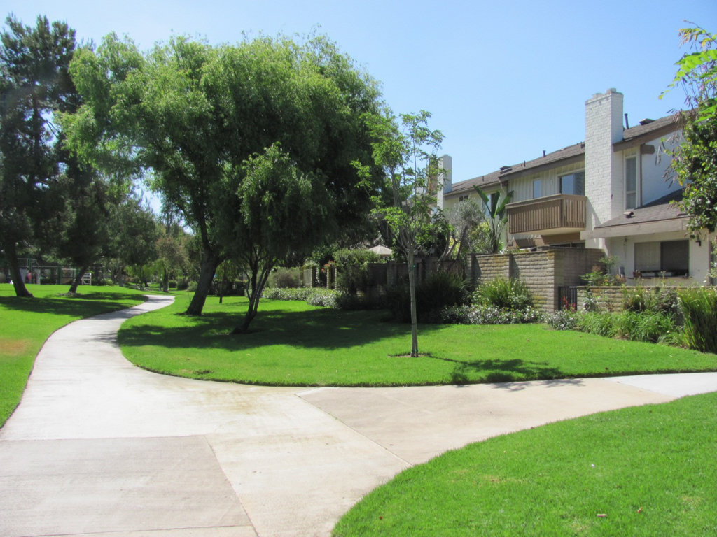
Pereira’s plan stipulated a city of small-scale villages around the campus. Each village would be designed as a superblock, keeping major arterials at its perimeter and including low-traffic neighborhood streets that responded to the natural topography, thus creating contained, defined neighborhood nodes or cul-de-sacs. Light industry and offices were restricted to a zoned area on the west side of the city. Wetlands and steep hillsides were designated as open space or preserves. Within each superblock, schools, libraries, community centers, recreation centers, swimming pools, and shopping centers would be within walking distance of the residences. Threading through each neighborhood was a system of well-landscaped greenbelts and pathways for pedestrian and bicycle circulation; most residences faced onto these common spaces. Each superblock would have a variety of housing types, including apartments, town houses, and single-family houses, to encourage a mixed socio-economic demographic.
As a result of this planning, the neighborhoods balanced both unifying and diverse elements in their designs. A typical residential street presented a unified overall appearance through the use of consistent setbacks, height restrictions, connecting walls, and repeated materials and details. It avoided the common criticism of conventional suburban tracts as repetitive and monotonous, however, by including several house models (one- and two-story structures, with open or walled courtyards) interspersed with open space, recreational facilities, and landscaping by Peter Walker of Sasaki Walker Associates. Cul-de-sacs were redesigned to include small, bermed green spaces that reduced the visual presence of automobiles parked in the street.
In his master plan, Pereira stipulated modernist architecture for all buildings to create this unified yet varied streetscape. Though some models referenced the region’s Spanish colonial history with red-tile roofs, all were modern in composition; flat or shed roofs were prominent, and trellises on post-and-beam structures provided decorative touches. Open floor plans often included atriums and two-story spaces with mezzanines. Architects for houses and apartments were respected California residential designers, including Frank Gehry, Greg Walsh, Fisher-Friedman, Backen Arrigoni and Ross, and Walter Richardson.
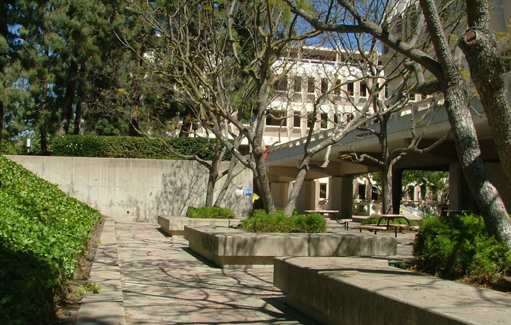
Modern concepts also governed the design of the university campus. Each academic department had its own compound, all situated around a pedestrian ring with a landscape park at its center. Future expansion for each department would extend along radial lines beyond the circle. Pereira, appointed campus architect, established the campus’s unifying motifs in the initial campus buildings: each building would be clad in precast concrete sunscreen units (unique unit designs distinguished each department) and raised off the rolling terrain on inset sculptural concrete piers.
Although architectural professionals and the public were only beginning to become aware of environmental issues in the early 1960s, Pereira designed the campus and the city to respect natural climatological and topographical features. The precast concrete sunscreens on each building incorporated passive solar design in response to the sunny climate. By lifting each building on piers above the rolling topography of the former grazing land, buildings appeared to float above the landscape. As the original campus was completed in the first decade, buildings by Jones and Emmons, Blurock Ellerbroek Associates, Kenneth Wing, Richard Dorman, and Kistner, Wright and Wright followed Pereira’s unifying concepts; he remained campus architect until 1977. Landscape design was by Robert Herrick Carter, C. Jacques Hahn, J. Charles Hoffman, and Frederick Lang.
The success of the first villages of University Park and Turtle Rock, opened in 1965, prompted the Irvine Company to plan a second, larger phase, known as Woodbridge. Though Pereira was not actively involved in its design, the planning team of Sasaki Walker Associates and Smith and Williams continued the concepts of Pereira’s master plan. The initial developments in Woodbridge opened in 1975.
The Irvine Company has gone through two changes in ownership since 1965. Nonetheless, many of the primary concepts established in Pereira’s original master plan are still used today as the last of the original ranch’s 90,000 acres are being developed. Open space, an organized mix of housing, retail, and civic amenities, a diverse socio-economic and ethnic mix, and unified architectural design still guide development, even as land values have increased and reduced the average size of house lots.
Irvine was, in many ways, the most successful of the large master planned communities of the 1960s. It was financially successful, never undergoing bankruptcy as did Reston and Columbia. Today it is a representative example of modern master planning, and contains one of the largest groupings of late modernist architecture in the country.
References
Forsyth, Ann. Reforming Suburbia: The Planned Communities of Irvine, Columbia, and the Woodlands. Berkeley: University of California Press, 2005.
Kane, Diane. “Westlake and Irvine, California: Paradigms for the 21st century?” Ph.D. dissertation, University of California, Santa Barbara, 1996.
Rocca, Alessandro. “Irvine, plan and architect of the campus and Irvine Ranch of Orange County: The city which does not imitate the city.” Lotus 98 (1996): 7-102.
Ruggeri, Deni. “Constructing Identity in Master Planned Utopia: The Case of Irvine New Town.” Ph.D. dissertation, University of California, Berkeley, 2009.
Schiesl, Martin. “Designing the Model Community: The Irvine Company and Suburban Development 1950-1988.” In Post Suburban California, edited by R. Kling, S. Olin, and M. Poster. Berkeley: University of California Press, 1991.
Writing Credits
Coordinator:
Emily Bills
If SAH Archipedia has been useful to you, please consider supporting it.
SAH Archipedia tells the story of the United States through its buildings, landscapes, and cities. This freely available resource empowers the public with authoritative knowledge that deepens their understanding and appreciation of the built environment. But the Society of Architectural Historians, which created SAH Archipedia with University of Virginia Press, needs your support to maintain the high-caliber research, writing, photography, cartography, editing, design, and programming that make SAH Archipedia a trusted online resource available to all who value the history of place, heritage tourism, and learning.