

Bountiful Grain and Craig Mountain Railroad BG&CM; Camas Prairie RailNet
You are here
Camas Prairie Railroad
1899–1927. Roughly parallels U.S. 95 for approx. 26.5 miles in Lewis and Idaho counties.
-
 (Photograph by Wendy R. McClure)
 -
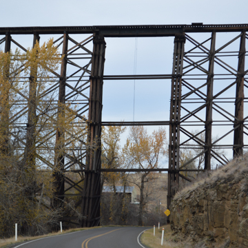
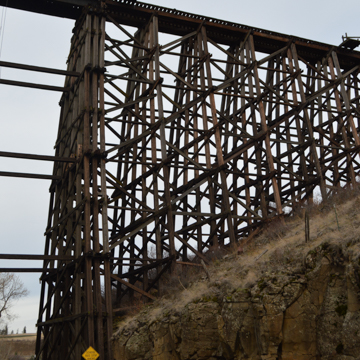
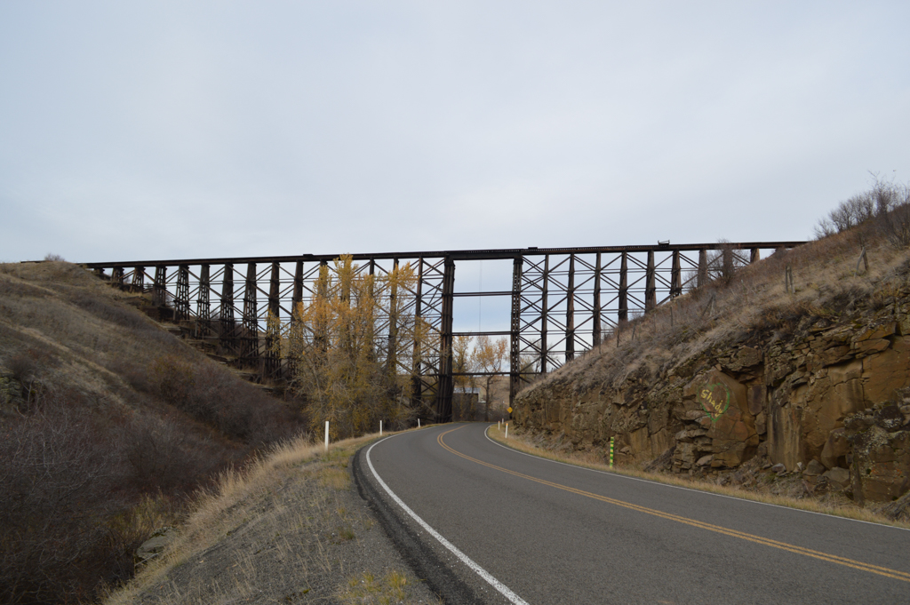
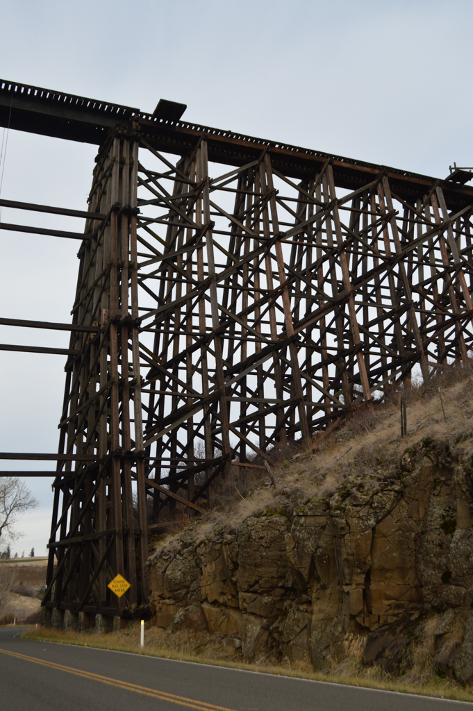
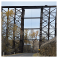
 Trestle Bridge #40 (Photograph by Wendy R. McClure)
 -
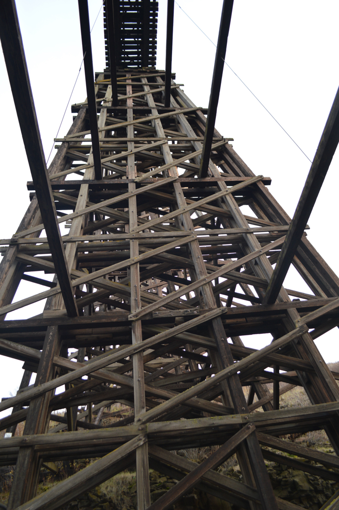
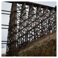
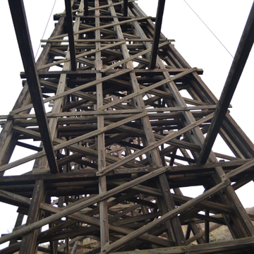 Cross section, Trestle Bridge #40 (Photograph by Wendy R. McClure)
 -
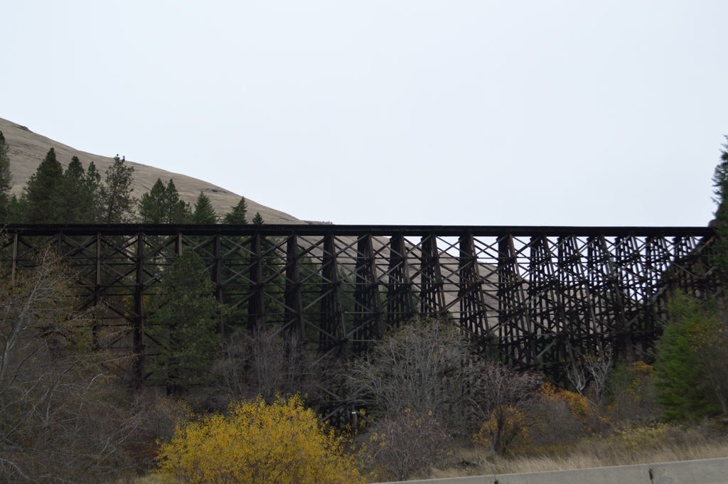
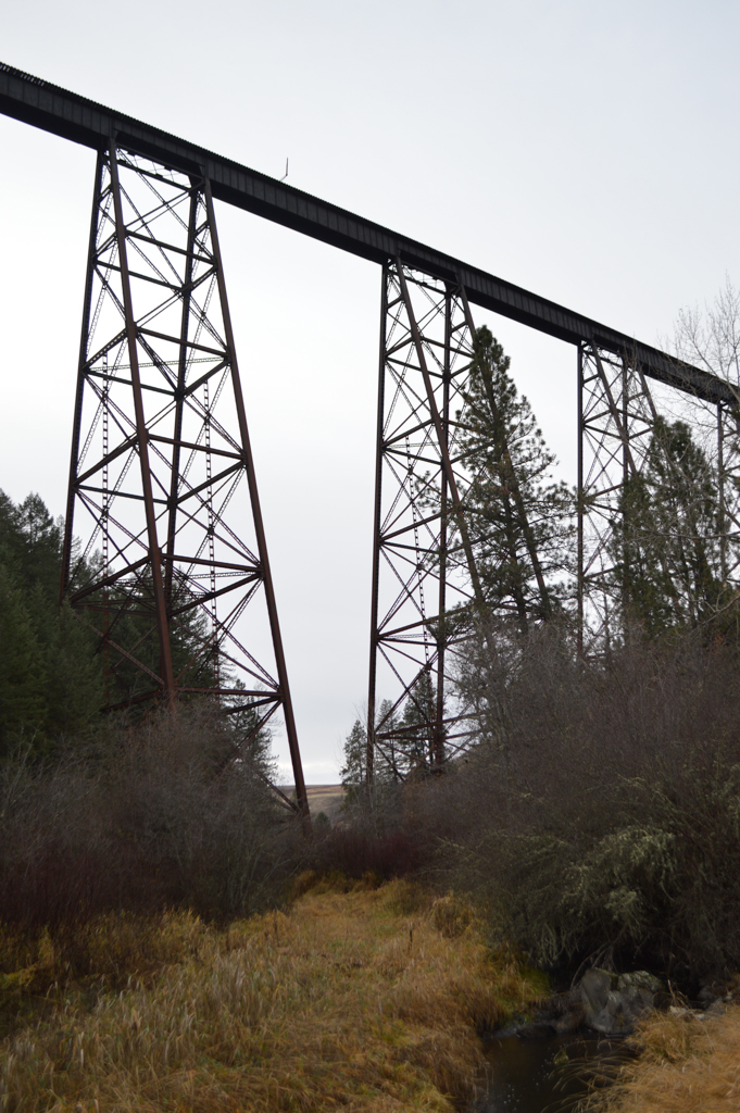
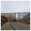
 Trestle Bridge near Cul-de-Sac (Photograph by Wendy R. McClure)
 -
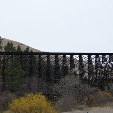 Trestle Bridge near Cul-de-Sac (Photograph by Wendy R. McClure)
 -
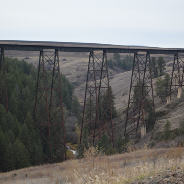
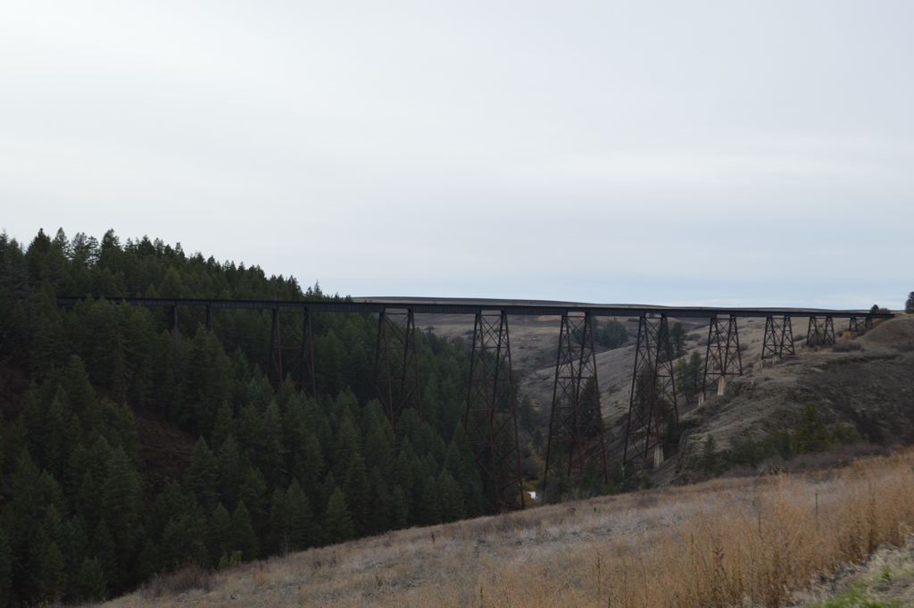
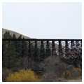
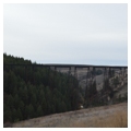
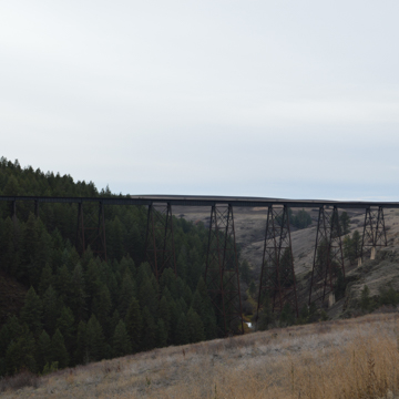 Steel trestle bridge across Lawyer's Canyon (Photograph by Wendy R. McClure)
 -
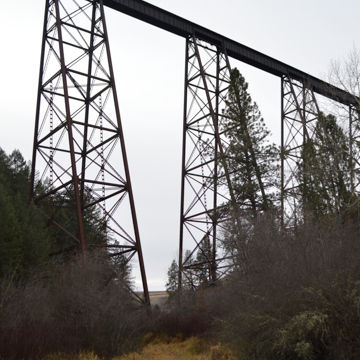
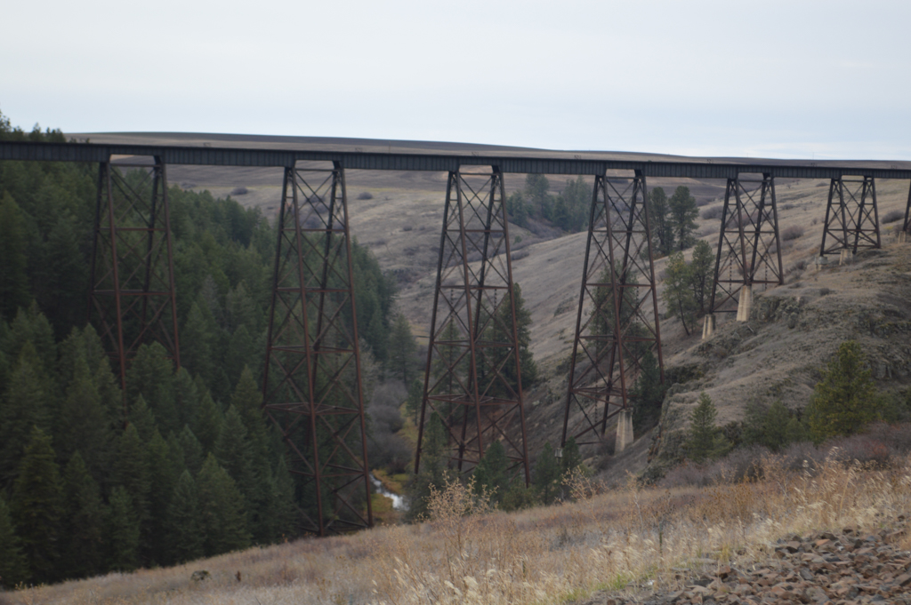
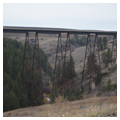
 Steel trestle bridge across Lawyer's Canyon (Photograph by Wendy R. McClure)
 -
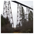
 Steel bents for Lawyer's Canyon trestle (Photograph by Wendy R. McClure)
 -
 Typical wood trestle bridge structural bents (Photograph by Wendy R. McClure)
 -
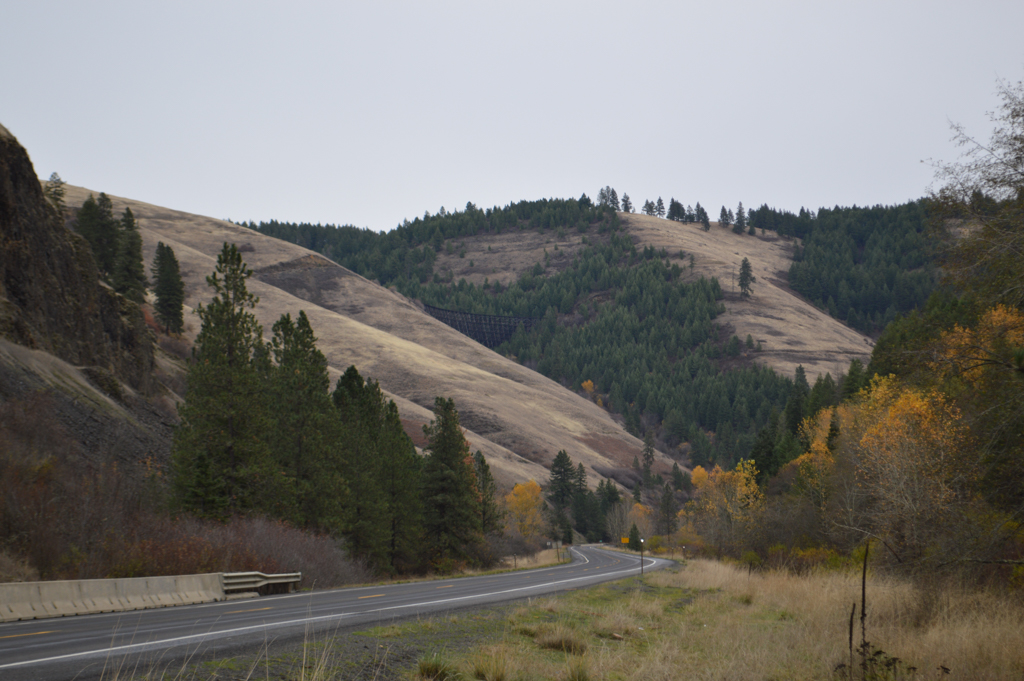
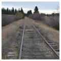
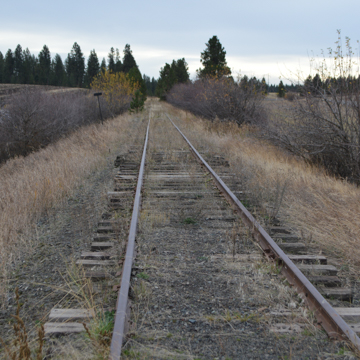 CPRR rail line (Photograph by Wendy R. McClure)


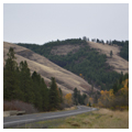
The construction of the Camas Prairie Railroad between 1899 and 1927, showcases, perhaps better than any other built works in Idaho, the daunting engineering challenges presented by the state’s natural geography. The 287-mile regional rail system originally consisted of four branches, with each branch constructed within a unique set of natural conditions: wild river channels, basalt sided canyons, rolling hills riddled with creek draws, or steep mountainous terrain.
The most visually striking and costly branch to build, known as the Second Subdivision, ran from Spalding along the Clearwater River up to Grangeville on the Camas Prairie’s high plateau above. The 66.5-mile route ascended from the Clearwater River, up the steeply winding Lapwai River Canyon at a 3-percent grade, crossed trestle bridges, tunneled through basalt hillsides, reached a peak elevation of 2,900 feet above the river, and traversed the Camas Prairie’s relentlessly rolling landscape to its destination. Railroad engineers engaged hundreds of workers, including local farmers and European immigrants, to construct the route’s 7 tunnels and 45 trestles. Since it was necessary to elevate much of the line, the Second Subdivision was popularly known as “the railroad on stilts.”
The Camas Prairie Railroad was built upon historically contested terrain. The Nimiipuu or Nez Perce people hunted, grazed horses, and gathered camas roots, an onion-like dietary staple, on the Camas Prairie’s rolling grasslands. In 1877, the first battle of the Nez Perce War ensued at Whitebird Pass on the Camas Prairie’s southern edge. The conflict arose from the Treaties of 1855 and 1863, which sought to confine all bands of Nez Perce to renegotiated boundaries of a greatly reduced reservation. The most profound change to the Camas Prairie, however, occurred when it was transformed from a natural state to cultivated ground as a result of the 1887 Allotment Act, which encouraged subdivision of reservation lands for agricultural use.
The Camas Prairie’s Allotment Act farmsteads and surrounding forested hillsides produced high yields of grain and timber. The resulting need for a transportation system to haul the region’s bountiful produce to urban marketplaces spawned the next chapter of regional conflict. Railroad tycoons Edward Harriman of the Union Pacific Railroad and James Hill of the Northern Pacific Railway engaged in fierce competition to secure exclusive shipping rights.
In 1906, the Northern Pacific initiated construction of the Second Subdivision. Local farmers and European immigrants provided the hard labor required to forge tunnels though solid basalt mountainsides using hand picks and explosives. Bridge crews constructed dozens of tall trestles from white pine timbers harvested along the route. Ultimately, extremely challenging geography and associated high construction costs elicited a rare display of cooperation between the two railroads. In 1909, Hill and Harriman jointly established the Camas Prairie Railroad as an independent regional railway, to avoid duplicating routes. The two railroads signed a 999-year agreement to merge their newly forged branch lines and to share access, operational costs, and moving stock.
A majority of the Second Subdivision’s most significant engineering feats are located in Lapwai Canyon at the Prairie’s northern edge. Among the 7 tunnels constructed within this section, the Horseshoe Tunnel is the most spectacular: it scribes a 14-degree continuous curve over its 883-foot length to complete a 180-degree turn. Farther up the canyon’s steep hillsides, Trestle Bridge Number 22, popularly known as Halfmoon Bridge, gracefully scribes a continuous 17-degree arc over its 684-foot length. Engineers working for the Northern Pacific Railway likely designed the bridge, which is formed by 47 wood-frame bents. Over one million board feet of hand-cut, heavy timbers were used in its construction. At 141 feet above the ground, Halfmoon Bridge is one of the line’s tallest wooden trestle bridges.
While Lapwai Canyon’s wooden bridges are more difficult to access for trestle enthusiasts, travelers along the U.S. Route 95 pass directly under a 120-foot-high trestle near the town of Ferdinand. Representative of the 45 wooden trestle bridges along the Second Subdivision Route, Bridge Number 40 was designed to span a particularly steep draw.
The Lawyer’s Canyon Bridge, completed in 1908, represents another remarkable engineering accomplishment that can be viewed from U.S. Route 95. Structural steel was used to span Lawyers Canyon, the widest and deepest canyon along the route. According to historian Nancy Renk, the American Bridge Company designed a steel viaduct to run 1,520 feet across Lawyer’s Canyon at a maximum height of 280 feet, placing it among the tallest trestle bridges. Steel girders, measuring 100 feet in length, were used for the bridge’s construction. Flat cars were used to transport the girders to the site via the newly completed Horseshoe Tunnel, with barely an inch to spare.
Use of the Camas Prairie Railroad declined in tandem with changes in transportation infrastructure; passenger train use was discontinued in 1955, and replaced by the automobile as the preferred mode for regional travel. Demand for rail freight service began to decline with the advent of dam construction along the Snake River in the 1970s. Barge traffic, which was able to reach the Port of Lewiston, began to compete with the railroads for a market share of grain and timber shipments to coastal cities. Freight business continued to decline, leading to the sale and restructuring of the Camas Prairie Railroad as a succession of railroad companies beginning in 1996. Revenue traffic ceased in 2002.
In 2002–2003, Bountiful Grain and Craig Mountain Railroad (BG&CM) purchased the most spectacular portion of the Second Subdivision, which runs between Spalding and Cottonwood, from Camas Prairie RailNet. The future of the former Camas Prairie Railway is uncertain; segments of the track have been pulled up; BG&CM’s segment is currently used for storing rail cars; the line’s towering wooden trestles require maintenance. Lacking an economic purpose, total abandonment remains a distinct possibility.
References
Butler, Dan. “Railroads of the Camus Prairie.” The Pacific Northwest Forum8, no. 2-3 (Spring–Summer 1983): 39-48.
“The Camas Prairie Railroad.” American Rails. Accessed November 1, 2015. https://www.american-rails.com/.
Gravelle, Matt. Shortline on Stilts: Camas Prairie Railroad. Film. Lewiston, ID : Soyk Television Production, 1995.
Neuberger, Richard. “The Camas Prairie Line.” Spokesman Review, February 10, 1952.
Renk, Nancy. “Camas Prairie Railroad.” Preservation Idaho. Accessed October 30, 2015. https://www.preservationidaho.org/.
Riegger, Hal. The Camas Prairie: Idaho’s Railroad on Stilts. Edmonds, WA: Pacific Fast Mail, 1986.
Sullivan, Todd. “The Camas Prairie.” Railfan2, no. 1 (December 1977):18-27.
Walker, Jodi. “Camas Prairie Line Will Run Again.” Lewiston Morning Tribune, December 18, 2002.
Walker, Jodi. “Cottonwood Has a Railroad, Again.” Lewiston Morning Tribune, January 9, 2003.
Writing Credits
Coordinator:
Anne L. Marshall
Wendy R. McClure
Phillip G. Mead
D. Nels Reese
If SAH Archipedia has been useful to you, please consider supporting it.
SAH Archipedia tells the story of the United States through its buildings, landscapes, and cities. This freely available resource empowers the public with authoritative knowledge that deepens their understanding and appreciation of the built environment. But the Society of Architectural Historians, which created SAH Archipedia with University of Virginia Press, needs your support to maintain the high-caliber research, writing, photography, cartography, editing, design, and programming that make SAH Archipedia a trusted online resource available to all who value the history of place, heritage tourism, and learning.