

Washington Street Station
Downtown Crossing Station


1915; 1986 renovation; 2016 renovation, Handel Architects; 2016 head house, Höweler and Yoon. 362- 430 Washington St.

Downtown Crossing Station exemplifies the responsiveness of Boston subway architecture to its specific neighborhood. In this case, certain entrances and exits are integrated with the character of the area so fully such that they are actually incorporated into existing building stock. In a neighborhood dense with pedestrian traffic and commercial uses, there would be little benefit in adding built resources at street level.
Downtown Crossing was part of Boston’s nineteenth-century commercial center, and it continues to serve that role today. Located just one stop away from one of the original Boston subway stops, Park Street, Downtown Crossing is also just one block removed from Tremont Street, the corridor most cited for street-level congestion in the late 1800s. This was the impetus for developing additional modes of transportation. The station, which opened in 1915, was part of the first extension phase of the Cambridge-Dorchester Line (now known as the Red Line). While most other stations of this extension phase were constructed across the Charles River, establishing connections between commercial Boston and residential Cambridge, Downtown Crossing Station (then called Washington Street Station) added a service stop to the crowded retail center of the city.
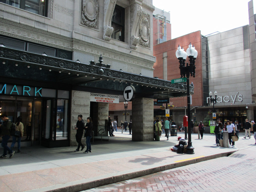
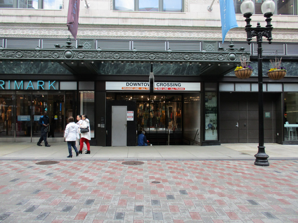
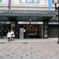
The station was initially modernized in the late 1980s, which included accessibility and cosmetic improvements, as well as platform extensions. Starting around 2010, redevelopment of the Filene’s Building complex (1911–1912, D.H. Burnham and Co.), the site of the subway station, necessitated additional changes to the entrance/exit portals. Two portals are now tucked into the Beaux-Arts building, converting it into a head house, albeit a massive, mixed-use facility. One of these portals fronts Summer Street and the other faces Washington Street (the street for which the station was originally named). Both portals are oriented to the pedestrian and automobile streetscape, although they are recessed under a decorative cast-iron canopy set back from the broad sidewalk. The portals are situated among retail spaces, blending in with the historic commercial character of the neighborhood, and the former department store.
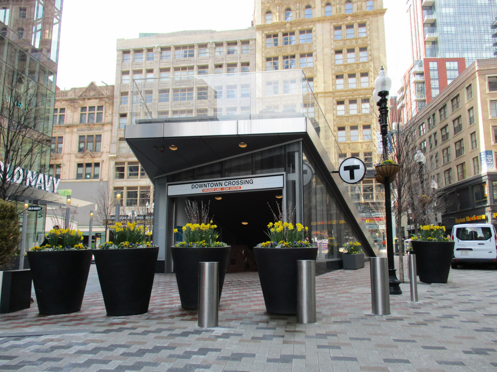
The station has three secondary entrance/exit structures; two of these are integrated head houses. One portal is built into the existing Macy’s (historically, the Jordan Marsh Building) fronting Washington Street. Another is built into the multistory commercial building located opposite the Filene’s Building, on the other side of Washington Street. The third secondary entrance/exit structure is a stand-alone head house—but an unusual one. The 2016 redevelopment of the Filene’s Building included an addition of a multistory contemporary luxury living tower designed by Handel Architects, which resulted in the removal of the original head house, although its portal remained. Höweler and Yoon designed a new, multi-use head house to signal and shelter the subway entrance/exit, and its “roof” doubles as a stepped platform or stadium stair (amphitheater) for pedestrians to sit, rest, and watch the spectacle of the busy commercial corridor.
All of the Downtown Crossing entrances feature several flights of stairs to reach the underground platforms. Colored subway tiles, in addition to the standardized wayfinding graphics and signage, are helpful visual cues in this station, which provides both Red Line and Orange Line service. Inbound and outbound platforms are separated by the respective rails and an arcade wall. On either side, granite seats are installed along the tiled walls in recesses, which feature Lewis “Buster” Simpson’s Situations.
As one of few stations opened in the first extension (or the second phase) of the Boston subway, Downtown Crossing set a precedent of site-specific approach to station design, rather than a systemwide architectural identity. More than a century later, the integration of the subway station into the very fabric of the neighborhood persists, arguable evidence of its success.
References
Boston Landmarks Commission. The Filene’s Complex: Study Report. Boston: City of Boston, 2006.
Cheney, Frank. Boston’s Red Line: Bridging the Charles from Alewife to Braintree. Charleston, SC: Arcadia Publishing, 2002.
Cheney, Frank, and Anthony M. Sammarco. Trolleys Under the Hub. Dover, NH: Arcadia Publishing, 1997.
Cudahy, Brian J. Change at Park Street Under: The Story of Boston’s Subways. Brattleboro, VT: Stephen Greene Press, 1976.
“Downtown Crossing Plaza | Höweler + Yoon.” Höweler + Yoon. Last modified 2015. Accessed February 8, 2018. http://www.howeleryoon.com/.
“Filene’s Department Store Adaptive Reuse.” Architect, March 23, 2016.
“Filene’s Department Store Adaptive Reuse – Handel Architects.” Handel Architects. Accessed February 18, 2018. https://handelarchitects.com/.
Massachusetts Highway Commission. Annual Report – Massachusetts Bay Transportation Authority 1987. Boston: Massachusetts Highway Commission, 1987.
Massachusetts Bay Transportation Authority. “On the Red Line.” Massachusetts Bay Transportation Authority. Accessed November 1, 2018.
Most, Doug. The Race Underground. New York: St. Martin’s Press, 2014.
O’Connell, James. The Hub’s Metropolis: Greater Boston’s Development from Railroad Suburbs to Smart Growth. Cambridge: MIT Press, 2013.
Writing Credits
If SAH Archipedia has been useful to you, please consider supporting it.
SAH Archipedia tells the story of the United States through its buildings, landscapes, and cities. This freely available resource empowers the public with authoritative knowledge that deepens their understanding and appreciation of the built environment. But the Society of Architectural Historians, which created SAH Archipedia with University of Virginia Press, needs your support to maintain the high-caliber research, writing, photography, cartography, editing, design, and programming that make SAH Archipedia a trusted online resource available to all who value the history of place, heritage tourism, and learning.