


The coastal town of Beaufort is a remarkable example of a gridded town plan—initially laid out by Richard Graves circa 1713—along the Intracoastal Waterway. North Carolina’s third oldest town contains an ensemble of well-preserved buildings within a distinctly coastal townscape.
Beaufort is located adjacent to Morehead City and is part of a larger region now known as the Crystal Coast. It lies just south and east of the Outer Banks. The town was established in this location because it offered easy access to the Atlantic Ocean via Beaufort Inlet but it was protected by the barrier islands of Shackleford Banks and Bogue Banks. For centuries, the town has supported commercial fishing and boatbuilding industries as well as tourism, the primary economic driver in the most recent decades.
Graves’s early-eighteenth-century town plan included twelve blocks oriented to the southwest, toward an adjacent waterway now known as Taylor Creek. The rectangular grid has long blocks stretching southwest to northeast and slightly shorter blocks running northwest to southeast. The grid’s original limits were marked by Front Street and the creek to the southwest, Broad Street to the northeast, a small bay to the northwest, and Pollock Street to the southeast.
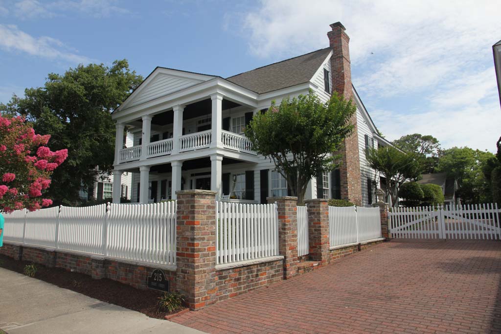
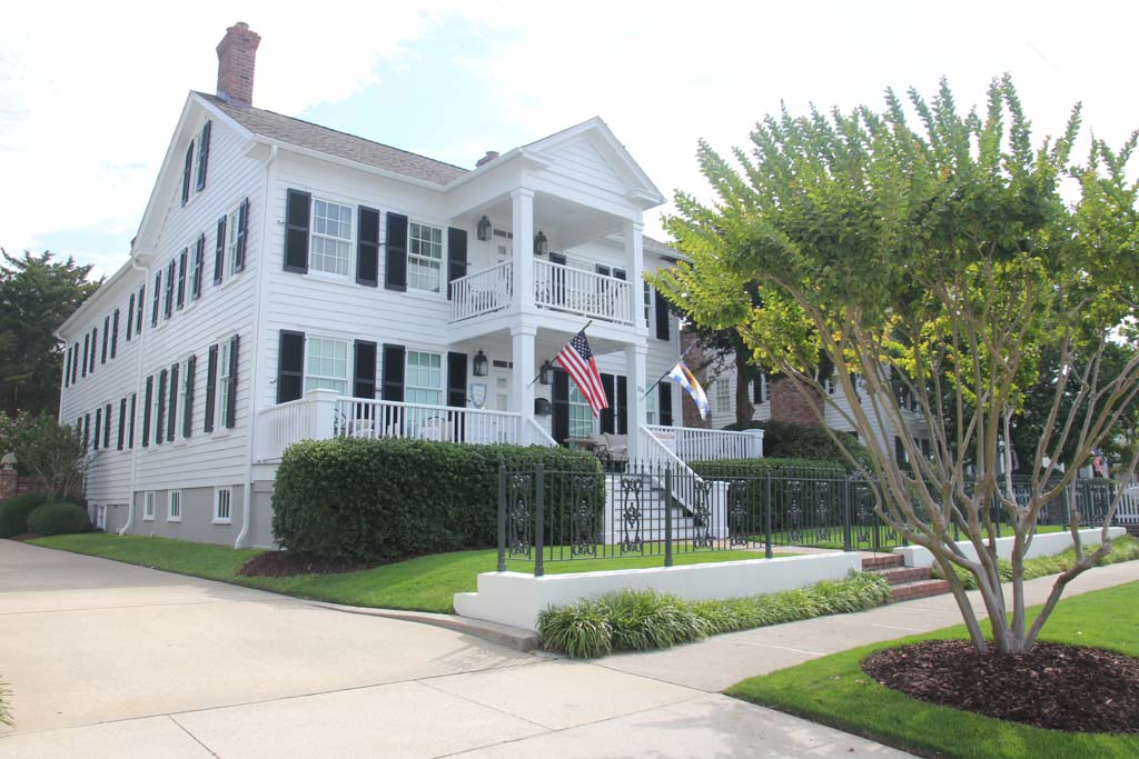
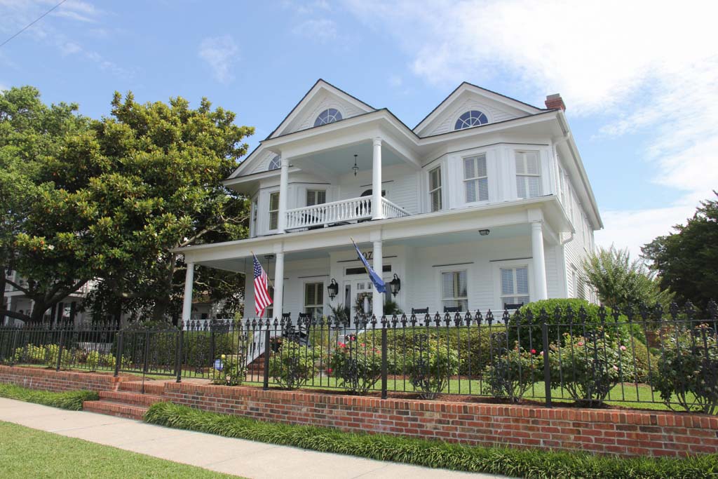
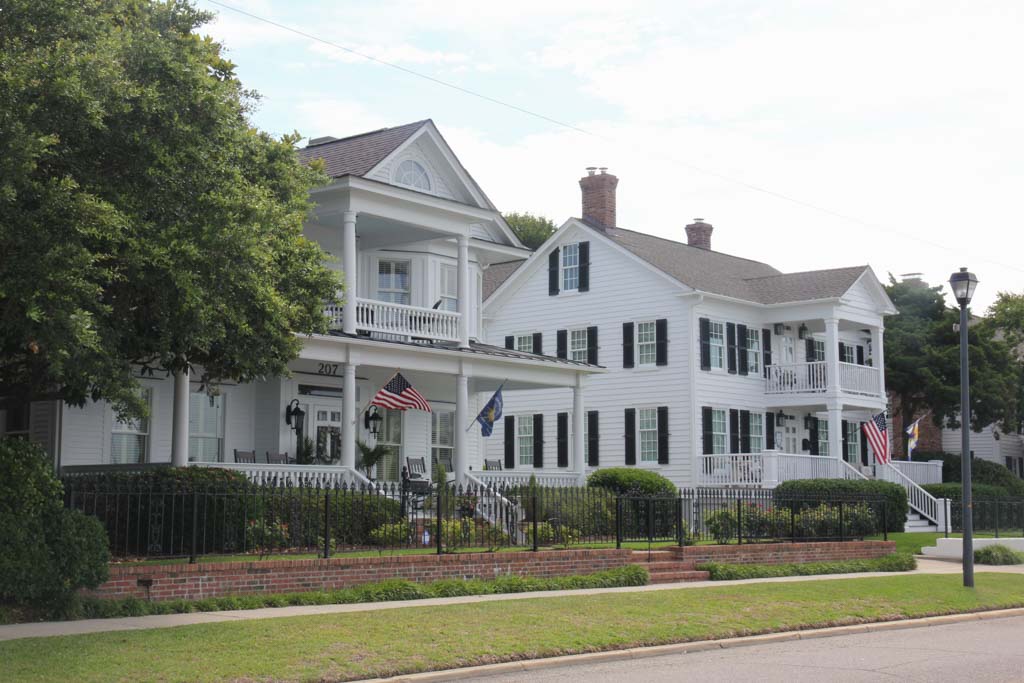
This original townsite is largely residential, primarily composed of one- to two-story white-painted houses with steeply sloped gable rooflines, masonry chimneys, and porches. The tree-lined streets and sidewalks provide shade in this hot, humid climate. While some houses date to the eighteenth century, the majority are from the nineteenth. The wood-framed dwellings—many of which were crafted by shipwrights—illustrate a variety of styles including Gothic Revival, Greek Revival, Craftsman, and American Foursquare.
The most remarkable houses line the north side of Front Street and face the harbor and Taylor Creek to the south. Many of these houses are Queen Anne in style, built after the Civil War, with double-level porches that offer a breezy extension of the house’s interior spaces. The colonnaded porches were often called piazzas, and they give the streetscape a rhythm and cohesion in spite of the various architectural styles. Primary examples include the Sloo House (1768), the Bordon House (1768), the Easton House (1771), and the Morse House (1771). Notable nineteenth-century houses that illustrate Victorian influences are located throughout the historic district: the Josiah Bell House (1825) and John Manson House (1825) on Turner Street; the Leecraft House (1857) on Ann Street; and the Joel Henry Davis House (1837) on Craven Street.
While Beaufort is most notable for its residential architecture, there are also several important churches and public sites. Ann Street Methodist Church (1854) is a Carpenter Gothic structure with pointed-arch windows, stained glass, and handsome wood details inside and out. The Old Burying Ground adjacent to the church contains graves dating from the early 1700s. Purvis Chapel (1820), also detailed with white-painted wood siding and pointed-arch windows, sits on the northeast corner of the cemetery.
A small commercial district with one- and two-story buildings exists on Front Street between Orange and Queen streets. Except for a Neoclassical bank building on the corner of Front and Turner streets, these buildings are not architecturally remarkable, but they provide a modestly scaled area of commerce that does not overwhelm the surrounding houses. Boat docks to the south of Front Street extend into Taylor Creek.
Subsequent development through the centuries has extended the original town grid several more blocks to the northeast and southeast. The 1974 inclusion of the Beaufort Historic District on the National Register of Historic Places incorporates within its boundaries Graves’s twelve-block grid but also extends six blocks to the northwest, seven to the southeast, and several hundred feet into the surrounding waterways in order to protect the harbor and maintain views from Front Street. The town has enacted strict buildings codes within the historic district to maintain the character of the place.
The Beaufort Historic District is easy to navigate by car, but the town’s small scale, tree-lined streets, and numerous historic sites make it convenient for pedestrians and bikers.
References
Beaufort Historical Association. “About.” Beaufort Historic Site. Accessed February 3, 2019. http://www.beauforthistoricsite.org/.
“Old Beaufort Jail,” Carteret County, North Carolina Historic American Buildings Survey, n.d. Prints and Photographs Division, Library of Congress (HABS NC,16-BEAUF,8-).
“Beaufort Historic District,” Carteret County, North Carolina. National Register of Historic Places Inventory–Nomination Form, 1974. National Park Service, U.S. Department of the Interior, Washington, D.C.