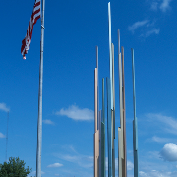
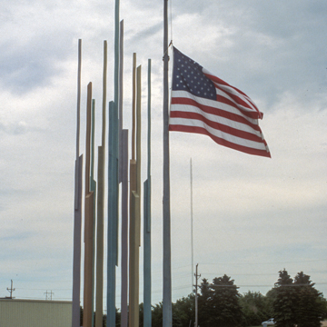
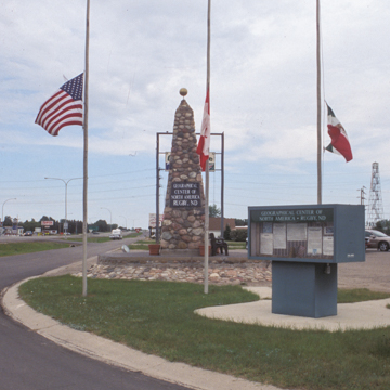
Based on a 1931 U.S. Geological Survey, Rugby was designated the geographical center of North America and the town has several monuments commemorating this status. The monuments include an eighty-eight-foot-tall steel installation (1999) painted in different colors to represent the Northern Lights, and a mural in the U.S. Post Office (PI5). The third and most long-standing feature is the stone cairn (1932) surrounded by flagpoles and with kiosks explaining the claim. The cairn is a pyramid in shape, resting on a heart-shaped foundation. It was built across the highway, just to the northwest of its present location, and constructed by W. B. and E. B. Paterson with assistance from local Boy Scouts and other young men in the community. In 1955, work was done to beautify the area around the cairn monument with a rock garden, information board, and three new flagpoles representing each of the countries making up North America (Canada, United States, and Mexico). The monument remained at that location until 1971, when improvements to U.S. 2 necessitated relocation of the monument to its present location.
You are here
Geographical Center of North America Site Monuments
If SAH Archipedia has been useful to you, please consider supporting it.
SAH Archipedia tells the story of the United States through its buildings, landscapes, and cities. This freely available resource empowers the public with authoritative knowledge that deepens their understanding and appreciation of the built environment. But the Society of Architectural Historians, which created SAH Archipedia with University of Virginia Press, needs your support to maintain the high-caliber research, writing, photography, cartography, editing, design, and programming that make SAH Archipedia a trusted online resource available to all who value the history of place, heritage tourism, and learning.


