


Fort Atkinson was the first United States Army post to be established west of the Missouri River in the region encompassed by the Louisiana Purchase and it played a significant role in the settlement of the American West. Located on the eastern edge of the small town of Fort Calhoun, eight miles north of Omaha, the site is on a bluff overlooking the Missouri River Valley.
In 1804, a year after the acquisition of the Louisiana Territory, the Lewis and Clark Expedition briefly occupied the site to host the first council between United States representatives and American Indian chiefs from several western tribes. Following the War of 1812, John C. Calhoun, Secretary of War under President James Monroe, was anxious to secure control of the new Northwest Territories. In 1819, Colonel Henry Atkinson led the Yellowstone Expedition to identify locations and establish military posts up the Missouri River. These forts were to support the American fur trade and river traffic, foster relations with indigenous populations, counteract British influence on the northern plains, and set the stage for the anticipated migration of settlers. New orders from Washington forced the expedition to curtail its efforts at the base of Council Bluff, a low-lying site near the present Fort Atkinson. A harsh winter, insufficient supplies, and high water from the Missouri River flooded the camp and forced the soldiers to relocate to higher ground atop Council Bluff in the following spring of 1820. Originally, the fort was to be named Fort Calhoun in honor of the Secretary of War, but Washington ordered that its first commander, Colonel Atkinson, receive the honor.
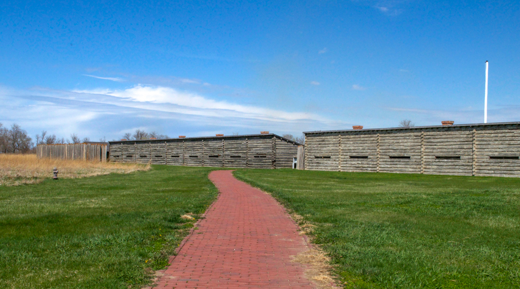
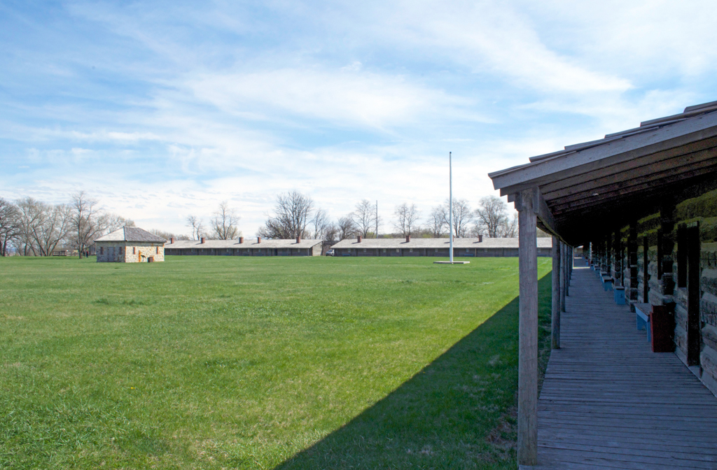
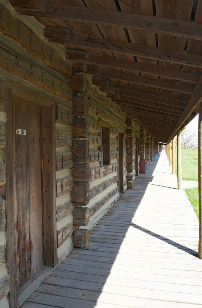
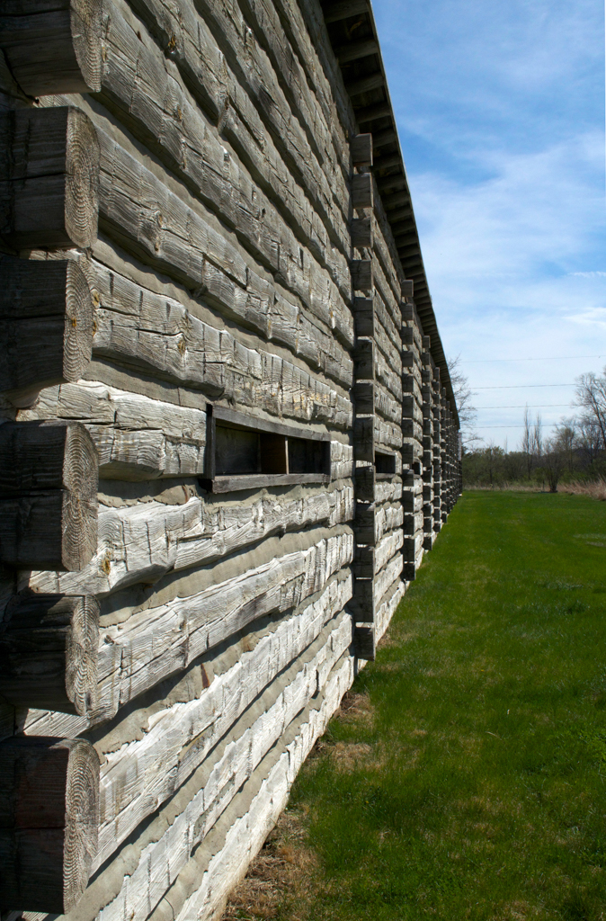
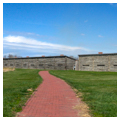
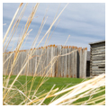
During the next several years, the construction of the fort proceeded rapidly. The most distinctive feature was the barracks quadrangle constructed of logs with cannons mounted on bastions at the northwest and southeast corners. Each side of the quadrangle consisted of two segments, each of which was 250 feet long and contained 10 rooms facing inward upon the enclosed parade ground. Each room had a long, narrow gun slit on the exterior wall. The barracks were covered with shed roofs that sloped to the interior of the quadrangle. Gates at the center of the north, south, and west walls of the quadrangle provided access to the parade ground that contained a massive powder magazine at the center.
A number of buildings were erected outside the fortification, many of log construction, including the council house for meetings with tribal representatives, armorer’s shop, sutler’s store, gristmill, sawmill, schoolhouse, storehouses, a brick kiln, and various outbuildings and residences. Buildings located on the riverbank below the fort included a bakery, blacksmith shop, and housing for non-military personnel. Hundreds of acres of adjacent land were farmed and thousands of bushels of grain were harvested. For much of its existence, Fort Atkinson was the only town in early Nebraska and the largest United States military installation in the West. At its peak, it hosted a population of over 1,000 military personnel and many civilian workers.
For nearly eight years Fort Atkinson was an outpost in the remote wilderness and performed its role as a pacifying presence in the forefront of anticipated settlement. However, as U.S. interests were directed further westward and the fur trade no longer required oversight, maintaining Fort Atkinson as a military post was no longer necessary. In 1827 Fort Atkinson was abandoned and its personnel were reassigned to other locations. When European-American settlement of the area began in the mid-1850s virtually nothing remained of the fort. In 1855 the town of Fort Calhoun was platted to the immediate west of the original fort whose grounds soon became farmland.
During the next century, occasional sparks of interest in preserving the location arose but nothing materialized until 1956 when the Nebraska State Historical Society undertook archaeological investigations and excavations unearthed foundations and a wealth of artifacts beneath the croplands. This work continued for the next 30 years. The Nebraska Game and Parks Commission acquired the site in 1971 and during the 1980s and 1990s the commission reconstructed much of the fort based upon historical records and extensive archaeological evidence. Rooms in the reconstructed barracks were fitted out to represent everyday living conditions in the early nineteenth century. Other rebuilt structures included the carpenter, blacksmith, and armorer’s shops, the council house, sutler’s store, and powder magazine. Today the fort is a National Historic Landmark and a State Historical Park with a tourist center and an array of interpretive programs.
References
Flint, Kenneth C. Images of American: Fort Atkinson. Charleston, SC: Arcadia Publishing, 2011.
Fort Atkinson, Nebraska, Archival Collection. Nebraska State Historical Society, Lincoln, NE.
Friends of Fort Atkinson and the Fort Atkinson Foundation.
“Fort Atkinson.” Fort Atkinson State Historical Park. Accessed September 6, 2016. http://www.fortatkinsononline.org/#/fort-atkinson.