

Engle Dam
You are here
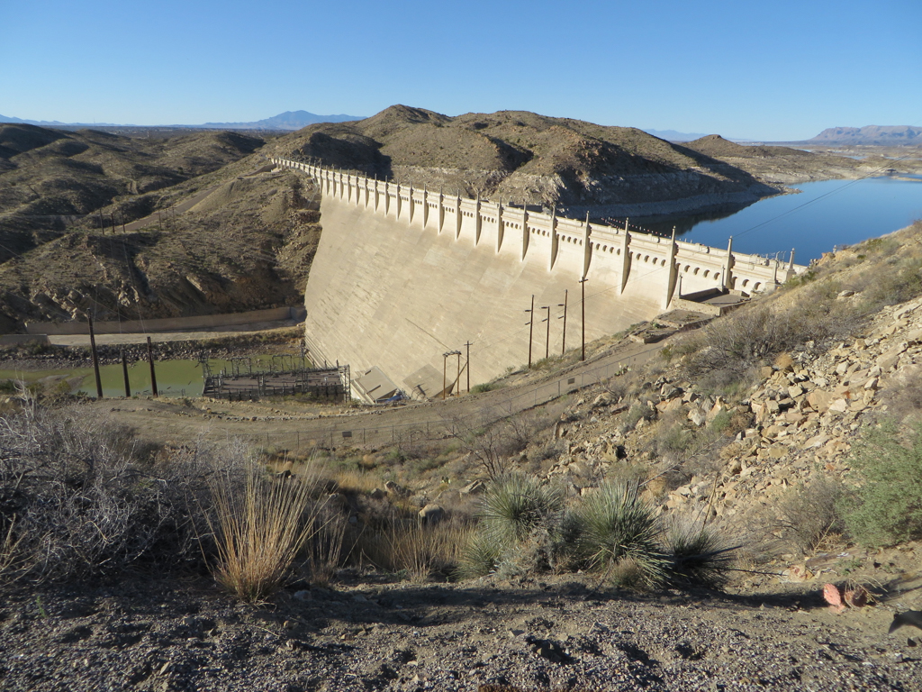
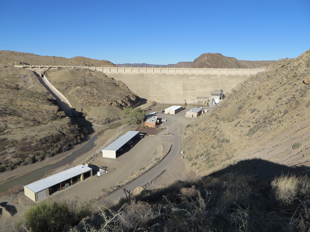
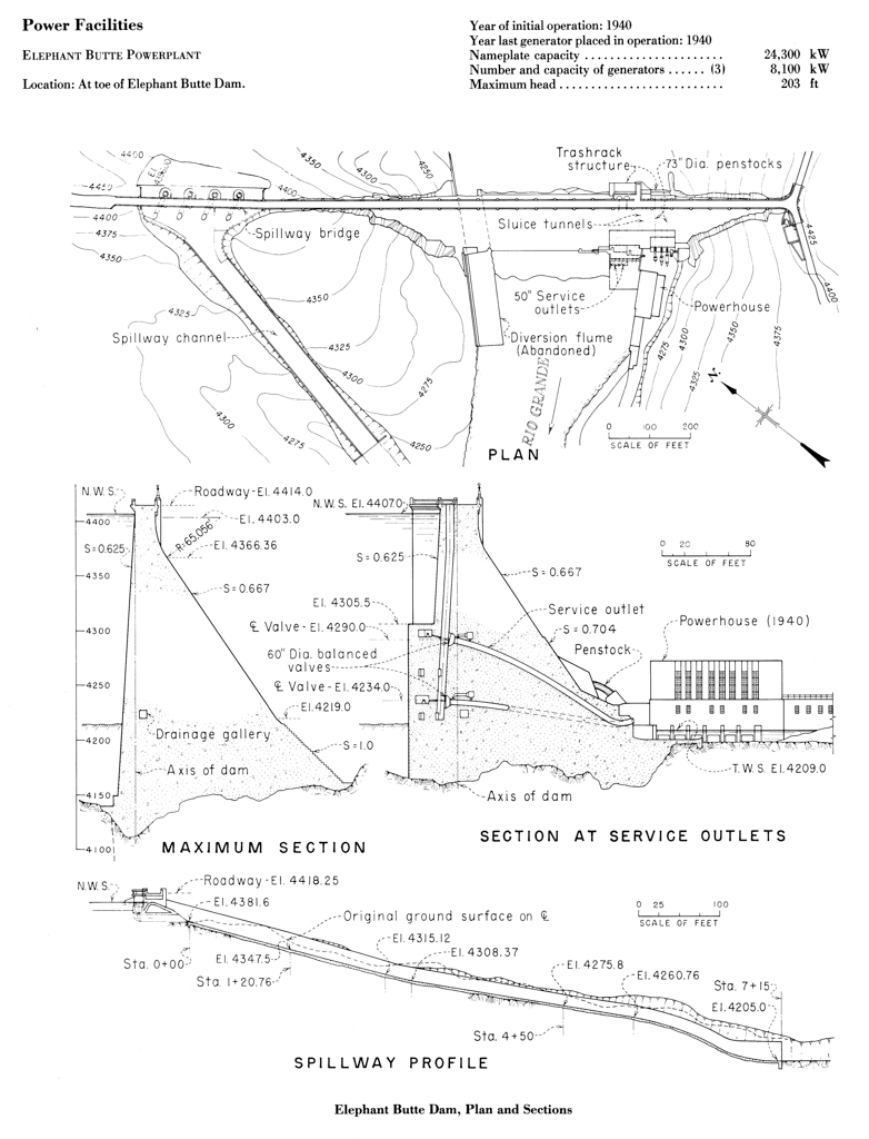
Elephant Butte Dam


1912–1916, U. S. Reclamation Service; 1921 spillway channel; 1940 power plant; 1944 service outlet deflectors; 1947 spillway channel modified. Four miles east of Truth or Consequences on NM 51.
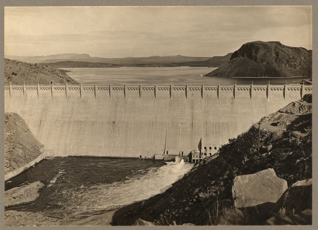
Elephant Butte Dam is an early demonstration of how the American West was transformed in the twentieth century by gigantic works of engineering designed to make natural conditions of geology, geography, and climate yield to the political dictates of water management, economic calculation, power generation, and international borders.
Completed in 1916, Elephant Butte Dam was built to control the unpredictable flow of the Rio Grande and provide a reliable source of water for agriculture in the Rio Grande Valley. It also engaged the complicated issue of water rights in the American Southwest, and set a historic precedent because it necessitated a treaty with Mexico, thus becoming the first dam to impound water under international jurisdiction. Elephant Butte Dam created one of the largest reservoirs in the world, and with the addition of a power plant in 1940, it became the first hydroelectric dam in New Mexico.
The Rio Grande is the main stem of the most important watershed in New Mexico. Originating in the San Juan Mountains of Colorado, it flows through the middle of New Mexico, passing into Texas just north of El Paso, and continuing along the boundary between Mexico and Texas to the Gulf of Mexico. The river has supported agriculture in the region for many centuries, but with the influx of Euro-American settlers, the demands upon its water dramatically increased. Compounding the problem, the river’s volume varies significantly year to year; by the 1890s, El Paso was beginning to see periods when the riverbed completely dried up.
In 1897, the Rio Grande Dam and Irrigation Company proposed the construction of a dam near Hot Springs (now Truth or Consequences) in the New Mexico Territory. Mexico challenged the proposal, arguing that it would divert an excessive quantity of water, and the U.S. Government supported Mexico’s case. Efforts to control the Rio Grande were renewed in 1902 with the passage of the Reclamation Act. This landmark piece of legislation for large-scale irrigation projects in the western U.S. created the Reclamation Service (now the Bureau of Reclamation). Surveying the Rio Grande the following year, the Reclamation Service reported favorably on the proposed dam site, noting, “About a half a mile above this site is an ancient volcanic remnant rising from the east bank to a height of about 500 feet. This remnant is called Elephant Butte because of its resemblance to an elephant’s head.”
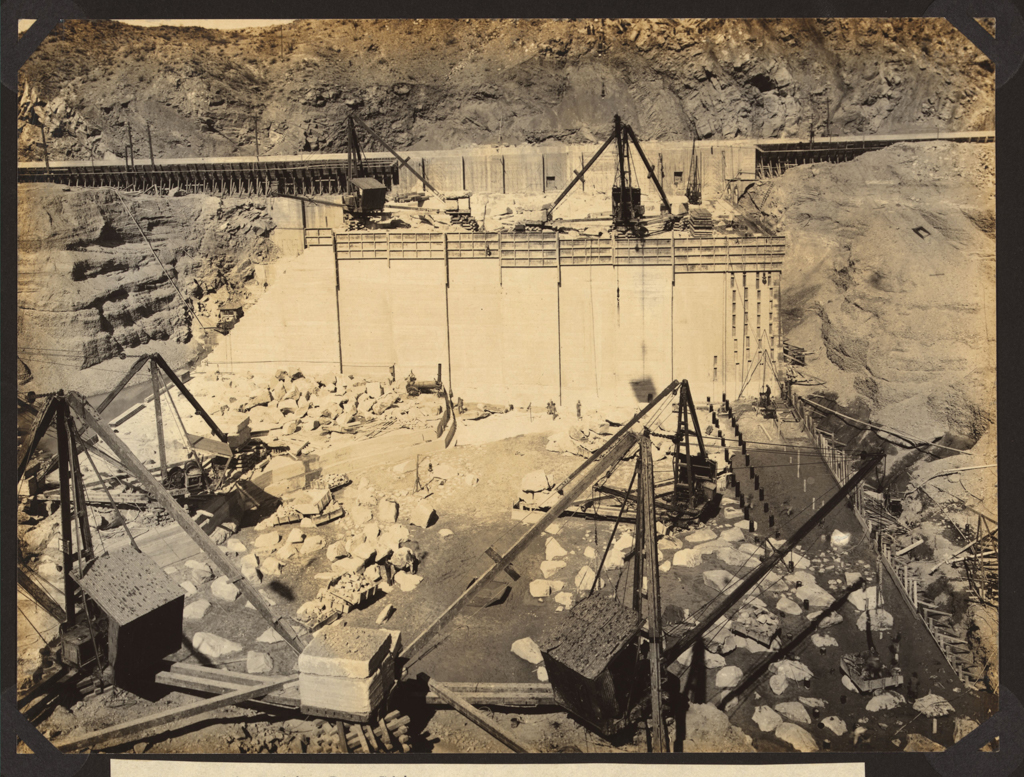
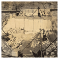
In 1905, Congress approved the construction of a dam at Elephant Butte and the Secretary of Interior authorized the Rio Grande Project, a comprehensive program to build the infrastructure for irrigation in the Rio Grande Valley. Elephant Butte Dam was the centerpiece of the plan, but its construction was delayed until the Rio Grande Project Water Provision Treaty, acknowledging Mexico’s claim to the river, was signed with Mexico in 1906. Congress approved $1 million for the dam’s construction in 1907, but the owners of the land were reluctant to sell until the federal government initiated condemnation proceedings and obtained the land in 1911. Construction finally began in 1912.
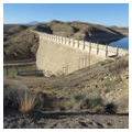
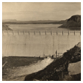
Elephant Butte Dam is built from blocks of cyclopean concrete, with large rocks called plumstones that weigh up to 8 tons and are embedded in wet concrete during construction. The blocks were cast in a staggered pattern to prevent movement as the concrete dried and generated heat. Contraction joints were engineered into the dam; in the bottom two-thirds of the structure, the joints are placed at intervals of 80-100 feet apart, while in the top third, the joints are spaced at intervals of 35-57 feet. The dam’s south side rises from its base at an incline of 55 degrees. Towards the top, it curves upward and becomes perpendicular to the ground. The uppermost section merges into ornamental buttresses that support lampposts and are connected by an arcaded corbel table called a Lombard band.
The dam was first employed to store water in 1915. The following year, the structure attained its final dimensions, and towers 301 feet with a maximum width of 228 feet. The total cost of the dam was just above $5.2 million. At the time of its completion, the Elephant Butte Reservoir was one of the largest in the world, with a surface area of 36,897 acres and a total capacity of over 2.1 million acre-feet.
The dam’s architecture suggests two complementary metaphors. The Neo-Romanesque ornament brings to mind the walls of medieval cathedrals, in a simultaneous reference to the inspiring dimensions and the promised permanence of the dam’s structure. The inclusion of a roadway lined with lampposts (which resemble ceremonial sentry figures) across the top of the dam turns Elephant Butte into a bridge and anticipates the more famous Hoover Dam. The roadway allowed the public to cross the structure and directly experience a marvel of modern engineering.
Designated a National Historic Civil Engineering Landmark, Elephant Butte Dam is also listed on the National Register of Historic Places, along with both the Elephant Butte Irrigation District, which has 217 contributing features, and the Elephant Butte Historic District, which identifies the recreation facilities constructed near Elephant Butte Dam during the New Deal.
The dam can be viewed from Highway 51, but the bridge across the dam is closed.
References
Autobee, Robert. Rio Grande Project. Washington, D.C.: U.S. Department of the Interior, Bureau of Reclamation, 1994.
Berlow, Lawrence H. The Reference Guide to Famous Engineering Landmarks of the World: Bridges, Tunnels, Dams, Roads, and Other Structures. Phoenix, AZ: Oryx Press, 1998.
Billington, David P., Donald C. Jackson, and Martin V. Melosi. The History of Large Federal Dams: Planning, Design, and Construction. Denver: U.S. Department of the Interior, Bureau of Reclamation, 2005. Accessed May 2, 2014. http://www.cr.nps.gov/history/online_books/dams/federal_dams.pdf.
Eisenhart, Henry Ashby. “The History of Elephant Butte Dam, Lake, and State Park.” PhD dissertation, University of New Mexico, 1979.
Rae, Steve, and T. Lindsay Baker. Elephant Butte Reservoir, Elephant Butte, Sierra County, New Mexico, HAER NM-20: Written Historical and Descriptive Data; Field Records.Washington, D.C.: U.S. Department of the Interior, National Park Service, Historic American Engineering Record, [after 1968].
Schodek, Daniel. Landmarks in American Civil Engineering. Cambridge: MIT Press, 1987.
U.S. Department of the Interior, Bureau of Reclamation, Southwest Region. Rio Grande Project; New Mexico: Dona Ana, Sierra, and Socorro Counties; Texas: El Paso County. Washington, D.C.: U.S. Government Printing Office, 1982.
U.S. Department of the Interior, National Park Service. “Elephant Butte Dam and Spillway.” Accessed April 28, 2014. http://www.nps.gov/.
Writing Credits
Coordinator:
Christopher Mead
Regina N. Emmer
If SAH Archipedia has been useful to you, please consider supporting it.
SAH Archipedia tells the story of the United States through its buildings, landscapes, and cities. This freely available resource empowers the public with authoritative knowledge that deepens their understanding and appreciation of the built environment. But the Society of Architectural Historians, which created SAH Archipedia with University of Virginia Press, needs your support to maintain the high-caliber research, writing, photography, cartography, editing, design, and programming that make SAH Archipedia a trusted online resource available to all who value the history of place, heritage tourism, and learning.