


Las Trampas (“The Traps”) is a traditional agricultural community that has been continuously occupied since the Spanish Colonial period.
Located at 7,200 feet in the Sangre de Cristo Mountains between Santa Fe and Taos, the village occupies a relatively flat and fertile valley where mountain rivers provide fresh water and south-facing fields capture sunlight. Santo Tomás Apóstol del Río de las Trampas (The Apostle Thomas of the River of Traps), soon shortened to Las Trampas, was established in 1751 with a communal land grant of 46,000 acres ordered by the provincial governor Tomás Vélez Cachupín. It is one of several small farming communities founded in northern New Mexico in the eighteenth century, when New Spain was trying to extend its control of this provincial frontier. Given to twelve families under the leadership of Juan de Arquello, a former soldier of the presidio in Santa Fe, the grant distributed individual parcels to each family on which to build a house and grow crops while allocating a large portion of the land to be held in common by the community.
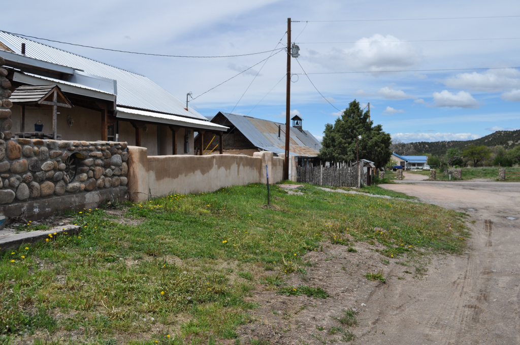
The village followed the model of the Spanish Colonial fortified settlements built in response to the Apache, Navajo, and Comanche raids that complicated life for settlers until at least the end of the eighteenth century. As can still be seen at Chimayo, one-story houses without windows or doors—built of adobe with flat roofs of vigas, latillas, and earth—were clustered around a rectangular plaza to form an outer defensive wall.
At first, the parishioners of Las Trampas were obliged to worship at the mission of Picuris Pueblo, nine miles to the north. When the threat of Indian attacks made this journey increasingly dangerous, the village petitioned to have their own church and, in 1760, Bishop Tamarón of Durango granted permission to construct the parish church dedicated to the “Lord Saint Joseph of Grace and… Most Holy Mary Immaculate.” The villagers built San José de Gracia themselves, using locally made adobe bricks and timbers harvested from the surrounding forests. Standing on the north side of the fortified plaza, it is one of the best extant examples of an eighteenth-century Spanish Colonial church; with the adjacent morada or chapterhouse of the Brothers of Our Father Jesus of Nazarene, it now forms the only surviving portion of the original settlement
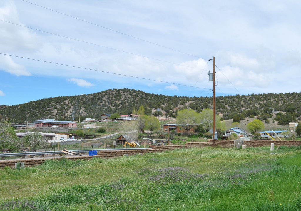
From the start, Las Trampas has been a self-sustaining agricultural community. Initially, the fields for cultivating wheat, beans, peas, squash, pumpkins, and lettuce extended directly out from the fortified plaza, so that the settlers could quickly retreat to safety in case of attack. As the threats diminished, particularly after the governor Juan Bautista de Anza concluded a treaty with the Comanches in 1786, the community began to spread outward. By the early nineteenth century, Las Trampas was assuming its present cordillera pattern, with separate houses run along the northern edge of the valley and fields extending south in long rectangular lots. These are irrigated by hand-dug irrigation ditches called acequias, which run east-west across the long lots and use the natural gravity of water from mountain streams.
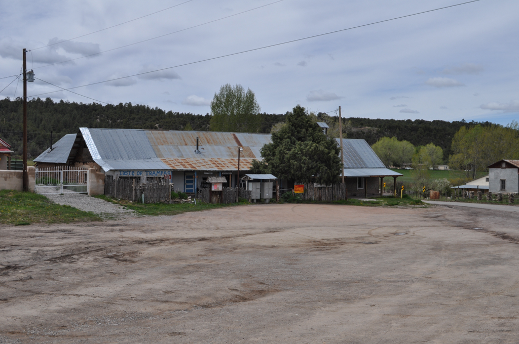
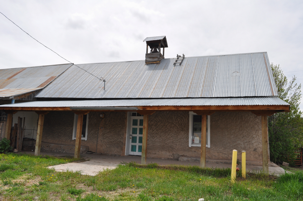
After the Santa Fe Trail opened in 1821, wheat and game became sources of local income and trade. By 1870, the village population reached its height at 323 residents and acquired its present form. As manufactured goods became available, small general merchandise stores opened on the south side of the plaza. Adobe remained the primary building material through the nineteenth century, but the arrival of the railroad in Española Valley in 1880 introduced milled lumber and metal roofs along with Territorial Style adaptations of the Greek Revival, which led to the addition of pitched roofs along with pedimented doors and window frames to the houses. The Max Ilfeld Mercantile Company, later converted for use as a schoolhouse, speaks to these economic and material changes with its pitched metal roof and small belfry.
The twentieth century brought a series of challenges for Las Trampas. In 1926, the United States Forest Service took the common lands of the original grant as part of Carson National Forest, with the result that only 210 acres of the original 46,000 acres still belong to the village. During the Great Depression in the 1930s, the population of Las Trampas declined as many entered the service or left in search of employment. In 1966, the New Mexico State Highway Department proposed demolishing the western half of the plaza and coming within 6 feet of the church in order to build a state highway. A group of preservationists from Santa Fe intervened, secured a National Landmark designation for the village, and got the State Highway Department to build a narrower and less destructive road. The village exists to this day, continuing to rely on subsistence farming and retaining the traditions and sense of community that have defined it since the eighteenth century.
References
Boyd, E., “San José de Gracia Church,” Taos County, New Mexico. New Mexico State Register of Cultural Properties Application for Registration Form, 1971. New Mexico Historic Preservation Division, Santa Fe, NM.
Greenwood, Richard and Cecil McKithan, “Las Trampas,” Taos County, New Mexico. New Mexico State Register of Cultural Properties Application for Registration Form, 1982. New Mexico Historic Preservation Division, Santa Fe, NM.
Kubler, George. The Religious Architecture of New Mexico: In the Colonial Period and Since the American Occupation. Colorado Springs, CO: Taylor Museum, 1940.
Treib, Marc. Sanctuaries of Spanish New Mexico. Berkeley: University of California Press, 1993.
Wilson, Chris, and Stefanos Polyzoides. The Plazas of New Mexico. San Antonio, TX: Trinity University Press, 2011.