Washington was among the earliest states to establish a system of scenic highways, and Chuckanut Drive was one of its first. Located in the northwestern corner of the state, the narrow, winding road was carved from Chuckanut Mountain 200 feet above sea level. In 1916, a party from the Automobile Club of Seattle drove the new road, which had a speed limit of 20 miles per hour and was 20 feet wide at the narrowest points. The club’s secretary published a log of the trip in a Seattle newspaper, providing detailed directions. The log was essential because the road, full of “chuckholes,” was not yet marked. The round trip from Seattle took two days and entailed an overnight stay in Bellingham. Another 1916 newspaper account noted passengers’ “exclamations of delight” at the sight of “islands that lay like so many gems set in the azure sea.”
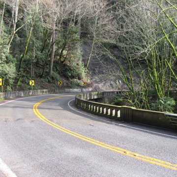
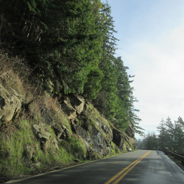
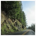
Chuckanut Drive, today well marked and significantly improved, connects Skagit and Whatcom counties as an alternative to I-5. The southern portion of the byway, designated as Route 11, begins at Exit 231 near Burlington and runs for 21 miles, entering Bellingham to the north at Exit 250 in the Fairhaven Historic District. The route passes through flat farmland in Skagit Valley for roughly three miles, offering sights of historic barns and farm buildings and a relatively straight right-of-way. As the road continues northward, it takes sharp turns and features steep drop-offs to the west. This portion of the drive provides breathtaking views of Samish and Chuckanut bays as well as the San Juan Islands.
The mountainside road has a lengthy history dating back to the 1860s. The early Old Blanchard Road followed the route of the current Chuckanut Drive, but was rutted, rough, and sometimes blocked by high tides. The Great Northern Railway bought the right of way and discontinued that road. In 1896, a primitive road was built through a joint appropriation by the state of Washington and Skagit County. The state legislature funded improvements in 1905, the same year the state’s highway department was established, but only a few miles were completed. Funding was a challenge at this time because few state residents owned automobiles or cared to pay for roads, so dirt roads were still the norm outside of towns and cities. Washington was nevertheless a leader in the Good Roads Movement and one of the early states to form a highway department. Locally, two philanthropic Bellingham entrepreneurs, Charles X. Larrabee and Cyrus Gates, completed a 1907 survey and lobbied the state legislature for more funds for what would eventually become Chuckanut Drive.
The slow progress of the road was accompanied by criticism of the “bungling” new highway department. The department hired convict crews in 1910, but they only finished 5.5 miles of road. Construction on the mountainside was difficult because workers had to cut stone away from the ledges while preventing it from falling on the Great Northern Railroad tracks along the shoreline below (rail tracks still run parallel to Chuckanut Drive today). Mudslides often blocked the road or washed it away, leaving gaps that had to be bridged with timber.
The road received state funding in 1913 when it was designated as part of Pacific Highway, intended to link Vancouver, British Columbia, with San Francisco, California. Chuckanut Drive was declared a scenic byway in 1931, when U.S. Highway 99 established the inland route that became the predecessor to I-5 (which did not reach Bellingham until the 1960s).
Over several years the narrow dirt and gravel road was widened and improved. The early guardrails shown on historic postcards were heavy wooden fences with stone guards. The original bridges spanning Oyster Creek were made of wood, but concrete bridges replaced them in 1925. The road began to be paved and widened in 1919, but was not fully paved until 1930. Not until 1958 was the entire road was paved in asphalt.
Chuckanut Drive was popular immediately after it opened for public use. In 1915, Charles Larrabee donated land to create the first state park at the northern edge of the road; today, the road provides access to the park. Photographs from early in the twentieth century show women wearing long skirts standing with their bicycles on the dirt road. During the late 1920s and 1930s, a specially designed motorized omnibus with observation windows offered rides for tourists. Chuckanut Drive was also known for its stills during Prohibition and was used as a route for moonshine smugglers.
Over the years, several notable Washington architects designed residences nestled into the hills above the drive. Most notable among these might be the AIA-honored, flat-roofed Marshall Forrest House, typifying the regional Northwest Modernism of the Bassetti and Morse firm. Other features of interest along the drive are broadcast journalist Edward R. Murrow’s family house; oyster beds tended by a family shellfish farm; an oyster bar that dates to the 1920s; and the Inspiration Point overlook at Cyrus Gates’s historic Woodstock Farm (now a city park).
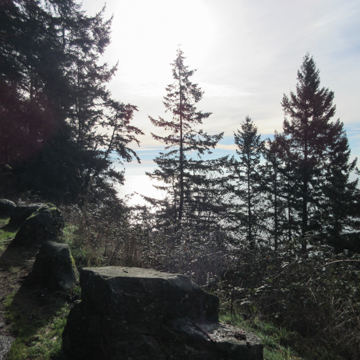
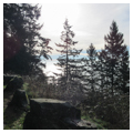
A century after the first automobile tourists marveled at the striking vistas, the road still provides fantastic views of stone outcroppings along Chuckanut Mountain and of the shimmering bays punctuated by stately Douglas firs and madrone trees. The Olympic Mountains serve as a backdrop to the scenic drama along the northwestern edge of the continental United States.
References
“Boundary Tour Log Completed.” Seattle Daily Times(Seattle, WA), August 13, 1916.
Dorpat, Paul, and Genevieve McCoy. Building Washington: A History of Washington State Public Works. Seattle: Tartu Publications, 1998.
Dougherty, Phil. “Chuckanut Drive Opens in the Spring of 1916.” Essay 9855. HistoryLink.org: The Free Online Encyclopedia of Washington State History, June 20, 2011. Accessed on December 16, 2014. www.historylink.org.
“New Road in North Finished.” Seattle Daily Times (Seattle, WA) .May 28, 1916.
Thomas, Robert B. Chuckanut Chronicles.1971. Reprint, Bellingham, WA: Chuckanut Community and Firefighters Association, 1992.
Whatcom Council of Governments. Chuckanut Drive: State Route II Corridor Management Plan. 2nd ed. Whatcom County, WA: December 18, 2003.

