You are here
Lake Guernsey State Park
Lake Guernsey State Park is an 8,600-acre recreation area located in southeastern Wyoming near the town of Guernsey in Platte County. The park is noted for its rustic buildings and structures, historic roads, extensive hiking trails, and recreational facilities, all constructed by the Civilian Conservation Corps (CCC) between 1935 and 1939.
Construction of the Guernsey Dam on the North Platte River created Lake Guernsey in 1927. The reservoir was one of many built by the U.S. Bureau of Reclamation for crop irrigation and power production starting in the early 1900s. The National Park Service (NPS) later collaborated with the Bureau of Reclamation to develop recreation areas around these reservoirs. Lake Guernsey State Park, one of the best examples of these collaborations nationwide, became a showplace of state park design in Wyoming and beyond. In addition to the features mentioned above, the CCC built facilities for swimming, camping, fishing, boating, and a nine-hole golf course (now abandoned).
As part of Franklin D. Roosevelt’s New Deal, NPS landscape architects, in cooperation with local park authorities, designed hundreds of state and local parks, most of which were developed with CCC labor. The parks generally followed master planning guidelines developed for national parks and monuments by landscape architect Thomas Chalmers Vint and his colleagues prior to 1933. The design of park buildings was likewise influenced by the NPS, especially architect Albert Good’s Park and Recreation Structures (1938), which laid out the basic requirements of its preferred Rustic architecture. Architect Herbert Maier, who designed museums and other park buildings in Yellowstone and other national parks, also influenced the design of the buildings through his role as a regional director of the CCC. Maier sent his regional inspector to Lake Guernsey to meet with the project architects and show them the portfolios of standard designs and photographs.
With a few minor exceptions, the park remains the same as that planned by NPS landscape architects Richard G. Redell and C. Eldon Jones in 1934–1935. The original park drives, picnic and overlook shelters, water fountains, trails, and even some original wooden signs have been well preserved. The reservoir itself is situated in the hills of the Hartville Uplift, a geological formation that forms a transition between the high plains to the east and the foothills of the Rocky Mountains to the west. Two major roads, Lake Shore Drive (1939) and Skyline Drive (1936), were designed to access key facilities and viewpoints along the lake, while minimizing the intrusion of automobiles as much as possible. A central developed area, with the Guernsey Museum as its center, is located near the park entrance, away from the campers, picnickers, and swimmers. The park includes an extensive system of hiking trails accessing the steep terrain, with stone steps, ramps, and other trail features built by CCC workers. The park roads, parking areas, and overlooks are likewise constructed with masonry retaining walls and guard rails. Of the two original CCC camps in the park, one remains well preserved as a site, although most of the buildings have been removed.
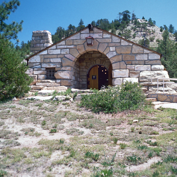
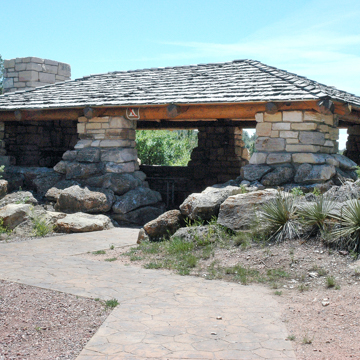
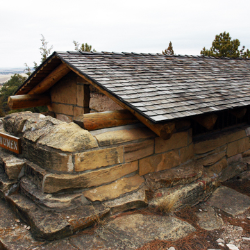
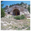
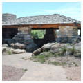
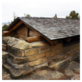
As specified by the park master plan, the structures in Lake Guernsey State Park are uniformly Rustic in style and share common materials and workmanship. They are typical products of the New Deal—labor-intensive structures built with locally acquired and processed materials, in this case local sandstone. They have random-coursed, load-bearing walls and thick, deeply scored masonry joints. Roofs are framed with heavy timbers or peeled logs, and clad with split shakes.
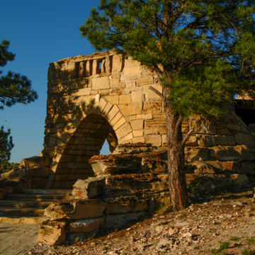
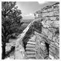
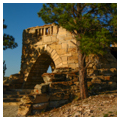
The major building in the park is the Guernsey Museum, designed by architects Roland G. Pray and E. S. Mosher and completed in 1939. In addition to the museum, the park contains numerous stone picnic shelters and overlooks, the most elaborate and famous of which is “The Castle,” located at the termination of Skyline Drive. The 50 x 34–foot sandstone structure features a square tower and circular staircase that give the impression of a medieval fortification. The upper level contains an observation platform. A log and frame roof covers the central portion and stone bulwarks at either end of the structure rise above the roofline. The interior has a stone fireplace and picnic tables.
The nearby comfort station was described by Regional Inspector Kenneth Jones as the most extraordinary NPS latrine he had ever seen. Nicknamed the “Million Dollar Biffey” (1936), the rectangular building has walls of battered, massive blocks of sandstone, and a gable roof. Other buildings and structures of note at Lake Guernsey State Park include bridges, roadside parking areas, spur roads, stone drinking fountains, barbeque pits, and administration and service buildings. Predating the park are the Guernsey Dam and Power Plant. There have been few major alterations to the park since construction ended in 1939.
In 1939, the original lands acquired by the Bureau of Reclamation as part of the North Platte River Project were supplemented by about 1,900 acres acquired through the “submarginal land” acquisition program of the Federal Emergency Relief Administration. The site officially became a state park in 1957, when the Bureau of Reclamation entered into a cooperative agreement with the Wyoming Department of Commerce. In 1980, Lake Guernsey State Park was one of the first CCC–era state parks to be recognized for its architectural significance and placed on the National Register of Historic Places. It was designated a National Historic Landmark District in 1997.
References
Begley, Susan, and Ethan Carr, “Lake Guernsey State Park” Platte County, Wyoming. National Historic Landmark Nomination, 1997. National Park Service, U.S. Department of the Interior, Washington, D.C.
Junge, Mark, “Guernsey Lake Park,” Platte County, Wyoming. National Register of Historic Places Inventory–Nomination Form, 1980. National Park Service, U.S. Department of the Interior, Washington, D.C.
Writing Credits
If SAH Archipedia has been useful to you, please consider supporting it.
SAH Archipedia tells the story of the United States through its buildings, landscapes, and cities. This freely available resource empowers the public with authoritative knowledge that deepens their understanding and appreciation of the built environment. But the Society of Architectural Historians, which created SAH Archipedia with University of Virginia Press, needs your support to maintain the high-caliber research, writing, photography, cartography, editing, design, and programming that make SAH Archipedia a trusted online resource available to all who value the history of place, heritage tourism, and learning.


