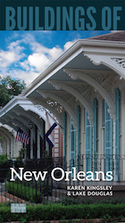
This suburb of New Orleans experienced phenomenal growth in the mid-twentieth century, although the area was rural throughout most of its earlier history. Because of the swampy nature of the soil, the remnants of the alluvial Metairie Ridge became the locus of the town’s early development. Metairie Road now traverses this ridge, overlying what was once a Native American footpath. The name Metairie is believed to derive from the French word métairie, which designated a type of small farm operated on the basis of métayage, whereby the farm’s products were split evenly between tenant and landowner. An electric streetcar line from downtown New Orleans to the suburb in 1915 encouraged a construction boom in the 1920s and 1930s. This included development of an exclusive residential area promoted as Metryclub Gardens, now known as Old Metairie. While many of the original houses remain, others began to be replaced in the 1990s, with large houses in historically derived styles and more crowded together, diluting the neighborhood’s original garden-like character.
In the second half of the twentieth century, expansion farther west and toward Lake Pontchartrain became possible after the completion of effective drainage systems and the lakefront levee system, the latter in 1948. Nevertheless, at approximately six feet below sea level, the area flooded following Hurricane Katrina in large part because the pumping system backed up; the area generally has recovered. The construction of the Lake Pontchartrain Causeway (1956, Ford, Bacon and Davis), followed by a second span in 1969, contributed to Metairie’s growth, spawning an undistinguished row of boxlike high-rise office buildings on Causeway Boulevard near the lake. By the 1980s, Veterans Memorial Boulevard, a multilane divided thoroughfare, offered approximately four miles of strip commercial development with accompanying parking areas, catering to and fostering the appetite for shopping via automobile.
Writing Credits
If SAH Archipedia has been useful to you, please consider supporting it.
SAH Archipedia tells the story of the United States through its buildings, landscapes, and cities. This freely available resource empowers the public with authoritative knowledge that deepens their understanding and appreciation of the built environment. But the Society of Architectural Historians, which created SAH Archipedia with University of Virginia Press, needs your support to maintain the high-caliber research, writing, photography, cartography, editing, design, and programming that make SAH Archipedia a trusted online resource available to all who value the history of place, heritage tourism, and learning.

