

Calumet and Hecla Mine Location
You are here
Calumet Unit, Keweenaw National Historical Park (Calumet and Hecla Mine Location)


1864–present. Bounded approximately by Rockland, Millionaire, 11th, and Spruce sts., U.S. 41, Osceola Rd., and Calumet Lake

Under the direction of Alexander Agassiz (1835–1910), Swiss-born, Harvard-educated scientist and son of world-famous geologist Louis Agassiz, the Calumet and the Hecla mining companies merged in 1871 into the Calumet and Hecla Mining Company (C&H). The original companies had organized in 1864 and in 1866, respectively, to work one of the richest copper deposits in the world. Using the financial backing of Quincy Adams Shaw and other Boston investors, along with his own managerial skills and technical knowledge, Agassiz made C&H the dominant mining company in the Copper Range. In the 1870s it mined 50 percent of the nation's copper. Copper Mining in Calumet, painted by Joe Lasker in 1941 and displayed over the postmaster's door in the U.S. Post Office at 201 6th Street, depicts this activity.
A roundhouse, warehouses, a machine shop, a blacksmith shop, a gear house, pattern shops, and other surface buildings now stand idle along either side of a line of mine shafts that once straddled the Hecla and Torch Lake Railroad. They represent the company's period of greatest growth between 1880 and 1910. Most were designed by Erasmus Darwin Leavitt, a machinery designer, together with other company engineers, and were built of mine waste rock, brick, and red Lake Superior sandstone rubble.
Hoping to stabilize the workforce as a group of family men and to improve employee efficiency, health, and morality, C&H provided the largest and most extensive programs for workers of all the companies in the Copper Country. By 1914 the company had invested nearly $1 million in twelve hundred houses for miners and their families, built an armory and ten schools (including Calumet High and Manual Training School on Calumet Avenue, 1905–1907, Charlton and Kuenzli), donated land for a YMCA, constructed and equipped a hospital and a thirty-five-thousand-volume library, built a bathhouse for residents, and subsidized thirty local church groups.
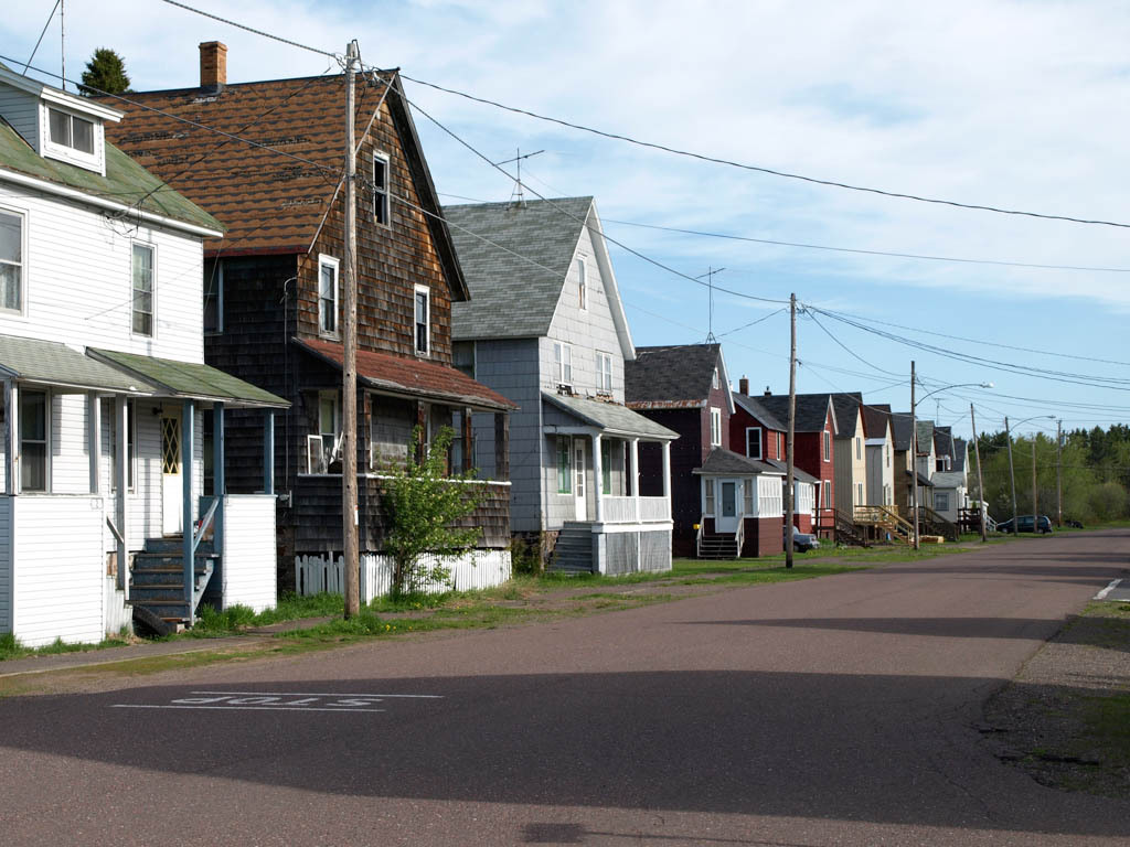
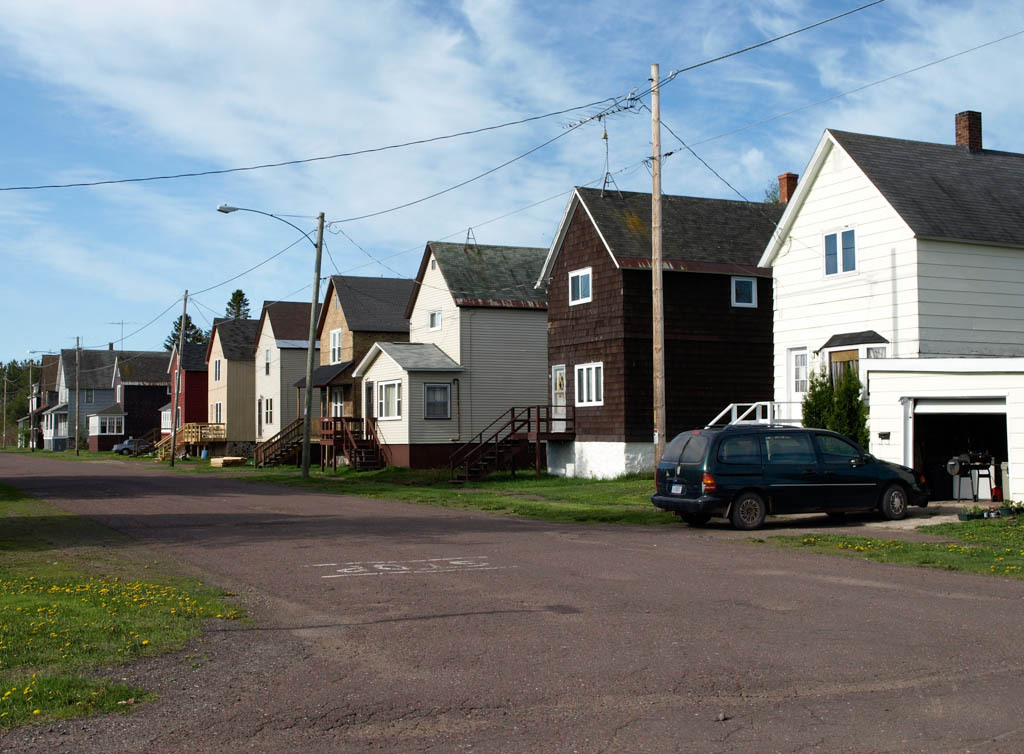
At the locations and villages that grew up around the C&H mine shafts—Blue Jacket, Yellow Jacket, Raymbaultown, Tamarack, and others—the company built rental houses for its employees. Most common were the single- and double-family houses built between 1870 and 1910. They are end-gable, two-and-a-half-story clapboarded or shingled houses on raised mine waste rock foundations. The houses took as well the forms of the saltbox, gambrel roofed, side gabled, and gabled ell. Behind most houses, a large garden allowed the families to grow vegetables and fruits. The houses were sold in the 1930s and 1940s to private individuals, who adapted them for continued use. In the winter, occupants connected the houses' entrances to the street by systems of planks on sawhorses known as “Calumet snow walks.” The social and economic differentiation of Calumet residents is best seen by comparing the simple miners' houses near St. Mary's Church (1896–1897; Portland Street between 9th and 10th streets) with the more elaborate dwellings of merchants and professionals along 8th Street, and with those of supervisory personnel along Calumet Avenue.
Writing Credits
×
Data
-
Location: Calumet Township, MichiganRegional Overviews:Architect:no metadata availableStyles:no metadata availableSubentries:Keweenaw National Historical Park Headquarters (Calumet and Hecla Mining Company General Office Building), St. Paul the Apostle Church (St. Joseph Church), Keweenaw History Center (Calumet and Hecla Public Library), Fifth and Sixth Streets, Vertin Gallery (Vertin Brothers Department Store), Edward Ryan Block, Bernard Shute's Bar (Marco Curto's Saloon), Calumet Village Hall and Calumet Theater (Red Jacket Town Hall and Opera House), Upper Peninsula Firefighters Memorial Museum (Red Jacket Fire Station), Keweenaw Heritage Center (Ste. Anne's Roman Catholic Church)
What's Nearby
Citation
Kathryn Bishop Eckert, "Calumet Unit, Keweenaw National Historical Park (Calumet and Hecla Mine Location)", [Calumet Township, Michigan], SAH Archipedia, eds. Gabrielle Esperdy and Karen Kingsley, Charlottesville: UVaP, 2012—, http://sah-archipedia.org/buildings/MI-01-HO17.
Print Source
Buildings of Michigan, Kathryn Bishop Eckert. Charlottesville: University of Virginia Press, 2012, 482-483.
If SAH Archipedia has been useful to you, please consider supporting it.
SAH Archipedia tells the story of the United States through its buildings, landscapes, and cities. This freely available resource empowers the public with authoritative knowledge that deepens their understanding and appreciation of the built environment. But the Society of Architectural Historians, which created SAH Archipedia with University of Virginia Press, needs your support to maintain the high-caliber research, writing, photography, cartography, editing, design, and programming that make SAH Archipedia a trusted online resource available to all who value the history of place, heritage tourism, and learning.