


White River State Park is a 250-acre park along the White River in the west side of downtown Indianapolis. Its grounds include a number of historic, cultural, and natural attractions.
The National Road, completed in 1830, originally ran east-west through the present-day park along Washington Street, the city’s primary thoroughfare. A two-lane covered bridge was built to cross the river at this point but was later replaced in 1916 by the Washington Street Bridge, which features seven spans of closed-spandrel arches, concrete and steel construction, and Indiana limestone pavers. It initially served both vehicles and pedestrians but was converted to pedestrian-only use in 1994.
Nearby, on the eastern side of the river, the Central Canal was developed in 1836, planned as a trade route for commercial shipping. The Indianapolis Water Works Pumphouse opened in 1870, providing pressurized and potable water to be used throughout the city for fire protection and drinking water. Now referred to as the Historic Pumphouse, the Italianate one-story brick structure with a slate roof and copper facing elements originally featured an L-shaped plan (later altered in 1930). It was sold to the Indianapolis Water Company in 1881, and larger hydraulic turbines and water pumps were added in 1908.
Adjacent to the historic canal in the northeast corner of the grounds is Military Ground (now Military Park), which was the site of Indiana’s first state fair in 1852 and subsequent fairs until 1860. To serve this purpose, stalls and exhibition halls were built on the 14-acre site. During the Civil War, the grounds were used as an encampment known as Camp Sullivan. The area was modestly improved in the postwar years with the addition of a pavilion (still extant) and fountain and small pool.
After the 1950s, the waterfront began to experience severe disinvestment, and in 1969, the Indianapolis Water Company closed the Historic Pumphouse. In 1971, the Central Canal was designated an American Water Landmark by the American Water Association. Due to the increased interest in the waterfront and the Canal, the Pumphouse and its surrounding property was donated to the city as a historic site in 1976. In 1979, the Indiana General Assembly appointed the ten-member White River Park Development Commission, later the White River State Park Development Commission, to provide Indianapolis with a new urban park funded by a mix of public and private financial investments. Two donations from the Krannert Charitable Trust and the Indianapolis Water Company provided the most significant property acquisitions, and the White River Commission agreed to fund the planning and site development expenses. The original master plans for the park were prepared by HNTB Corporation with landscape architecture firms Danadjieva and Koenig Associates, Sasaki Associates, and the Indianapolis-based Landstory. Work began in January 1981.
The 1980s and 1990s saw significant growth in the development of White River State Park. Improvements to the landscape of Military Park began in 1980. On the opposite end of White River State Park, in the southeast corner on the western riverbank, the 64-acre Indianapolis Zoo opened in 1988. Organized around five biomes, the zoo eventually expanded to include an aquarium and a 3-acre botanical garden and observatory later known as the White River Gardens. In 1989, the Eiteljorg Museum of American Indians and Western Art opened just south of the Central Canal and Military Park, along West Street. Designed by Browning Day Mullins Deardorf, the 74,000-square-foot structure of veined Minnesota dolomite and German sandstone accents evokes the collection contained inside, with massing and color similar adobe architecture but at a massive scale.
In 1996 a new minor league baseball stadium, Victory Field, was added to the park complex at the southwest corner. The construction of this stadium, designed by HOK Sport (now Populous) contributed to the ongoing revitalization of downtown Indianapolis. The state’s first and largest IMAX Theater also opened later that year. In 1999, the Congressional Medal of Honor Memorial (ROAMworks), located on the north bank of the Central Canal and adjacent to Military Park, was dedicated. The memorial consists of 27 glass panels set in concrete bases, accented by varying shades of Indiana limestone; a lighting system illuminates certain panels to correspond to a brief audio presentation. Along the east side of the river, the NCAA Hall of Champions and National Federation of State High School Association Headquarters, relocated from Kansas City, opened their new facilities. The brick postmodern structure was designed by Michael Graves with Schmidt Associates.
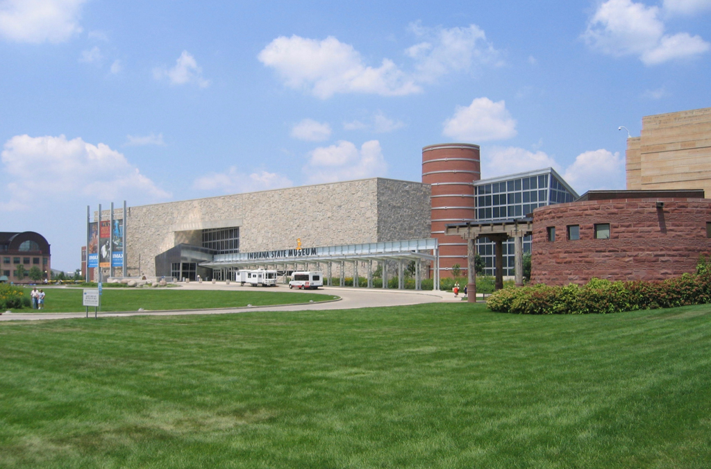
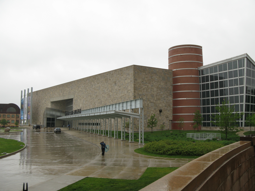
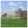
The new Indiana State Museum (RATIO Architects), which had been in the works since the late 1970s, opened in the park in 2002, moved from its previous location in the former Indianapolis City Hall on Alabama Street. Located on the south bank of the Central Canal, and adjacent to the IMAX Theater, the museum is constructed of limestone, sandstone, steel, brick, and glass, and features icons representing each of Indiana’s 92 counties integrated into its exterior walls.
The most important year of development for the park was 2003, when efforts to connect all of the park’s attractions using infrastructure and designed greenspaces were completed. On the site of the former Beveridge Paper Company (demolished in 2000), south of the canal, improvements included the Farm Bureau Insurance Lawn, which hosts an outdoor concert series; a bandstand on the riverbank; a children’s play maze; and the Oval, a recreational open lawn surrounded by tulip and oak trees. To welcome visitors to the park, a new tree-lined drive and the Dr. Frank P. Lloyd Sr. Visitor’s Center (designed by Craig McCormick of Blackline Studio) were built. Other twenty-first-century additions to the park complex include a stadium and additional athletic facilities along the northern border, west of Military Park.
From 2005 to the present, the park facilities have undergone several significant alterations. The Eiteljorg Museum of American Indians and Western Art completed a 47,000-square-foot expansion in 2005, doubling its size. Other expansions include the Indianapolis Zoo in 2006–2007, with the addition of several new exhibits, as well as the enlargement of the Lawn in 2007 and 2010 to accommodate a total of 8,000 guests. In 2009, a partnership with Urban Earth Indy (Now Growing Places Indy) and Big City Farms initiated a 6,000-square-foot organic and urban food garden, which functions as a working urban farm and educational site. In 2014, the Indianapolis Zoo expanded its facilities even more, adding the Simon Skjodt International Orangutan Center, the first LEED-certified building within the park.
In 2008–2011, the construction of a $450 million, 7-acre Marriott hotel and restaurant complex at the park entrance signal the success of the efforts to revitalize downtown Indianapolis. White River State Park is now the largest of six designated cultural districts in the Indianapolis area.
References
“History.” White River State Park. Accessed June 11, 2016. https://www.whiteriverstatepark.org/.
“White River State Park Development Commission Agency Overview.” White River State Park Development Commission. Accessed June 11, 2016. http://www.in.gov/sba/files/ABR_2011-2013_310_WRPC_Transmittal.pdf.