


The eight-mile Indianapolis Cultural Trail is a multi-modal urban trail that connects downtown Indianapolis with surrounding cultural and historic districts and regional greenways and bicycle routes. The trail was built within the public right-of-way, in most cases replacing one lane of automobile traffic within the city’s unusually wide streets.
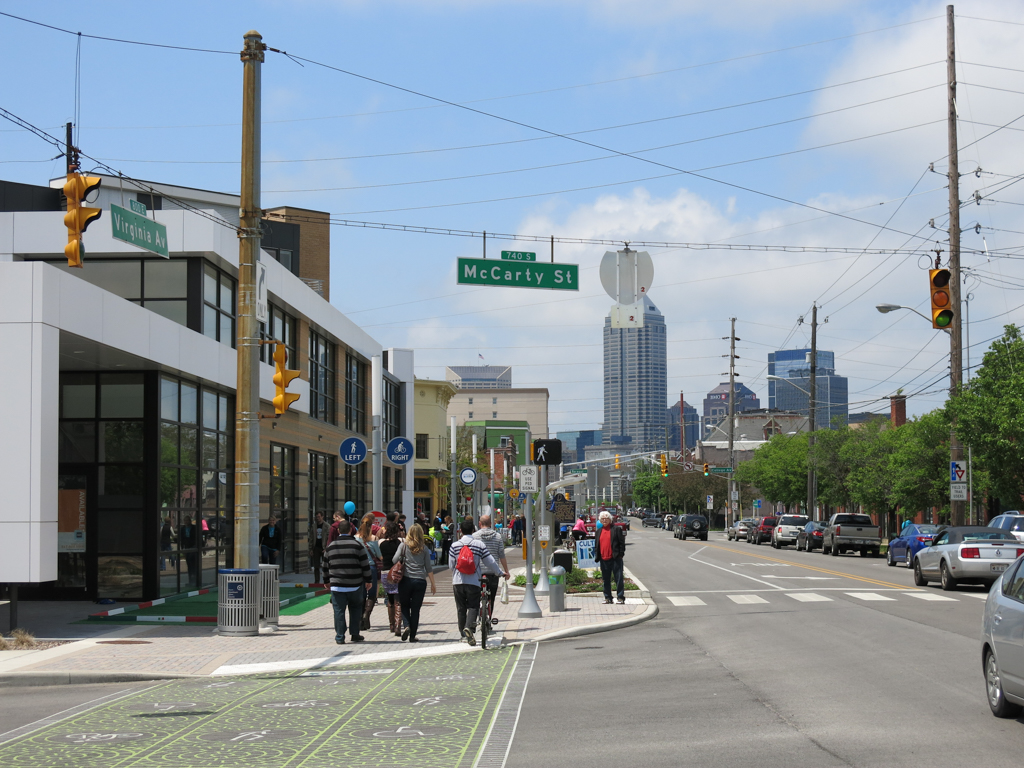
The Cultural Trail connects Indianapolis’s major downtown public spaces, reinforcing the primacy of the broad main street and the three greenspaces laid out in Alexander Ralston’s 1821 plan for the new city. Along Washington Street, the historic National Road, the trail connects the Marion County Courthouse Square, the south gateway to Monument Circle, and the Indiana State House Square (the three public spaces of Ralston’s plan), while continuing through White River State Park, where it meets the White River Greenway and historic Military Park along the Indiana Central Canal. It loops back through the Indiana World War Memorial Plaza and passes historic City Market before returning to Washington Street. An extension along Capitol Avenue connects the Indiana Convention Center and Lucas Oil Stadium with the pedestrian promenade (2012, RATIO Architects) on Georgia Street, connecting through the Wholesale District to Banker’s Life Fieldhouse. The branch along Virginia Avenue connects to the eponymous public space of Fountain Square, where it links to the Pleasant Run Greenway. The branch up Massachusetts Avenue connects to the Monon Trail and on to Broad Ripple Village.
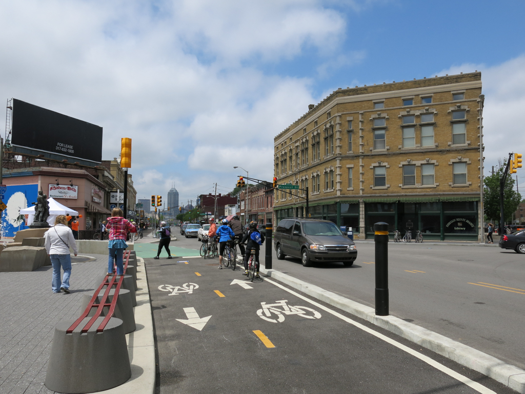
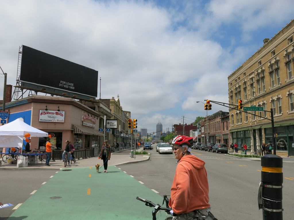
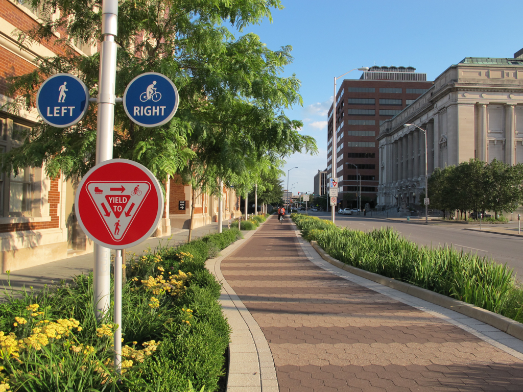
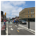
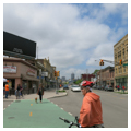
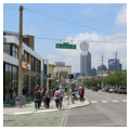
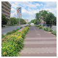
Along the busiest stretches, the Cultural Trail includes dedicated two-way bicycle paths and a separate pedestrian path. Other stretches include two-way mixed pedestrian and bicycle paths. The bicycle and combined paths are paved with hexagonal concrete pavers in two tones of reddish brown, forming integral traffic markings in the pavement. Dedicated pedestrian paths are paved with concrete pavers reminiscent of blue-green slate. Approaches to crosswalks are paved with a contrasting paving material for visual and tactile cues to slow and stop and crosswalks themselves are marked by thermoplastic imprints that help all users of the road to understand their right of way.
Pedestrian-scale lighting, interpretive signage, and public art were incorporated into the trail, including the Glick Peace Walk, which highlights 12 individuals who made peaceful contributions to humanity. Key sections of the trail include rain gardens that capture and filter stormwater runoff from the trail and adjacent streets, diverting approximately four million gallons of stormwater per year. Areas associated with the trail that are planted with a mix of native and adapted vegetation and ornamental flowers have created more than five acres of new greenspace within the existing right-of-way.
Few precedents for an urban trail system existed in the United States in the early 2000s. The design team worked with the Project for Public Spaces to consult designers from cities like Copenhagen, Paris, and Bogota, where similar systems had been developed. The trail was designed as a system and was built in phases between 2007 and 2012, with the first phase opening in 2008. At the time of its formal opening in 2013, the Cultural Trail was cited as being among the most significant urban public space investments in the United States in recent history, comparable to New York’s High Line and Chicago’s Millennium Park.
The project received wide public support as residents and business owners understood the quality-of-life and economic benefits the Cultural Trail could realize. The $63 million budget included $15.5 million of federal transportation funding, $26.5 million in private and corporate donations, and a $20.5 million Transportation Investment Generating Economic Recovery (TIGER) grant. Fundraising for the project included the creation of a $6 million maintenance endowment to cover maintenance of the trail and landscape as well as snow removal.
The opening of the Cultural Trail rapidly increased the revitalization of the Fletcher Place, Holy Rosary, and Fountain Square historic districts, while furthering ongoing revitalization in the Massachusetts Avenue, Wholesale District, and Chatham Arch historic districts and the Cottage Home and Ransom Place conservation districts. Private development contiguous to the trail between 2008 and 2014 exceeded $300 million and economic benefits from private investment along the trail upon its opening in 2013 to 2016 were estimated at $863 million. The trail is used by bicyclists and pedestrians for commuting and recreation alike, and businesses along the trail route have seen an increase in customers and revenue, resulting in extended hours of operation and the creation of approximately 90 new jobs. The construction of the Cultural Trail sparked continued revitalization of historic urban neighborhoods and a boom of mixed-use infill development on vacant parcels along its route, contributing to the addition of thousands of new downtown housing units. In 2014, the Cultural Trail launched the Pacers Bike Share system along the trail route and throughout downtown Indianapolis. During its first two years of operation, the bike share exceeded ridership expectations.
The Cultural Trail helped to reconnect Indianapolis’s downtown and surrounding neighborhoods that had previously been cut off from one another by post–World War II trends that included the construction of freeways, the reconfiguration of urban streets as one-way automobile thoroughfares, and the drastic reduction in mass transit service. Reconnecting these neighborhoods helped to reduce residents’ automobile dependence while creating a system of linear parks offering a safe and attractive route between various parts of the city.
The Cultural Trail is a major investment in civic space for all citizens of Indianapolis. As a placemaking and economic development project, the design and construction of the trail is comparable to earlier generations’ development of Monument Circle (1888–1902), the Indianapolis Park and Boulevard System (1907–1928, George E. Kessler and Lawrence Sheridan), the Indiana World War Memorial Plaza (1921–1950, Walker and Weeks), White River State Park (1979–2004), and the 1985–2001 reconstruction of the Indiana Central Canal (1836–1839) as the Canal Walk. This carefully designed piece of contemporary infrastructure fits sensitively within the existing urban fabric, reflecting contemporary thinking on urban design interventions. The development of the trail highlighted the historic and architectural character of Indianapolis’s neighborhoods, drawing new life and attention to the city’s cultural heritage while reinforcing and enriching its contemporary culture.
References
“Bold Moves and Brave Actions.” Project for Public Spaces. Accessed October 13, 2016, http://www.pps.org/.
Comiskey, Daniel S. “Brian Payne’s Next Big Idea.” Indianapolis Monthly,July 2016. http://www.indianapolismonthly.com/arts-culture/brian-paynes-next-big-idea/
“Indianapolis Cultural Trail: Improving Livability in Central Indiana.” Sustainable Communities, June 2013.
Indiana University Public Policy Institute. Assessment of the Impact of the Indianapolis Cultural Trail: A Legacy of Gene and Marilyn Glick.Indianapolis: Indiana University School of Public and Environmental Affairs, 2015.
Litt, Steven. “The new Indianapolis Cultural Trail is a masterpiece of bike-friendly design Cleveland should emulate.” The Plain Dealer(Cleveland), May 18, 2013.
“Making the Journey a Destination: Indianapolis’ Cultural Trail Debuts.” Project for Public Spaces. Accessed October 13, 2016. http://www.pps.org/.
Simmons, Andrew. “In Indianapolis, a Bike Path to Progress.” New York Times, March 4, 2014.
“The biggest bicycling infrastructure achievement in North America that you've never heard about.” TreeHugger. Accessed June 12, 2013. http://www.treehugger.com/.
Tuohy, John. “Study: Property values along Cultural Trail up $1B.” Indianapolis Star, July 23, 2015.
U.S. Department of Transportation: Federal Highway Administration. “Case Studies: Indianapolis Cultural Trail.” ContextSensitiveSolutions.org. Accessed October 13, 2016. http://contextsensitivesolutions.org/.