


Sited six miles northeast of Jerome, the town of Clarkdale has an urban form that is antithetical to its neighbor’s, despite sharing a similar history and patronage. Developed between 1913 and 1930, Clarkdale is considered the first planned community in the state of Arizona. William Andrews Clark (1839–1925), owner of the United Verde Copper Company (UVCC) and its mine in Jerome, conceived the new town as a model workers’ community to manage his state-of-the-art copper smelter complex. Unlike neighboring Jerome, Clarkdale was a true company town, an unincorporated community under the total ownership and control of UVCC subsidiaries (the United Verde Public Utility Company and the Clarkdale Improvement Company). The UVCC companies owned the streets, infrastructure, commercial buildings, and residential lots and houses, which they rented rather than sold to UVCC employees. According to Clark’s vision, Clarkdale’s organized manifestation would contrast with Jerome’s additive, pell-mell development and mélange of architectural styles. From the outset, Clarkdale took a drastically different form than its mountainside predecessor, and one that was inherently based on socioeconomic and de facto racial segregation.
Although Clark began purchasing 1,200 acres in the Verde Valley (at the base of Mingus Mountain, some 2,000 feet below Jerome) as early as 1910, the town of Clarkdale wasn’t founded until 1912, when a standard-gauge branch of the Santa Fe Railway arrived at Drake from the Ash Fork–Phoenix mainline. Clark’s first act was to erect a large copper smelter complex (1912–1913) by the Verde River, with standard-gauge rail connections up to his Jerome mine works and electric-utility connections to the new oil-fired power plant on the opposite river bank. The earliest (circa1912) buildings on Clarkdale’s flat terrain—erected near the industrial complex, in an area now called Patio Town—were temporary frame houses for the smelter’s construction workers as well as a post office and a mercantile. A fire in 1914 destroyed all but the old jail and the Loftus Pool Hall. Thenceforth, Clark specified the use of brick over wood to reduce the risk of fire as well as to attract workers (in particular, stable, family-oriented workers) with higher-quality construction.
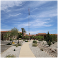
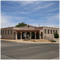
Clarkdale began to take shape in 1913, when T.C. Roberts, UVCC’s chief engineer, platted the town just south of the smelting works. Roberts divided Clarkdale into Upper and Lower towns connected by Main Street, an east-west spine from which perpendicular, numbered streets radiate. The gridded streets are 40 feet wide between curbs and 60 feet wide between buildings, allowing for broad sidewalks; Main Street, as the principal thoroughfare, is 55 feet wide between the curbs and 75 feet wide between the building lines, suggesting its status at the top of the circulation hierarchy. Situated near the river, Lower Town (also known as Clarkdale East) was developed first, between 1913 and 1916, as the workers’ residential area. It included a Mission Revival elementary school with an adjacent baseball field, one tan-brick commercial building, and three streets of subsidized housing near Bitter Creek. Upper Town (Clarkdale West), developed between 1914 and the 1930s, constituted the tonier residential area meant for UVCC executives, engineers, and town merchants as well as the central business district. The municipal core, lying just east of the commercial center, was the nexus between the two towns. Clarkdale’s second post office (1914), civic and administrative buildings, high school, and three churches were sited there. Almost as an afterthought, between 1916 and 1929 Patio Park (colloquially called “Patio Town”) was built north of Lower Town—across the railroad tracks. With derogatory street names like “fiesta” and “siesta,” Patio Park was intended for the mine’s Mexican and Native American workers. This was the site of Clarkdale’s earliest buildings and structures, as well as the clay beds and brick plant that provided the materials for the town’s permanent structures.
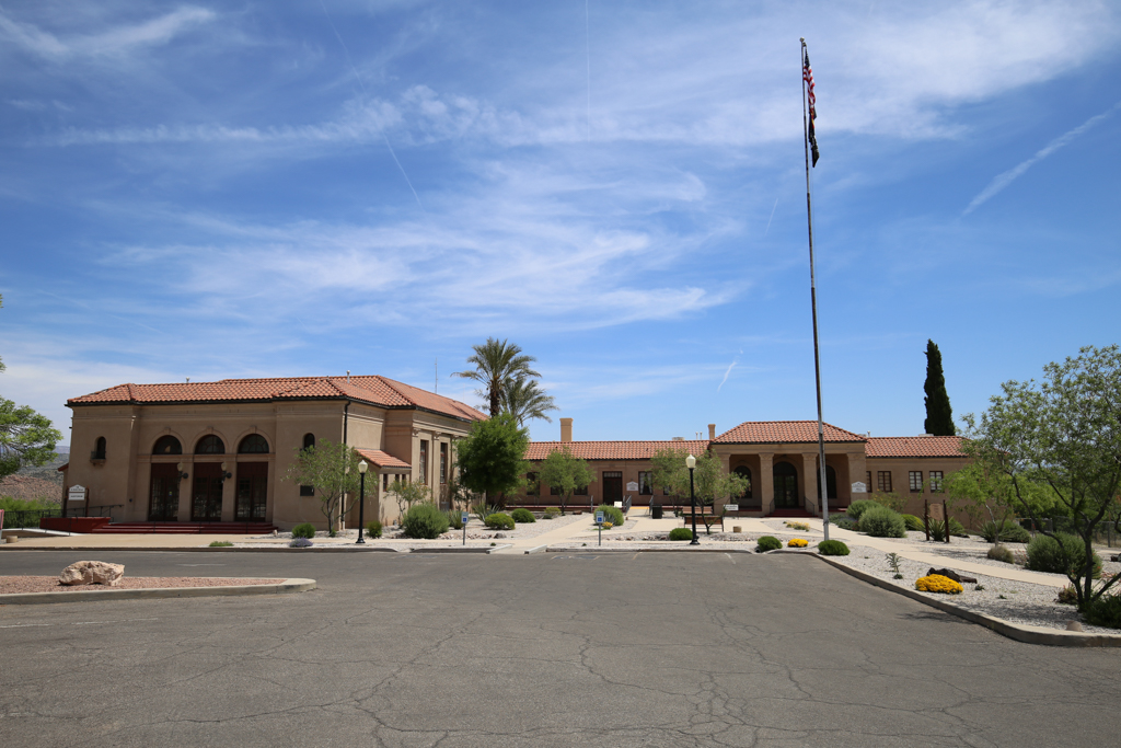
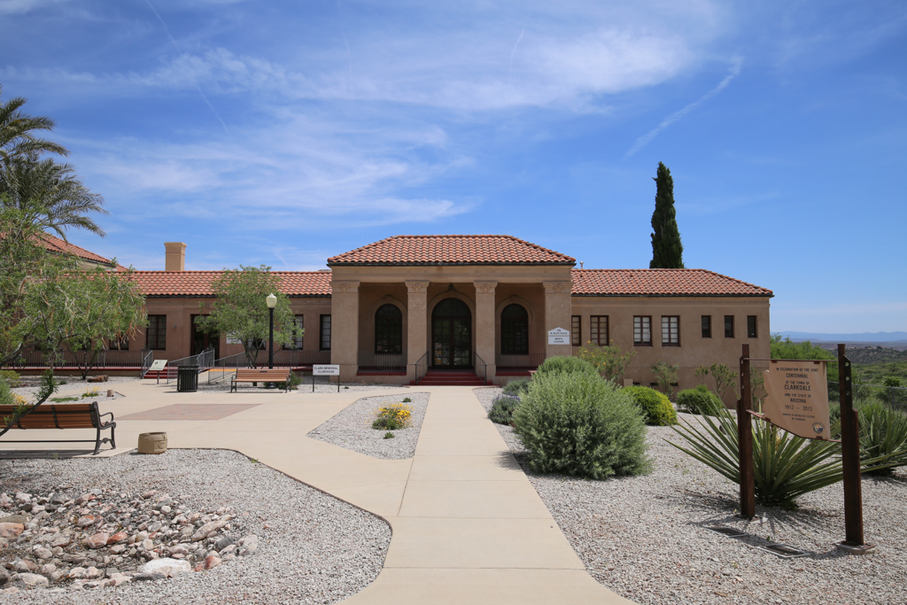
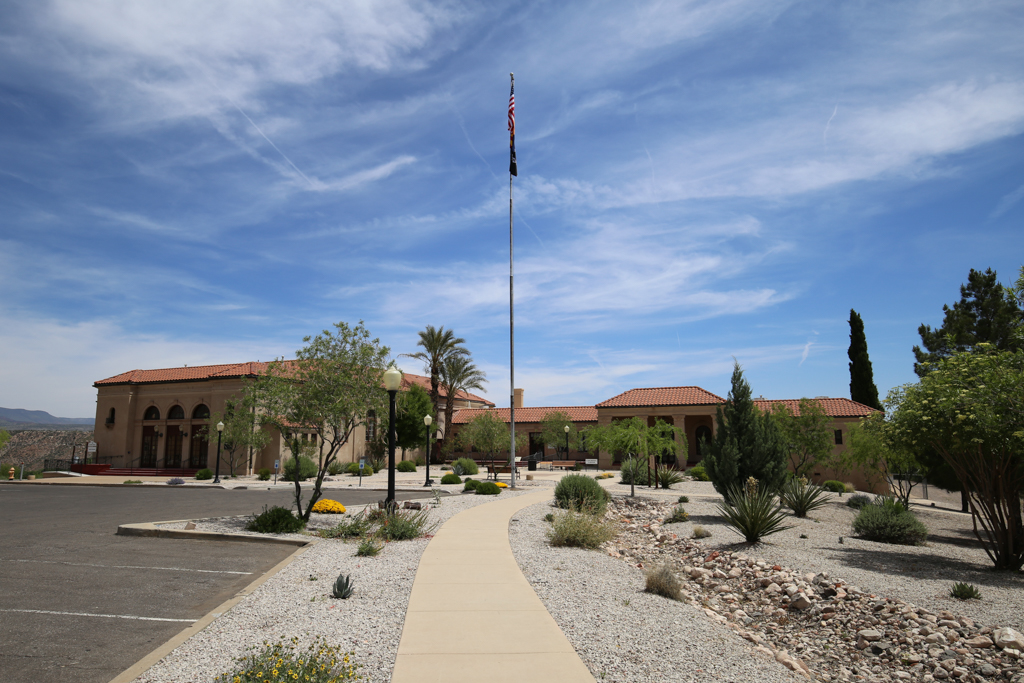
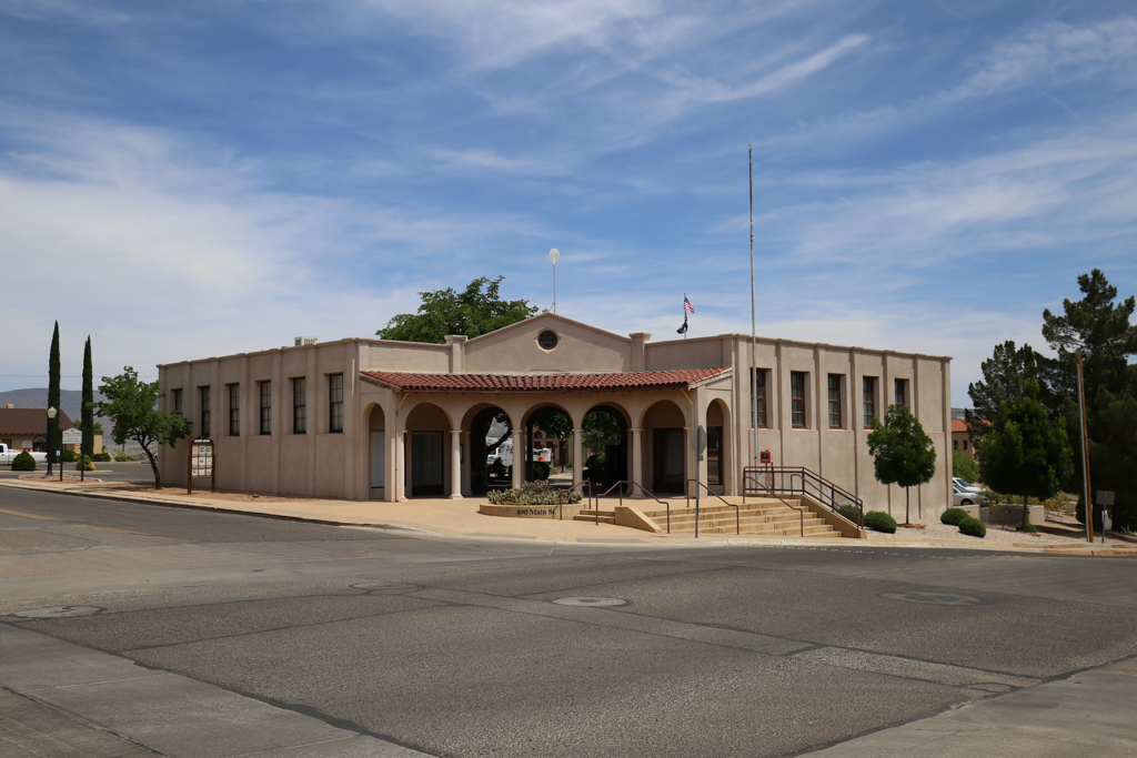
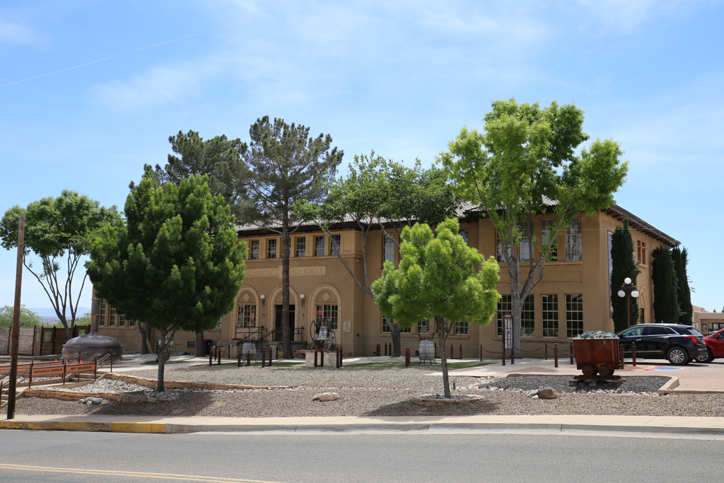
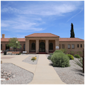
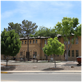
By 1915, Main Street was lined with eight one- and two-story, tan- and red-brick buildings in a variety of architectural styles. Yet the municipal complex set the stylistic tenor of Clarkdale, rendered in a Spanish Colonial Revival idiom characterized by tan brick walls, red-tile roofs, and arcades. The style is best expressed in the Clark Memorial Clubhouse and Memorial Library (1926–1927) and the Clarkdale High School (1927–1928), which dominate the town plaza. Both buildings were designed by Lee M. Fitzhugh (1877–1937) and Lester A. Brown (1889–1963), who, in 1913, formed one of the first architectural practices in Phoenix. Besides housing a lending library, the Clubhouse included a 600-seat auditorium that doubled as a gymnasium, separate lounges for men and women, and a concrete outdoor swimming pool. The one-and-a-half-story building has an asymmetrical facade featuring a red-tile roof, a portico with arched openings, a stucco exterior finish, and a mélange of classical elements such as pilasters and a terrace with balustrades. Built from a $100,000 bequest left by Clark “in appreciation of the loyalty of his employees,” the civic center is a monument to the man who made and controlled Clarkdale.
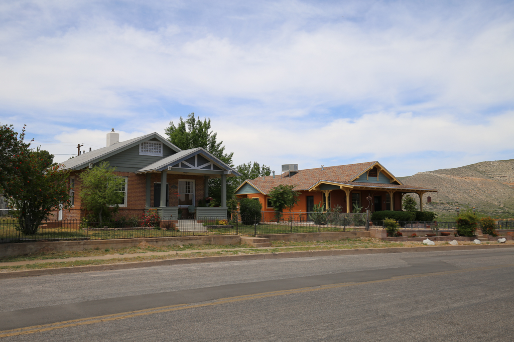
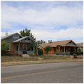
While the residential architecture in Lower Town was mainly Classical Revival in style, the architectural variety in Upper Town ran the gamut of styles, from Arts and Crafts bungalows to English Tudor Revival. Most of the housing (including the workers’) was designed by regionally well-known architects. Clark retained Los Angeles–based Arthur Kelly to design a row of Spanish Colonial and Pueblo Revival, stucco-covered bungalows in 1917. The following year, Kelly designed three one-story, sixteen-room, reinforced concrete boarding houses for single workers, presumably in Lower Town. In 1918, Clark hired the St. Louis architecture firm Herding and Boyd to build more housing for both Anglo-American and Mexican-American employees. Upon arrival, the architects expressed dismay at what they called Clarkdale’s “stupid” plan and published, in the December 1920 edition of The Architect and Engineer, a unified master plan designed along City Beautiful principles. This plan for Patio Town included a coherent plaza and, more importantly, homogenous house designs that utilized a precast concrete panel system similar to that invented by Grosvenor Atterbury in the previous decade. The prefabricated houses, rectangular in footprint, could be left as detached dwellings or combined in terraces. Taking into account the natural topography’s steep grades, the dwellings presented a two-story street facade but a three-story rear elevation. Each house offered miners and their families at least three bedrooms, built-in furniture in the living area, and rear garden plots.
Clark and Roberts largely ignored Herding and Boyd’s proposal and allowed Clarkdale to continue to develop along the lines they had established in 1913. The first ten patio apartments—in which brick building units with five apartments each were separated by patio spaces—were built in Patio Town about 1916, followed in 1919 by twenty-four poured-concrete duplexes covered in stucco. Two additional five-unit patio apartment buildings, composed of hollow block clad in stucco were built in 1928. The wood-frame houses, with either shiplap siding or board-and-batten finishes, indicate the empty lots on which miners were allowed to build their own dwellings.
Roberts’ urban plan for Clarkdale exhibits an inherent socioeconomic and racial segregation. Upper Town was placed atop a ridge high above the industrial smelting complex and provided higher-quality, single-family detached dwellings on ample lots (32 by 120 feet) with fenced yards connected by cement sidewalks. Lower Town was closer to the smelter, and its residential lots were smaller (30 by 90 feet) than those in the Upper Town, the streets lacked sidewalks, and the yards were unfenced. The built environment’s aesthetics reinforced this class division: while Upper Town’s houses exhibited architectural variety, both stylistically and in terms of floorplans, Lower Town’s one-story dwellings all had standardized, rectangular footprints; the only variety was the sizes the housing took, i.e., small single-family dwellings, large single-family dwellings, or duplexes. Although promotional literature published in 1917 claimed that there was freedom of mobility between Upper and Lower towns, this was belied by the housing stock built, their market or subsidized prices, and the layout of the town itself. The 1920 census shows that Lower Town, intended for the Anglo-American working class, was inhabited by the smelter’s mechanics, clerks, and general laborers who originated from fifteen different nations in Asia, northern and southern Europe, and Canada. Of the 100 families in Lower Town, only four were of Mexican origin; the majority of the town’s Mexican and Native American workers lived in Patio Town, built adjacent to the smelter—the most polluted part of town. Patio Town’s physical separation from the rest of Clarkdale by Bitter Creek and Clark’s standard-gauge Arizona Extension Railroad was an overt attempt to segregate Latinos from European Americans, while its utter omission in the 1917 article conveyed the status the neighborhood held in the eyes of Clarkdale residents.
In 1935, the Phelps Dodge Corporation (PD) purchased all of the Clark family’s UVCC holdings, which included the town of Clarkdale. An interesting building from this era is the copper-clad Texaco gas station (1937), designed by the industrial designer Walter Dorwin Teague. PD ceased all major mining operations in Jerome in 1953; faced with abandonment from its sole industry and employer, Clarkdale was incorporated as an independent municipality in 1957. The municipal government sought to bring in new economic enterprises and the Phoenix Cement Company opened a facility west of the town in 1959, which mitigated the town’s decline. As the population continued to expand, the abandoned houses in Lower Town were heavily remodeled while new suburbs (such as Black Hills I and II, Verde Palisades, Foothills Terrace, etc.) arose on the historic town’s edges. Largely a retirement community today, Clarkdale boasts a population of approximately 4,200—ten times larger than neighboring Jerome’s. Much of the historic core of Clarkdale has been lost to redevelopment, although what remains was designated an historic district in 1997.
References
Bain, Tommie, Karl Klassen, Edward E. King, and Dorothy King, “Clarkdale Historic District,” Yavapai County, Arizona. National Register of Historic Places Registration Form, 1997. National Park Service, U.S. Department of the Interior, Washington, D.C.
Benatz, Dorothy. Revised by Roger Brevoort and Gerald A. Doyle and Associates, PC. “Clark Memorial Clubhouse,” Yavapai County, Arizona. National Register of Historic Places Registration Form, 1982. National Park Service, U.S. Department of the Interior, Washington, D.C.
Crawford, Margaret. Building the Workingman’s Paradise: The Design of American Company Towns. New York: Verso, 1995.
Morrow, Irving F. “Two Town Planning Projects in Arizona Herding & Boyd, Architects.” The Architect and Engineer63, no. 3 (December 1920): 47-87.
Peterson, Helen Palmer. “Landscapes of Capital: Culture in an Industrial Western Company Town, Clarkdale, Arizona, 1914-1929.” Ph.D. dissertation, Northern Arizona University, May 2008.
Roberts, T.C. “Clarkdale, Arizona, United Verde’s Million Dollar Town.” Engineering and Mining Journal104, no. 13 (September 29, 1917).
Schwantes, Carlos A. Vision and Enterprise: Exploring the History of Phelps Dodge Corporation. Tucson: University of Arizona Press, 2000.
Snell, Charles W., “Jerome (United Verde Mine),” Yavapai County, Arizona. National Survey of Historic Sites and Buildings Form, 1966. National Park Service, U.S. Department of the Interior, Washington, D.C.
Town of Clarkdale, AZ. “The History of Clarkdale.” Accessed April 21, 2016. http://www.clarkdale.az.gov/.
Town of Jerome, AZ. “Clarkdale, Arizona.” Accessed April 21, 2016. http://www.azjerome.com/.
“With the Architects: Building Reports and Personal Mention of Interest to the Profession.” The Architect and Engineer63, no. 1 (July 1919): 113-118.