


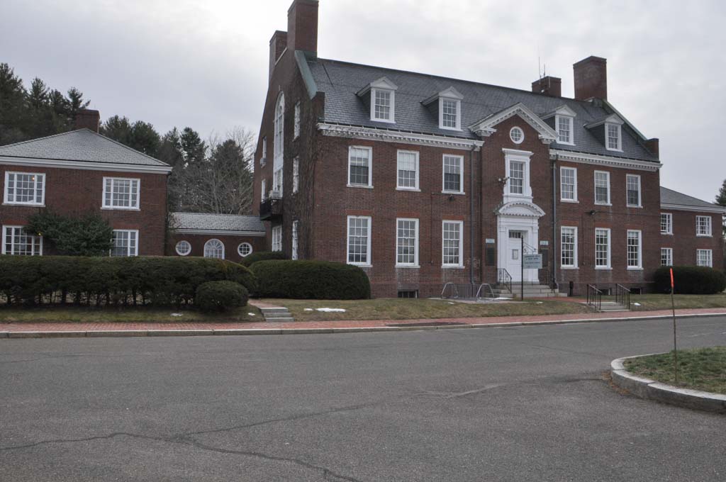


In order to manage the complicated components of the Quabbin Reservoir system, the Metropolitan District Water Supply Commission (MDWSC) built a large administrative complex adjacent to Winsor Dam, the system’s primary control facility, between 1937 and 1938. Situated above a large underground hydroplane hanger, the site contains an office building, two residences, and two garages, all composed of concrete and brick in the Colonial Revival style. This complex, arranged in a formal, axial plan, not only provides a space for the operation of the Quabbin, but architecturally projects the MDWSC’s sense of authority and quest for order.
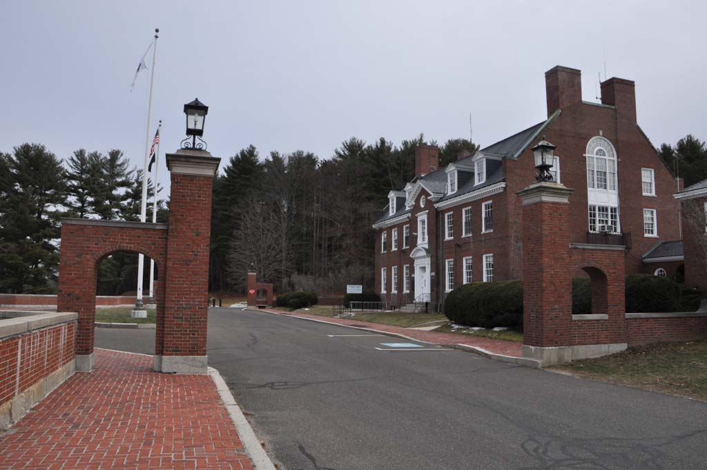
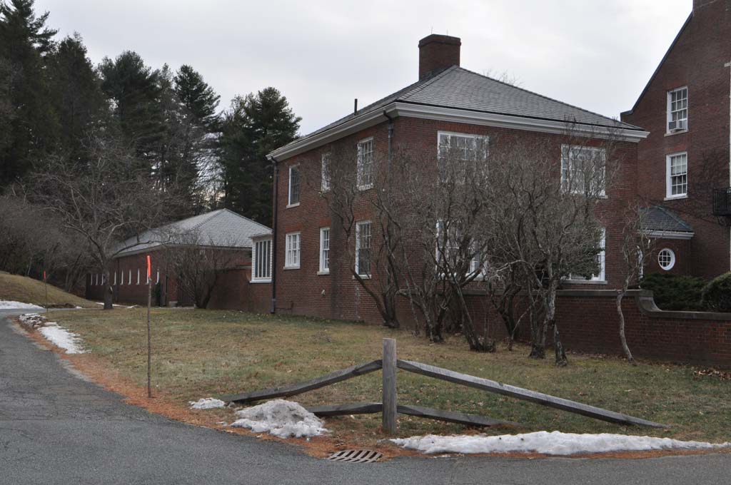
The MDWSC hired Densmore, LeClear and Robbins to design the complex using southern colonial buildings and the reconstruction of Colonial Williamsburg for inspiration. The Quabbin Administration complex’s grouping centers around a two-and-a-half-story, red brick, gabled, rectangular main office block with single-story hyphens connecting to two square, brick, two-story, hipped-roof domestic units to house personnel. The symmetrically arranged main block features parapet end walls with paired, brick chimneys. A pedimented, projecting central bay with a Georgian-style doorway; above the entry is a single six-over-six window and an oculus in the pediment. Behind the domestic units are two large rectangular garages, sited parallel to each other and perpendicular to the office-house complex, forming a courtyard. The garages feature roll-type wooden garage doors.
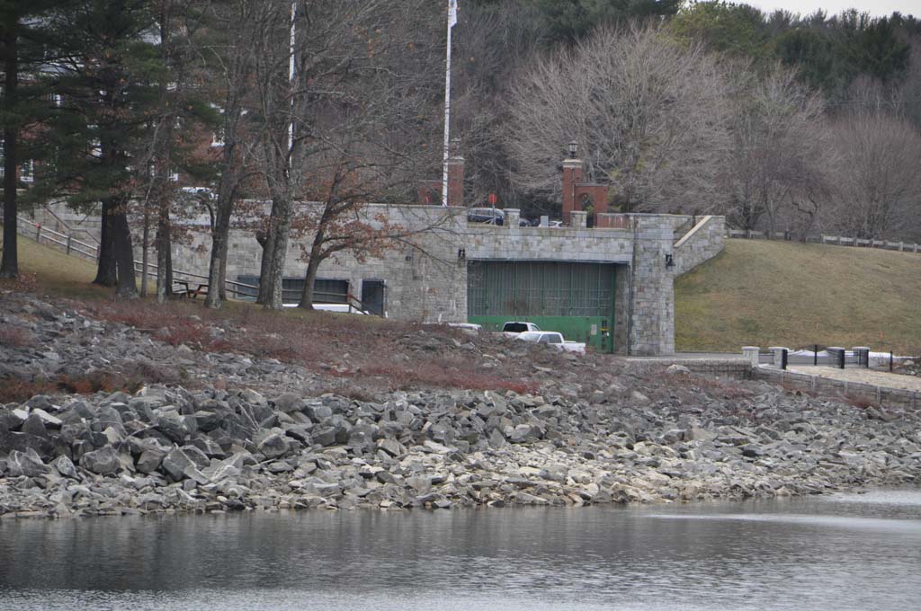
The complex’s landscape design, created by Arthur Shurcliff, features brick and gravel walks, evergreens, brick walls, and a brick gate designed by Frederick Kingsbury. The buildings sit on elevated land and face toward the reservoir. Beneath this area is a boat ramp (completed 1941) and hydroplane hanger (no longer in use) constructed of concrete and faced with random ashlar similar to that of the Quabbin Aqueduct structures.
The use of Colonial Revival forms throughout the complex consciously sought to assuage fears about the overall Quabbin project, particularly in its disguising of a modern, massive infrastructure system behind the visage of a recreated colonial ideal. In addition, its strictly ordered garden landscape paralleled the process of the natural system ordering that the reservoir enacted. In 1984, a space on the first floor of the Administration Building was converted to a visitors’ center for the reservoir, operated in cooperation with the Friends of Quabbin, Inc., a non-profit organization. It features exhibits on the Quabbin’s history and role as a public water supplier as well as on wildlife and recreation. As a result, the site further (and more overtly) extends its didacticism. Today the facility also houses a precinct of the Massachusetts State Police.
References
Bowers, M.H. “Form A – Area: Quabbin Reservoir, Belchertown, MA (BLC.G).” Boston: Massachusetts Historical Commission, May 1985.
Carolan, Jane. “Form A – Area: Quabbin Administration Building, Belchertown, MA (BLC.H).” Boston: Massachusetts Historical Commission, April 1985.
Tougias, Michael. Quabbin: A History and Explorer's Guide. Yarmouth Port, MA: On Cape Publications, 2002.